CW3E Event Summary: 11-17 December 2020
December 18, 2020
Click here for a pdf of this information.
Active Weather Pattern Brings Multiple Episodes of Rain and Snow to the Western U.S.
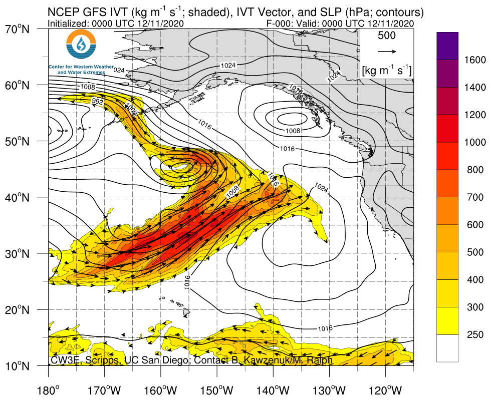
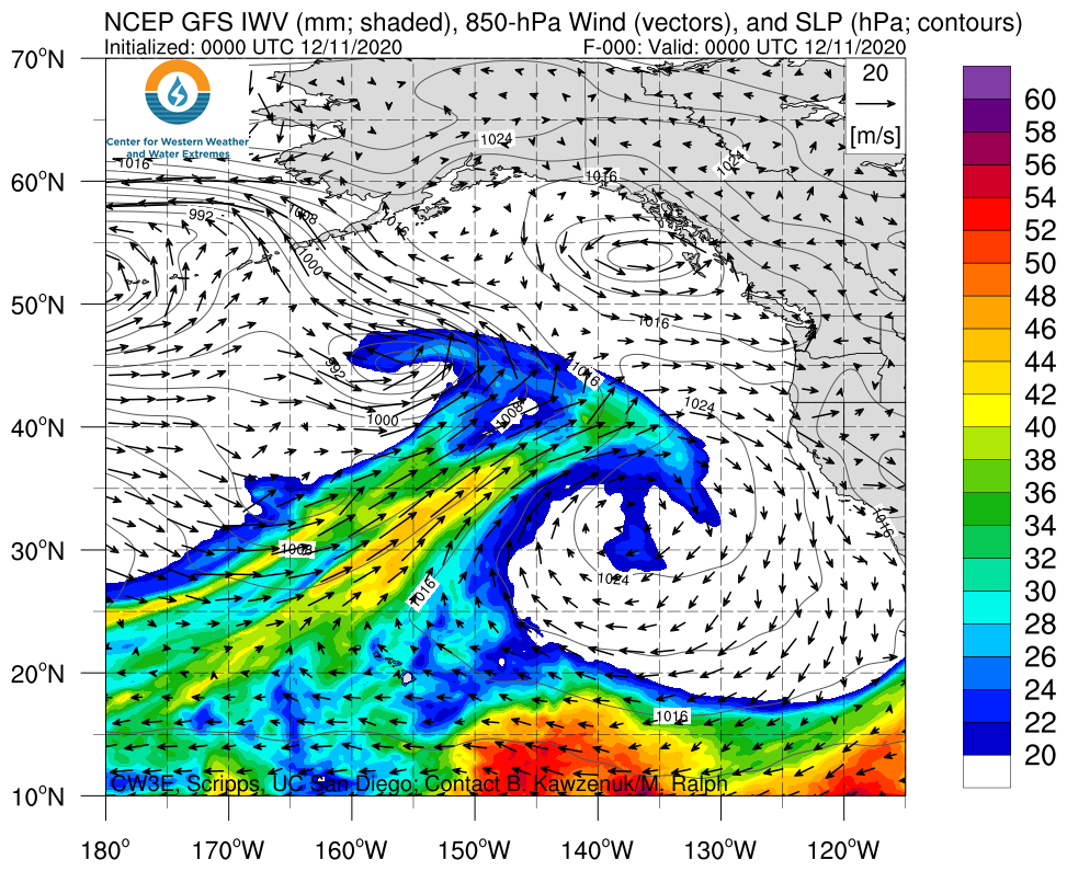
- Several ARs associated with a series of cyclones over the Northeast Pacific Ocean have impacted the Western U.S. during the past 7 days
- These storms produced at least 2–5 inches of total precipitation in the Sierra Nevada, Cascades, and Pacific Coast Ranges, and lighter amounts across the Intermountain West
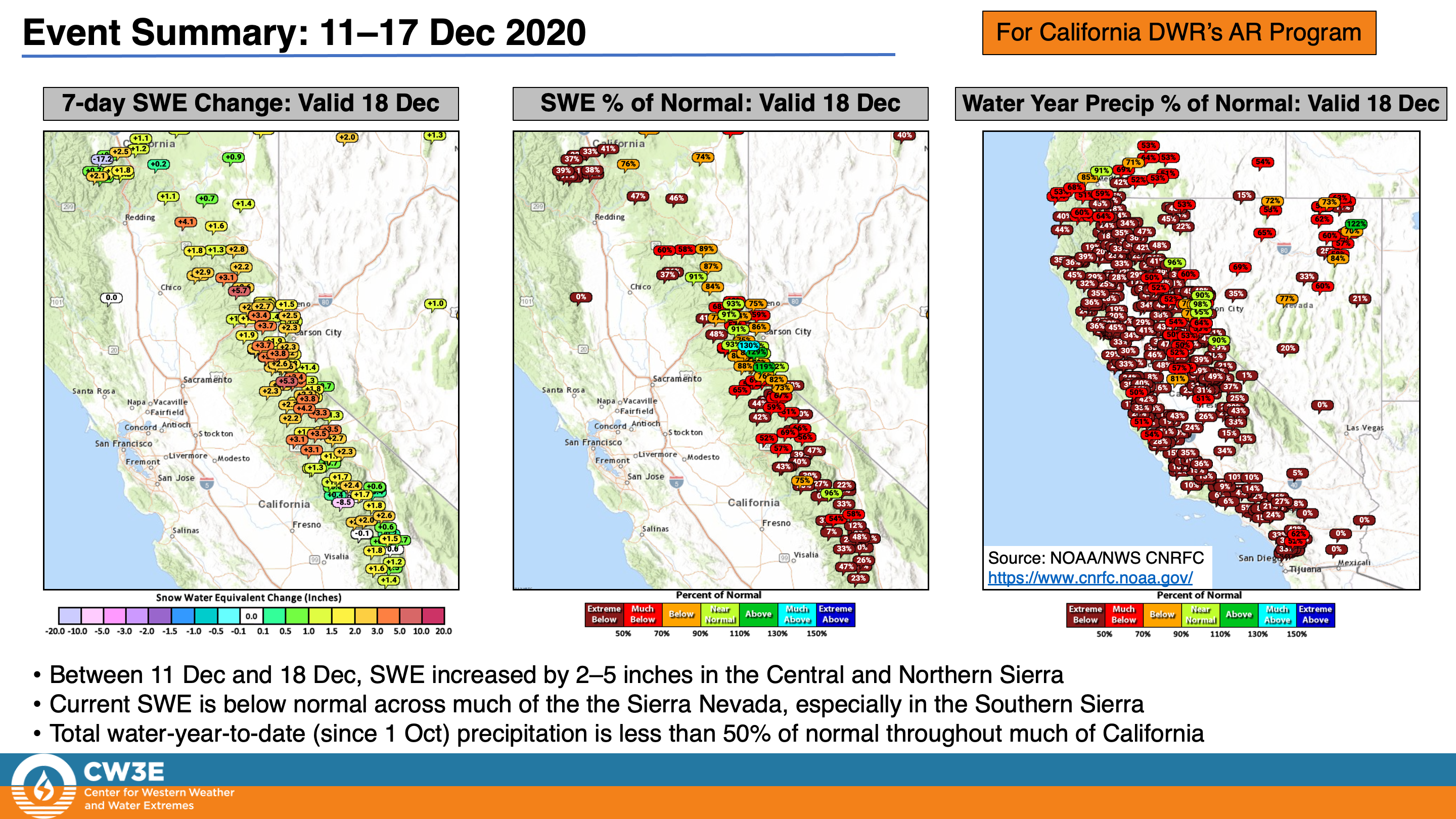
- An estimated 1–3 feet of snow fell in the higher terrain of the Sierra Nevada, Cascades, and northeastern Nevada
- Total water-year-to-date precipitation remains well-below normal across much of California
Click images to see loops of GFS IVT/IWV analyses Valid 0000 UTC 11 December – 0000 UTC 18 December 2020 |
|
 |
 |
Summary provided by C. Castellano, C. Hecht, J. Kalansky, B. Kawzenuk, and F. M. Ralph; 18 December 2020


