
CW3E Event Summary: 18-20 February 2024
27 February 2024
Click here for a pdf of this information.
Low-Pressure System and Atmospheric River Produce Heavy Rain and Snow in CA
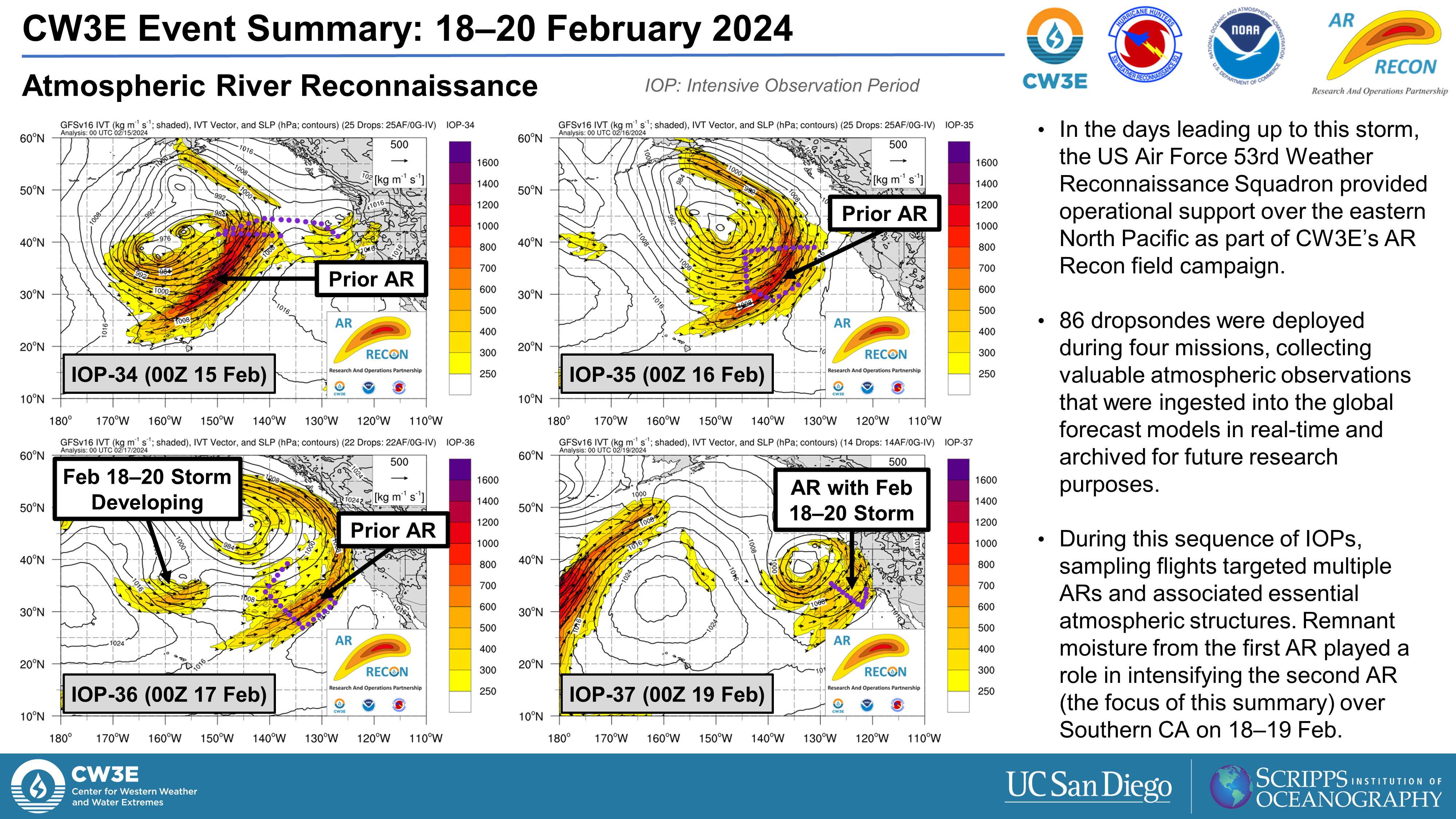
- An atmospheric river (AR) associated with a slow-moving area of low pressure brought widespread precipitation to California during 18–20 Feb.
The AR:
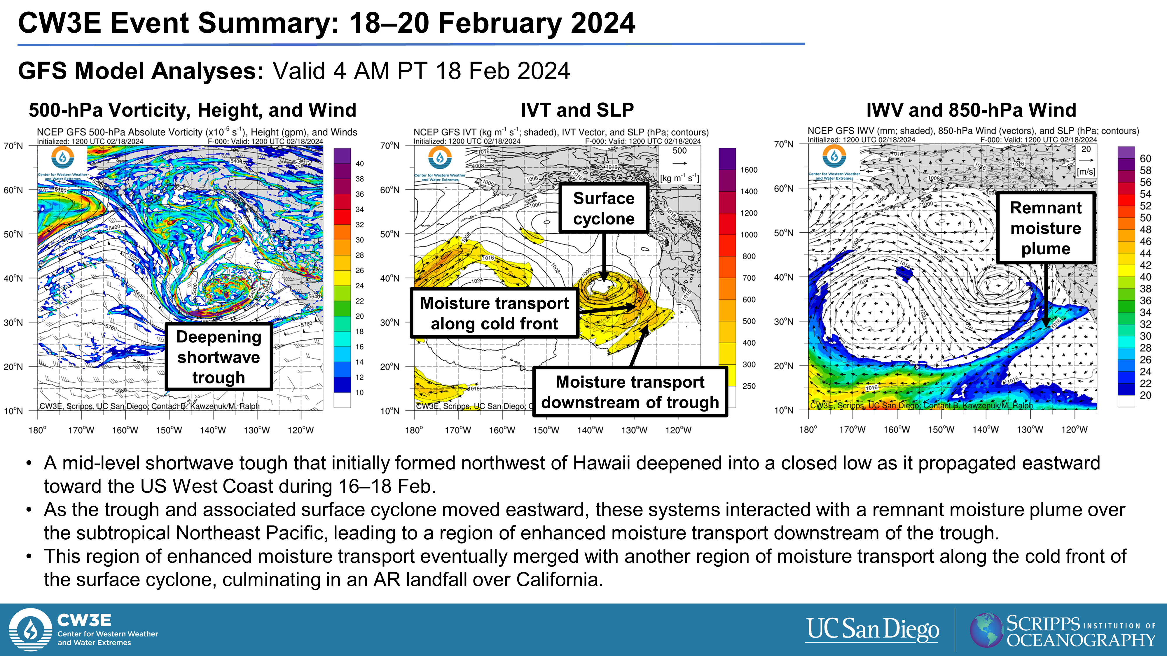
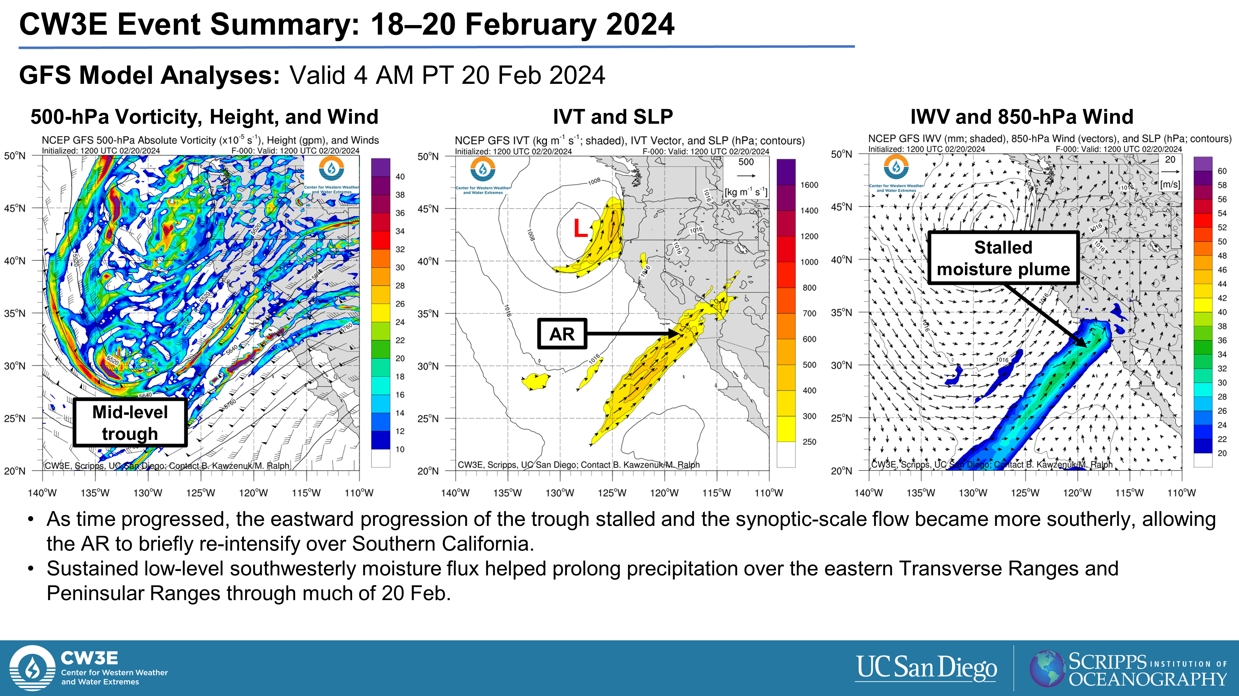
- A deepening mid-level trough off the US West Coast interacted with a remnant plume of subtropical moisture, leading to an AR landfall over California on 18 Feb.
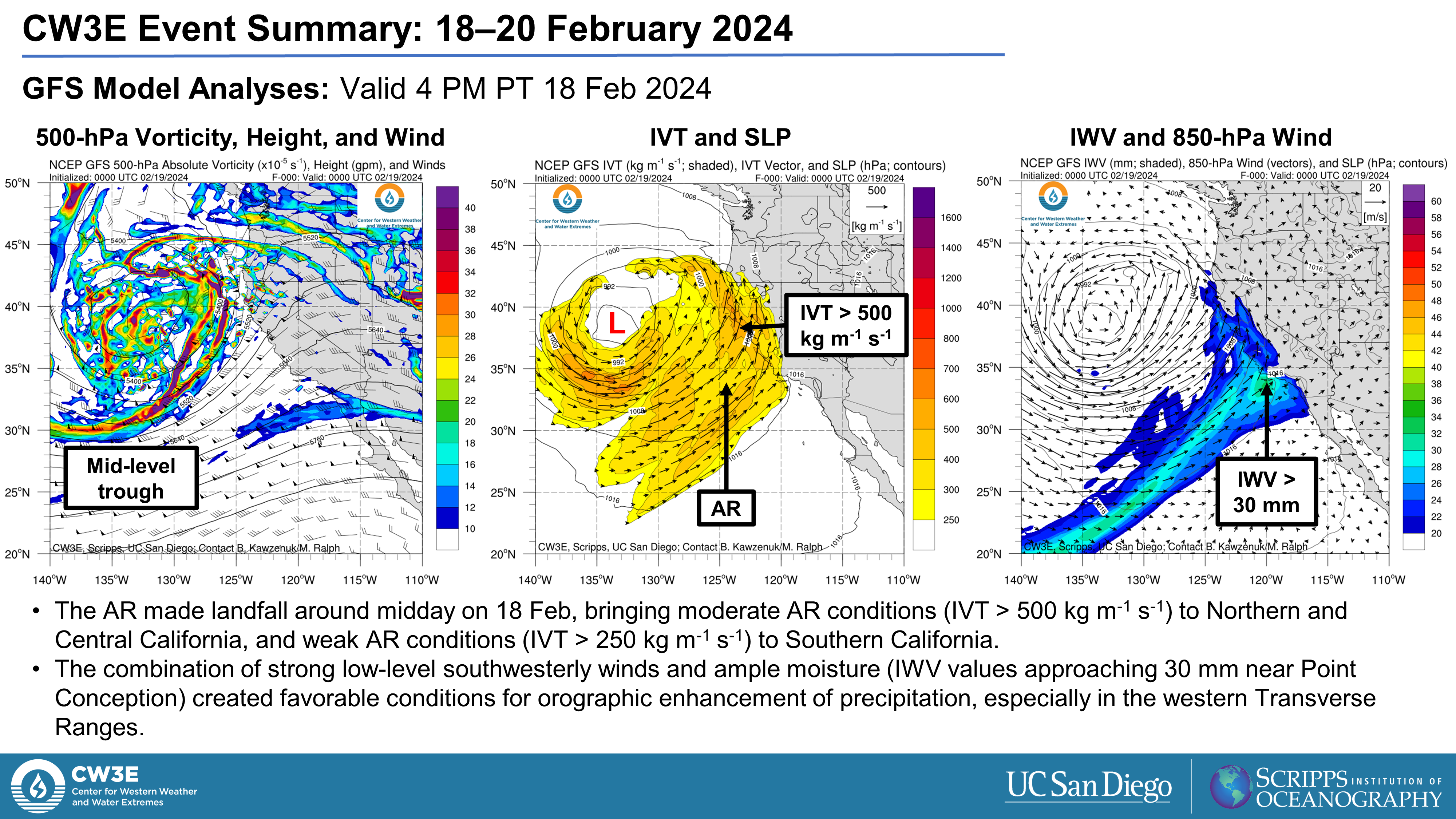
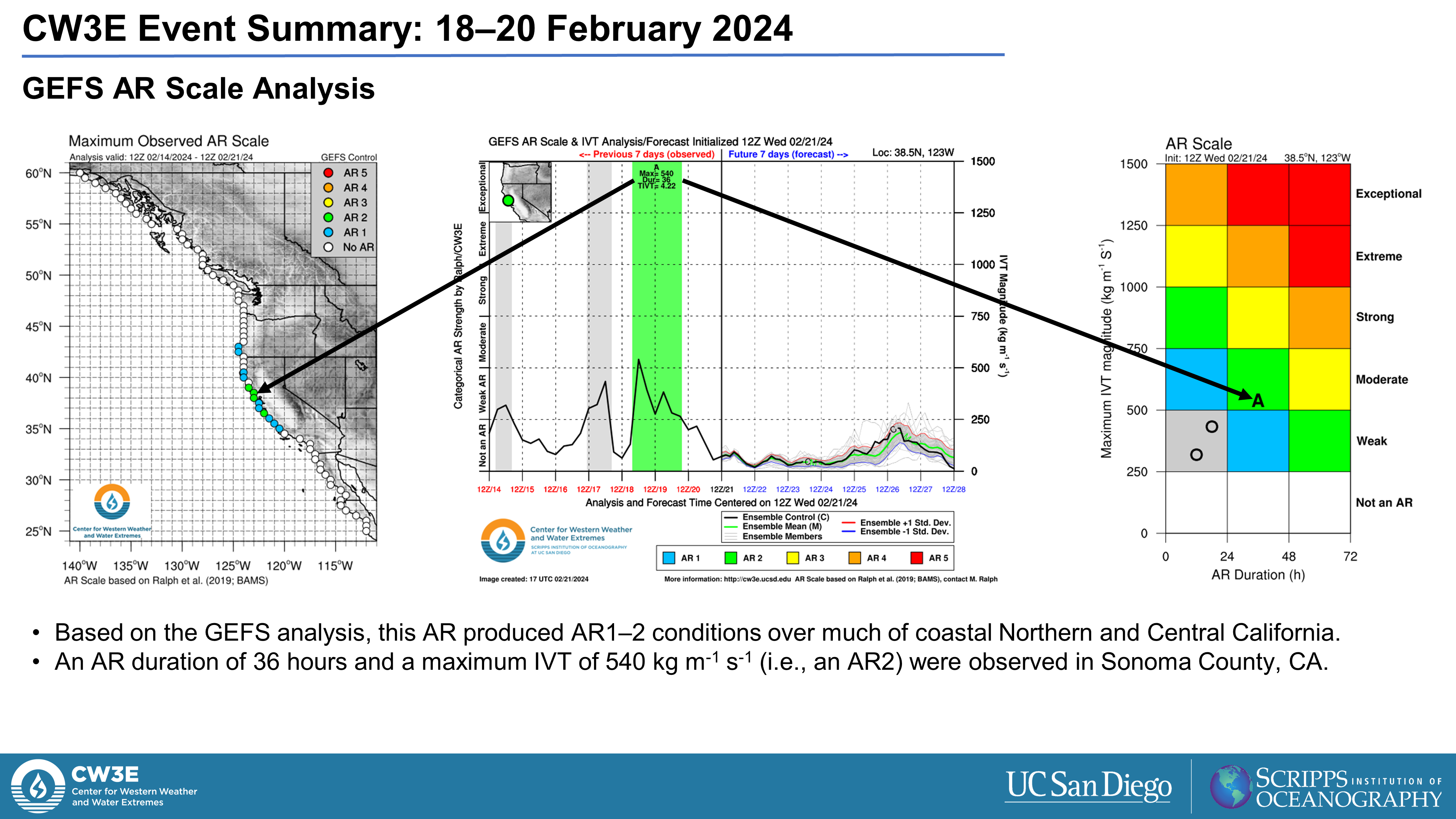
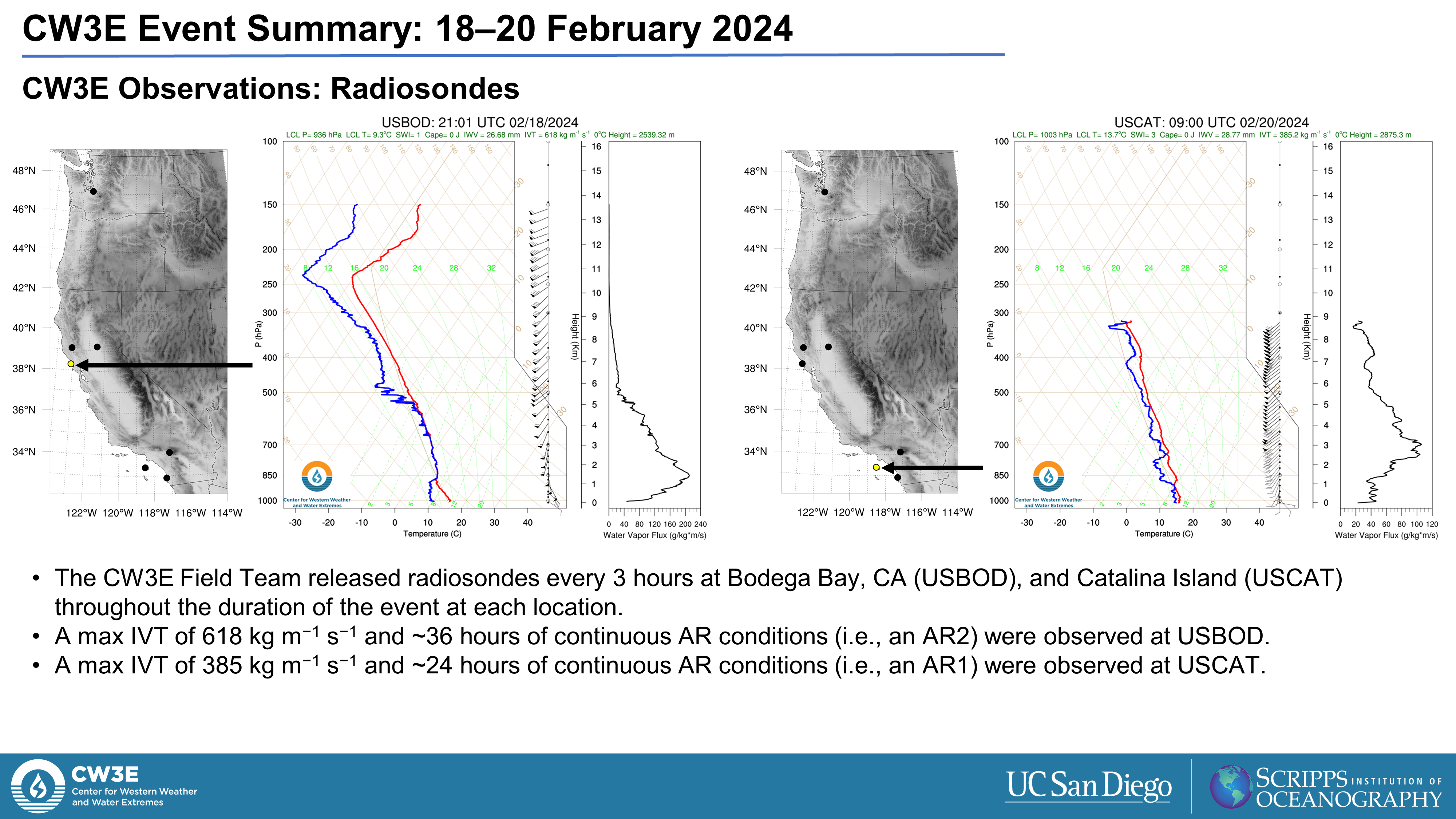
- AR1–2 conditions (based on the Ralph et al. 2019 AR Scale) were observed in coastal Northern and Central California.
- As the eastward progression of the trough stalled and the synoptic-scale flow became more southerly, the AR briefly re-intensified over Southern California, prolonging precipitation over the Transverse Ranges.
Impacts:
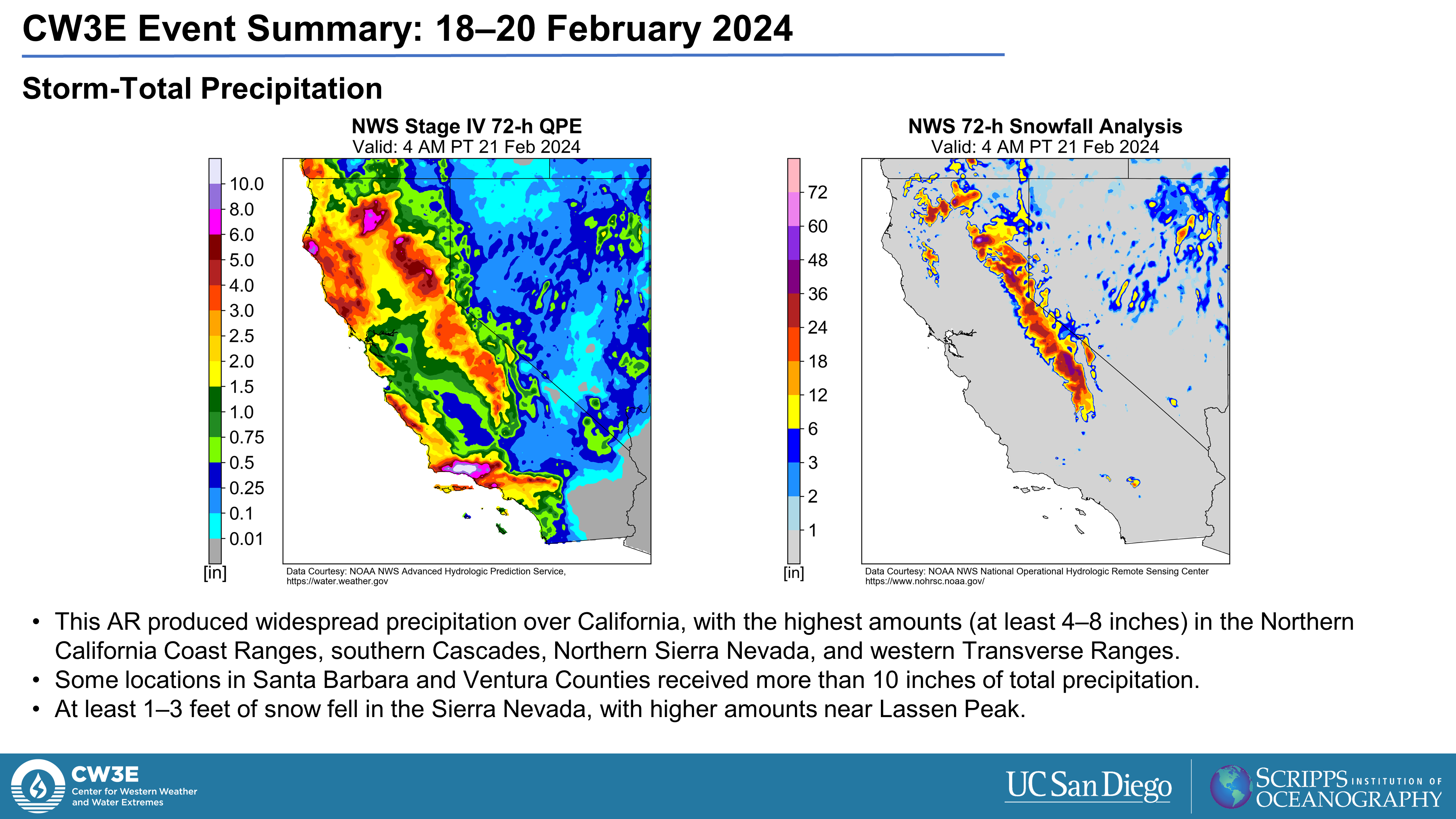
- The heaviest precipitation occurred in the western Transverse Ranges, with more than 10 inches in some locations.
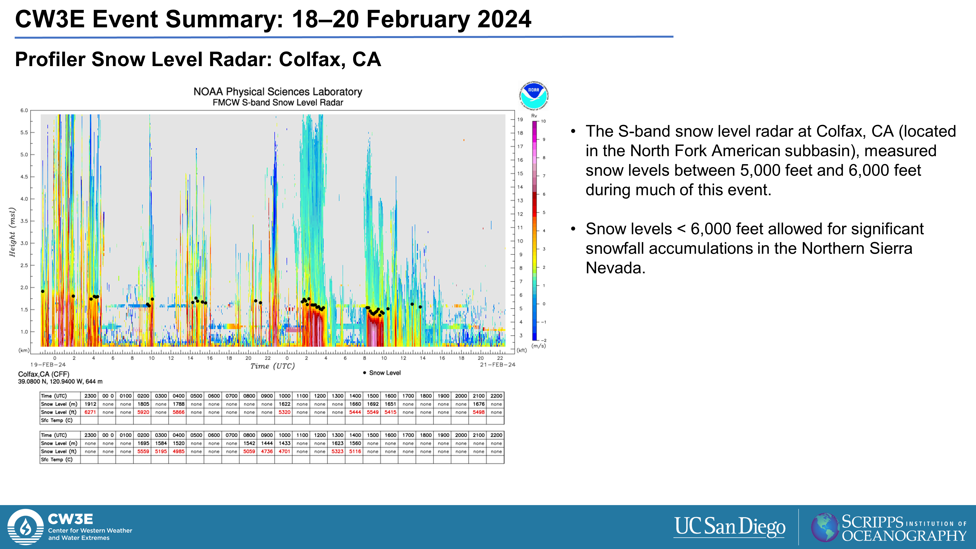
- At least 1–3 feet of snow fell in the Sierra Nevada, with higher amounts in the vicinity of Lassen Peak.
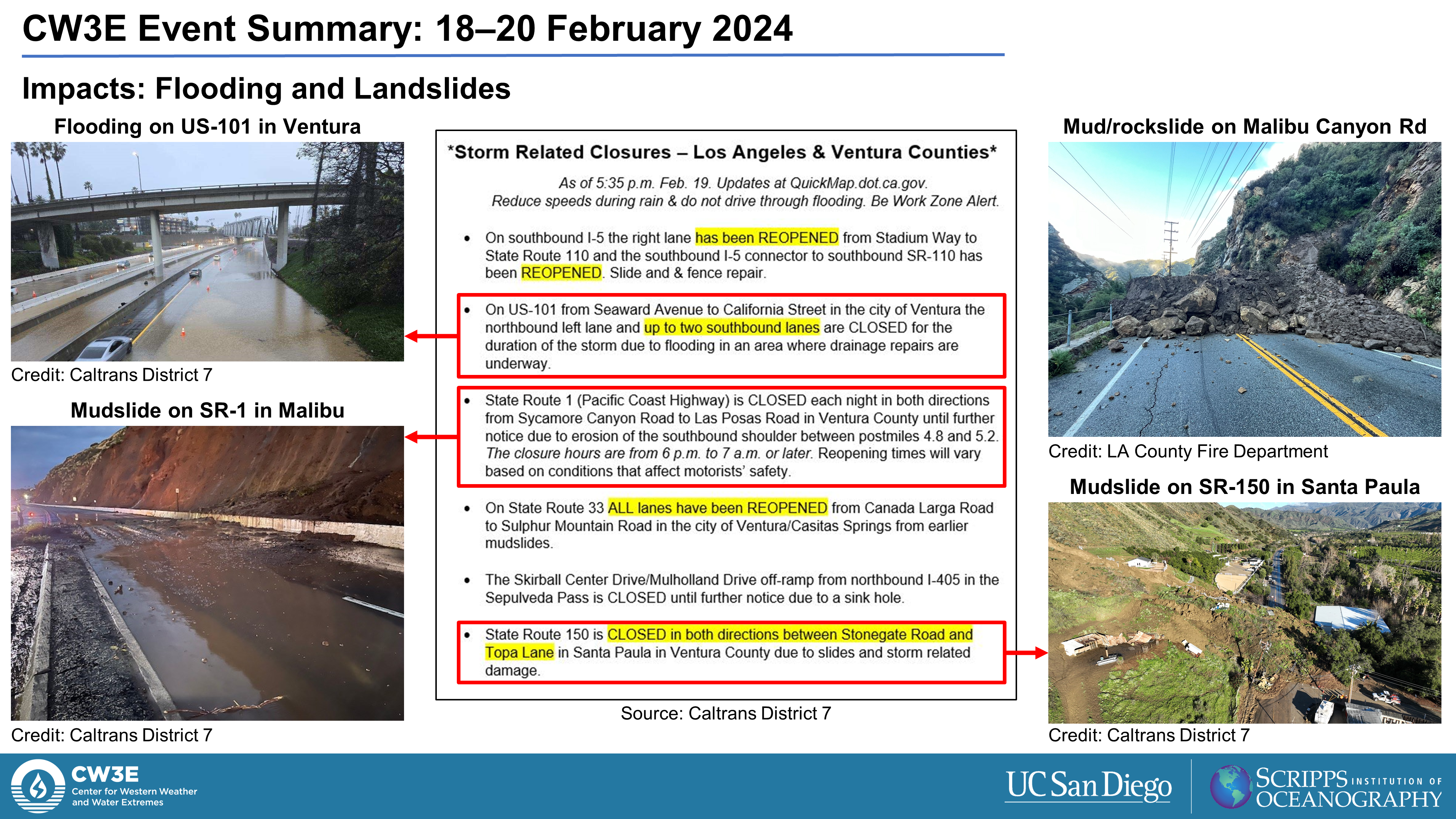
- Heavy rain falling on moist soils caused minor riverine flooding in the Sacramento Valley.
- Flooding and mudslides closed portions of US-101, SR-1, SR-33, and SR-150 in Ventura and Los Angeles Counties.
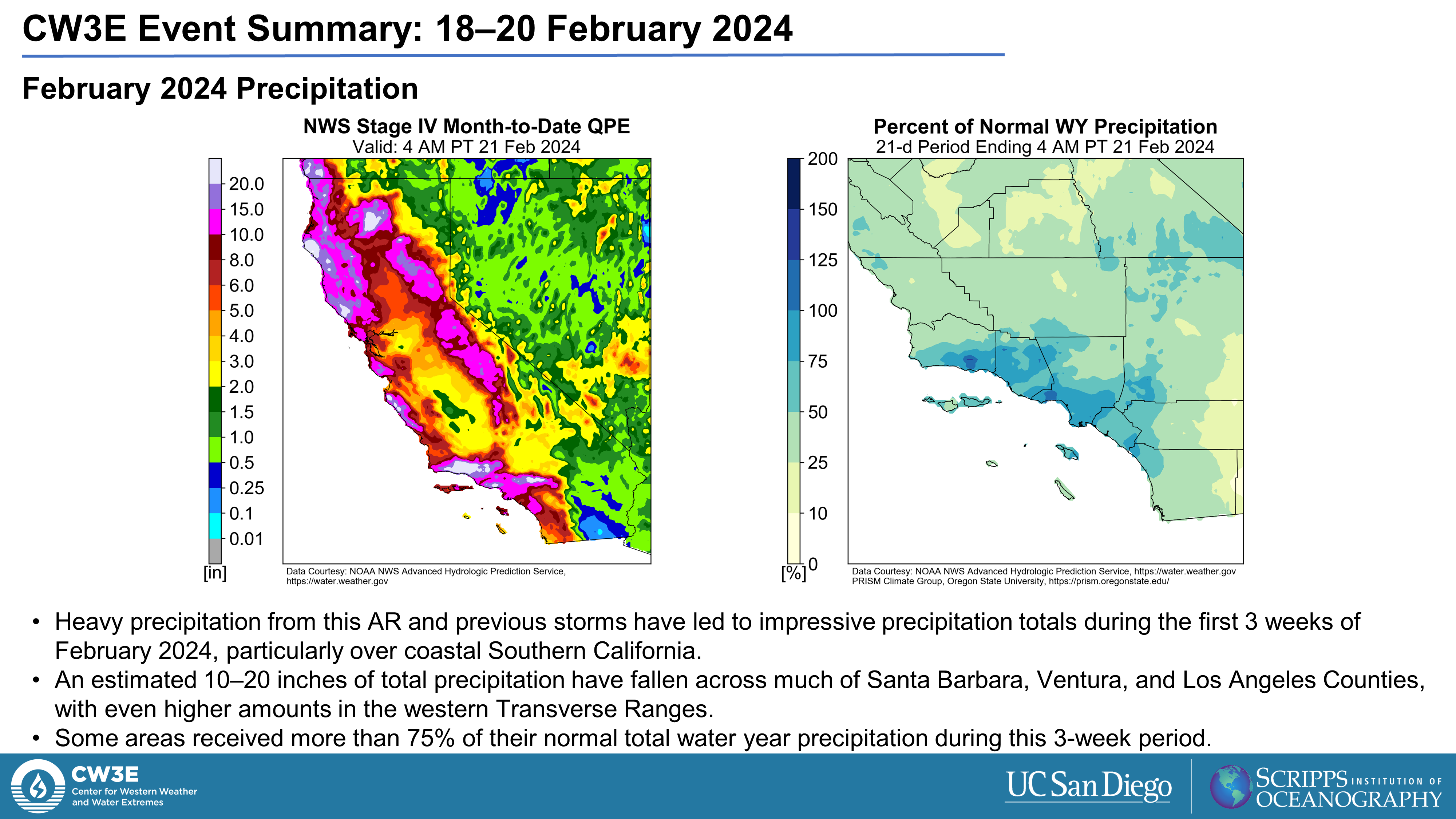
- Portions of coastal Southern California have received more than 75% of their normal total annual precipitation during the first 3 weeks of February.
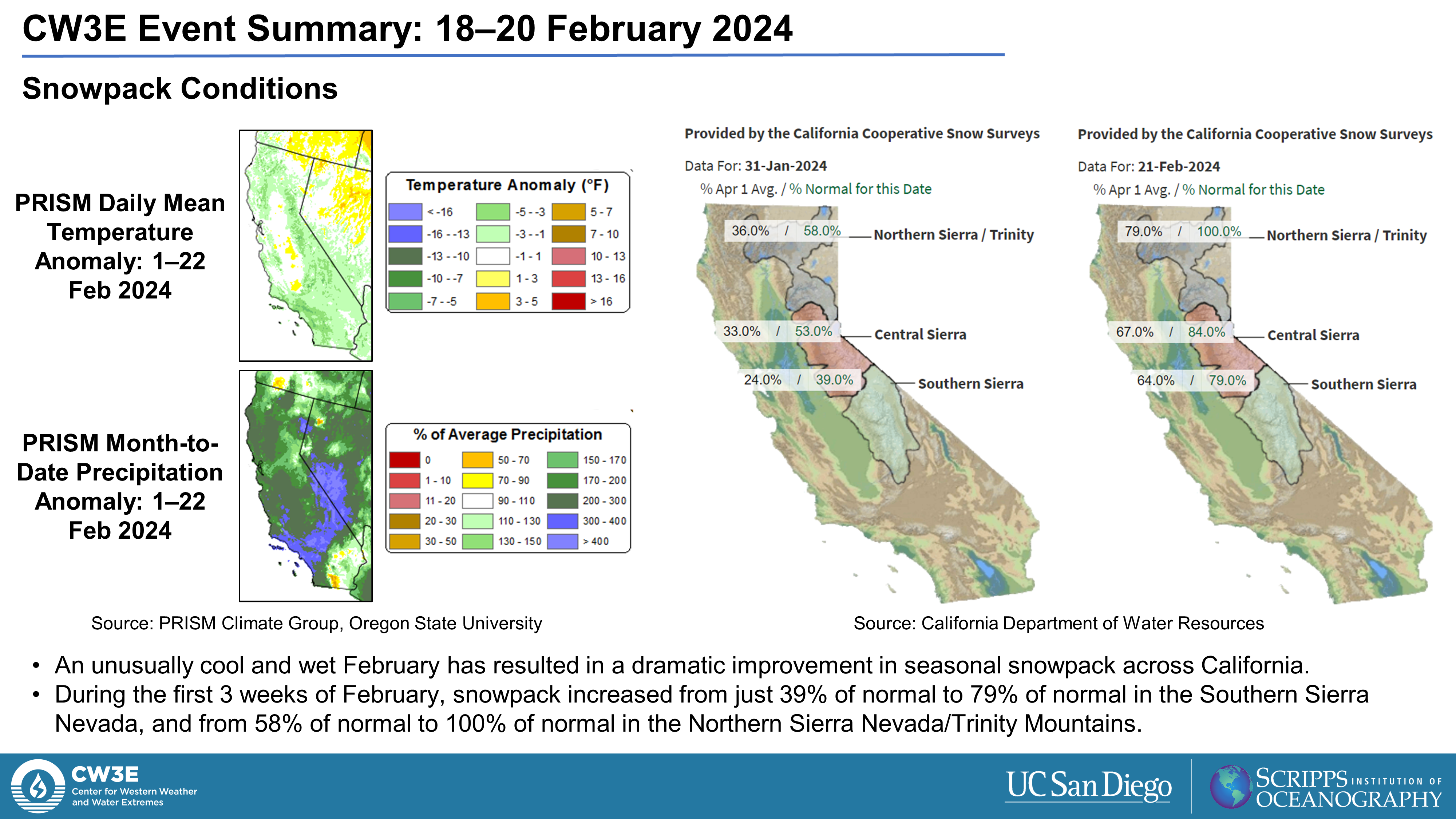
- Unusually cool and wet conditions during the month of February have facilitated a dramatic improvement in snowpack conditions throughout the state.
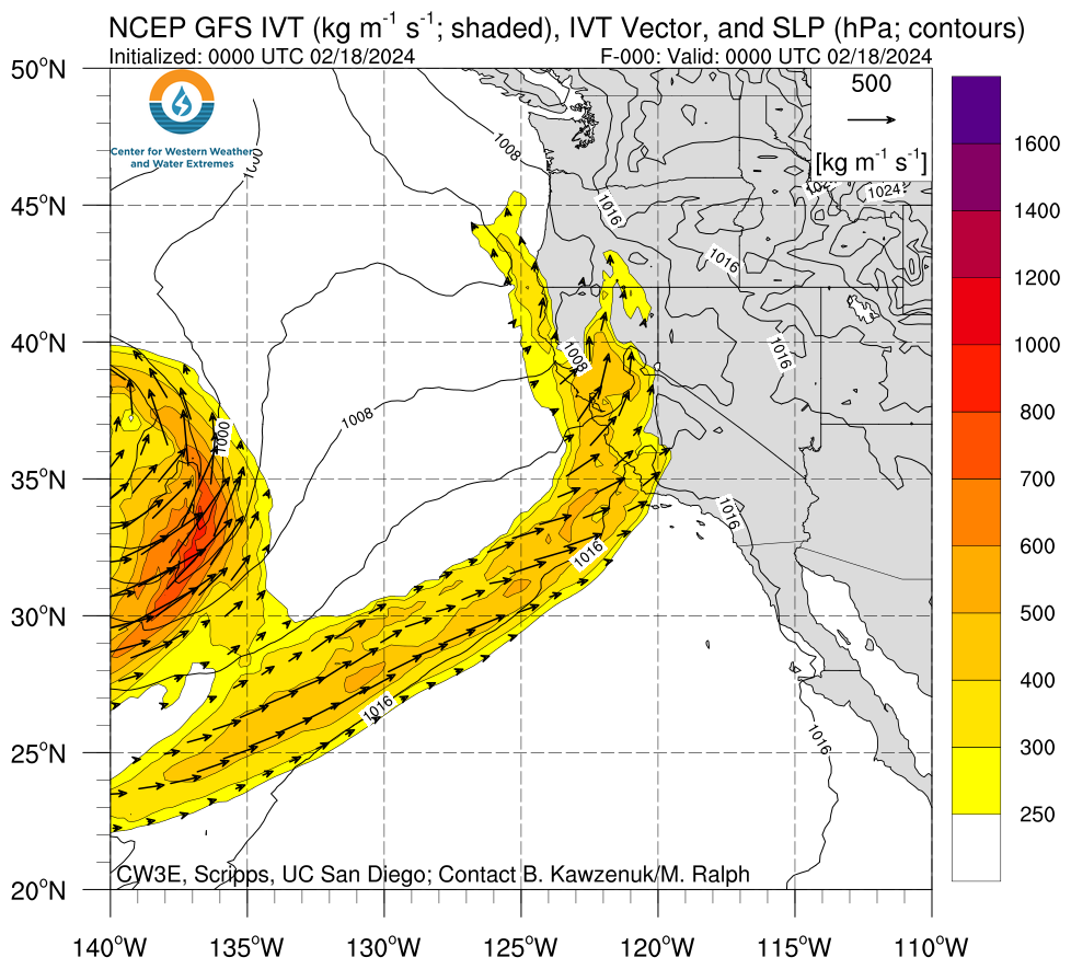
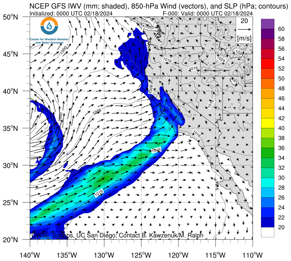
Click images to see loops of West-WRF IVT/IWV analyses and forecasts Valid: 0000 UTC 18 February – 0000 UTC 21 February 2024 |
|
 |
 |

Summary provided by C. Castellano, S. Bartlett, P. Iniguez, and S. Roj; 27 Feb 2024
To sign up for email alerts when CW3E post new AR updates click here.