CW3E Event Summary: 22-25 February 2025
4 March 2025
Click here for a pdf of this information.
Multiple Atmospheric Rivers Produce Heavy Rain and Flooding in the Pacific Northwest
The ARs:
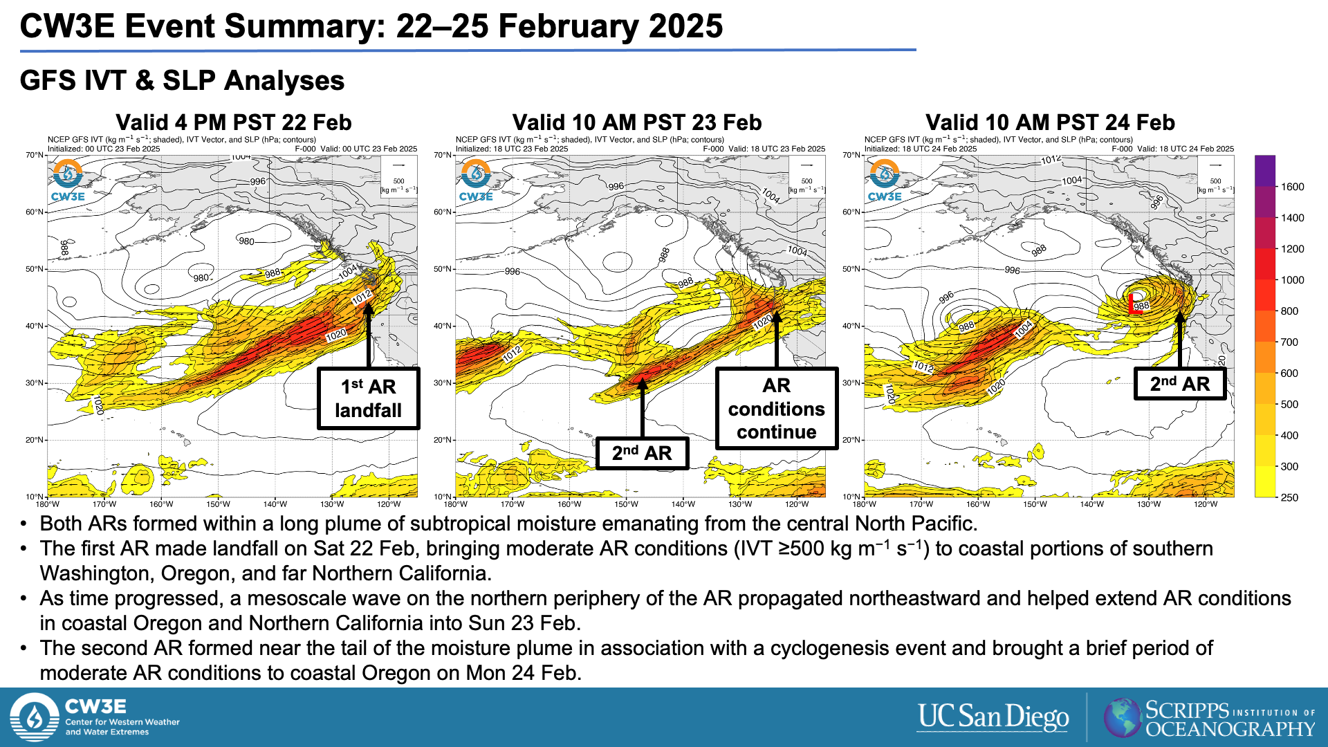
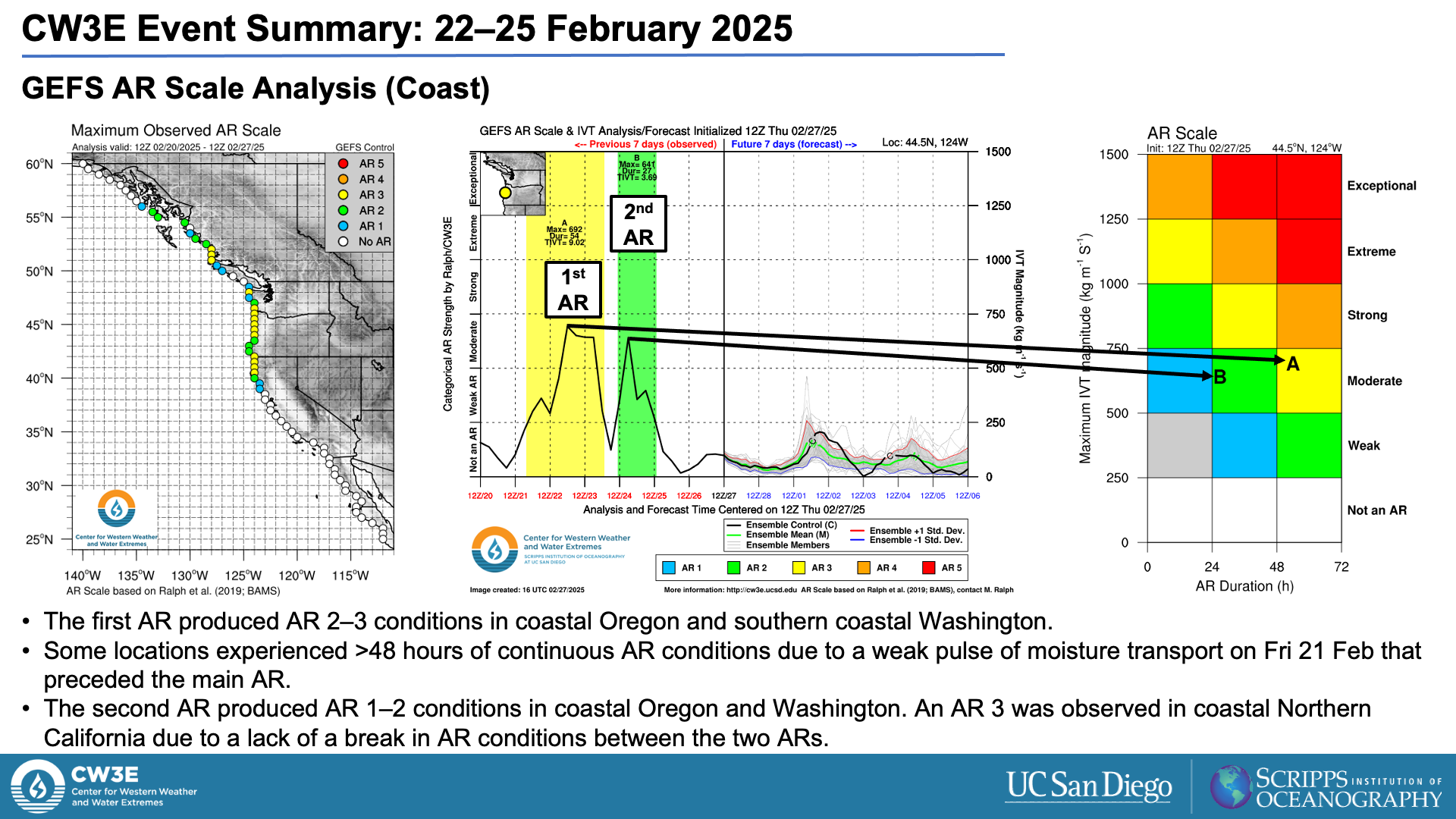
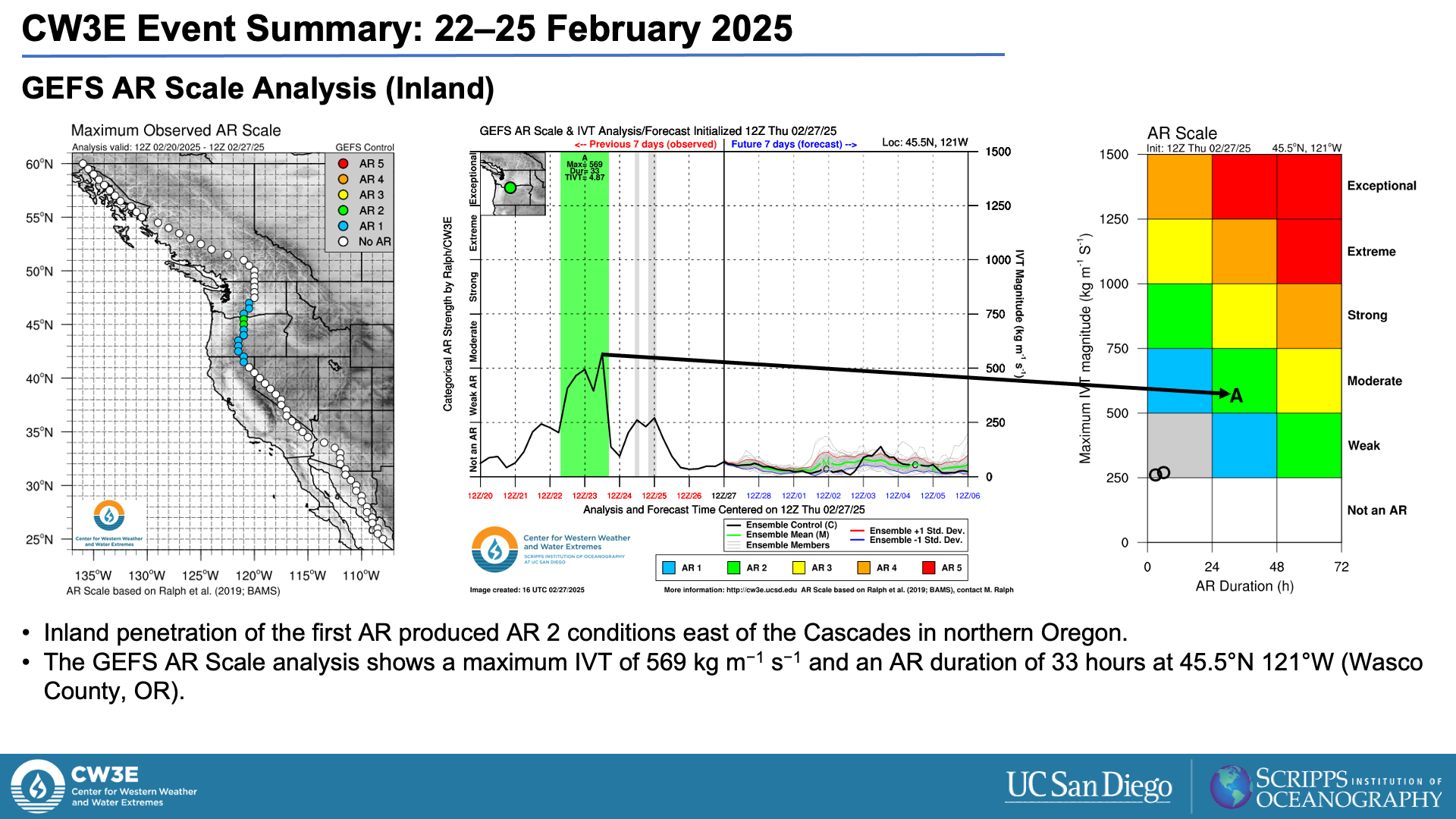
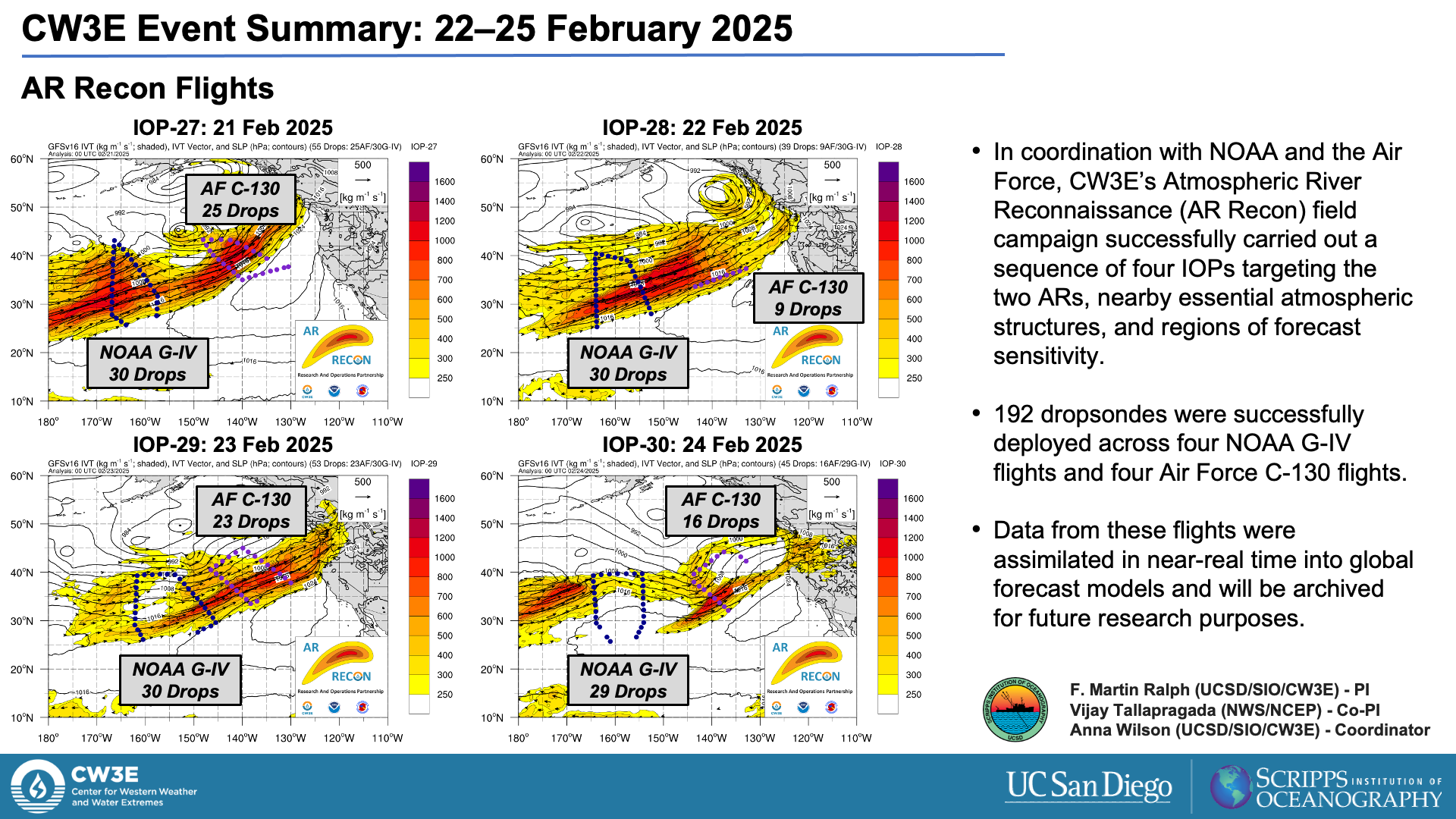
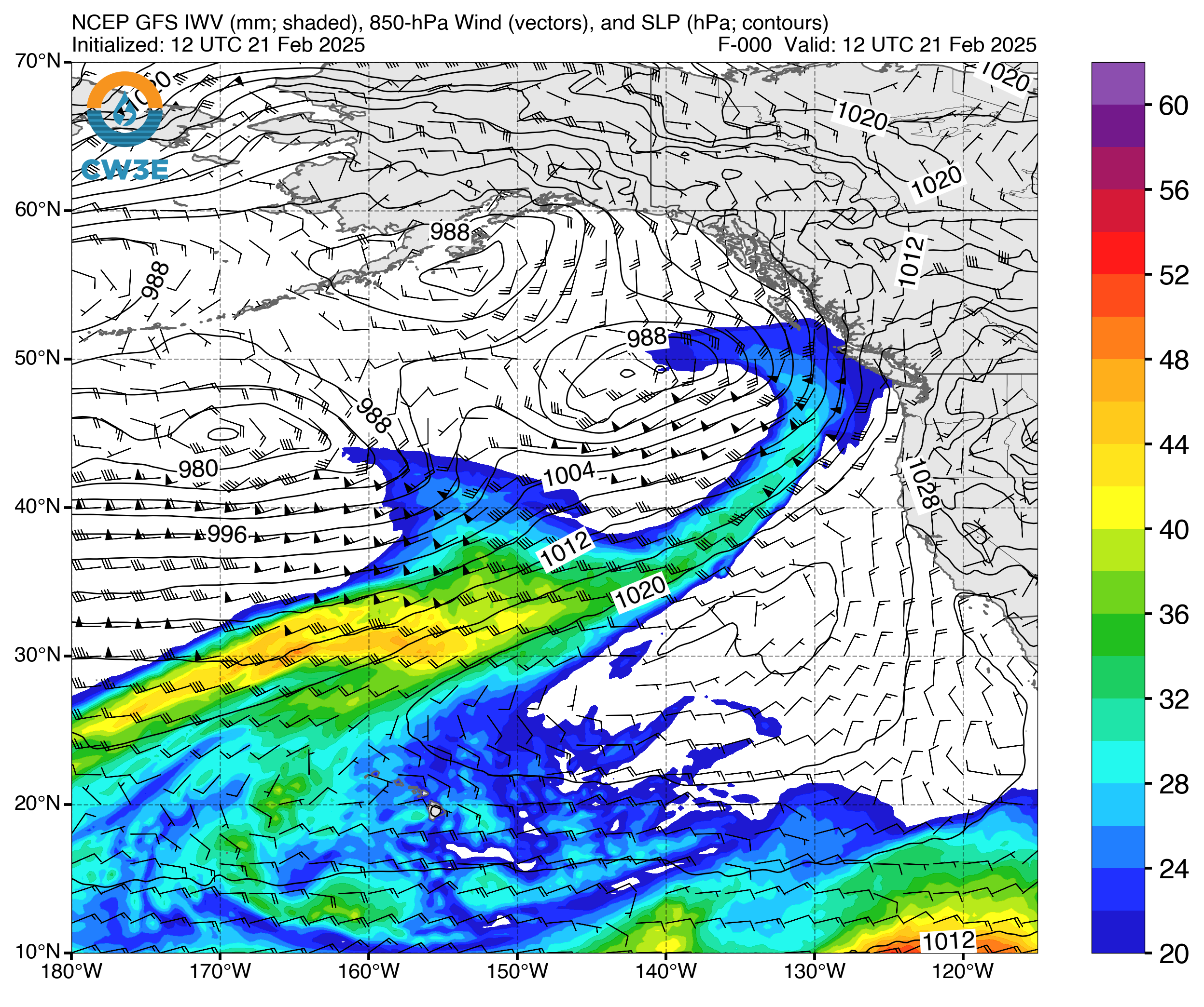
- The first AR made landfall on Sat 22 Feb and produced AR 2–3 conditions (based on the Ralph et al. 2019 AR Scale) in southern coastal Washington and coastal Oregon.
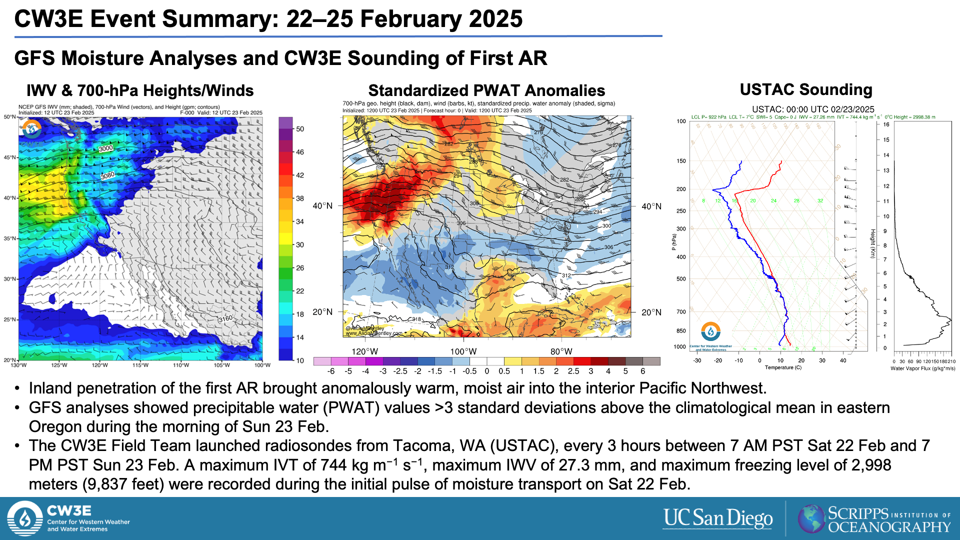
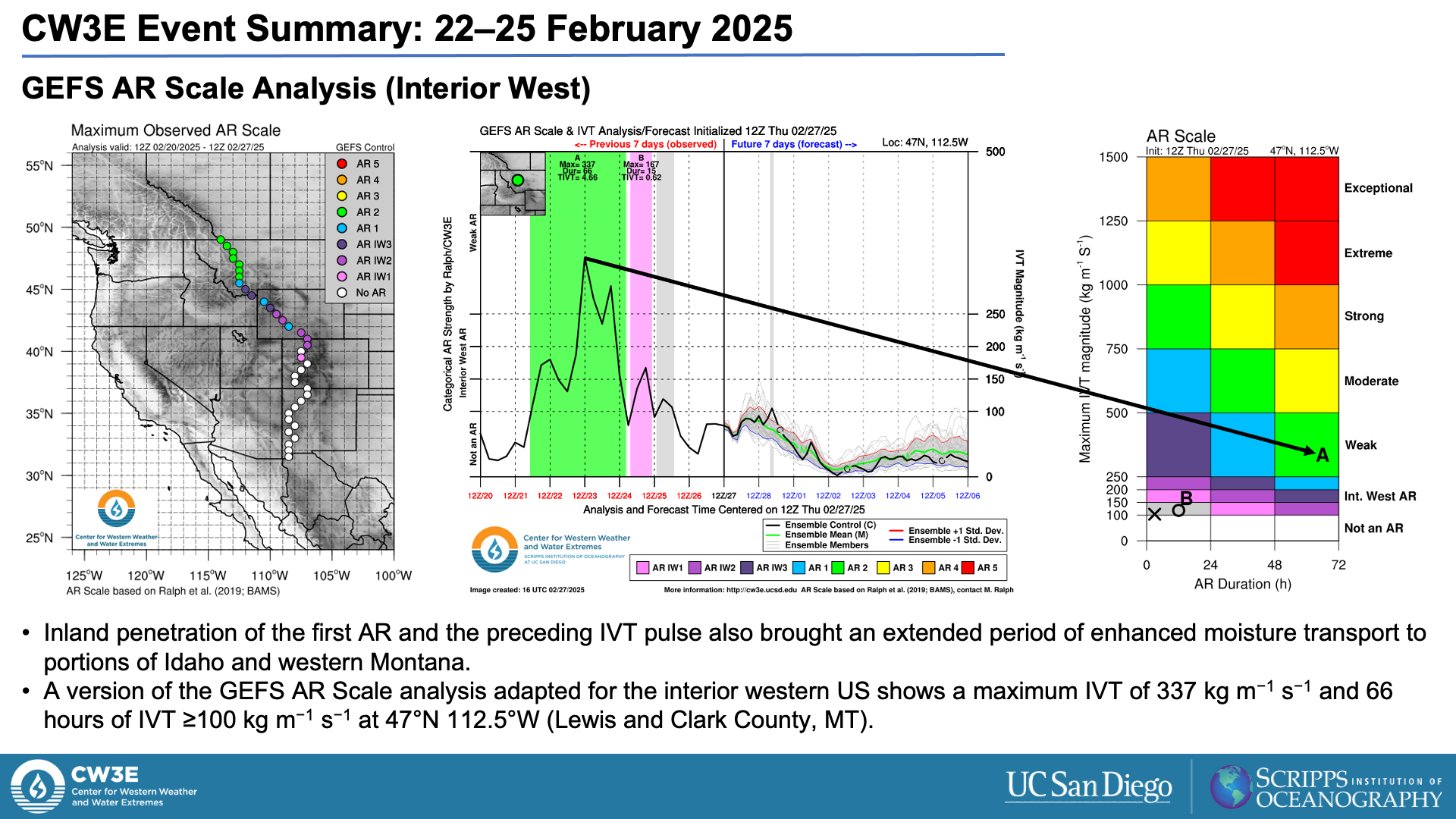
- Significant inland penetration of the first AR also brought AR 2 conditions to interior portions of the northwestern US.
- The second AR made landfall on Mon 24 Feb in association with a strong low-pressure system and produced AR 1–2 conditions in coastal Washington and Oregon.
Impacts:
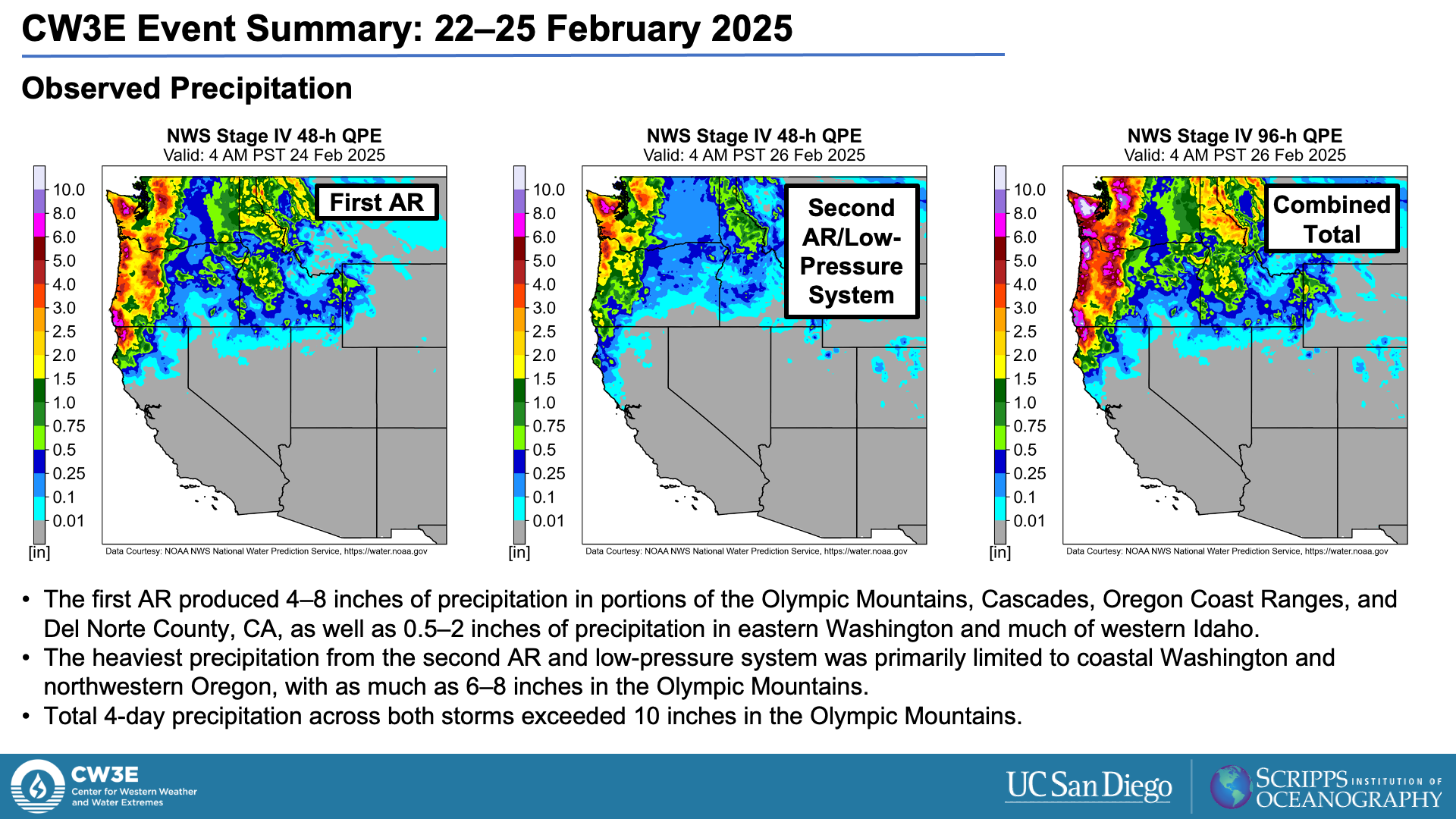
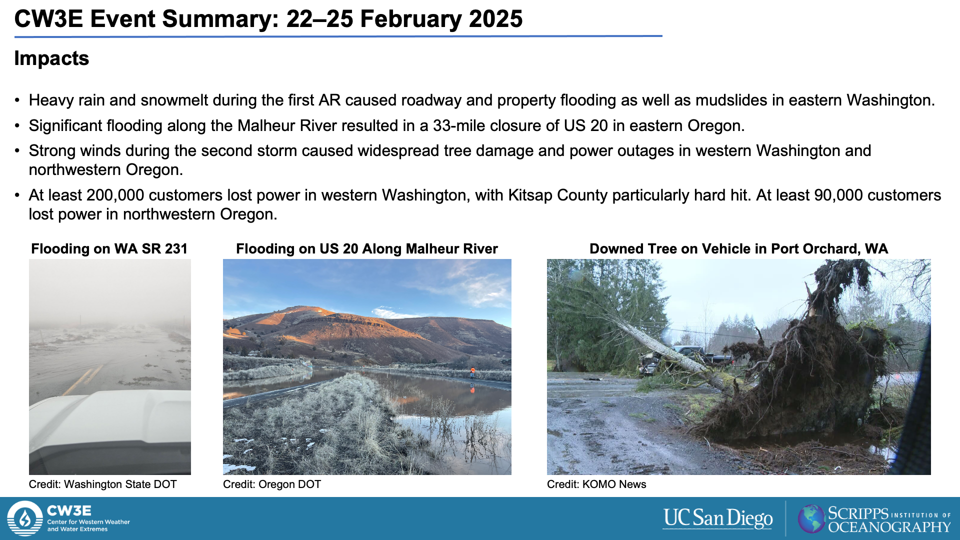
- At least 5–10 inches of total precipitation fell over much of coastal Washington and Oregon as well as the Cascades.
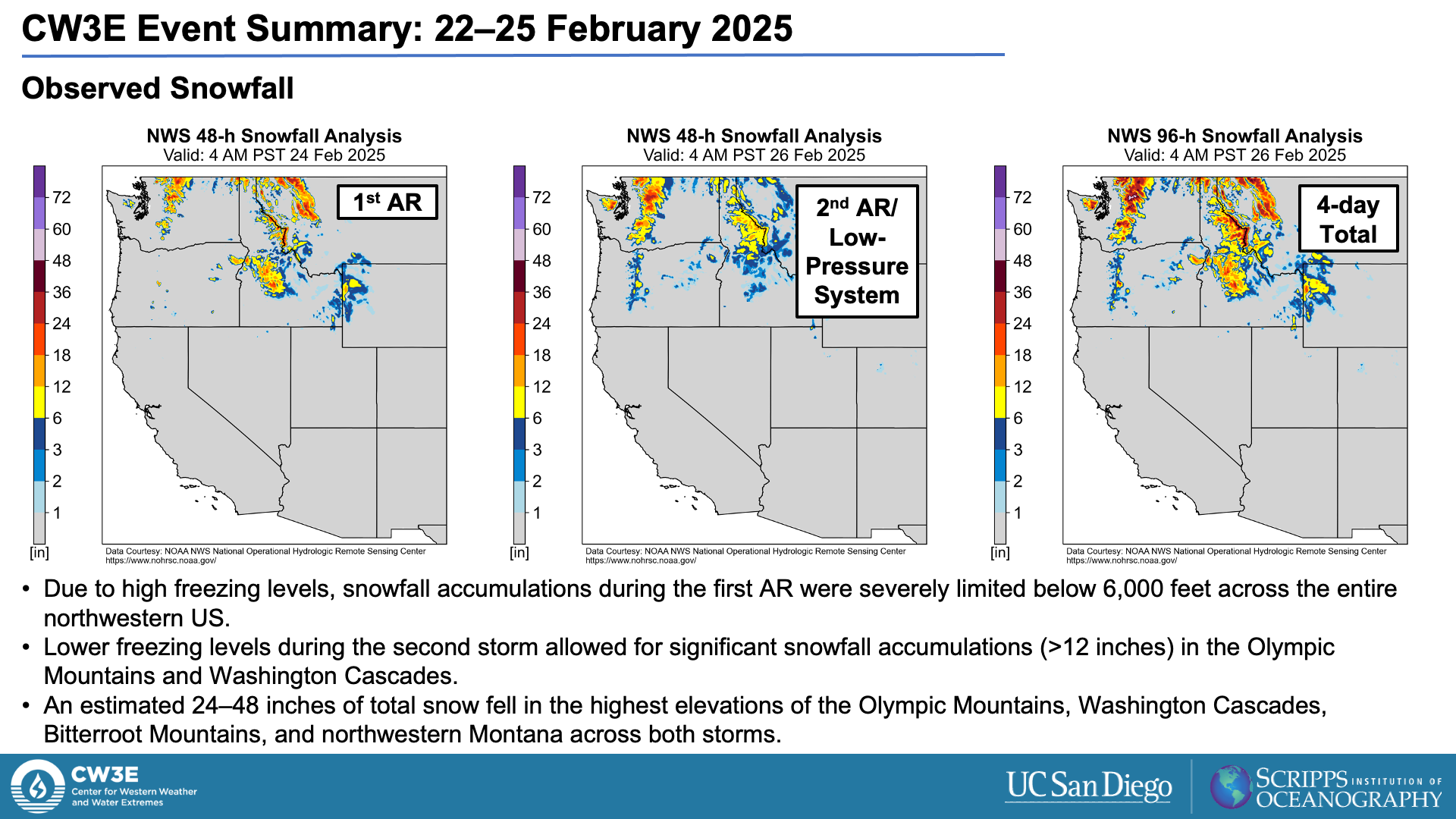
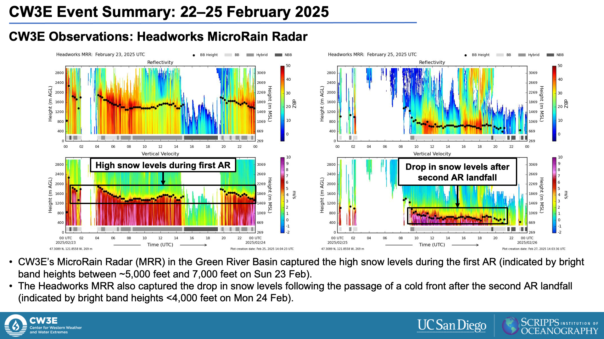
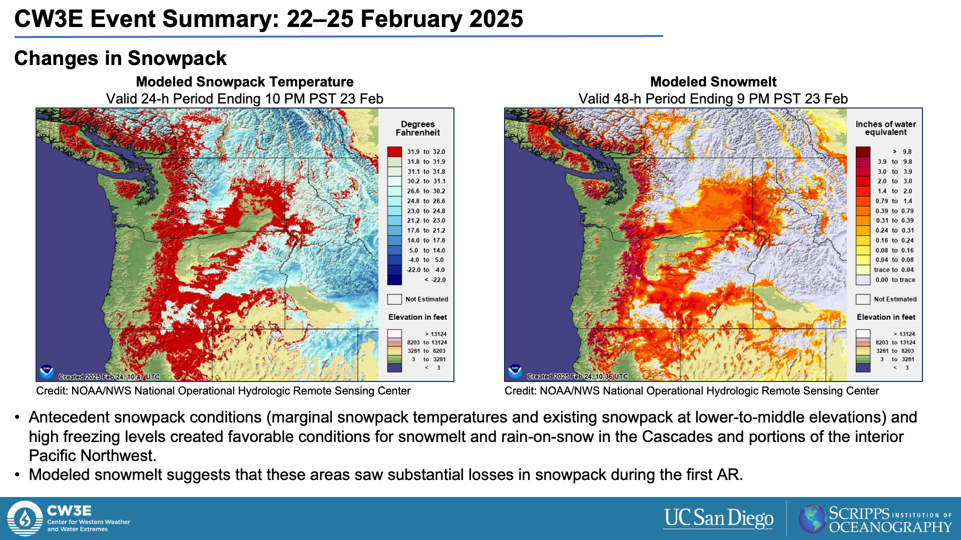
- Unusually warm temperatures and high freezing levels created favorable conditions for snowmelt and rain-on-snow during the first AR in the Cascades and interior portions of the Pacific Northwest.
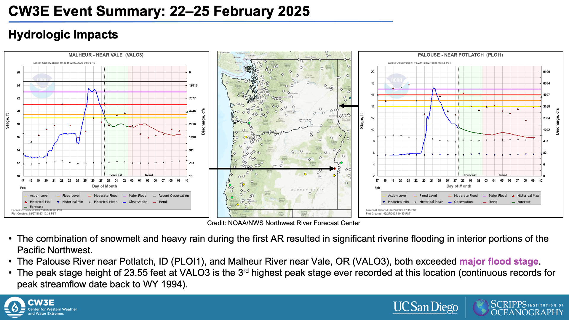
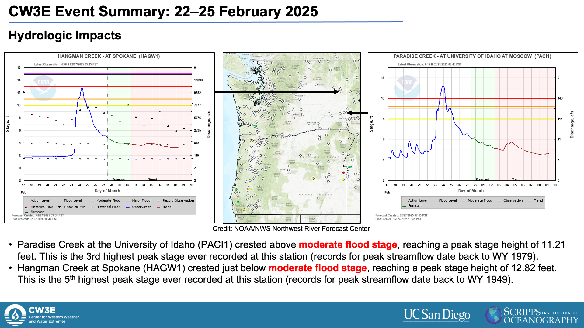
- The combination of snowmelt and heavy rainfall led to significant riverine flooding in eastern Washington, northern Idaho, and eastern Oregon.
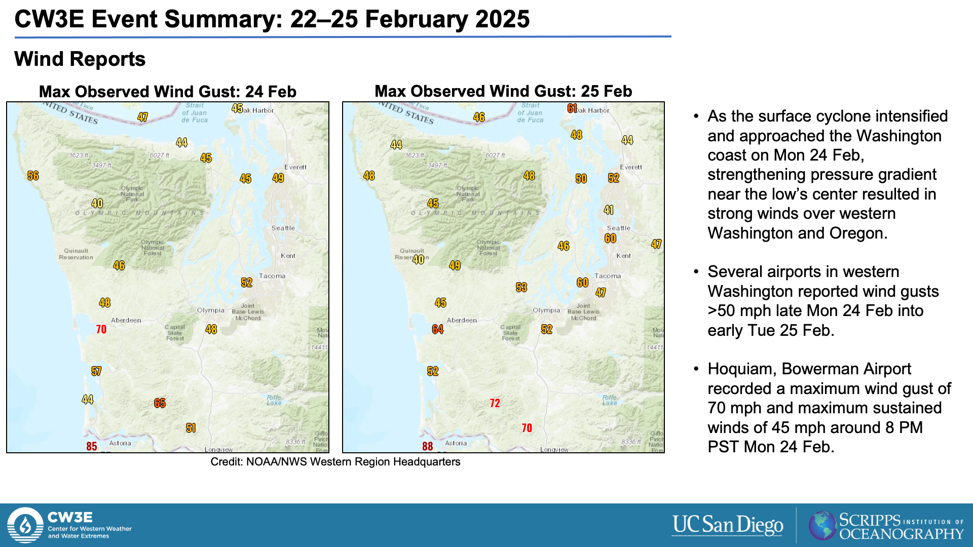
- Strong winds during the second storm caused widespread tree damage and power outages in western Washington and northwestern Oregon.
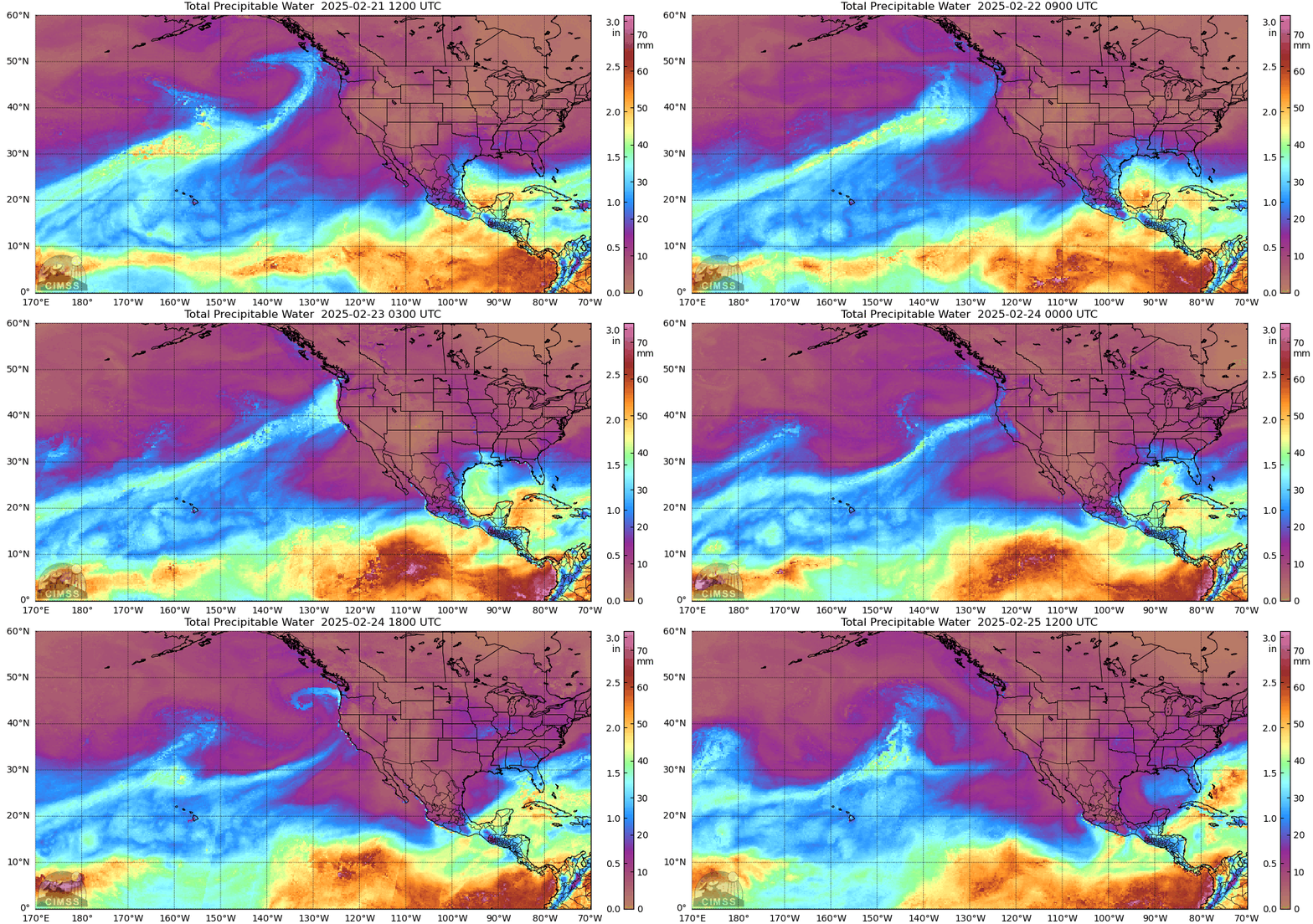
MIMIC-TPW2 Total Precipitable Water
Valid: 1200 UTC 21 February – 1200 UTC 25 February 2025
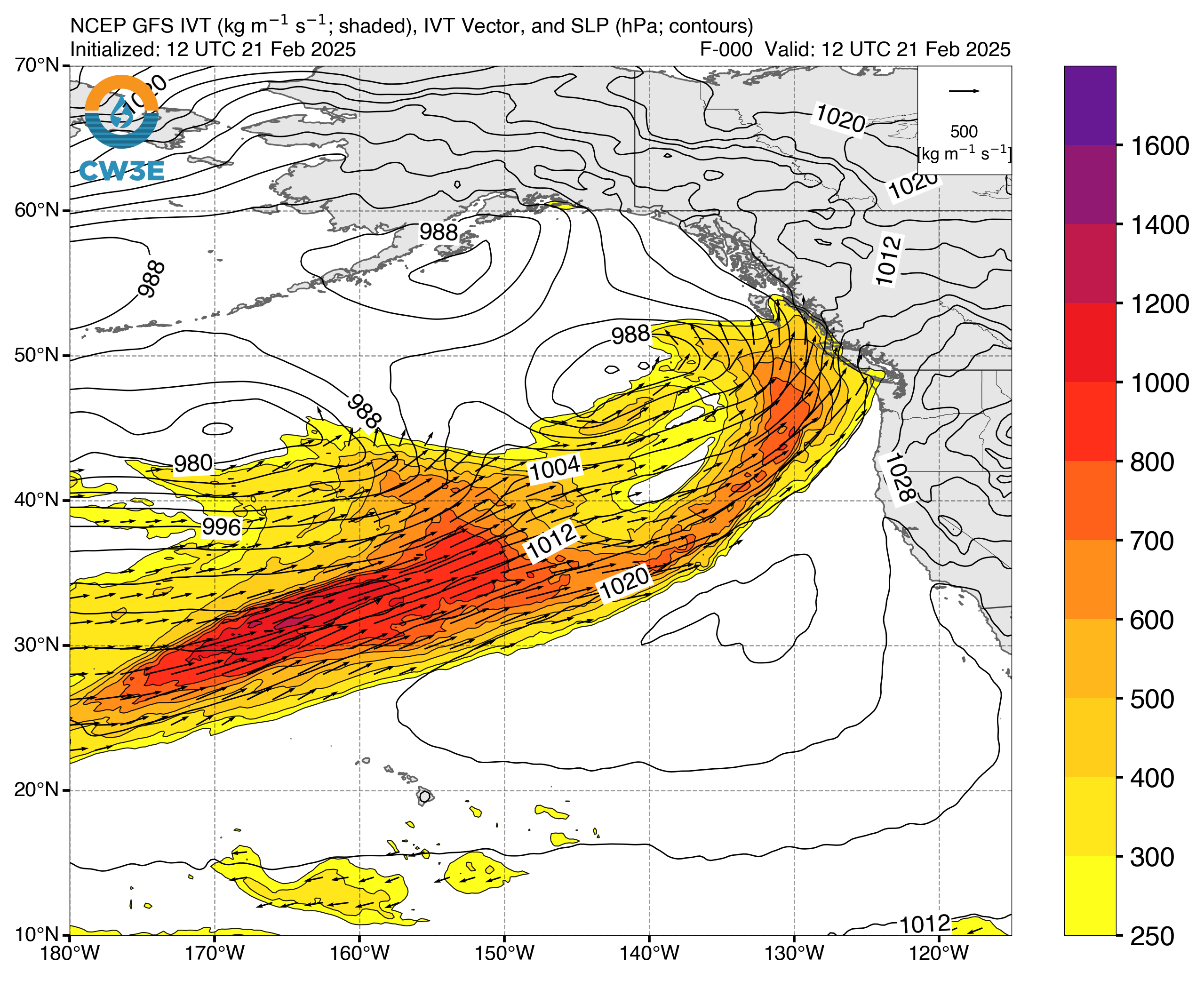
Click images to see loops of GFS IVT/IWV analyses Valid 1200 UTC 21 February – 1200 UTC 25 February 2025 |
|
 |
 |
Summary provided by C. Castellano, S. Roj, and J. Kalansky; 4 March 2025
To sign up for email alerts when CW3E post new AR updates click here.

