CW3E Event Summary: 22 December 2021 – 1 January 2022
January 5, 2022
Click here for a pdf of this information.
Atmospheric River and Upper-Level Systems Bring Heavy Rain and Snow to the Western US
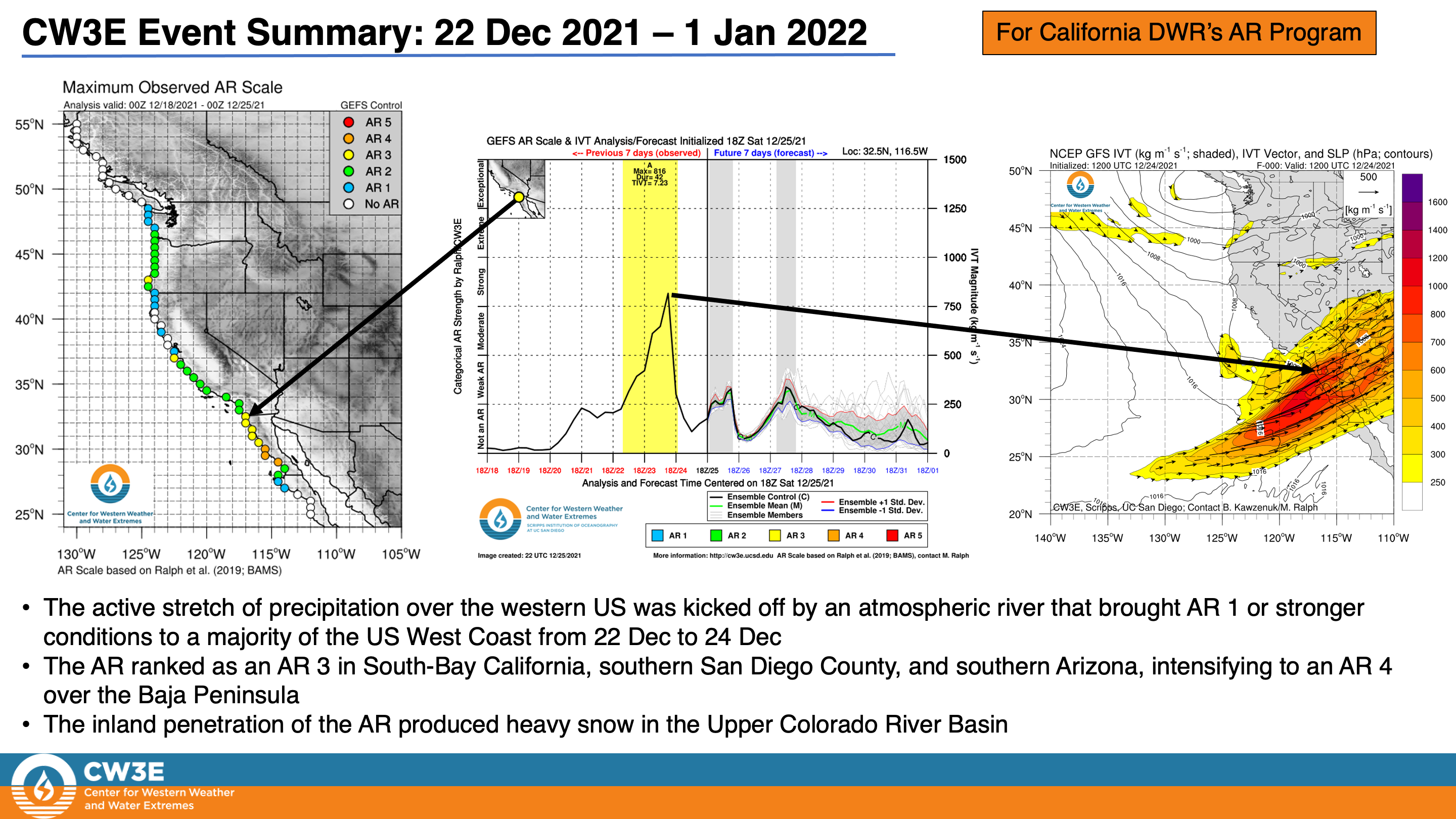
- An atmospheric river (AR) made landfall over California on 22 Dec and gradually strengthened as it spread across the interior southwestern US
- AR 2/AR 3 conditions (based on the Ralph et al. 2019 AR Scale) were observed over coastal Central and Southern California
- Significant inland penetration of this AR produced AR 3 conditions over southern Arizona and heavy snow in the Upper Colorado River Basin
- After the AR dissipated, a series of upper-level shortwaves brought additional rain and heavy snow to much of the western US
- Low freezing levels allowed for accumulating snowfall in the lower elevations of Washington, Oregon, and Northern California
- Portions of the Sierra Nevada, the Southern California Transverse Ranges, and the Sawatch Range in Colorado received more than 10 inches of total precipitation
- Several feet of snow fell across the Cascades, the Sierra Nevada, and the Intermountain West, with the heaviest snowfall (> 10 feet) near Lake Tahoe and in western Colorado
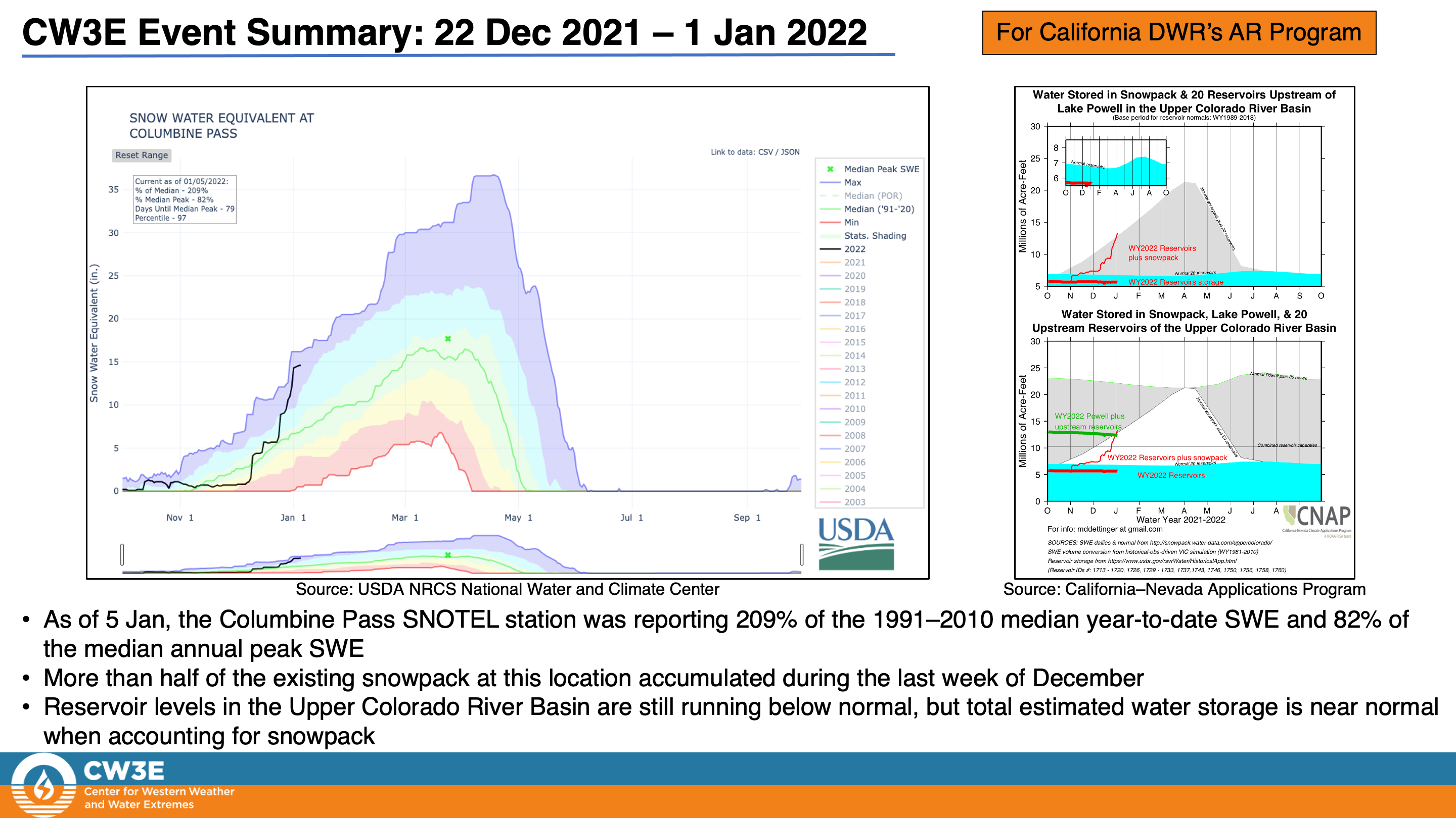
- These storms produced dramatic increases in snowpack in the Sierra Nevada and Upper Colorado River Basin
- As of 1 Jan, statewide snowpack in California was 154% of normal, and statewide water-year-to-date precipitation had already exceed the statewide total precipitation during WY 2021
- Heavy snow in the Sierra Nevada caused major travel disruptions and numerous power outages
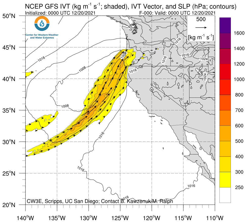
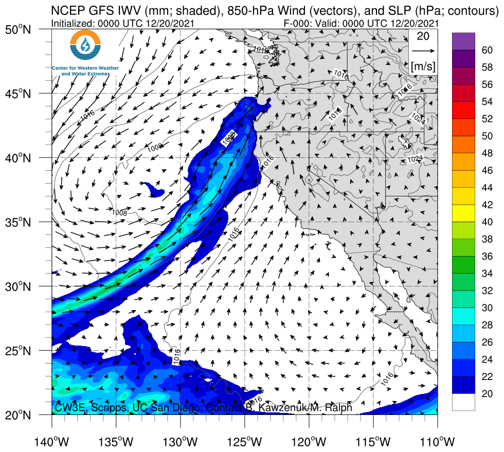
Click images to see loops of GFS IVT/IWV analyses Valid 0000 UTC 20 December – 1800 UTC 25 December 2021 |
|
 |
 |
Summary provided by C. Castellano, C. Hecht, S. Roj, J. Cordeira, J. Kalansky, B. Kawzenuk, F.M. Ralph; 5 January 2022
To sign up for email alerts when CW3E post new AR updates click here.
*Outlook products are considered experimental


