CW3E Event Summary: 9-11 September 2022
September 13, 2022
Click here for a pdf of this information.
Rare Tropical Cyclone Brings Heavy Rain and Strong Winds to Southern California
- Tropical Storm Kay and its remnants produced heavy rain and high winds across portions of Southern and Central California during 9–11 September
- Some locations in the San Diego County mountains recorded more than 4 inches of rain on 9 September. Wind gusts of over 100 miles per hour were also recorded.
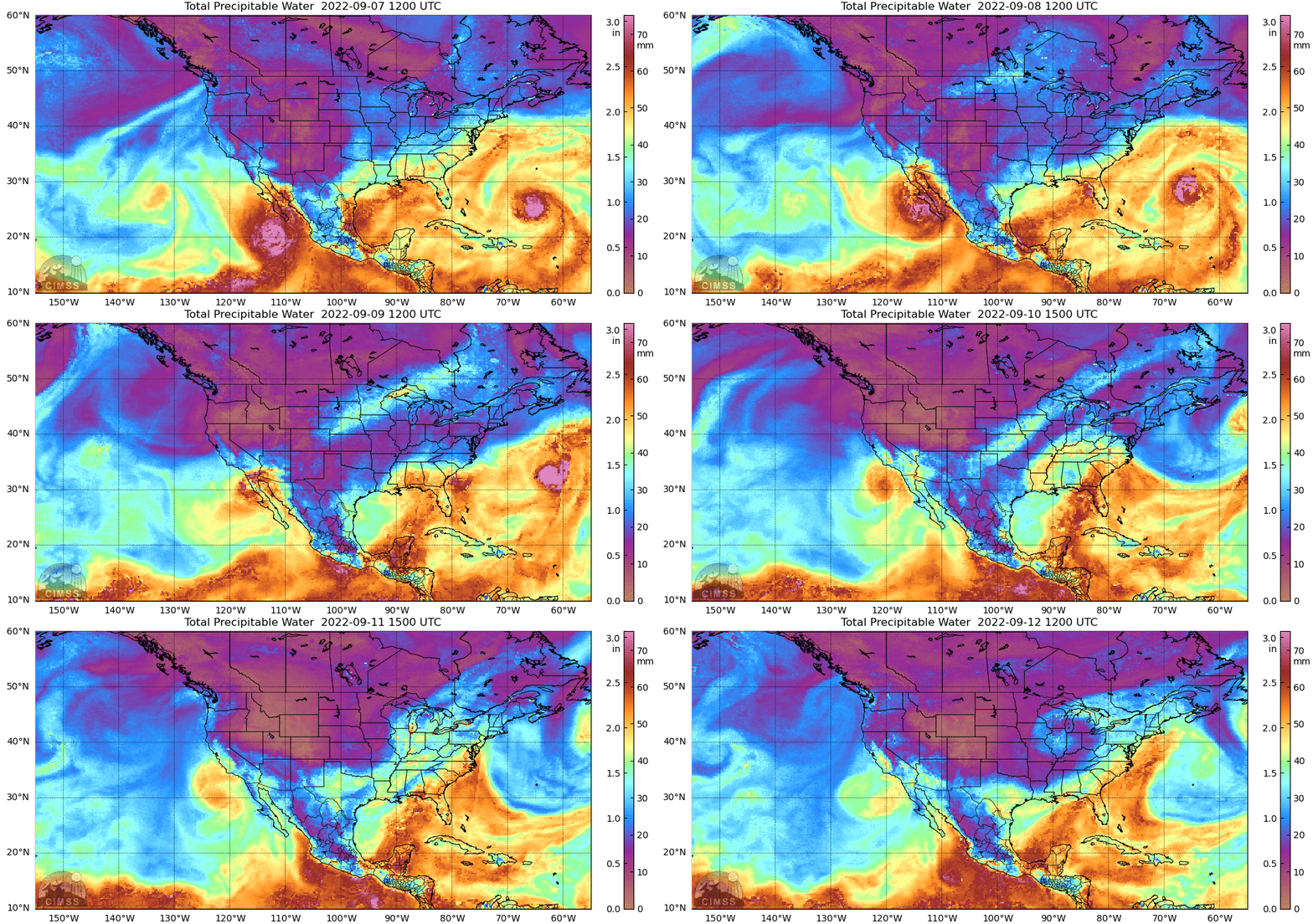
- Precipitable water observed during this event in San Diego was 2.35 inches, the 3rd highest during the period of record and the highest value observed during the month of September
- Heavy precipitation over desert areas resulted in roadway flooding, debris flows, and rockslides which caused prolonged roadway closures in multiple locations
- High winds forced multiple school districts to cancel school due to hazardous conditions
- Power outages for more than 60,000 customers were reported across Southern California
- Heavy rain helped to bring the Fairview and Radford fires under control. As of the morning of 13 September, Inciweb was reporting 62% and 67% containment, respectively
MIMIC-TPW2 Total Precipitable Water
Valid 0500 PDT 7 September – 1200 PDT 12 September 2022
Summary provided by Shawn Roj, Chris Castellano, Samuel Bartlett, Chad Hecht, J. Kalansky, F.M. Ralph; 13 September 2022
To sign up for email alerts when CW3E post new AR updates click here.
*Outlook products are considered experimental


