CW3E Event Summary: 9-12 June 2022
June 15, 2022
Click here for a pdf of this information.
An Unseasonably Strong Atmospheric River Produced Heavy Rainfall and Flooding in the Pacific Northwest, Northwest Wyoming, and Southern Montana
- An atmospheric river (AR) impacted the Pacific Northwest and Northern California between 9 and 12 June
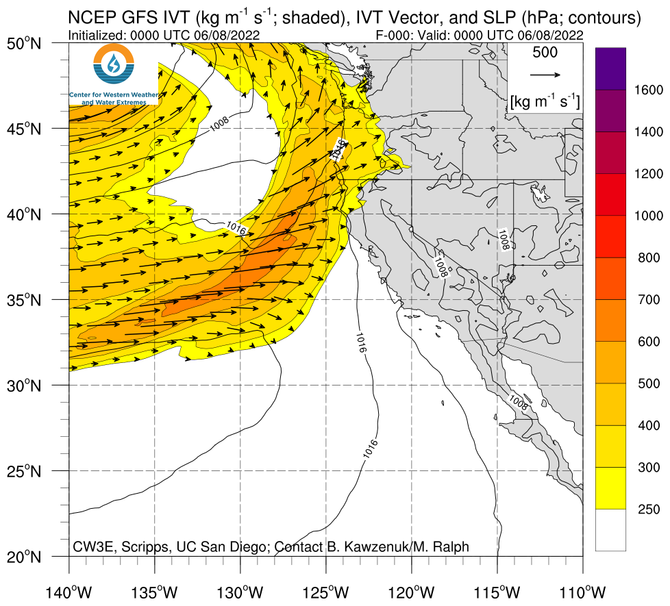
- An AR 5 (based on the Ralph et al. 2019 AR Scale) was observed in coastal Oregon, where AR conditions persisted for more than 60 consecutive hours with maximum IVT values exceeding 1100 kg m−1 s−1
- AR 4 conditions extended inland across eastern Oregon and northern California
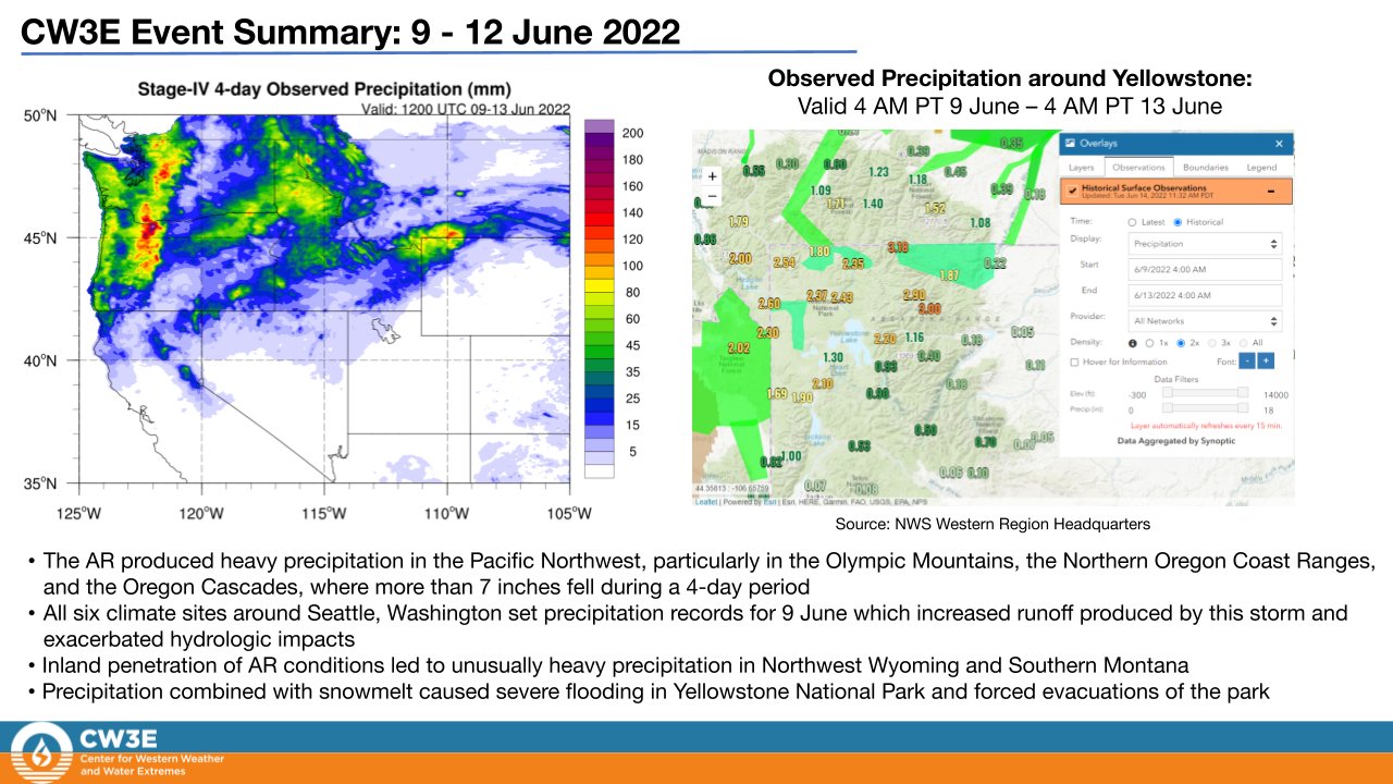
- Maximum total precipitation up to 7 inches fell in parts of the Oregon Cascades with more than 2 inches elsewhere throughout Oregon and Washington
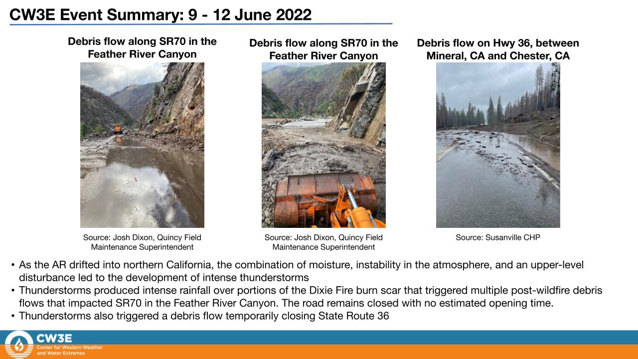
- Thunderstorms produced intense rainfall over portions of the Dixie Fire burn scar that triggered multiple post-wildfire debris flows that impacted SR70 in the Feather River Canyon
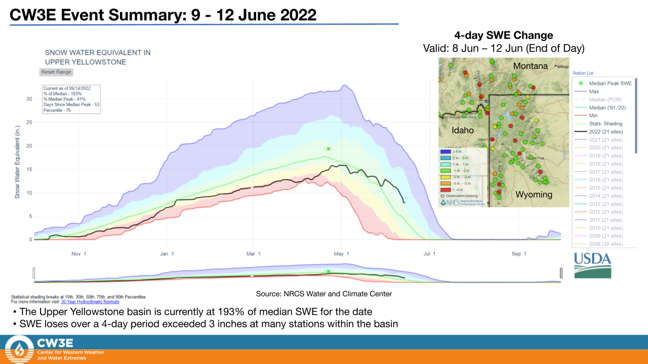
- A favorable atmospheric environment for severe weather over Yellowstone National Park, including diurnally driven instability and low-level shear, was enhanced by the presence of moisture associated with the AR. This resulted in intense rainfall and heavy snowmelt in Northwest Wyoming and Southern Montana forcing evacuations of parts of Yellowstone National Park
- Stream gauges along rivers within Yellowstone National Park experienced flows well above previous records
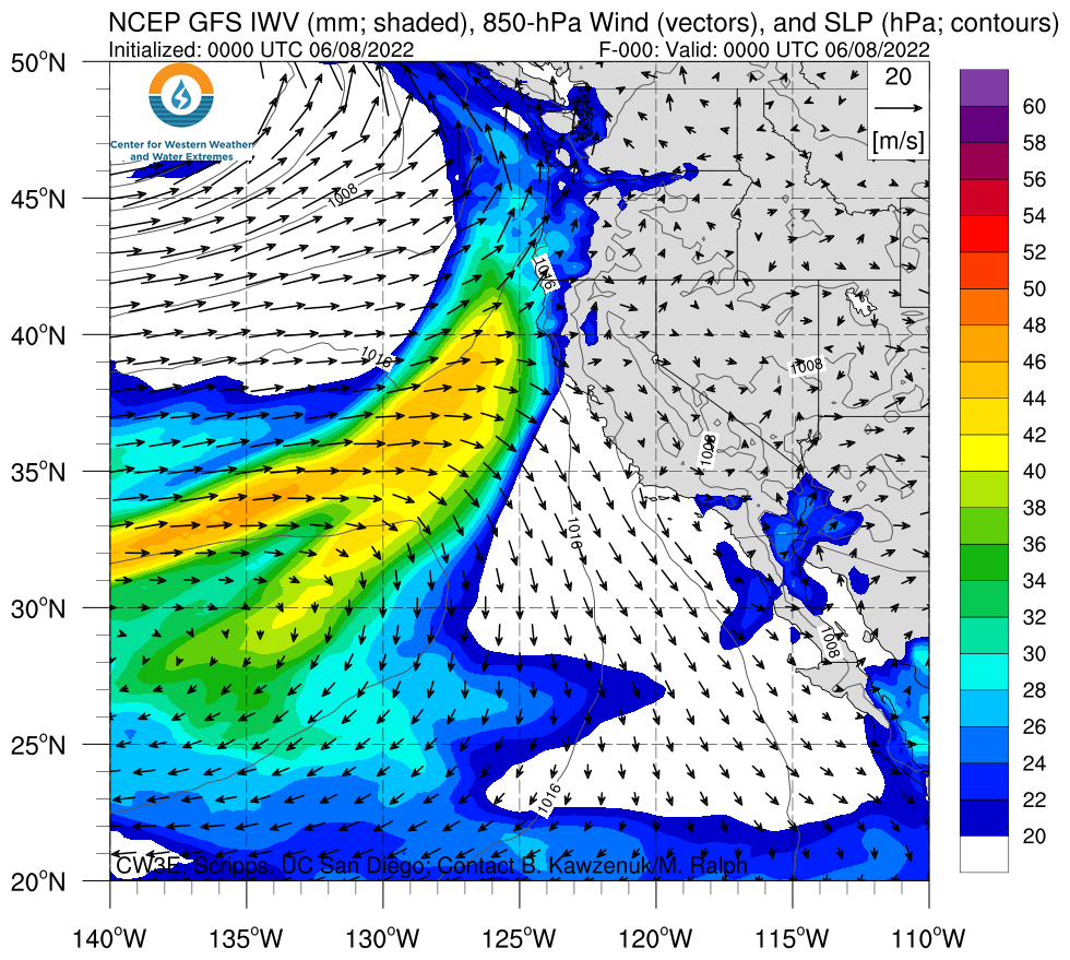
Click images to see loops of NAM IVT/IWV analyses Valid 0000 UTC 8 June – 1800 UTC 13 June 2022 |
|
 |
 |
Summary provided by Shawn Roj, Samuel Bartlett, Chad Hecht, Nina Oakley, J. Kalansky, B. Kawzenuk, F.M. Ralph; 15 June 2022
To sign up for email alerts when CW3E post new AR updates click here.
*Outlook products are considered experimental


