CW3E AR Update: 9 April Summary
April 9, 2019
Click here for a pdf of this information.
Summary of the atmospheric river that impacted Oregon and Northern California between 6 and 9 April 2019
- A strong and long duration AR made landfall over Oregon and Northern California during 6–9 April 2019
- Numerous locations across Northern California and Southern Oregon received >5 inches of precipitation over 72 hours with multiple gauges recording >10 inches
- The maximum three day total was 365 mm, or 14.58 inches. The max including a couple of days earlier reached over 17 inches.
- The AR resulted in AR Category 4 conditions over Southern Oregon, a lightly populated region
- Ten river gauges in OR and WA exceeded flood stage, and many others reached action level or bankfull.
- The landfall and limited southward propagation of the AR resulted in a large north-south gradient in precipitation accumulations between Del Norte and southern Humboldt Counties in Northern California
SSMI/SSMIS/AMSR2-derived Integrated Water Vapor (IWV)
Valid 0000 UTC 4 April – 1500 UTC 9 April 2019
Images from CIMSS/Univ. of Wisconsin
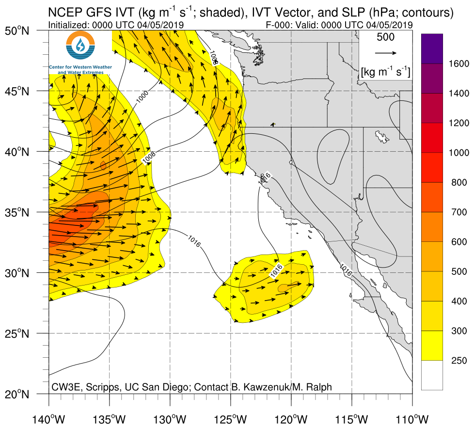
Click IVT or IWV image to see loop of GFS Analysis Valid 0000 UTC 5 April – 0600 UTC 9 April 2019 |
|
 |
 |
Summary provided by C. Hecht, B. Kawzenuk, and F. M. Ralph; 4 PM PT 9 April 2019


