CW3E AR Update: 10 June 2021 Outlook
June 10, 2021
Click here for a pdf of this information.
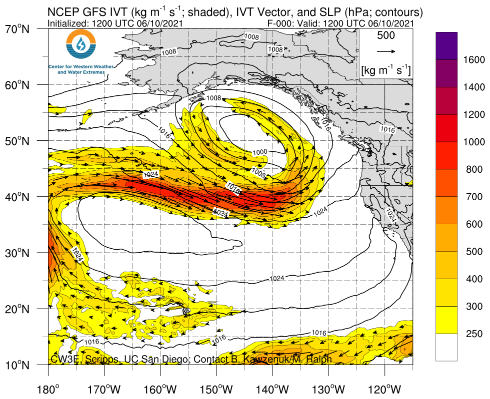
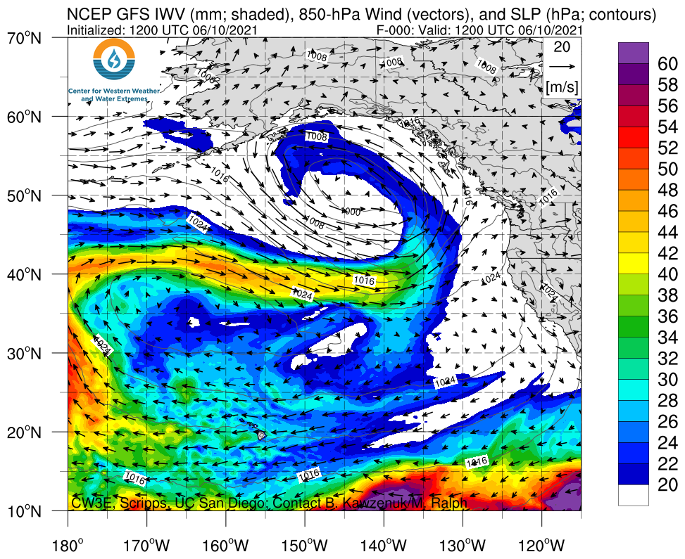
Multiple Late Season Atmospheric Rivers are Forecast to Impact Northern California and the PNW this Weekend
- This first AR is forecast to make landfall on Friday while the second and potentially stronger AR is forecast to make landfall late on Saturday
- The first AR is forecast to bring weak to moderate AR conditions to far Northern California and Southern Oregon
- Several GEFS ensemble members suggest the second AR could bring strong AR conditions (IVT >750 kg m–1 s–1) to Coastal OR, but there is higher forecast uncertainty surrounding this AR compared to the first
- The WPC is forecasting as much as 2–4 inches of precipitation over some of the higher elevation locations in Northern CA, OR, and WA
- While these ARs are forecast to bring impressive IVT magnitudes to the USWC for June, they are likely to be less productive than an AR of similar magnitude during the Winter
- Due to the extremely dry conditions across the U.S. West, any precipitation produced by these ARs will be beneficial with little to no hazards, though the precipitation will not be enough to mitigate the extensive drought conditions
Click images to see loops of GFS IVT & IWV forecasts Valid 1200 UTC 21 April – 1200 UTC 29 April 2021 |
|
 |
 |
Summary provided by C. Hecht, C. Castellano, J. Kalansky, and F. M. Ralph; 10 June 2021
*Outlook products are considered experimental
