CW3E AR Update: 12 November 2021 Outlook
November 12, 2021
Click here for a pdf of this information.
Unsettled Weather to Continue through the Weekend in Pacific Northwest
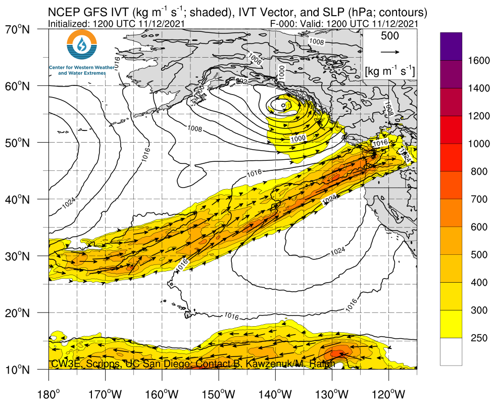
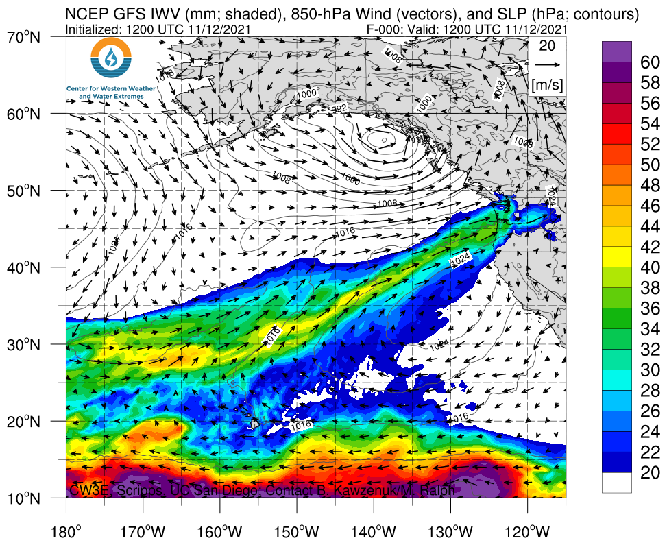
- A strong atmospheric river (AR) made landfall on Wednesday, bringing AR 3/AR 4 conditions (based on the Ralph et al. 2019 AR Scale) to southern coastal Washington and coastal Oregon
- Another strong AR is forecasted to make landfall in Washington and northern Oregon tomorrow
- AR 3/AR 4 conditions are once again likely across portions of coastal Washington and Oregon
- The first AR produced heavy rainfall in western Washington and northwestern Oregon yesterday into this morning
- An additional 5–10 inches of precipitation are forecasted over the Olympic Peninsula and Washington Cascades during the next 5 days
- Widespread riverine flooding is expected in western Washington in association with these two ARs
- Snowfall accumulations will be limited due to high initial freezing levels, but significant snow is possible in the North Cascades toward the end of the second event
Click images to see loops of GFS IVT & IWV forecasts Valid 1200 UTC 12 November – 1200 UTC 16 November 2021 |
|
 |
 |
Summary provided by C. Castellano, C. Hecht, J. Kalansky, and F. M. Ralph; 12 November 2021
To sign up for email alerts when CW3E post new AR updates click here.
*Outlook products are con
