CW3E AR Update: 18 April 2022 Outlook
April 18, 2022
Click here for a pdf of this information.
Active pattern is forecast to continue throughout today and into mid-week, increasing the potential for precipitation across the U.S. West Coast
- Over the past week, a series of ARs and low-pressure systems impacted Northern and Central California bringing 3 – 6 inches of liquid precipitation and 1–3 feet of snow
- The active pattern is forecast to continue over the next several days, resulting in additional precipitation and mountain snow
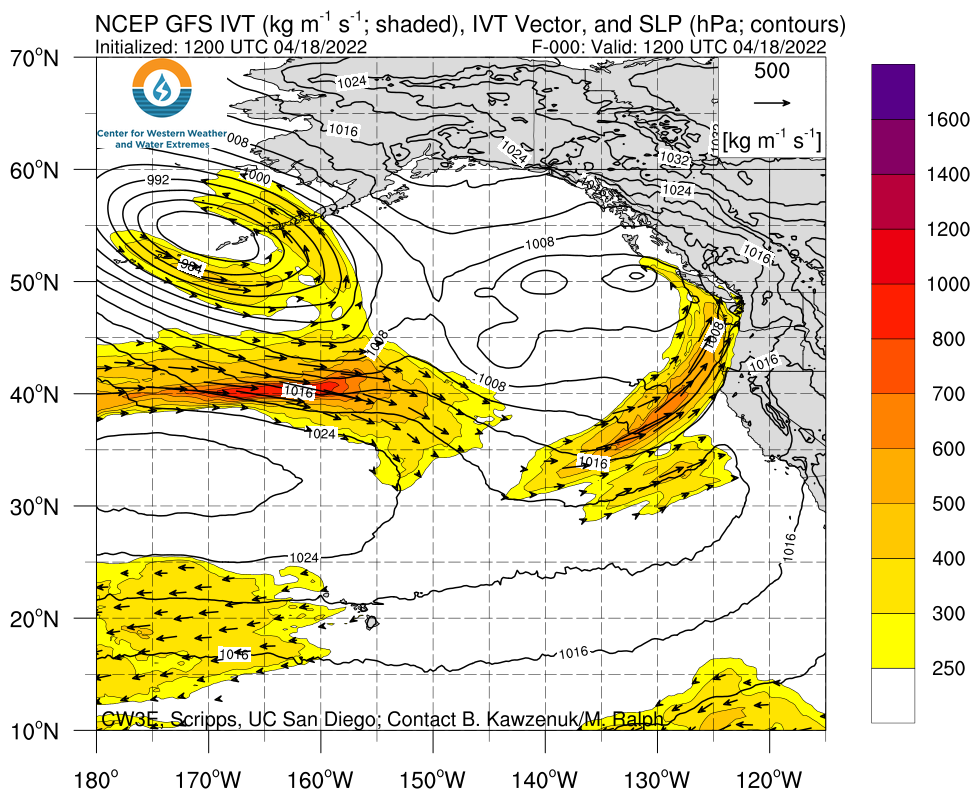
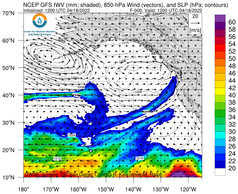
- An AR is currently impacting the Pacific Northwest and is forecast to move down the coast, impacting Northern California later today
- Another AR is forecast to move-in behind the current AR between the 20th and 21st, bringing an additional period of precipitation to the region
- Due to the relatively weak and short duration of these ARs in the forecast, it is unlikely that they will bring conditions that fall on the AR scale and the probability of AR 1+ conditions is low across a majority of California
- The NWS Weather Prediction Center (WPC) is forecasting at least 2–5 inches of precipitation over the Northern Sierra Nevada, Northern California Coast Ranges, and southern Oregon Coast Ranges during the next 5 days
- The National Weather Service has issued a Winter Weather Advisory of portions of the Northern Sierra Nevada
Click images to see loops of GFS IVT & IWV forecasts Valid 1200 UTC 18 April – 1200 UTC 19 March 2022 |
|
 |
 |
Summary provided by C. Castellano, C. Hecht, S. Roj, S. Bartlett, J. Kalansky, and F. M. Ralph; 18 April 2022
To sign up for email alerts when CW3E post new AR updates click here.
*Outlook products are considered experimental

