CW3E AR Update: 4 November 2022 Outlook
November 4, 2022
Click here for a pdf of this information.
Major Winter Storm Expected to Impact California Early Next Week
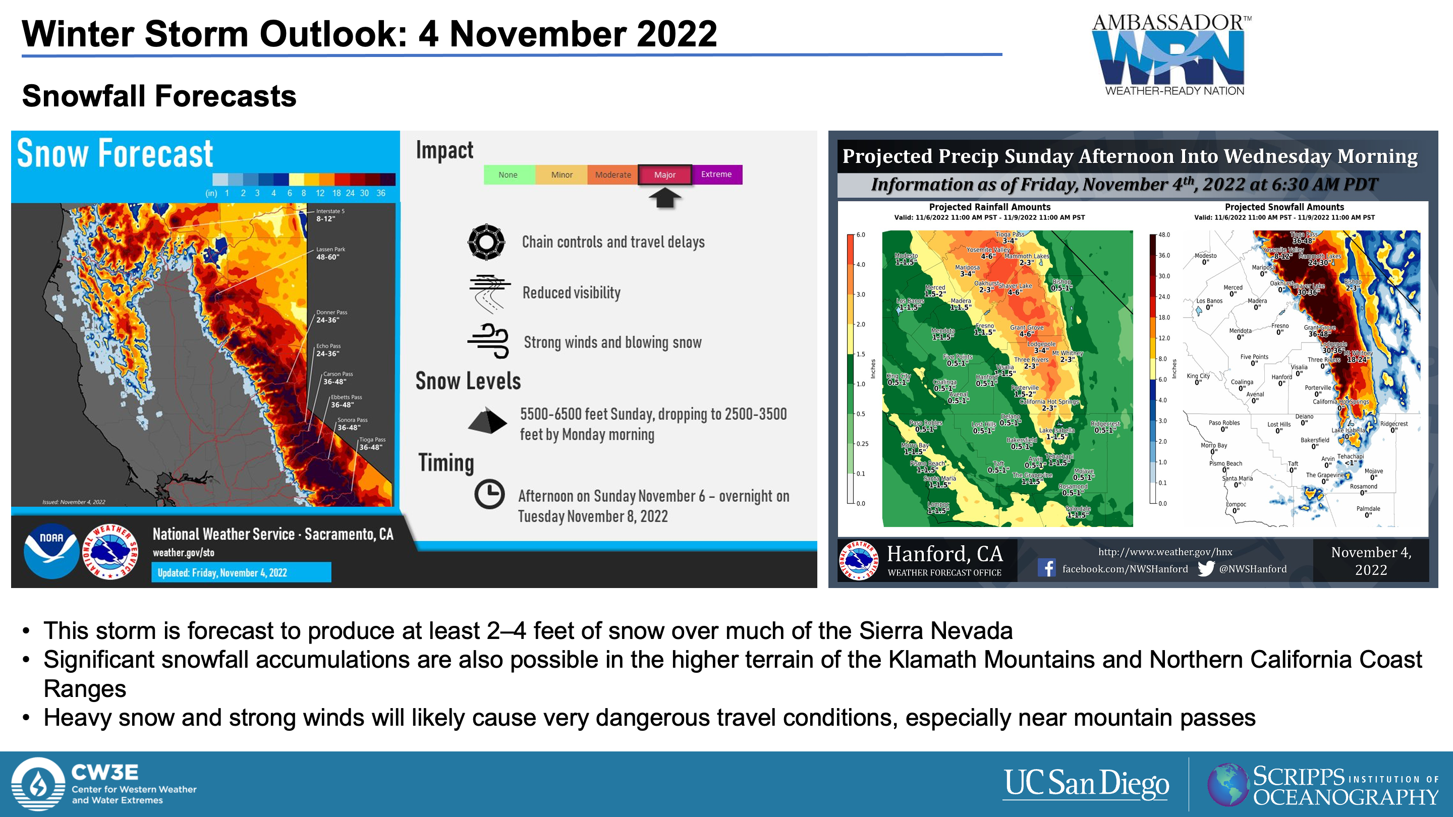
- An early-season winter storm is forecast to bring precipitation to much of California, with heavy snow likely in the Sierra Nevada
- Precipitation during this event will be fueled by a combination of strong dynamical forcing downstream of an upper-level trough and upslope moisture flux as the trough interacts with a weakening atmospheric river (AR) currently over the Pacific Northwest
- The heaviest precipitation is forecast over the Sierra Nevada, eastern Transverse Ranges, and Peninsular Ranges, with 3–6 inches of total precipitation expected in these areas
- There is still considerable uncertainty in storm-total precipitation over Central and Southern California, with large differences between the 00Z GFS and 00Z ECMWF models
- Due to low freezing levels, a significant portion of the storm-total precipitation is expected to fall as snow in the watersheds surrounding the Sierra Nevada
- More than 2 feet of snow is forecast over the much of the Sierra Nevada
Click images to see loops of GFS 500-hPa Vorticity & IVT forecasts Valid 1200 UTC 6 November – 1200 UTC 9 November 2022 |
|
 |
 |
Summary provided by C. Castellano, C. Hecht, J. Kalansky, S. Roj, and F. M. Ralph; 4 November 2022
To sign up for email alerts when CW3E post new AR updates click here.
*Outlook products are considered experimental


