Weather on Steroids: The Art of Climate Change Science

Weather on Steroids: The Art of Climate Change Science

March 9, 2017

La Jolla Historical Society: February 11 – May 21

San Diego Public Library: June 10 – September 3

Click here for a pdf file of this information.

WEATHER ON STEROIDS: THE ART OF CLIMATE CHANGE SCIENCE

Weather on Steroids explores the consequences, challenges, and opportunities that arise from the changing climate on our planet. The exhibition partners artistic and scientific communities to create a visual dialogue about the vexing problem of climate change, and explores how weather variability affects the day-to-day life of local communities. The exhibition investigates Southern California vulnerability to climate change, and draws on the region’s scientific expertise at the Scripps Institution of Oceanography, whose investigators are at the forefront of climate research. Weather on Steroids brings together artists and scientists to reflect on humanity’s role in our changing climate and to envision new possibilities for a sustainable future. The focus is on weather extremes fueled by the steroids of climate change and their impacts on society: heat waves, atmospheric rivers, and drought with impacts on health and agriculture; deluges, sea level rise, and coastal erosion; extreme winds and devastating wildfires. Science serves as a basis and inspiration for imaginative and creative responses from artists. Artists’ subjective images and scientists’ objective scientific results reveal how climate change upsets the planet’s balance with extreme weather impacts. By illuminating the reality of climate change, Weather on Steroids aspires to take a proactive local role to engender collaboration between art and science for the benefit of cross-disciplinary and public education.

https://lajollahistory.org/exhibitions/current-exhibitions/

11 artists and 11 scientists collaborated, usually 1-1, to produce Weather on Steroids

Atmospheric Rivers

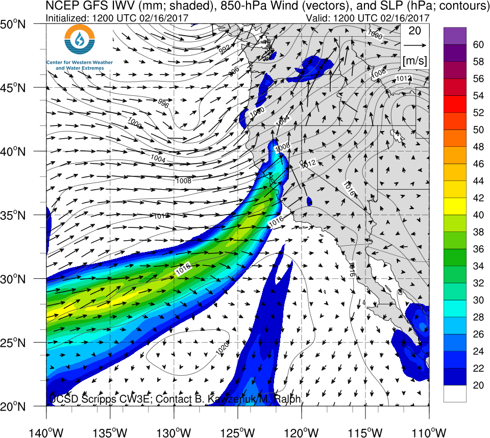
Was produced for the Exhibition from mixed media, recycled and repurposed materials, by Oscar Romo in consultation with CW3E’s Alexander Gershunov. It is one example of CW3E’s research inspiring art and contributing to Weather on Steroids. Each installation at the Exhibition is accompanied by 2 didactic panels: one from the artist and one from the scientist. Excerpts of the panels follow.

“…Made of repurposed materials, Romo’s piece symbolizes Nature’s power. Wind and moisture manifest kinetic/male and latent/feminine energy that together represent creation or creativity that we are learning to harness in ever-greater amounts. Rather than induce a negative perception of the subject, Romo, as a practitioner of “natural systems design”, argues that resilience can be accomplished through the understanding of nature and its remarkable ability to adapt and the human capacity to learn from the natural world. Repurposed objects in the installation communicate a concern over our excessive use of energy and massive generation of waste but also demonstrate an opportunity for us to become more efficient and respectful of our natural resources by reducing, recycling, reusing and recovering goods.” (from didactic panel by Oscar Romo)

“…The extreme rainfall that ARs can produce in California over a couple of days is similar to the rainfall amounts associated with land-falling hurricanes of the East and Gulf coasts. ARs provide much of the precipitation to California and they drive the volatile water resources in our State, but they do so in spurts, and so can cause floods, landslides and avalanches. In a warming climate, ARs are expected to carry more water vapor. ARs are the mechanisms that will produce many of the stronger precipitation extremes that are projected for our region by climate models. Extreme precipitation events are also expected to be warmer in the future and to produce a much larger proportion of rain compared to snow, further enhancing their potential to cause catastrophic floods and be less amenable to regulated water storage in reservoirs.” (from didactic panel by Alexander Gershunov)

On Romo’s Globe, continents are made from bicycle sprockets. Tropical moisture and atmospheric rivers (ARs) are represented by the bottoms of bottles collected from the Tijuana River. The Globe is directly exposed to landfalling ARs and is designed to rotate and rust as it catches wind and moisture.

Global warming, includes trends in climate extremes (e.g. drought) and extreme weather events (e.g. heat waves, floods, hurricanes, atmospheric rivers) that are devastating and locally felt. These changing extremes can register climate change acutely in our individual experiences. Yet the connection of regional weather extremes to global climate change is somewhat like the connection of an athlete’s performance in an individual sports event to her use of steroids. The steroids are only a partial and obscure cause of any individual outcome, yet their impact is evident in the statistics of the athlete’s performances over an entire season, especially when compared to pre-steroid seasons’ statistics.

(photos by Alexander Gershunov)

CW3E Launches New Website

CW3E Launches New Website

March 8, 2017

Today CW3E launches it’s new and improved website. In addition to the new design, the website is now more efficient, more user-friendly, more secure, and more able to handle increased traffic as interest in western weather extremes, in particular atmospheric rivers grows. CW3E is collaborating with the Jacobs School of Engineering at UCSD, which is hosting the website and has infrastructure built to prevent any down time of the CW3E website. The development was lead by staff researcher Brian Kawzenuk with additional input from CW3E employees and collaborators. All the same great material, including news items and real-time forecasts and observations are still available on the website.

For comments, concerns, or questions about the new website contact Brian Kawzenuk, Julie Kalansky, Chad Hecht, or Marty Ralph.

Odds of Reaching 100% Water Year Precipitation – Mar Update

Odds of Reaching 100% of Normal Precipitation for Water Year 2017 (March Update)

March 8, 2017

Contribution from Dr. M.D. Dettinger, USGS

The odds shown here are the odds of precipitation in the rest of the water year (after February 2017) totaling a large enough amount to bring the water-year total to equal or exceed the percentage of normal listed. “All Yrs” odds based on monthly divisional precipitation totals from water year 1896-2015. Numbers in parenthesis are the corresponding odds if precipitation through February had been precisely normal (1981-2010 baseline).

Click here for a pdf file of this information.


How these probabilities were estimated:

At the end of a given month, if we know how much precipitation has fallen to date (in the water year), the amount of precipitation that will be required to close out the water year (on Sept 30) with a water-year total equal to the long-term normal is just that normal amount minus the amount received to date. Thus the odds of reaching normal by the end of the water year are just the odds of precipitation during the remaining of the year equaling or exceeding that remaining amount.

To arrive at the probabilities shown, the precipitation totals for the remaining months of the water year were tabulated in the long-term historical record and the number of years in which that precipitation total equaled or exceeded the amount still needed to reach normal were counted. The fraction of years that at least reached that threshold is the probability estimate. This simple calculation was performed for a full range of possible starting months (from November thru September) and for a wide range of initial (year-to-date) precipitation conditions. The calculation was also made for the probabilities of reaching 75% of normal by end of water year, 125%, and 150%, to ensure that the resulting tables of probabilities cover almost the full range of situations that will come up in the future.

[One key simplifying assumption goes into estimating the probabilities this way: The assumption that the amount of precipitation that will fall in the remainder of a water year does not depend on the amount that has already fallen in that water year to date. This assumption was tested for each month of the year by correlating historical year-to-date amounts with the remainder-of-the-year amounts, and the resulting correlations were never statistically significantly different from zero, except possibly when the beginning month is March, for which there is a small positive correlation between Oct-Mar and Apr-Sept precipitation historically.]

Contact: Michael Dettinger (USGS)

Director of CW3E to Present at Birch Aquarium

Director of CW3E to Present at Birch Aquarium

March 7, 2017

Director of the Center for Western Weather and Water Extremes, Dr. F. Martin Ralph, will present on atmospheric rivers, their impacts, and their role on California’s water cycle and budget as part of Birch Aquarium’s Perspectives Lectures. The lecture series features presentations on research conducted by scientists from Scripps Institution of Oceanography. Dr. Ralph’s presentation on atmospheric rivers will be held from 7–8 P.M. (doors open at 6:30) on Monday, March 13th. Tickets are $8 for the general public, $5 for students and teachers, and free for Birch Aquarium Members.

Click here for more information.

Current Winter Setting a New California-Wide Record Precipitation Accumulation

Current Winter Setting a New California-Wide Record Precipitation Accumulation

March 7, 2017

Fueled by a string of strong atmospheric rivers (ARs), California’s current winter-to-date accumulated precipitation has hit a new record high level, eclipsing the previous record set during the strong El Niño winter of 1982-83.

The winter began with an unusual early season AR, which contributed 6% of normal annual California-wide precipitation over the period Oct 14-17. Strong AR activity continued in Jan and Feb 2017, with exceptionally strong precipitation Jan 8-10, which produced 14% of normal statewide annual precipitation in just three days and reached R-cat 4 intensity. (R-cat levels measure intense precipitation events; a fuller description of R-cat levels and this event can be found here). The AR during Feb 7-9 produced 9.5% of total annual California precipitation. Together, the latter two AR events produced nearly a quarter of an entire normal year’s precipitation in just 6 days, with each event including extreme intensity AR landfalls in the state.

The figure below shows the water year (Oct 1st – the following Sep 30th) that holds the record for maximum precipitation in California accumulated since the beginning of October for each day of winter. The current water year, 2017, broke the old record in early February and has continued to be the record-holder up to the current date (first week of March). Currently, 1982-82 holds the record for the maximum state-wide accumulated precipitation at the end of May in observations that go back to 1948. The accumulation so far this year is above the pace of 1982-83, but 1982-83 received a significant amount of precipitation in March and early May.

This figure shows California statewide accumulated precipitation estimated from 96 stations distributed across the state, but similar results are seen in the “Eight Station Index”, which uses eight stations in the Sierra Nevada selected for their importance to the state’s water supply. The eight station index is likewise currently at new record levels of accumulated winter precipitation, superseding the previous record-holding winter of 1982-83.

The southern portion of the state, including the greater Los Angeles region and San Diego county, are unusually wet so far this winter but not at record breaking levels. For instance, the Los Angeles region received substantially more precipitation in 2005, which led to widespread flooding, infrastructure damage, and several deaths.

The record-breaking precipitation has led to high values of snow cover, as shown by the yellow line (winter of 2016-2017) below. In the central and southern Sierra Nevada, current values are almost twice what is seen at the typical peak of snow accumulation on April 1st, and significantly above the high values seen during the El Niño winter of 1997-98 (dashed blue line). Snow is an important component of California’s water supply, since it holds the precipitation from intense winter storms, releasing the water more slowly via snow melt.

Contact: David Pierce and Marty Ralph

CW3E AR Update: 28 February 2017 Post Event Summary and Outlook

CW3E AR Update: 28 February 2017 Post Event Summary and Outlook

February 28, 2017

Click here for a pdf of this information.

Summary of the ARs that impacted the U.S. West Coast over the past week

  • Landfalling AR brought weak-to-moderate AR conditions to portions of Southern CA for ~24 hours between 27 and 28 February
  • >6 inches of precipitation fell over the high elevations of San Diego County with lower elevations receiving 1.5–4 in.
  • The San Diego River rose to ~14.15 feet at 2 am 28 Feb, 2.8 feet above flood stage, and the 3rd highest peak all time
  • The heavy precipitation led to several road closures, multiple mudslides, hotel evacuations, and flooded businesses

Click IVT or IWV image to see loop of GFS analysis

Valid 0000 UTC 26 Feb – 0600 UTC 28 Feb 2017


Three ARs expected to make landfall over the U.S. West Coast over the next ten days

  • The first AR is expected to make landfall over the Pac NW ~1800 UTC 2 March 2017 with weak strength (IVT=250–500 kg m-1s-1). Weak AR conditions may propagate over N CA. prior to dissipation.
  • A second AR is expected to make landfall over N CA. at ~0000 UTC 5 March 2017. Coastal areas of N CA may see several hours of moderate strength AR conditions.
  • Long range forecasts indicate the potential for a third weak AR during 8-10 March 2017, however there is large uncertainty in the models beyond forecast day 5.
  • Large scale pattern beyond forecast day 9 indicates the potential for a return to active AR landfall conditions over the Pac NW
    Highest precipitation and impacts from these events is predicted to be over the Olympic and Cascade Mtns. in WA and Coastal Mtns. In NW CA.

Click IVT or IWV image to see loop of 0-180 hour GFS forecasts

Valid 0600 UTC 28 Feb – 1800 UTC 7 Mar 2017


Summary provided by C. Hecht, B. Kawzenuk, and F.M. Ralph; 1 PM PT Tues 28 Feb. 2017

CW3E AR Update: 22 February 2017 Post Event Summary

CW3E AR Update: 22 February 2017 Post Event Summary

February 22, 2017

Click here for a pdf of this information.

Summary of the ARs that impacted the U.S. West Coast over the past week

  • Three separate ARs made landfall and impacted the U.S. West from 14–21 February 2017
  • Over 20 inches of precipitation fell over some of the high elevations of the West Coast
  • There were 291 total storms reports made to NOAA NWS during the three ARs
  • A summary of the ARs and their impacts are discussed in this post event summary

SSMI Integrated Water Vapor (IWV)

Valid 14-21 Feb 2017

  • The first AR made landfall between 18 UTC (10 AM PST) 14 February and 00 UTC 15 February (4 PM PST 14 Feb) over the Pacific Northwest before propagating southward over California
  • Maximum IVT at the Coast was between 800 and 1000 kg/m/s, which is considered a strong AR
  • Some locations experienced AR conditions for up to 42 hours during this event
  • Note: The strength of AR conditions noted on this summary was determined based on 6-hourly NCEP GFS analysis periods and observed IVT magnitudes may have been higher at specific locations along the coast
  • The second AR, which developed in conjunction with a mesoscale frontal wave, made landfall ~6 UTC on 17 February (4 PM PST 16 Feb) over Southern CA
  • Some locations experienced AR conditions for up to 24 hours during this event
  • Note: The strength of AR conditions noted on this summary was determined based on 6-hourly NCEP GFS analysis periods and observed IVT magnitudes may have been higher at specific locations along the coast
  • The third AR made landfall at ~6 UTC on 20 February (4 PM PST 19 Feb) over the Northern Ca
  • Maximum IVT at the Coast was between 700 and 800 kg/m/s, which is considered a moderate strength AR
  • Some locations experienced AR conditions for up to 42 hours during this event
  • Note: The strength of AR conditions noted on this summary was determined based on 6-hourly NCEP GFS analysis periods and observed IVT magnitudes may have been higher at specific locations along the coast


Summary provided by C. Hecht, B. Kawzenuk, and F.M. Ralph; 3 PM PT Wed. 22 Feb. 2017

CW3E AR Update: 17 February 2017 Outlook

CW3E AR Update: 17 February 2017 Outlook

February 17, 2017

Click here for a pdf of this information.

Update on ARs Currently Impacting and Forecast to Impact West Coast

  • Precipitation continues to fall over a majority of California
  • The Transverse Mountains (north of Santa Barbara) have received over 3.5 inches in the last 24-hours
  • SoCal is forecast to receive another 2 – 6 inches in the next 24-hours, raising concerns for flooding and landslides
  • Forecast confidence for this weekends landfalling AR has increased over Northern California

NOAA NWS NEXRAD Pacific Southwest Radar Loop

Valid 10:08 AM – 11:18 AM PST 17 Feb 2017


Summary provided by C. Hecht and F.M. Ralph; 1 PM PT Fri 17 Feb. 2017

CW3E AR Update: 16 February 2017 Outlook

CW3E AR Update: 16 February 2017 Outlook

February 16, 2017

Click here for a pdf of this information.

Update on ARs Currently Impacting and Forecast to Impact West Coast

  • As much as 6 inches of precipitation has fallen over the past 24-hrs over the high elevations of Northern CA, OR, and WA
  • The second AR, which develops in conjunction with a mesoscale frontal wave, is forecast to impact Southern CA
  • Over 12 inches of precipitation is forecast to fall over the Transverse Ranges, raising concern for flooding and landslides
  • The lower elevations of Los Angeles and San Diego are forecast to receive 1–4.5 inches over the next 72 hours


Click IVT or IWV image to see loop of 0-126 hour GFS forecast

Valid 1200 UTC 16 Feb – 1800 UTC 21 Feb 2017

  • A mesoscale frontal wave is forecast to develop off of the current AR which will bring AR conditions to Southern CA.
  • The proximity and propagation of the low-pressure system will bring non-AR related precipitation the North/Central CA
  • Another AR is forecast to make landfall over Northern CA from 20 – 22 Feb.


Summary provided by C. Hecht and F.M. Ralph; 1 PM PT Thurs 16 Feb. 2017

CW3E AR Update: 15 February 2017 Outlook

CW3E AR Update: 15 February 2017 Outlook

February 15, 2017

Click here for a pdf of this information.

Update on Multiple ARs Forecast to Impact West Coast

  • Precipitation has begun to fall over portions of WA, OR, and Northern CA in association with first AR
  • A second AR, which develops with a mesoscale frontal wave, is forecast to propagate southward and impact Southern CA
  • A third AR could impact portions of Northern CA on 20–22 February, but forecast certainty is currently low
  • Maximum 7-day precipitation forecasts are over 12 inches over the high elevations of Northern CA, OR, and WA
  • Southern CA could see as much as 8 inches over the Transverse ranges, which could be a concern for flooding and landslides

Click IVT or IWV image to see loop of 0-180 hour GFS forecast

Valid 1200 UTC 15 Feb – 0000 UTC 20 Feb 2017


Summary provided by C. Hecht and F.M. Ralph; 12 PM PT Wed 15 Feb. 2017