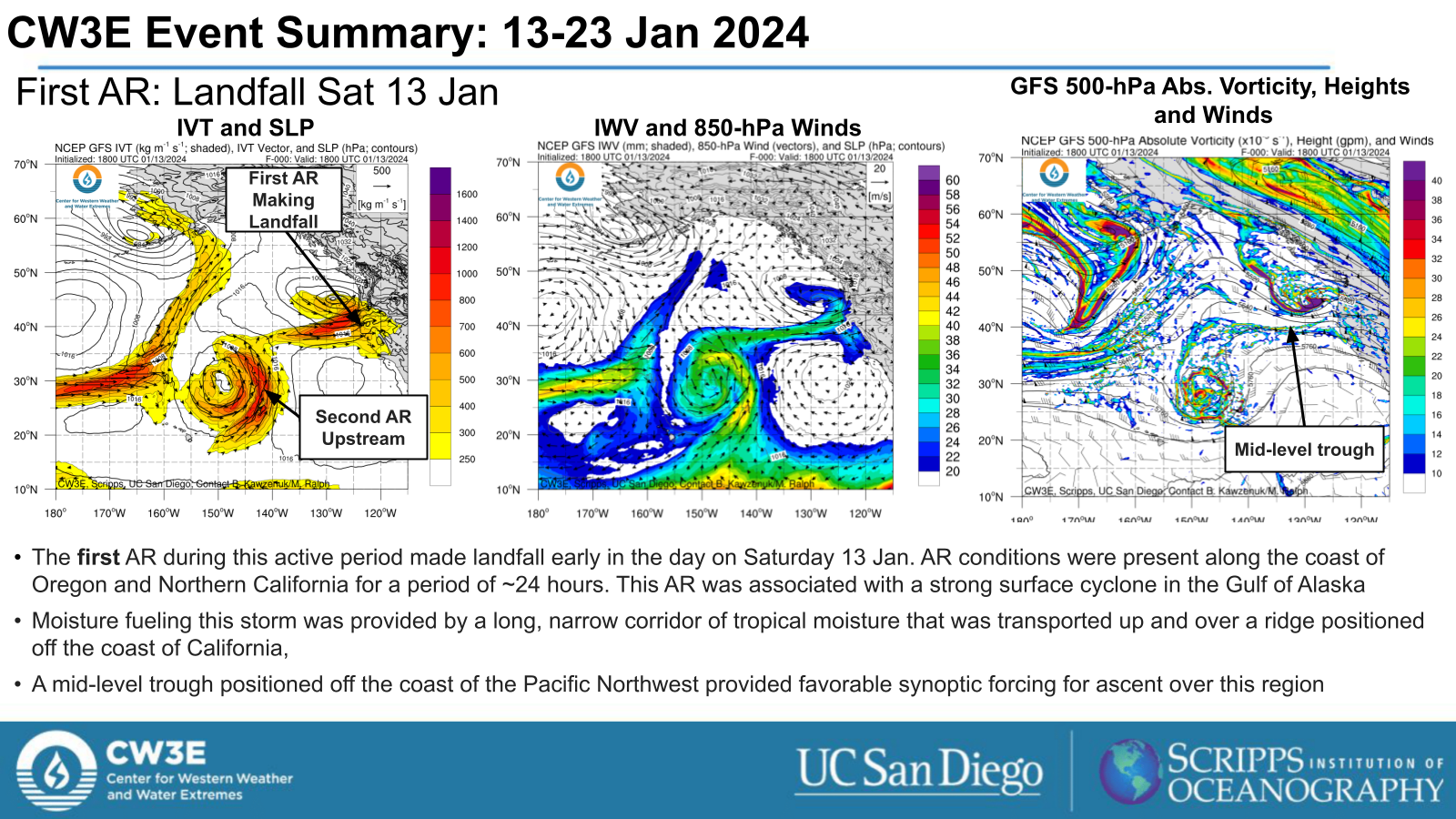
CW3E Event Summary: 13-23 January 2024
29 January 2024
Click here for a pdf of this information.
Four Atmospheric Rivers Highlight Active Weather Period Across US West Coast
- A series of four distinct atmospheric rivers made landfall along the US West Coast between Jan 13 and Jan 23 2024
- This prolonged period of active weather for the region resulted in a variety of liquid and frozen precipitation impacts
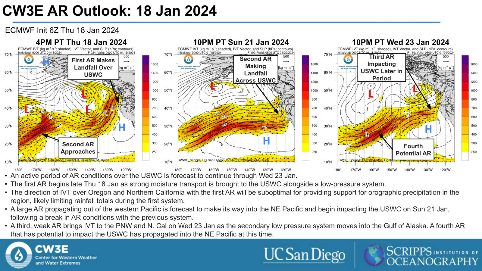
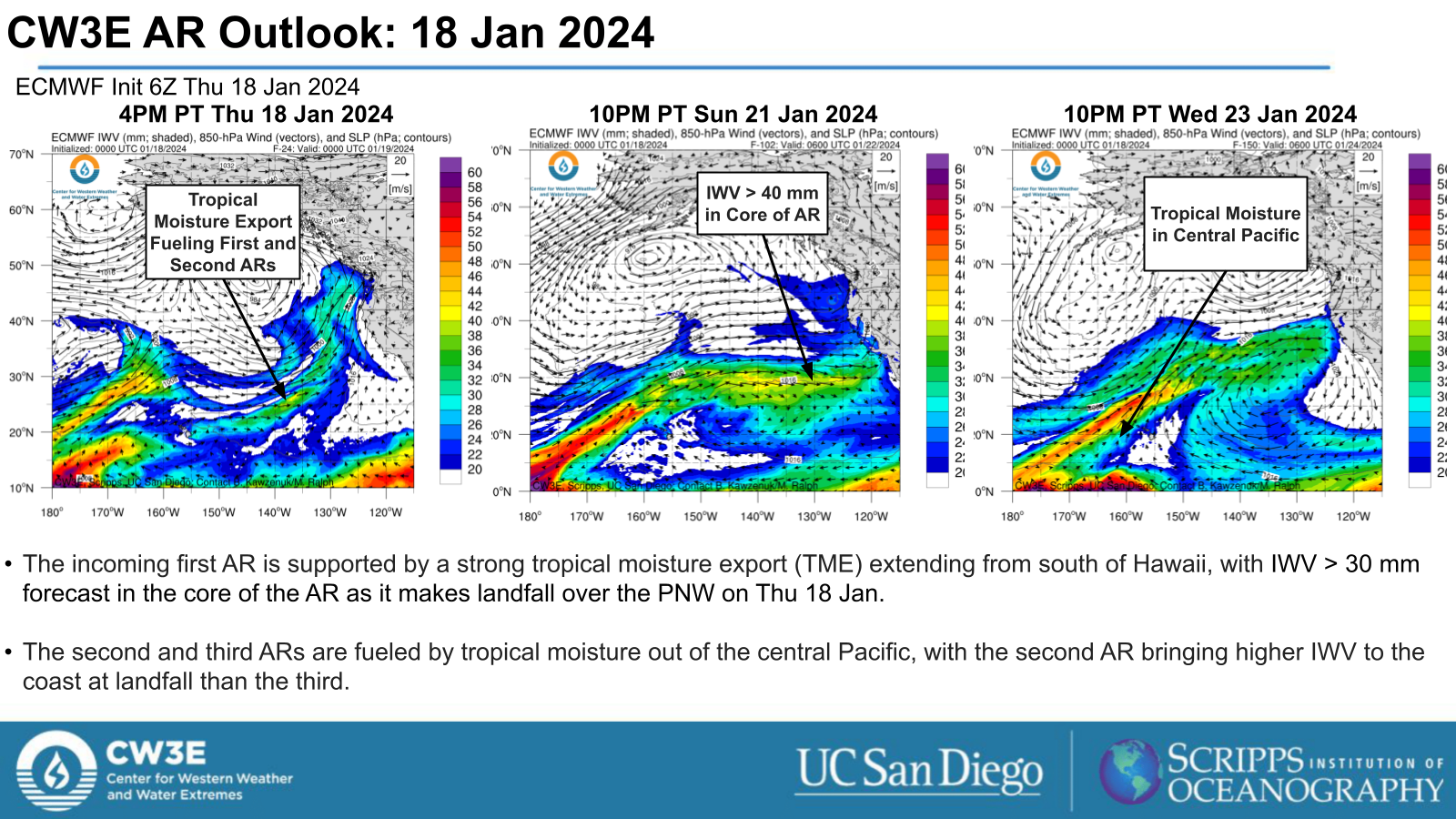
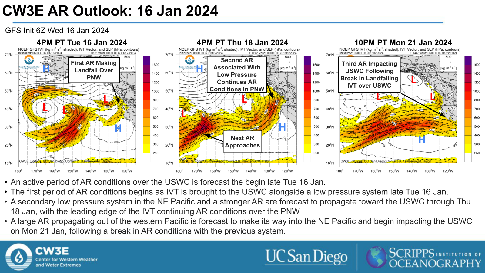
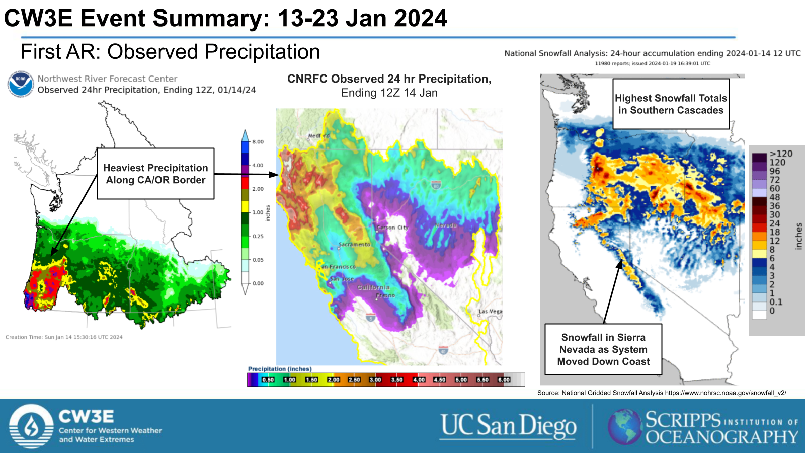
- The first AR made landfall along the OR/CA border early on Sat 13 Jan alongside a low pressure system, bringing heavy precipitation to the OR/CA border and the Southern Cascades.
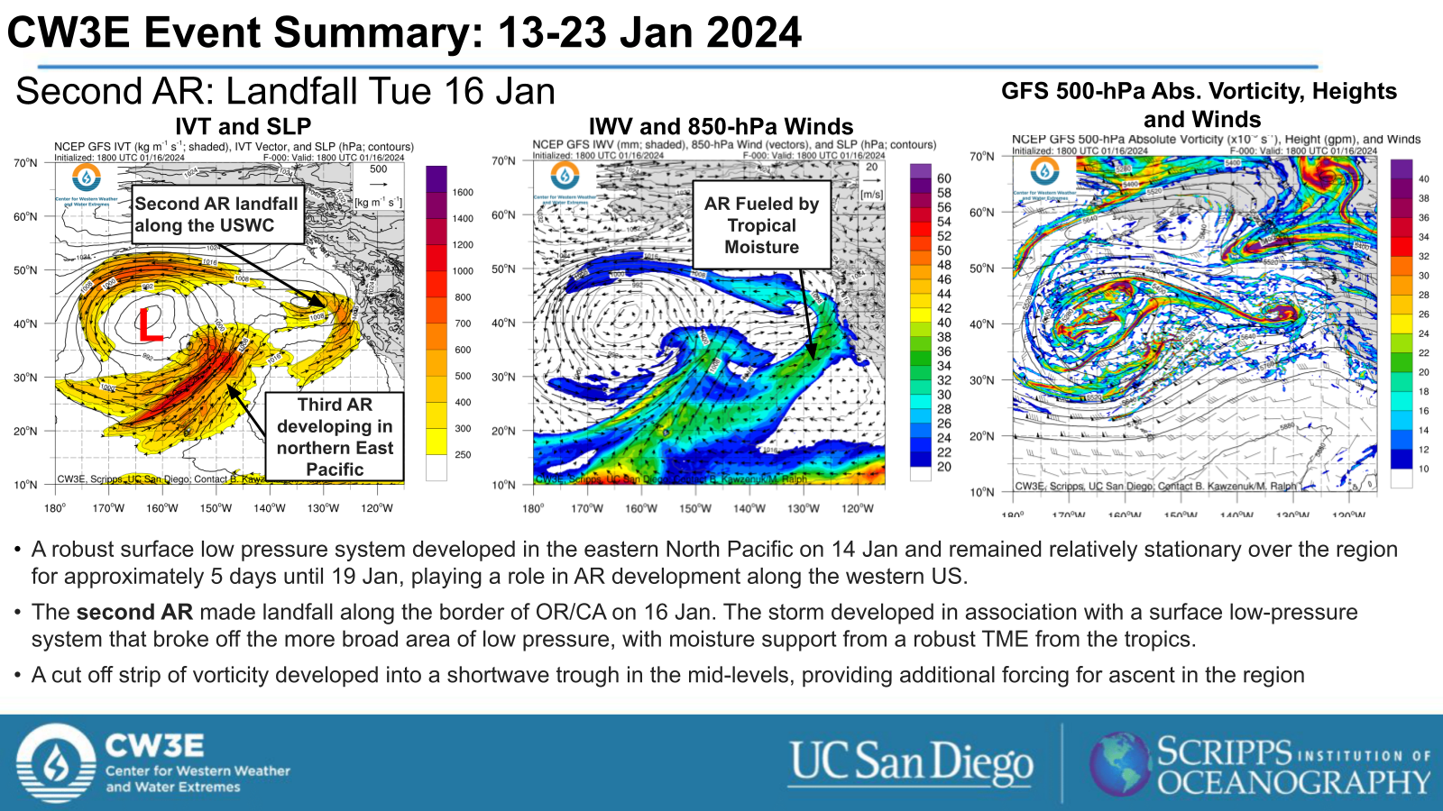
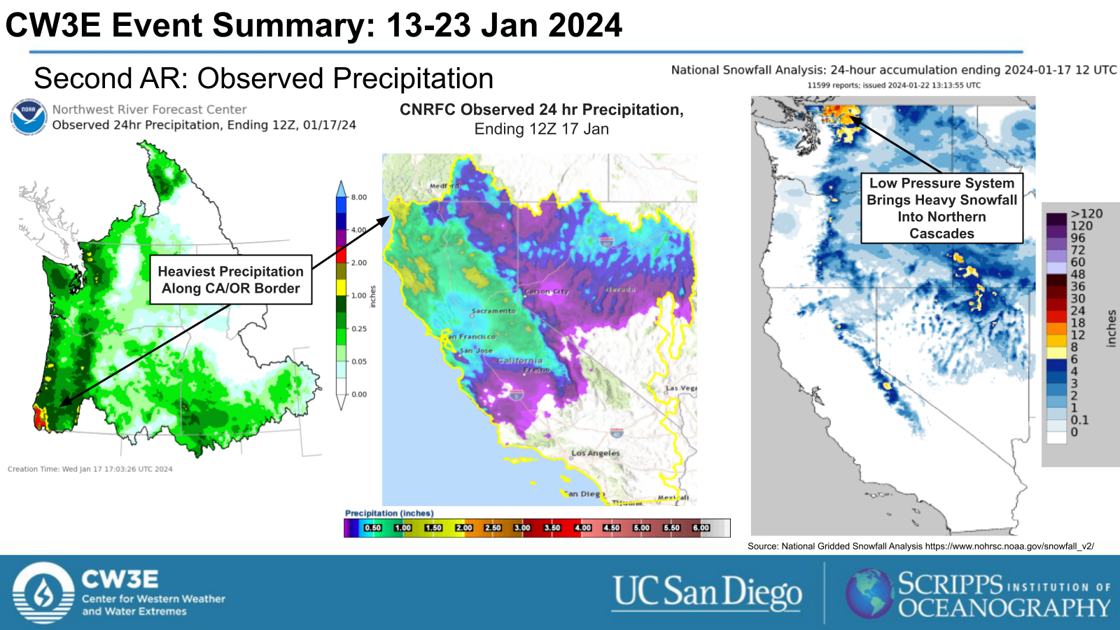
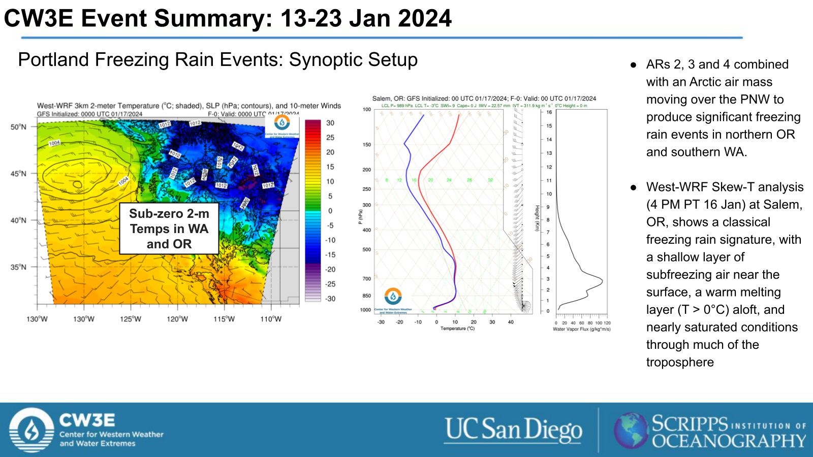
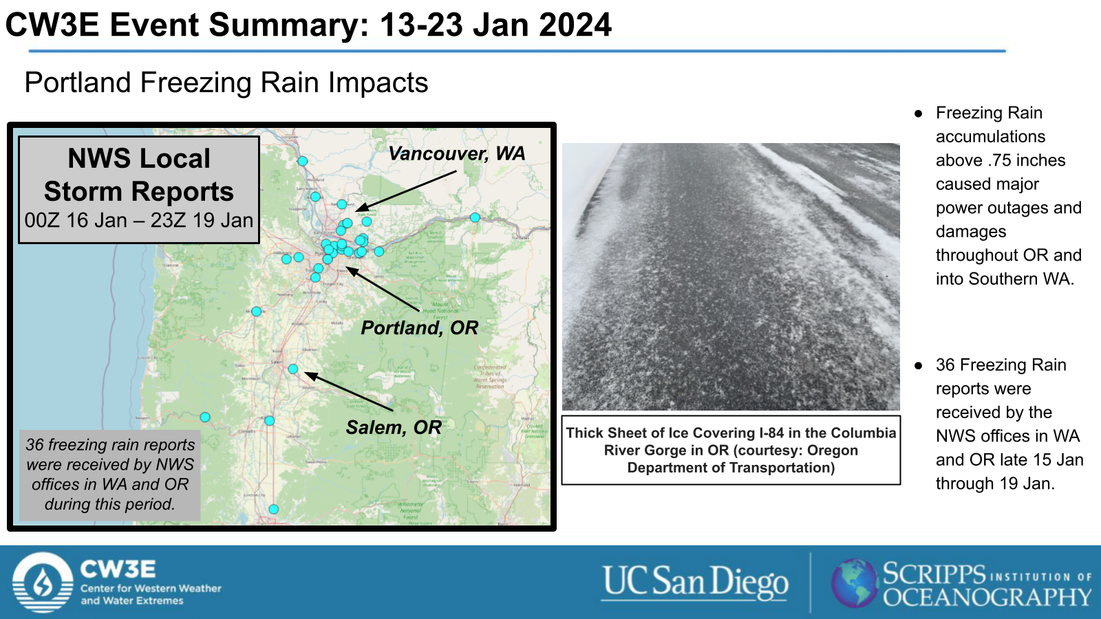
- A cut-off low pressure system brought the second AR to the USWC. The burst of IVT with the AR alongside the persistence of the low pressure system resulted in heavy precipitation in the PNW, including significant freezing rain in the Portland Metro, and heavy snowfall in the Cascades.
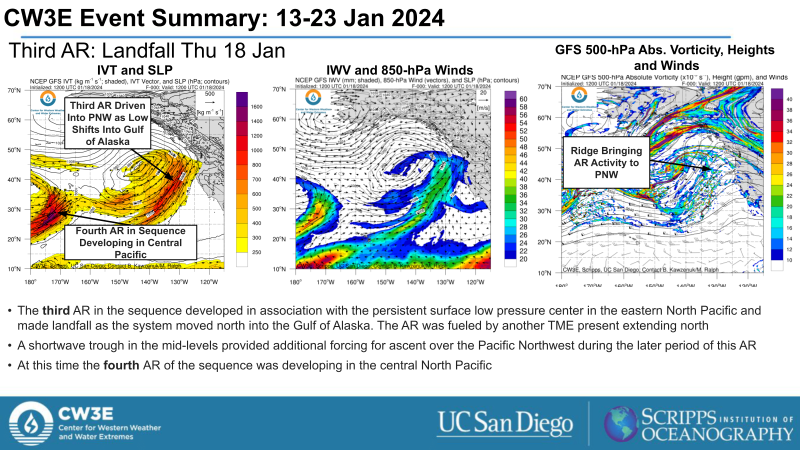
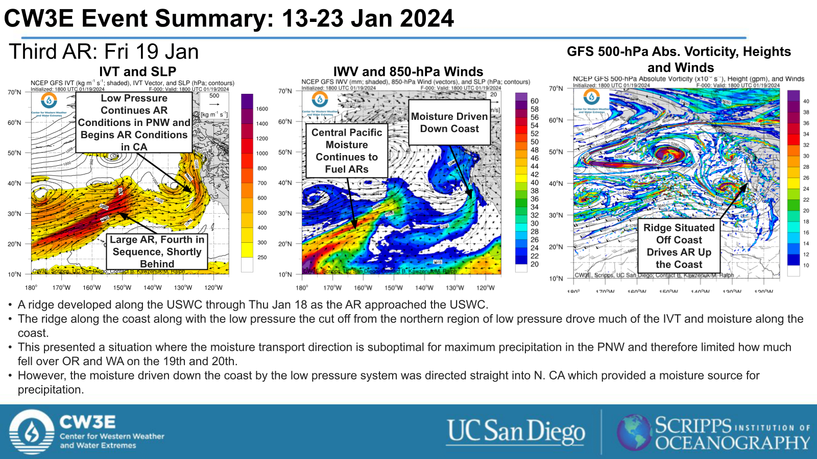
- The third AR in the sequence developed as the persistent low pressure system shifted into the Gulf of Alaska, resulting in counterclockwise moisture transport around the cyclone, leading to southerly IVT transport along the US West Coast
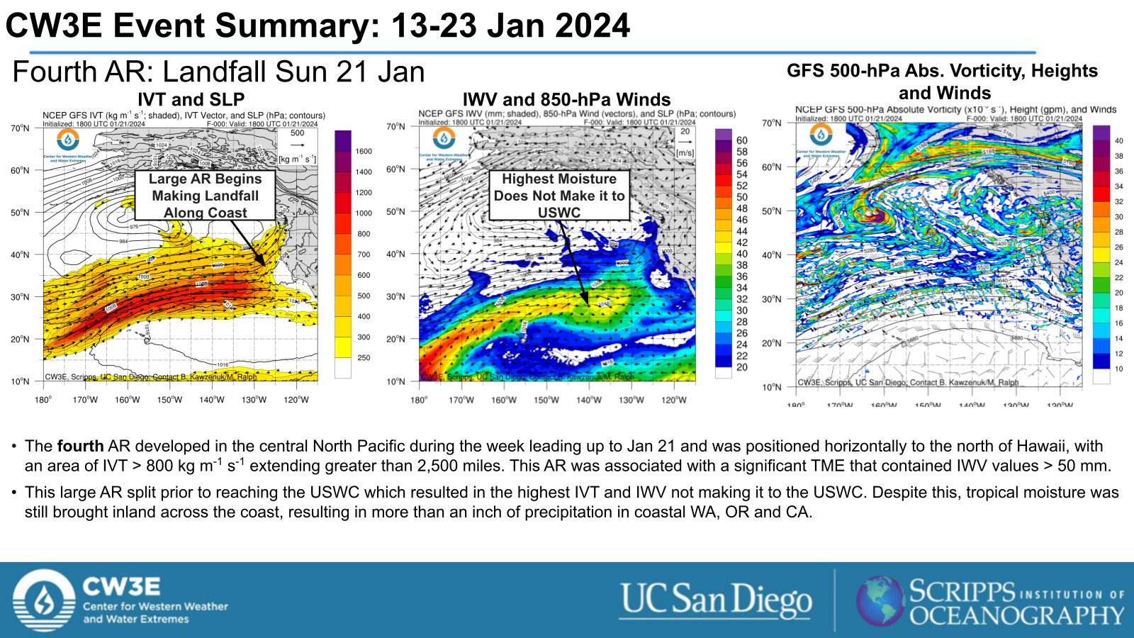
- A fourth AR developed over the eastern North Pacific, with a robust corridor of elevated moisture transport extending greater than 2,500 miles from north of Hawaii to the US West Coast
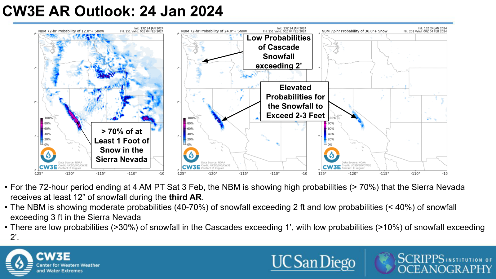
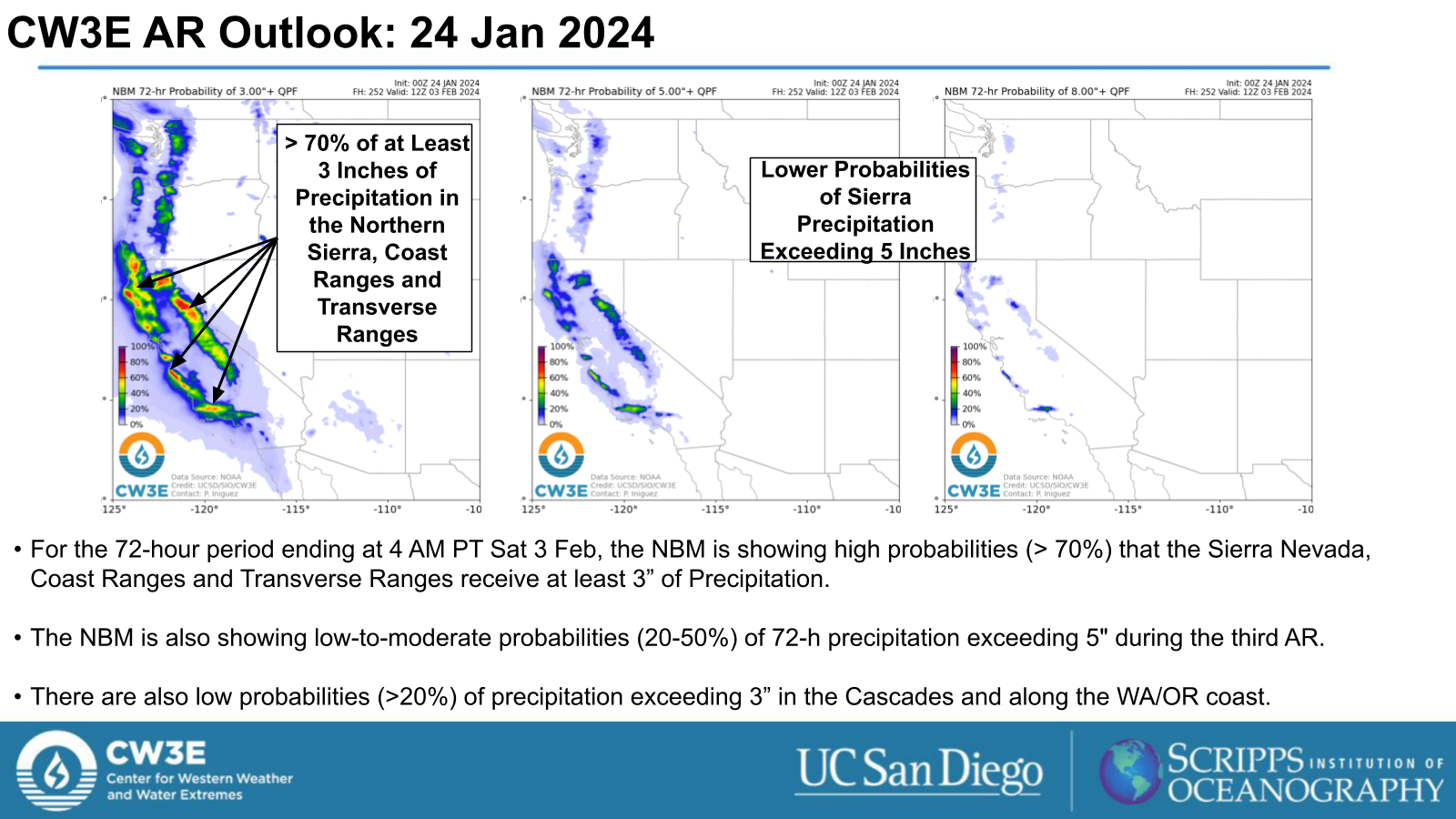
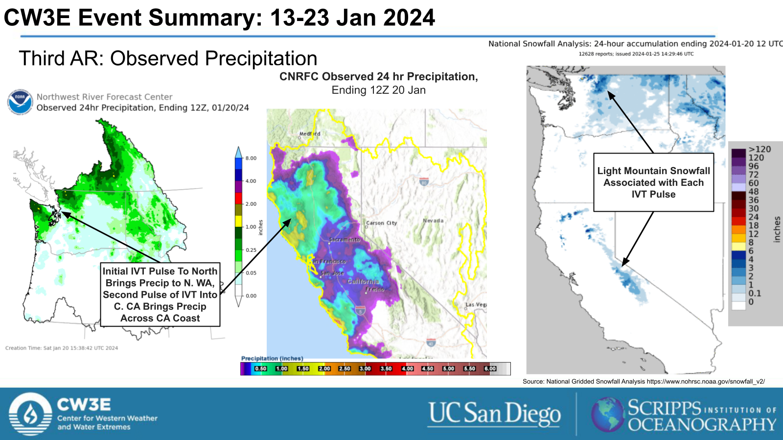
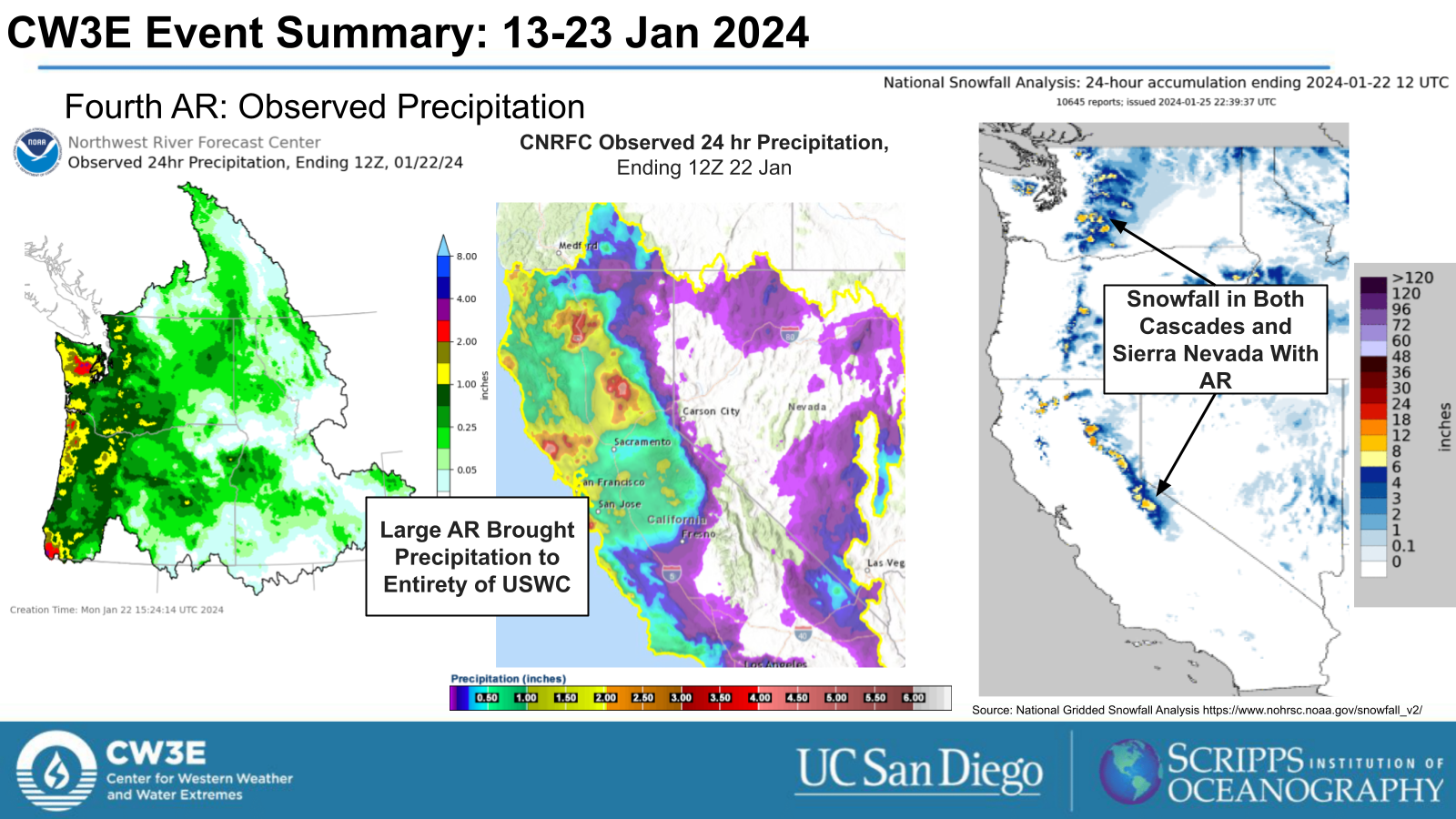
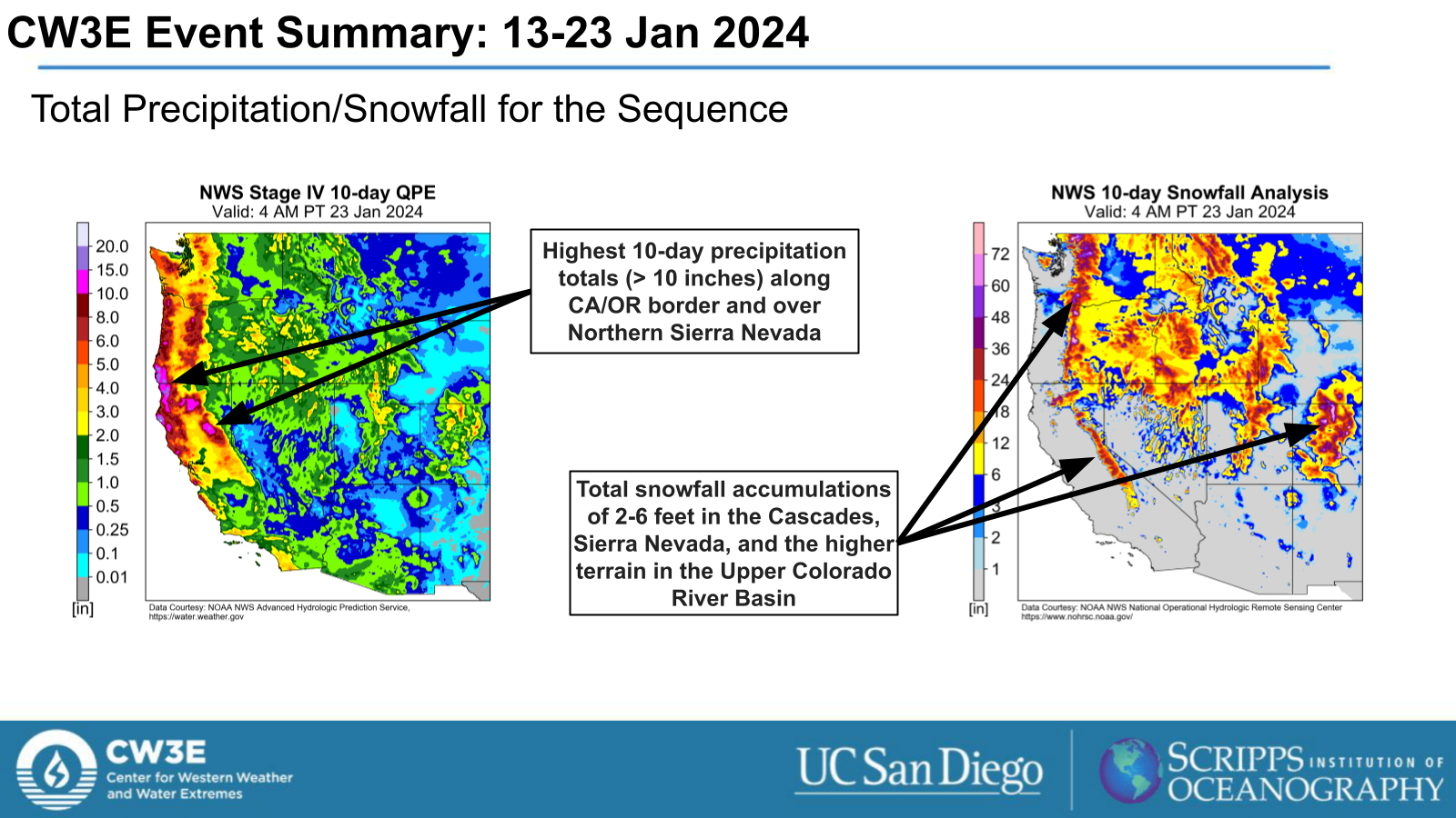
- The highest 10-day precipitation totals (> 10 in.)were observed along CA/OR border and over Northern Sierra Nevada
- Snowfall accumulations during this period ranged from 2-6 feet in the Cascades, Sierra Nevada, and the higher terrain in the Upper Colorado River Basin
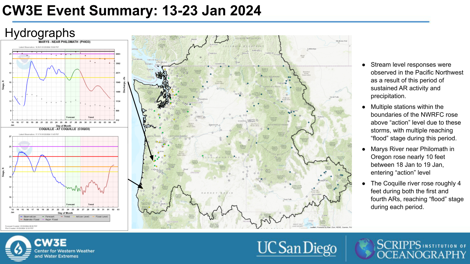
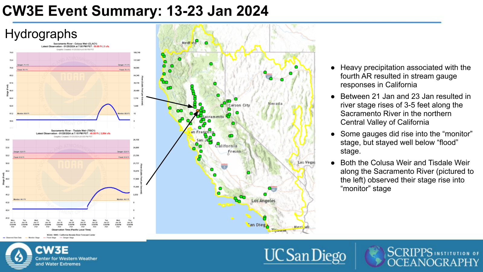
- Addition impacts during this active period included river level rises due to heavy precipitation and a multi-day freezing rain event in the Pacific Northwest
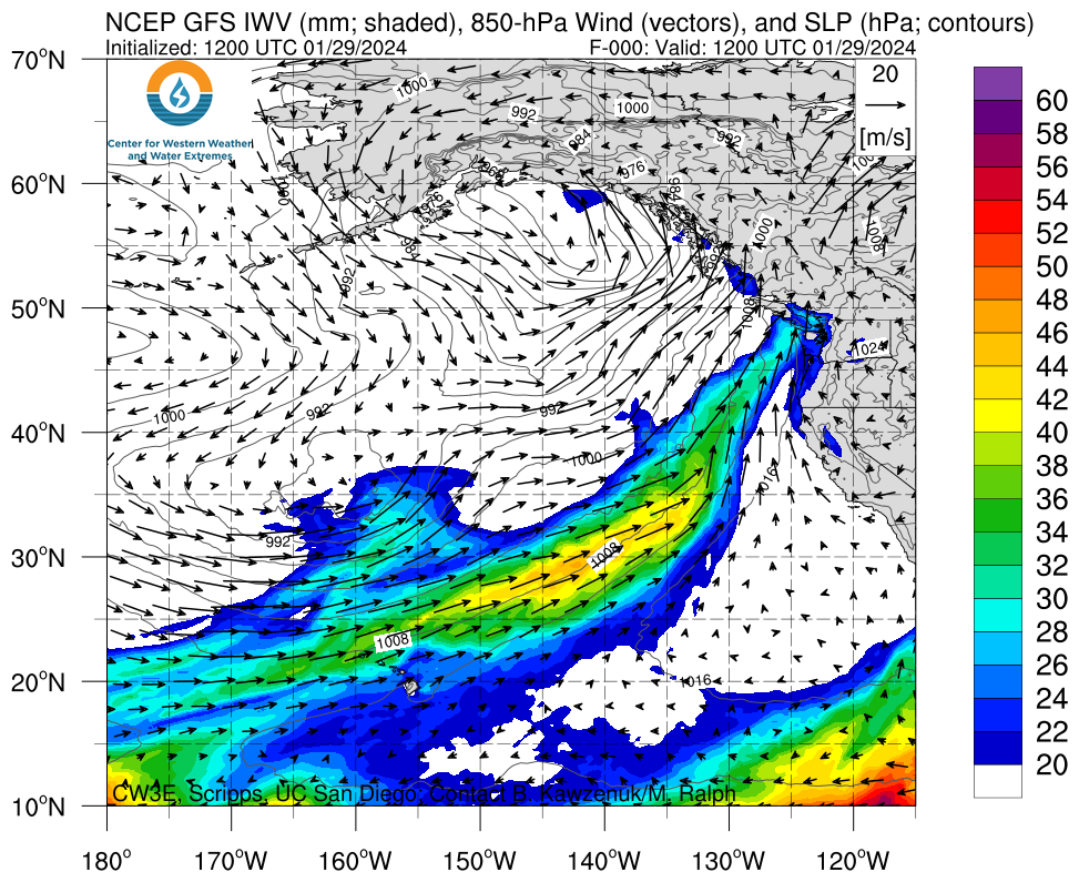
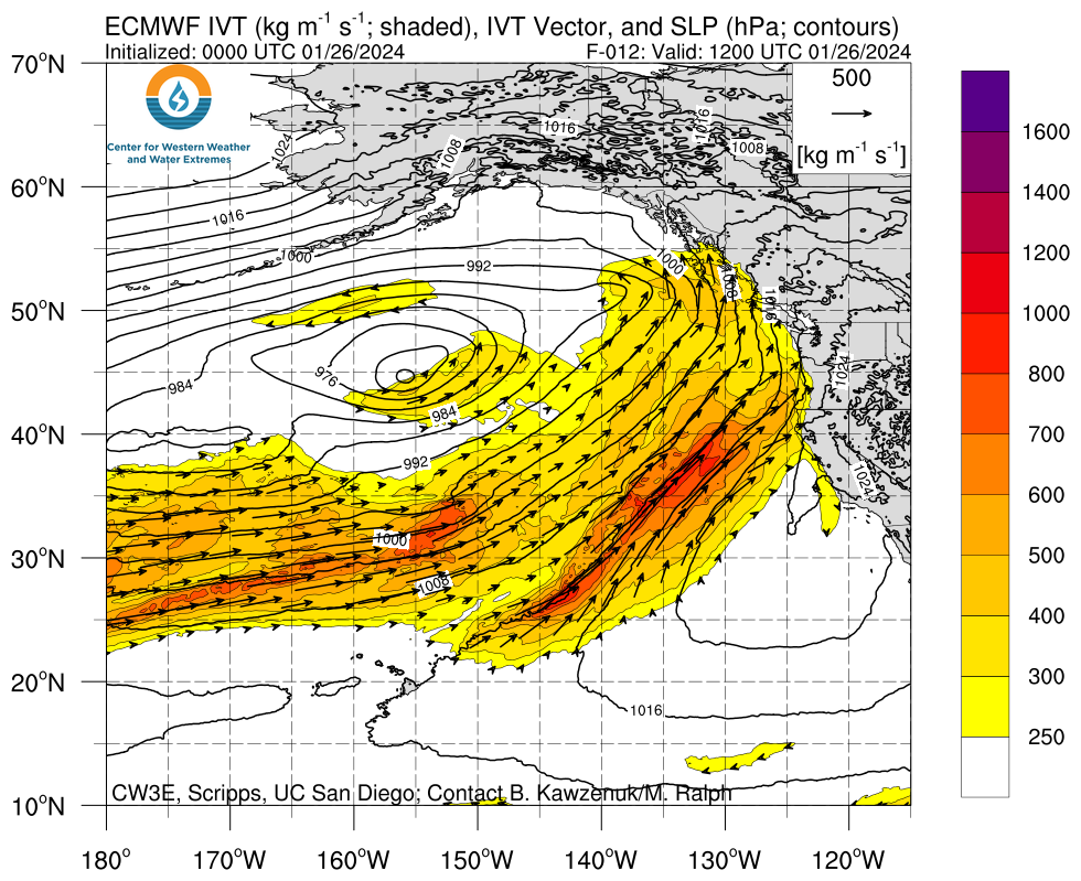
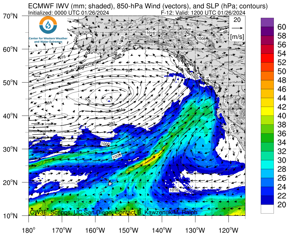
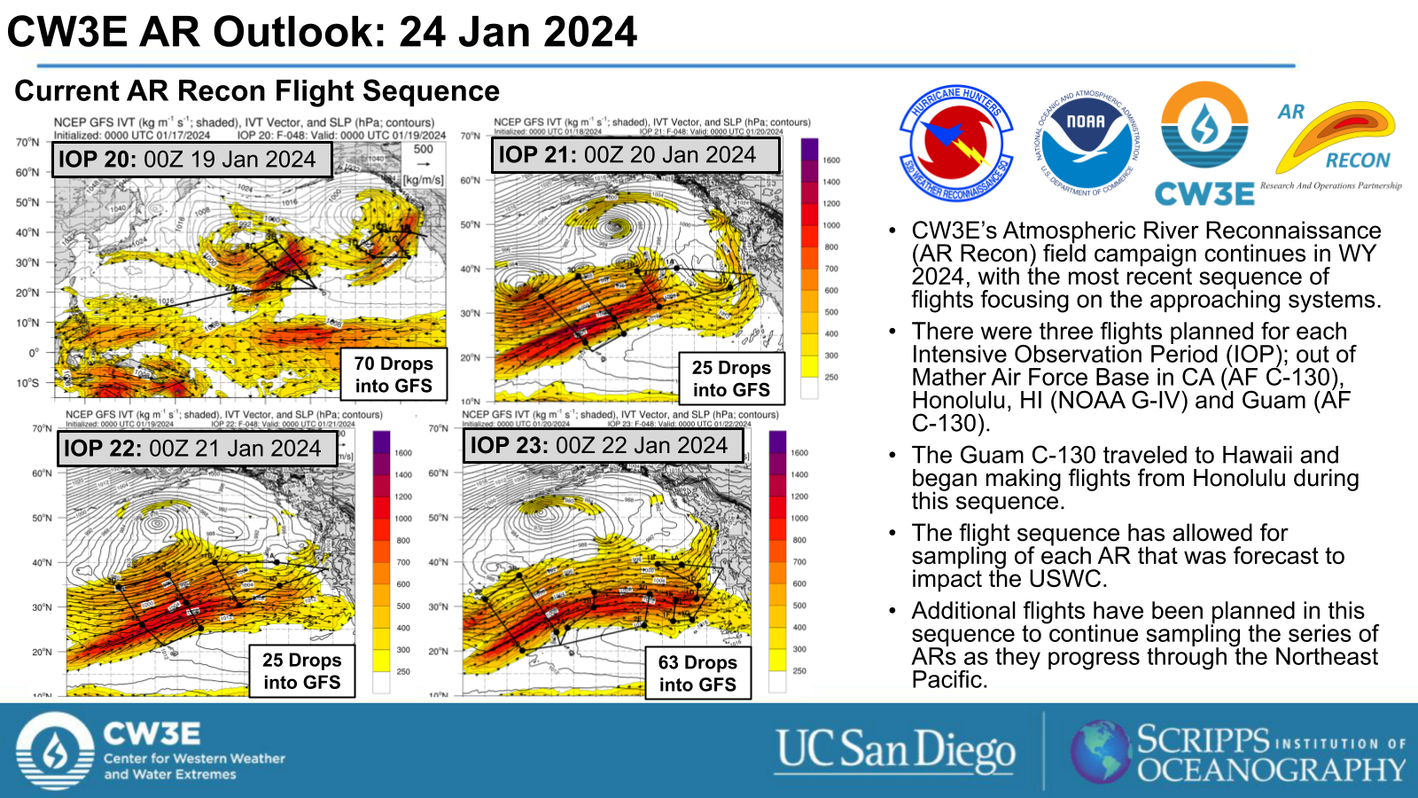
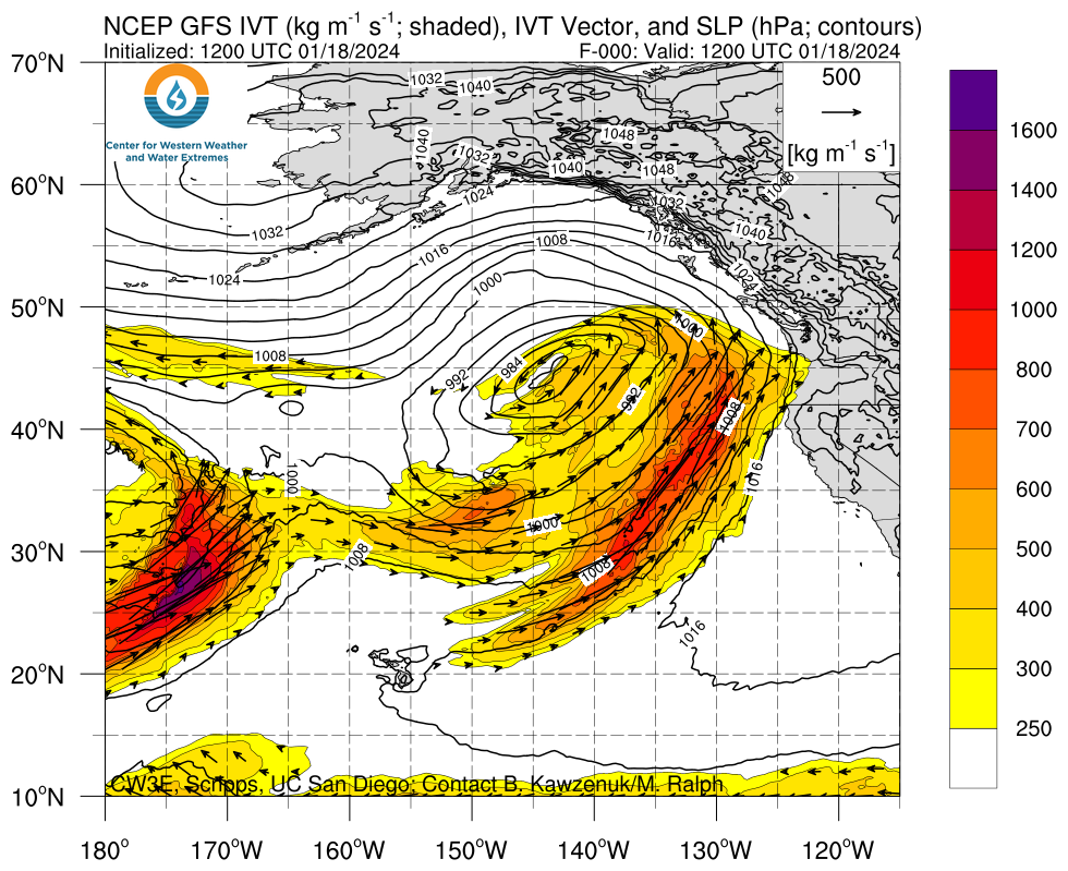
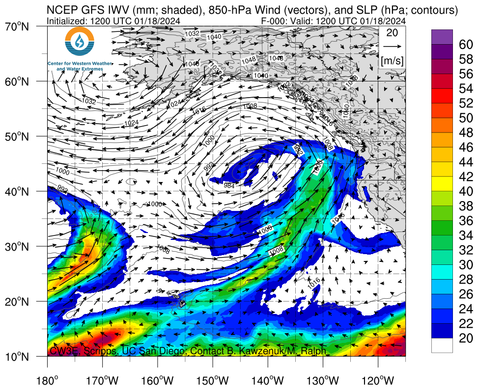
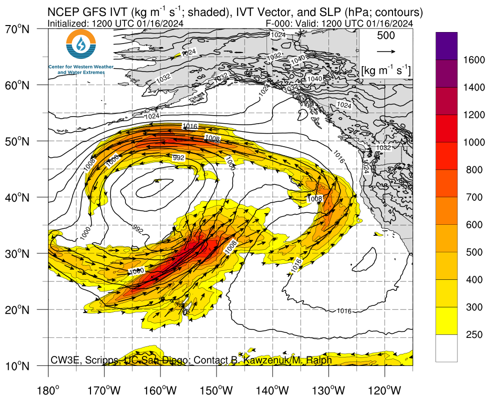
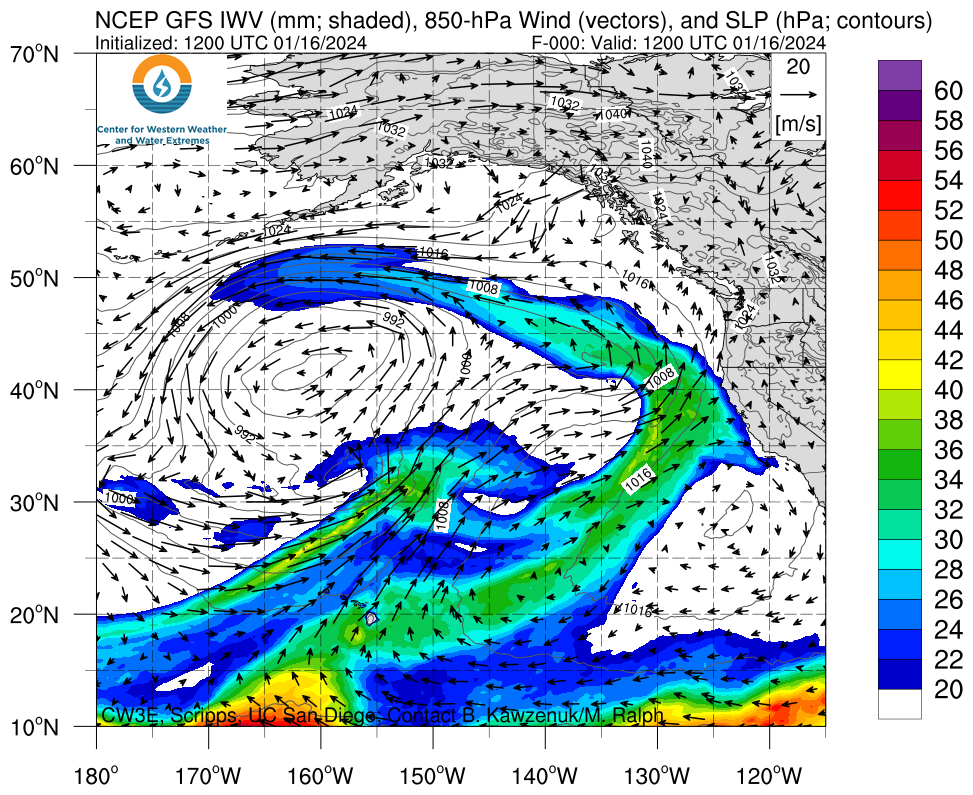
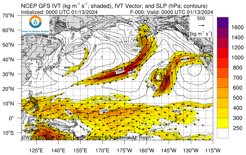
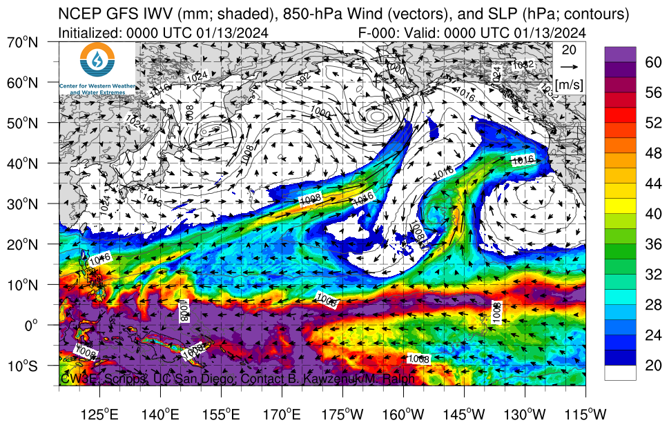
Click images to see loops of GFS IVT/IWV analyses Valid: 0000 UTC 13 January – 0000 UTC 23 January 2024 |
|
 |
 |


Summary provided by M. Steen, S. Bartlett, J. Kalansky, and P. Iniguez; 29 Jan 2024
To sign up for email alerts when CW3E post new AR updates click here.