CW3E Analysis – Hurricane Hilary: 18 August 2023
August 18, 2023
Click here for a pdf of this information.
Hurricane Hilary To Impact Southern California and Nevada This Weekend
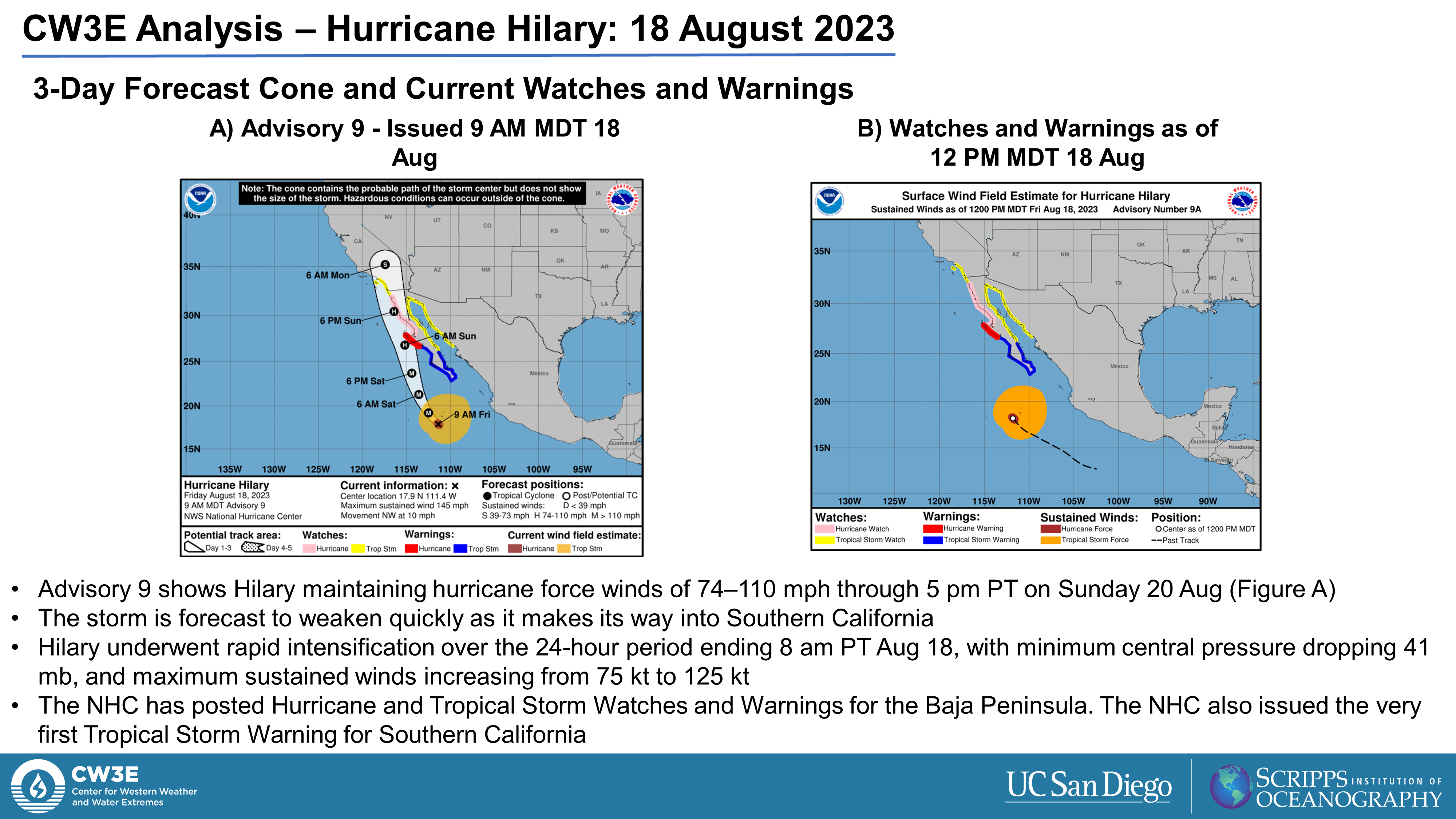
- Hurricane Hilary has rapidly intensified over the past 24 hours, reaching Category 4 strength as of the 8 am PT advisory from the National Hurricane Center (NHC)
- Hilary is expected to begin weakening tonight as it turns northward and passes over colder ocean temperatures
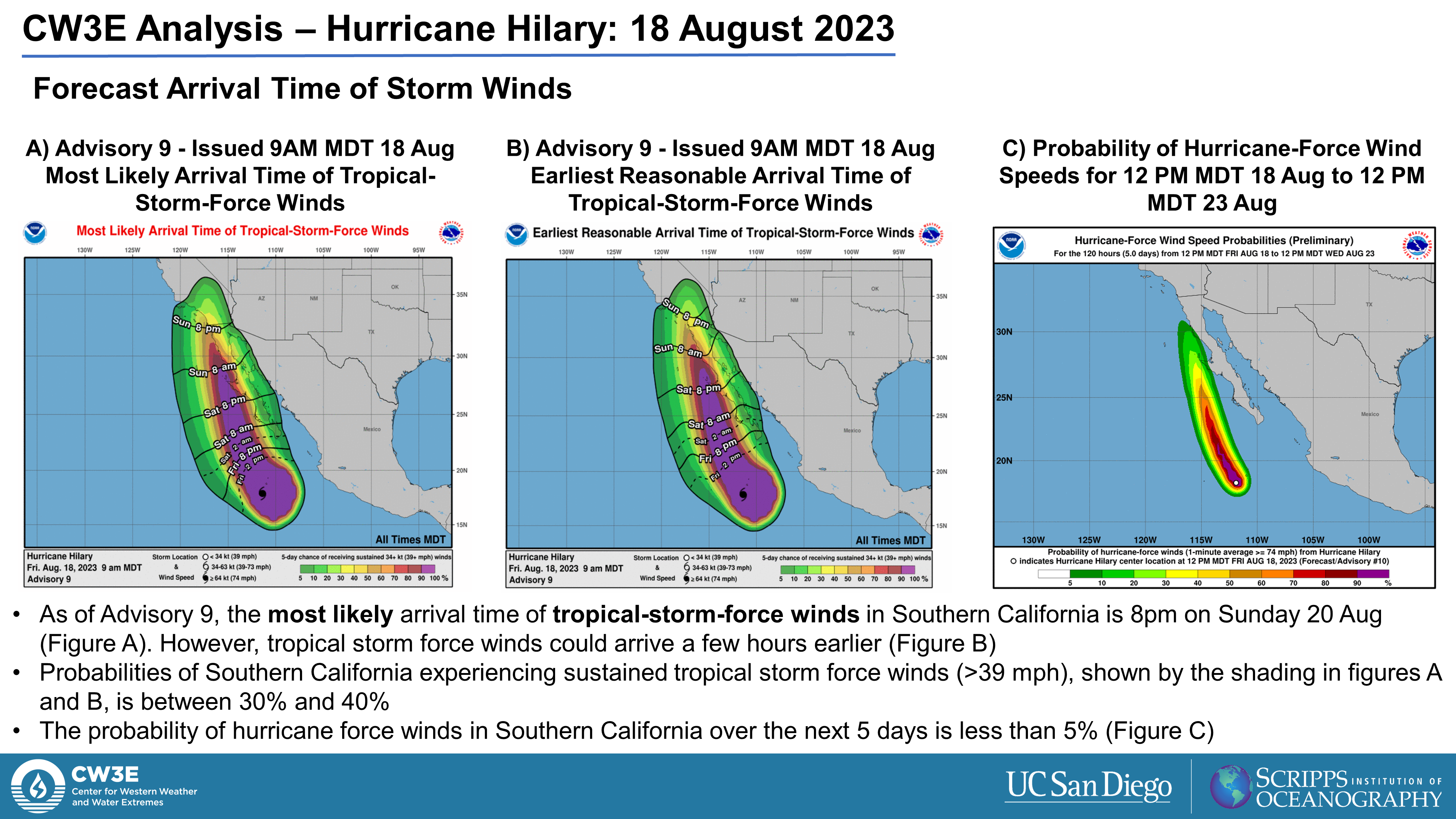
- The NHC has issued the first ever Tropical Storm watch for Southern California
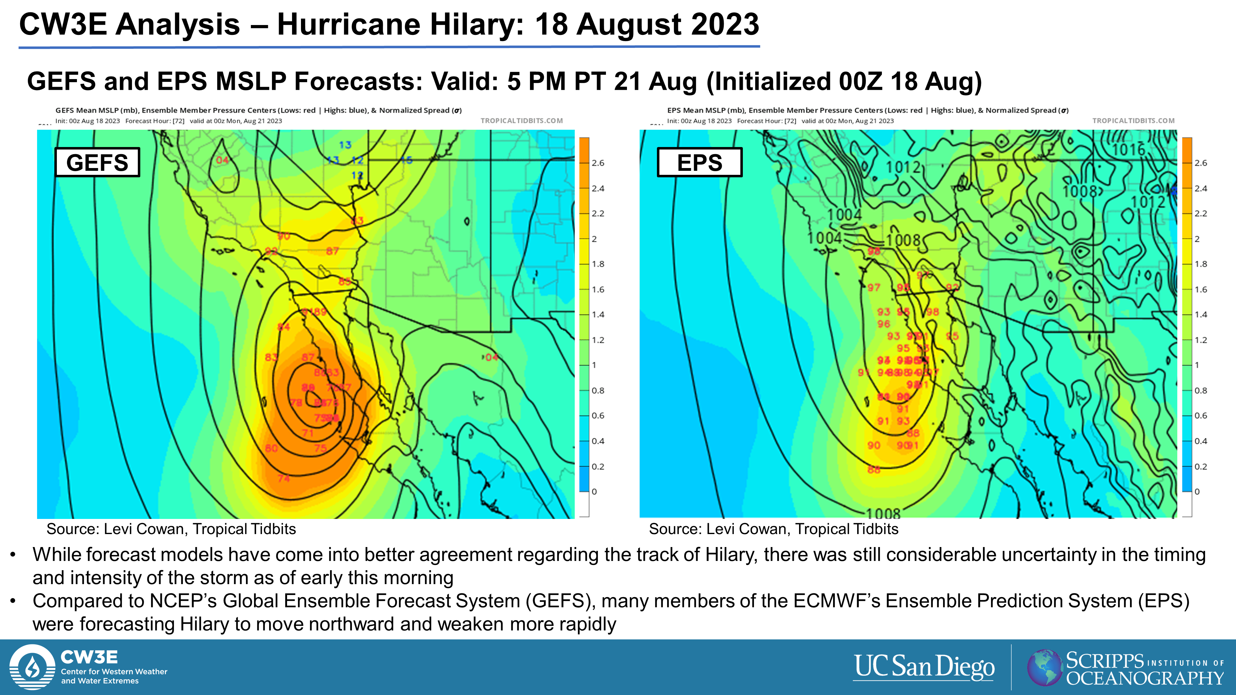
- Hilary is expected to move up the coast of the Baja Peninsula Saturday night before making its way into Southern California by Sunday night into Monday morning
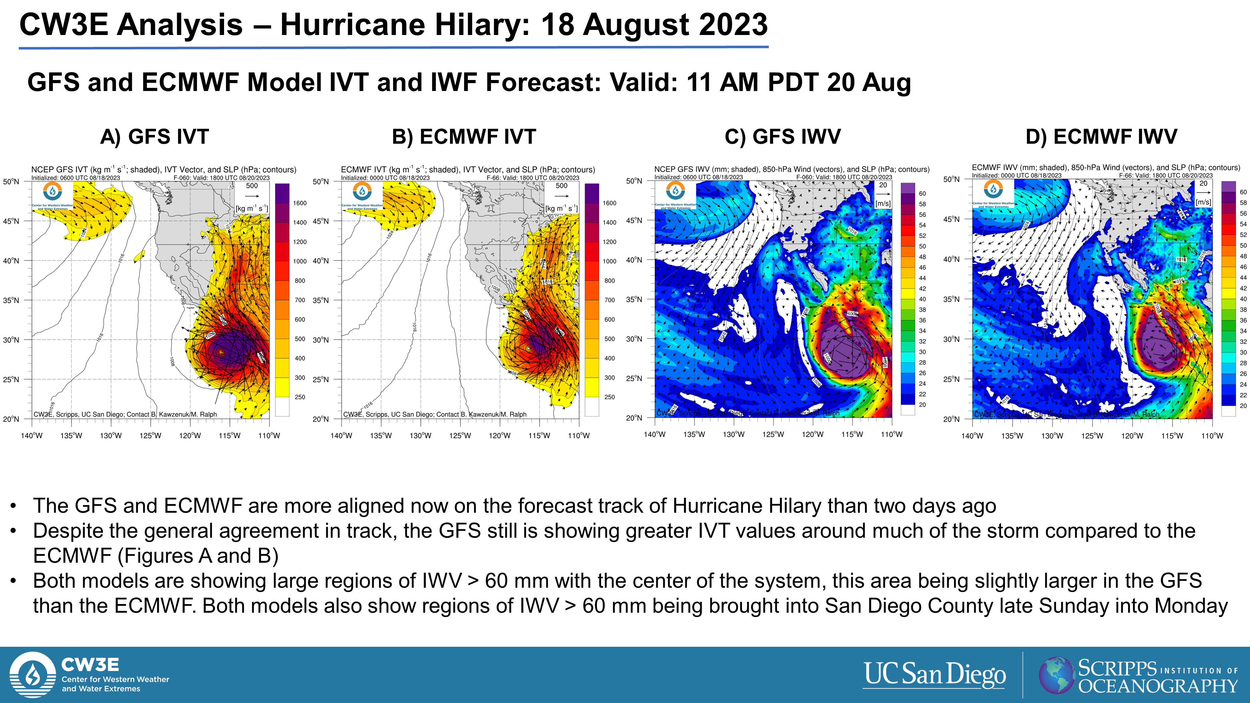
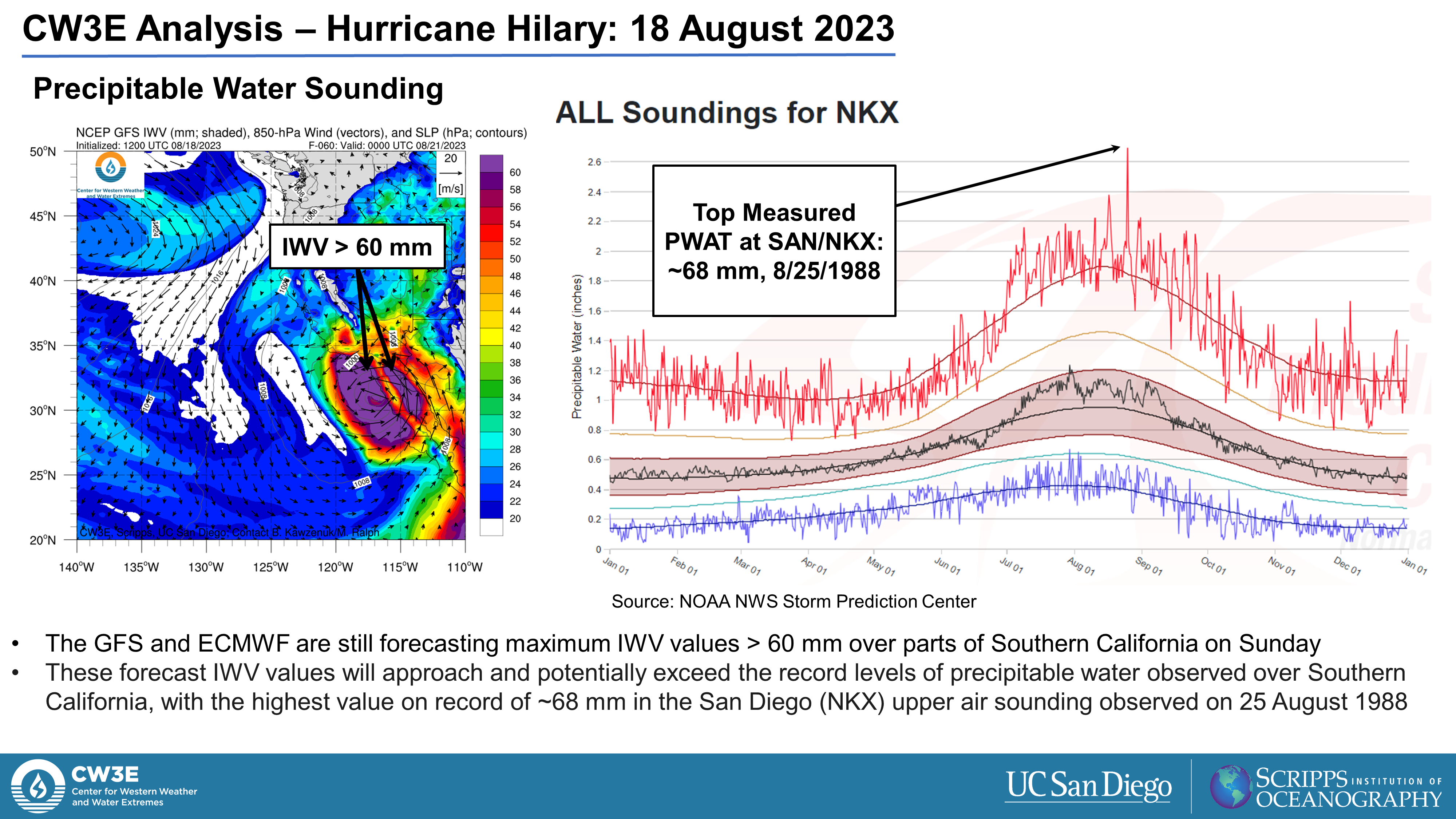
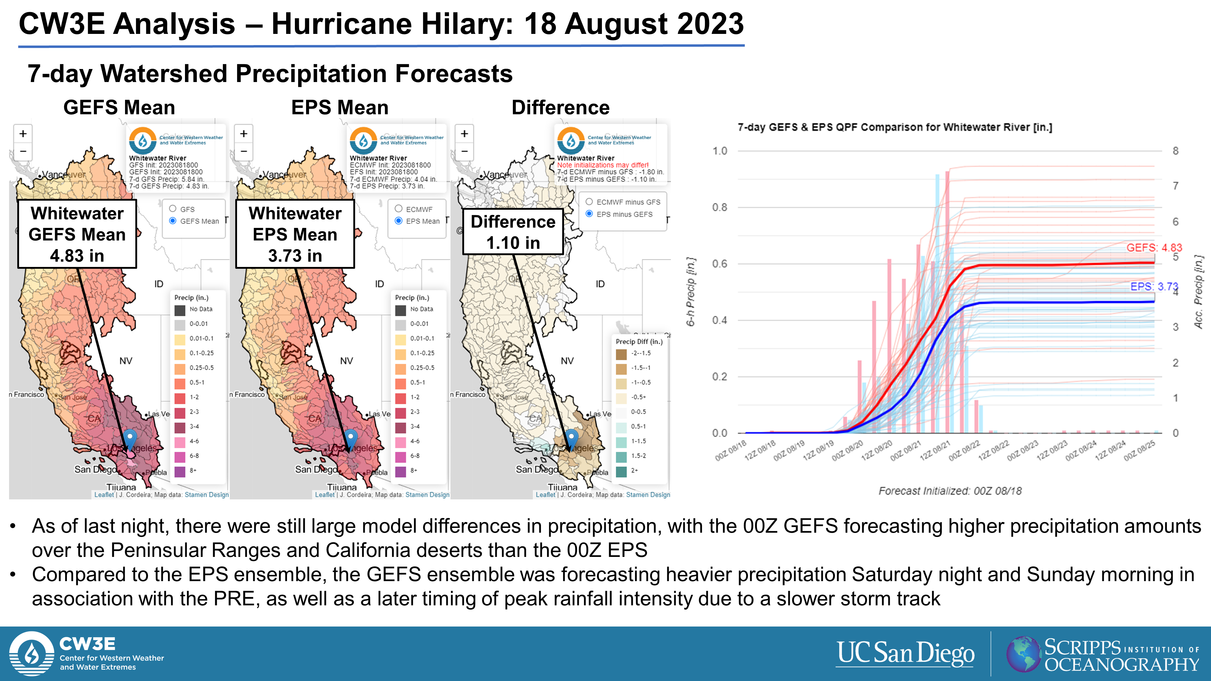
- A predecessor rain event (PRE) is forecast to occur north of Hilary, potentially bringing heavy rainfall to portions of California and Nevada Saturday into Sunday
- Additional heavy rainfall and high winds are likely as the storm center approaches Southern California late Sunday
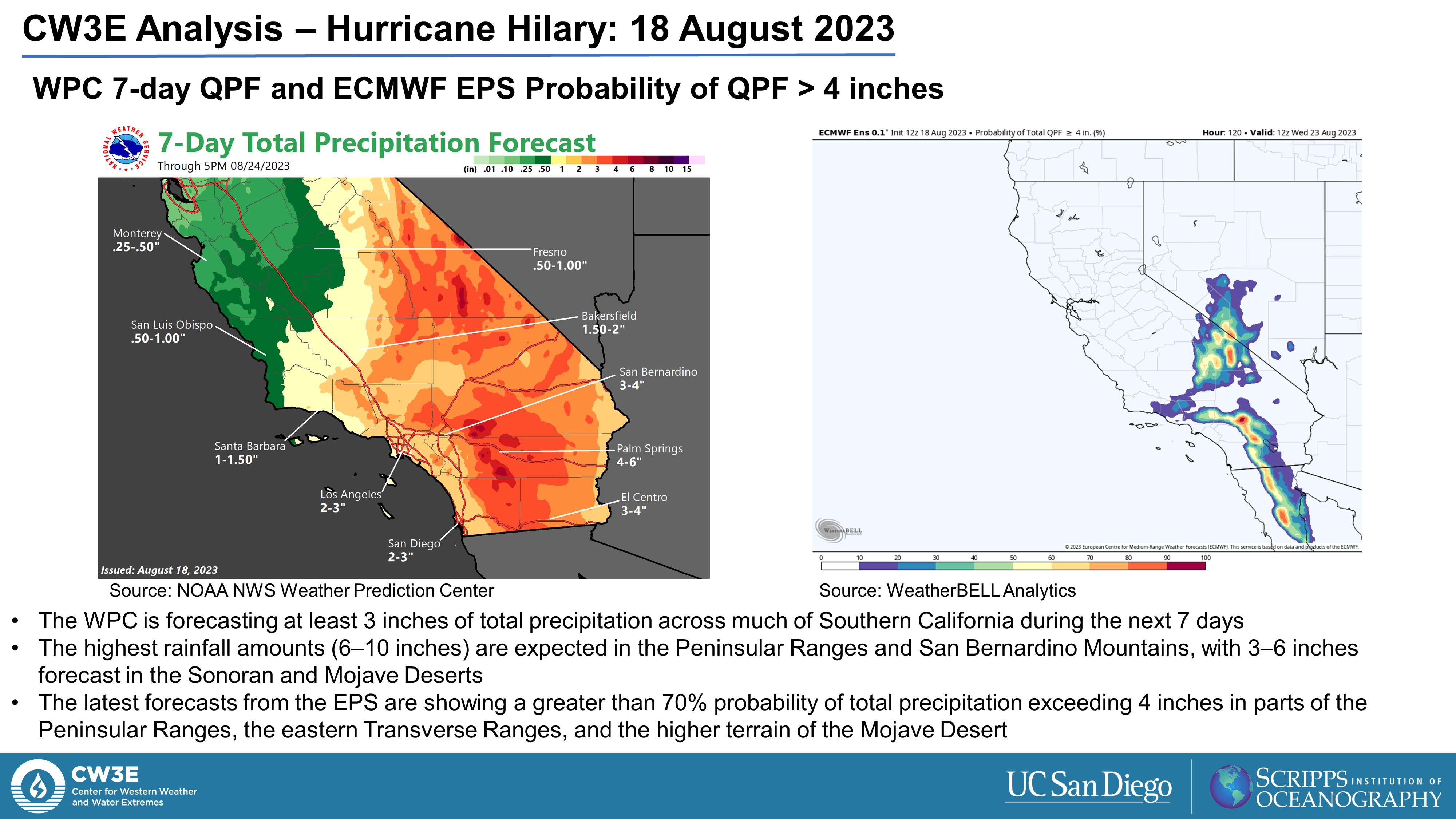
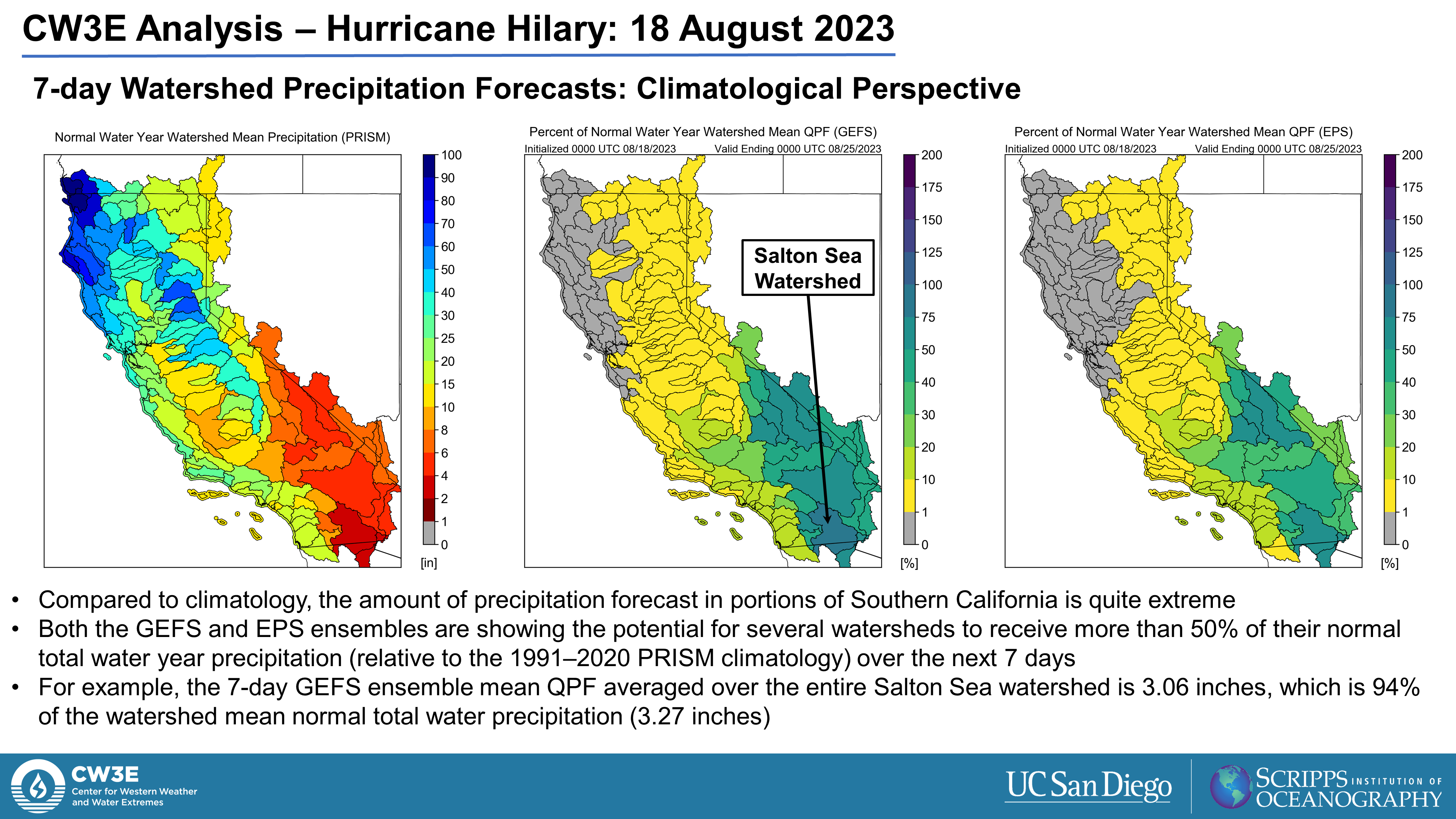
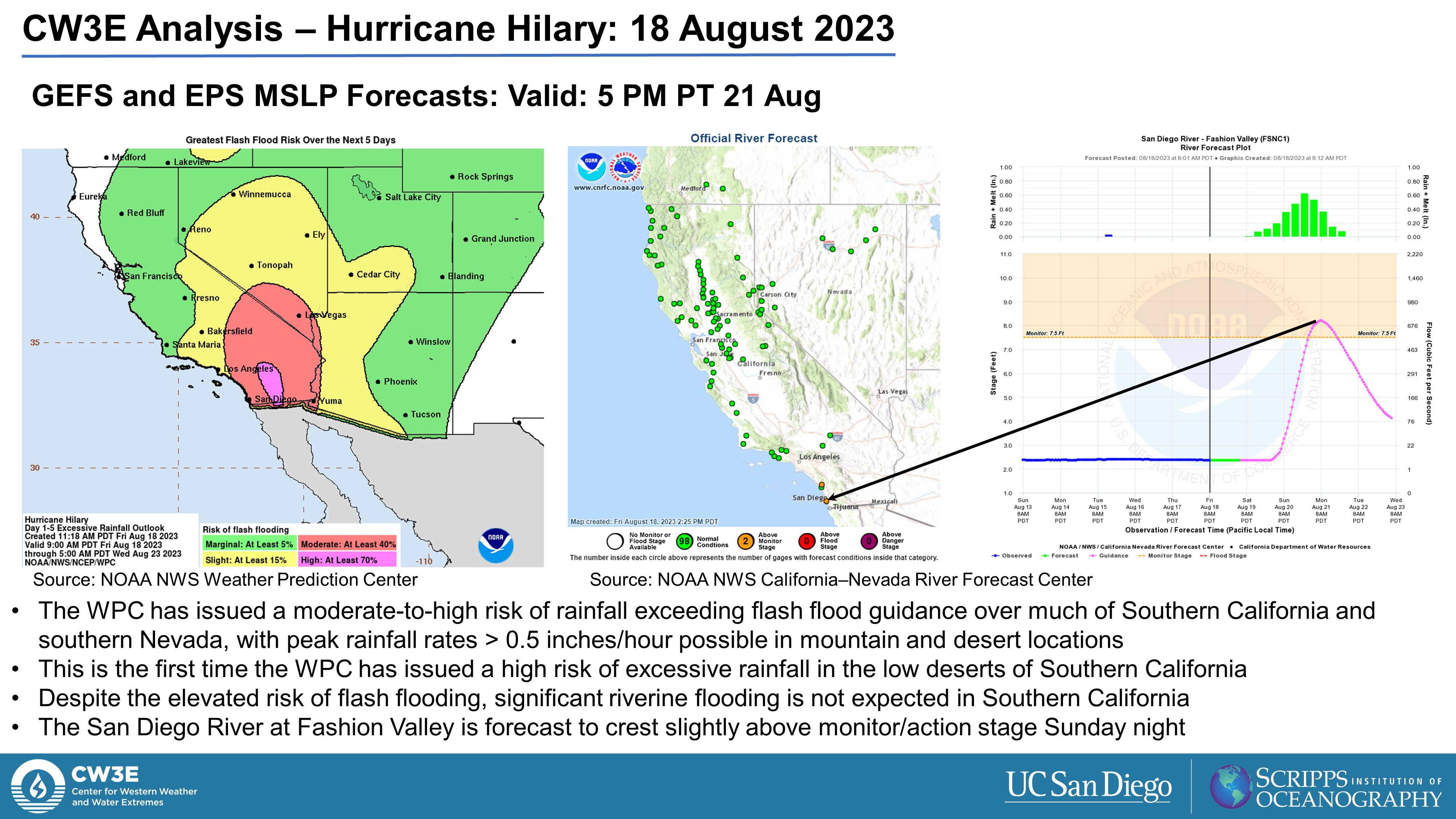
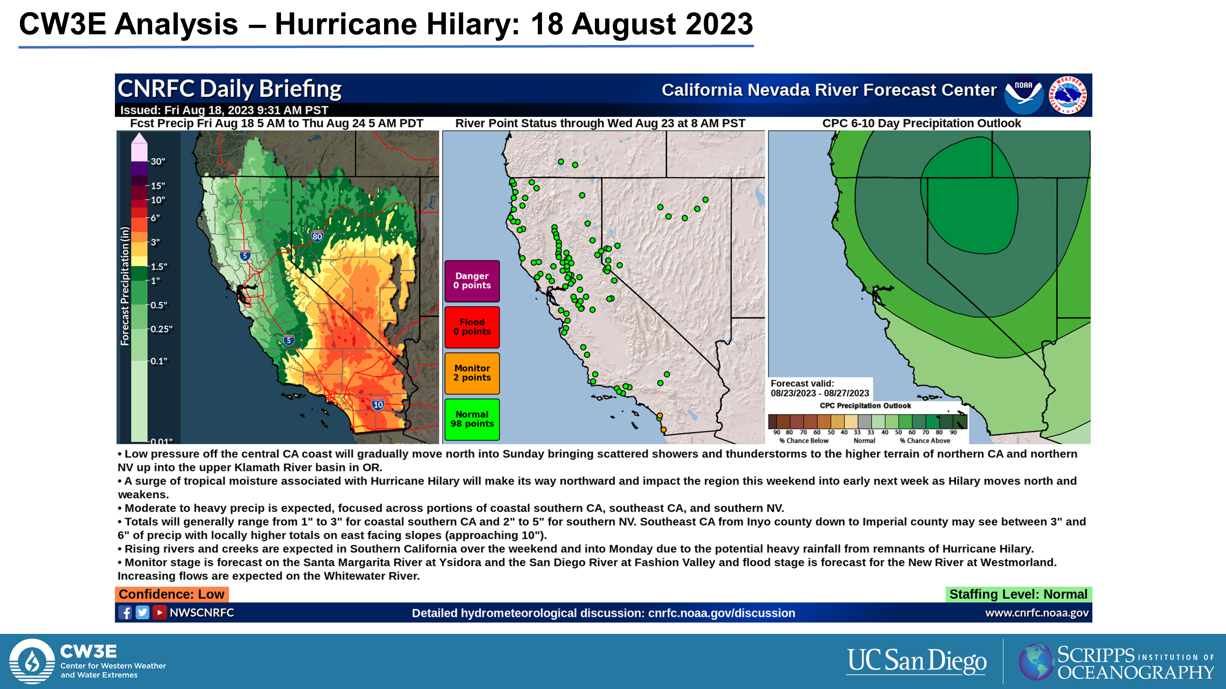
- The highest rainfall amounts (> 5 inches) are expected in the vicinity of the Peninsular Ranges and San Bernardino Mountains, with 3–5 inches forecast in portions of the Sonoran and Mojave Deserts
- The NWS Weather Prediction Center (WPC) has issued a moderate-to-high risk of rainfall exceeding flash flooding guidance over much of Southern California
- Stay alert to official NWS forecasts, watches, and warnings from the National Hurricane Center at nhc.noaa.gov, information from local NWS weather forecast offices at weather.gov, and follow guidance from local emergency management officials
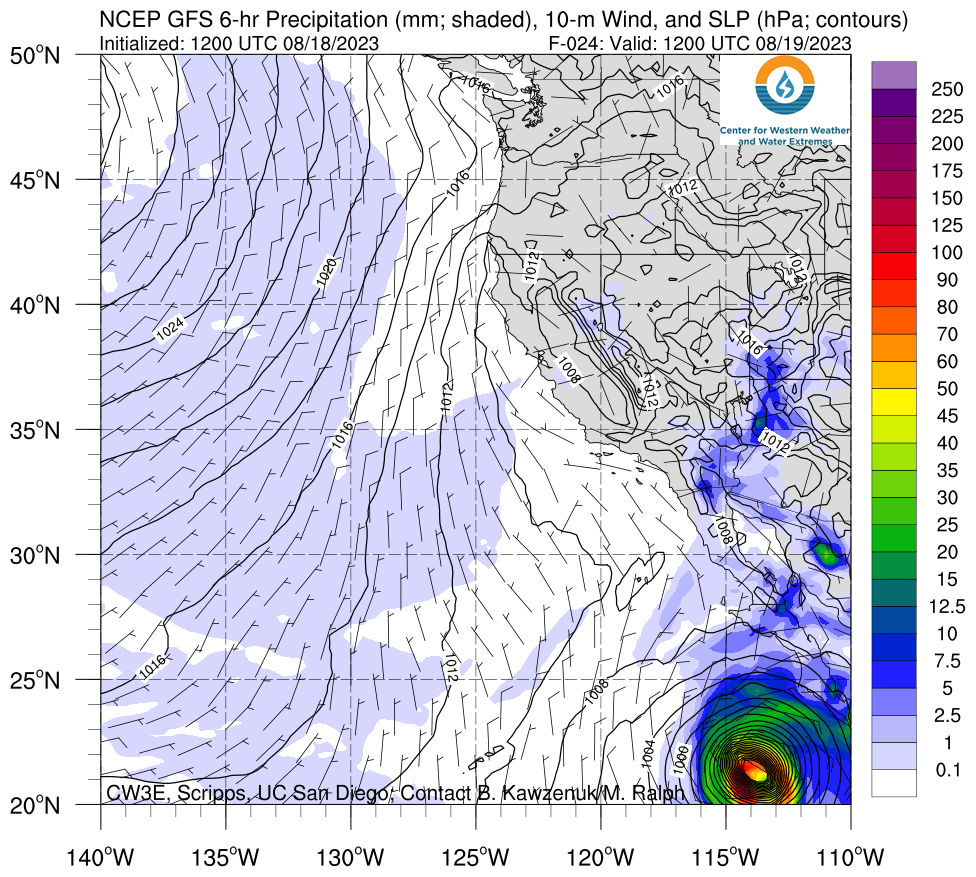
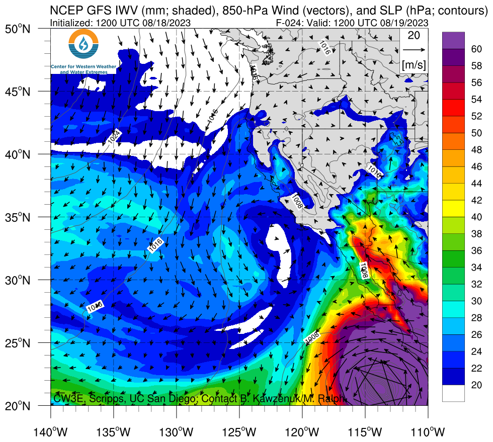
Click images to see loops of GFS Precipitation and IWV forecasts Valid 1200 UTC 19 August – 1200 UTC 22 August 2023 |
|
 |
 |
Analysis provided by M. Steen, C. Castellano, S. Roj, and P. Iñiguez; 18 August 2023
To sign up for email alerts when CW3E post new AR updates click here.
*Outlook products are considered experimental

