CW3E AR Update: 11 February Outlook
February 11, 2019
Click here for a pdf of this information.
Update on AR Forecast to Impact SoCal This Week
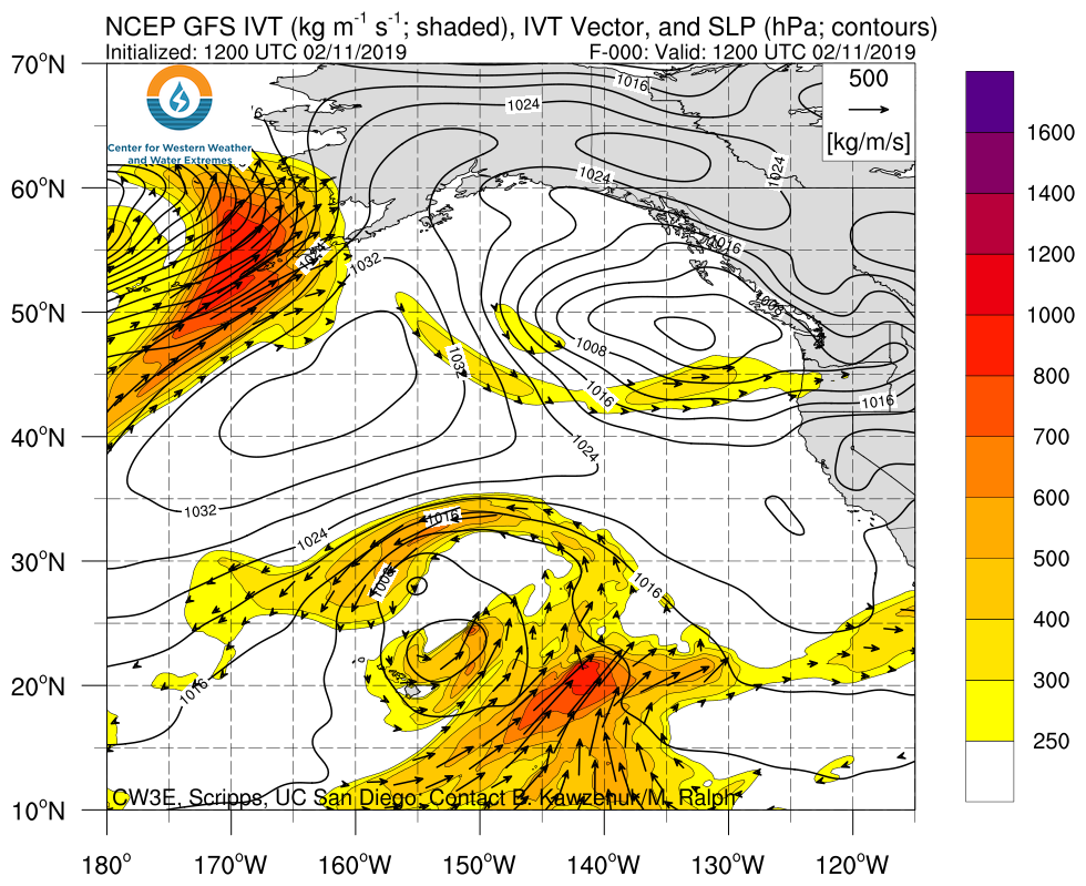
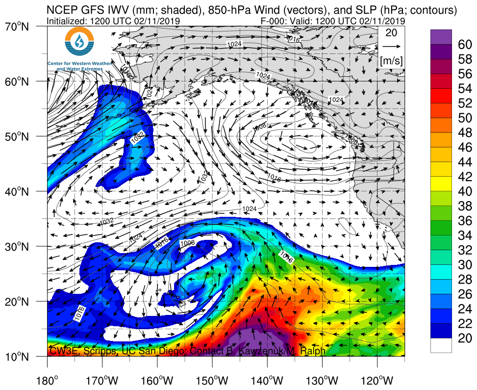
- A Low-pressure system that is currently impacting Hawaii is forecast to propagate northeastward, interact with a separate low off the Pacific Northwest Coast, and bring AR conditions to the U.S. West Coast
- Coastal Locations over Southern CA could experience moderate to strong AR conditions for an extended duration (>72-hrs)
- The GFS is currently forecasting this AR to be an AR-Cat 3 event (based on duration and maximum integrated vapor transport; IVT) over Coastal Los Angeles County based on the newly published Atmospheric River Category over Southern California
- There is currently large ensemble spread of forecast AR conditions associated with the end of the AR leading to uncertainties in overall duration of the event over Southern California
- The CNRFC is currently forecasting 6-day precipitation accumulations of 11 inches over the Coastal Mountains of Northern California due to the landfalling AR and trajectory/inland propagation of the low-pressure system
- Portions of Southern California are forecast to receive 1.5–5.5 inches (higher amounts at higher elevations) over the next 6 days
- The Russian River in both Hopland and Guerneville are currently forecast to rise to within 1 foot of monitor stage
Click IVT or IWV image to see loop of 0-126 hour GFS forecasts Valid 1200 UTC 11 February – 1800 UTC 16 February 2019 |
|
 |
 |
Information on the recently published Atmospheric River Category Scale can be found here
Summary provided by C. Hecht, F. M. Ralph, J. Kalansky; 4 PM PT 11 February 2019
