CW3E AR Update: 15 January Outlook
January 15, 2019
Click here for a pdf of this information.
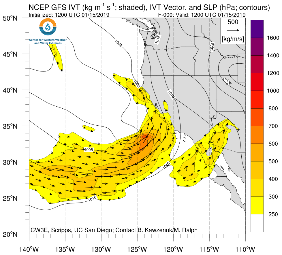
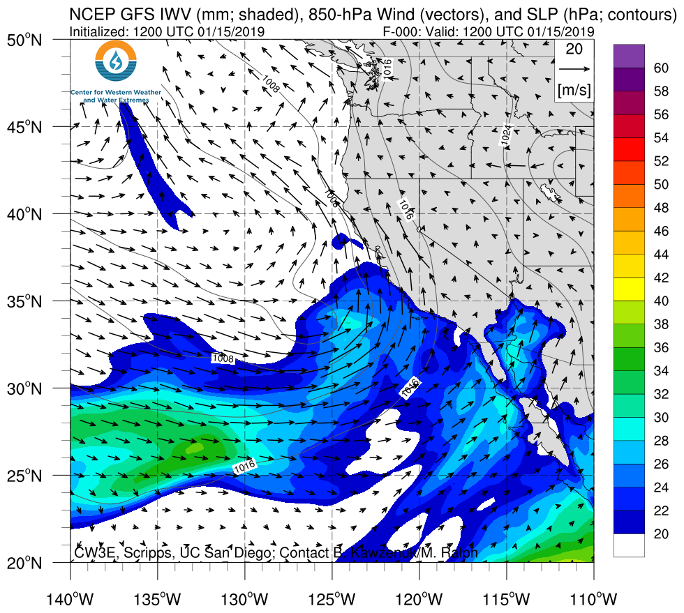
Two ARs forecast impact the US West Coast over the next six days
- A moderate strength AR is expected to make landfall over the U.S. West Coast during 17-18 January.
- This AR is expected to produce up to 10 inches of precipitation over the Sierra Nevada in 72 hours.
- A second AR is expected to make landfall over the Pacific Northwest during 19-20 January.
- An additional 1-2 inches of precipitation over CA and 4-5 inches of precipitation in WA and OR could be produced from the second AR.
- Lake Mendocino storage levels are currently near the top of the Water Supply Pool and precipitation this week could push storage levels into the Flood Control Pool.
Click IVT or IWV image to see loop of 0-144 hour GFS forecasts Valid 1200 UTC 15 January – 1200 UTC 21 January 2019 |
|
 |
 |
Summary provided by B. Kawzenuk, J. Kalansky, and F. M. Ralph; 3 PM PT 15 January 2019
