CW3E AR Update: 24 January 2020 Outlook
January 24, 2020
Click here for a pdf of this information.
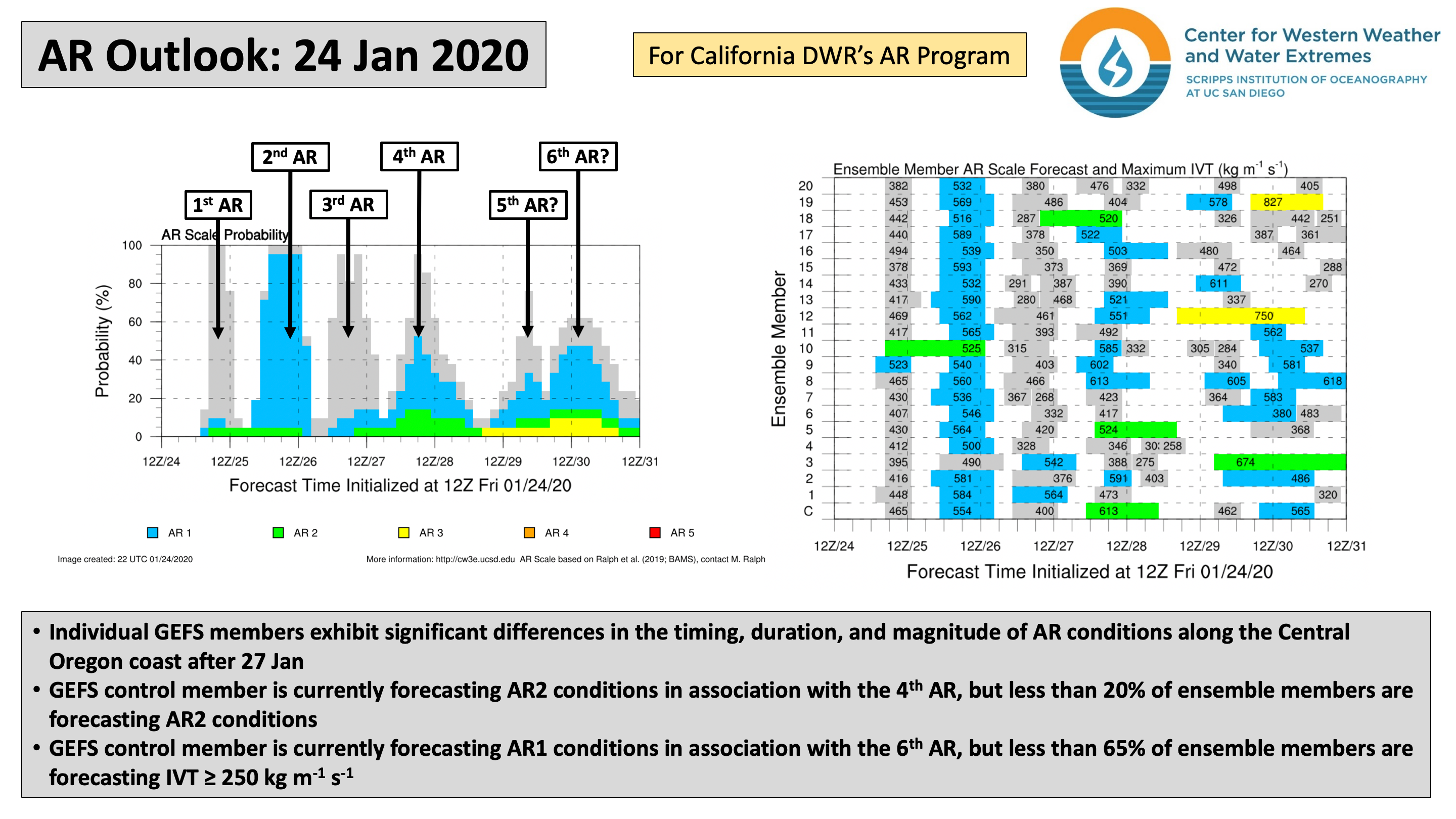
Active weather pattern will bring frequent AR activity and rainfall to the Pacific Northwest
- A series of storms over the Northeast Pacific Ocean will result in frequent episodes of AR conditions over the next 7 days
- Total 7-day precipitation amounts in excess of 5 inches are forecast over extreme northwestern California, the Oregon Coast Ranges, the Olympic Peninsula, and the Cascades
- Long-range ensemble forecasts suggest the potential for additional landfalling AR activity during the first week of February
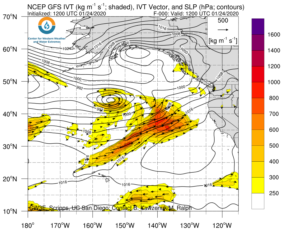
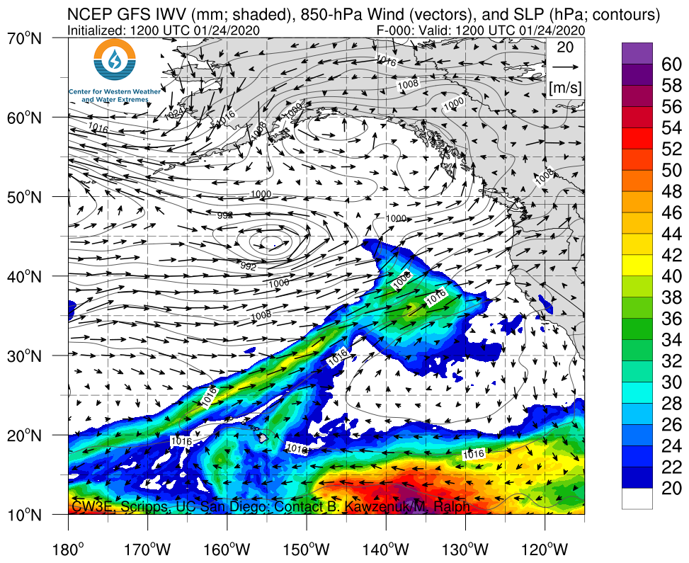
Click IVT or IWV image to see loop of GFS analyses/forecasts Valid 1200 UTC 24 January – 1200 UTC 31 January 2020 |
|
 |
 |
Summary provided by C. Castellano; 24 January 2020


