CW3E AR Update: 25 November Outlook
November 25, 2019
Click here for a pdf of this information.
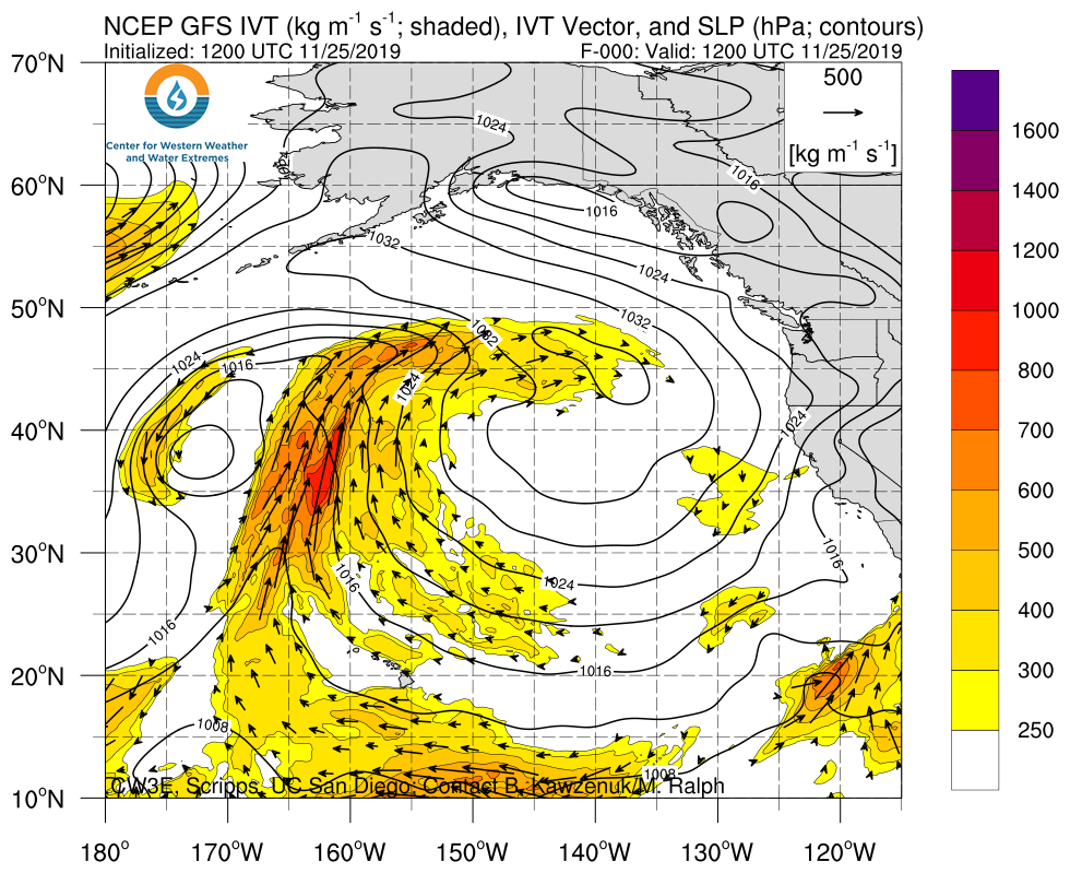
Period of active weather to bring impacts to a large majority of the Western United States
- A cyclone is forecast to undergo rapid intensification over the northeastern Pacific before moving inland over Northern CA
- While the parent cyclone associated with this event is forecast to be strong, the AR is forecast to be fast moving and of relatively low moisture content, which will result in primarily beneficial instead of hazardous rainfall
- The primary impacts associated with this event will be strong winds over North-Coastal California (gusts >50 mph) and heavy snow (>3 feet) over the high elevations of California
- A second cyclone is forecast to intensify over Southern CA and bring additional AR activity to Southern CA and AZ
- Overall, as much as 2–3 feet of snow could fall above 3,000 ft. (4 feet over the highest elevations) in the Sierra Nevada Mountains whereas Southern CA could receive as much as 2 in. of rain over the next 5 days
Click IVT or IWV image to see loop of 0-105 hour GFS forecasts Valid 1200 UTC 25 November – 2100 UTC 29 November 2019 |
|
 |
 |
Summary provided by C. Hecht, C. Castellano, B.Kawzenuk, J. Kalansky, F. M. Ralph; 4 PM PT 25 November 2019
