CW3E AR Update: 26 October 2022 Outlook
October 26, 2022
Click here for a pdf of this information.
Multiple Atmospheric Rivers to Bring Precipitation to the Pacific Northwest
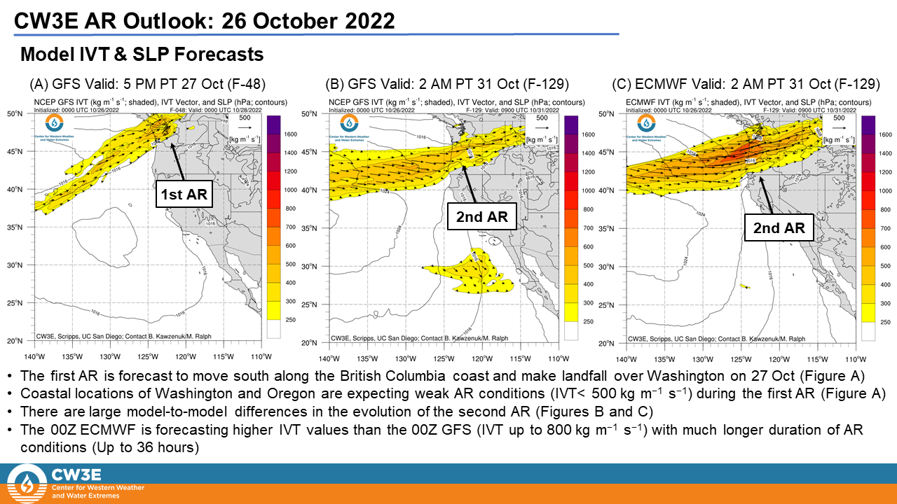
- Two atmospheric rivers (ARs) are forecast to move south along the British Columbia coast and bring AR conditions to the Pacific Northwest through the end of October
- The first AR is forecast to make landfall on 27 Oct and bring AR 1 conditions (based on the Ralph et al. 2019 AR Scale) to coastal Washington and Oregon
- There is substantial uncertainty in the timing, location, and duration of AR conditions with the potentially stronger second AR which is forecast to make landfall between 29 and 30 Oct
- The 00Z ECMWF EPS is forecasting the second AR to make landfall earlier and bring stronger AR conditions to the Pacific Northwest
- The National Weather Service (NWS) Weather Prediction Center (WPC) is forecasting 3-6 inches of precipitation over the Coast Ranges of Washington and Oregon and the northern Cascades over the next 7 days
- Precipitation associated with these ARs will help to improve severe drought conditions in the northern Coast Ranges and Cascades
- The second AR may bring precipitation to the Willamette National Forest in Oregon this weekend and help with firefighting efforts at the Cedar Creek Fire
Click images to see loops of GFS IVT & IWV forecasts Valid 0000 UTC 26 October – 1200 UTC 02 November 2022 |
|
 |
 |
Summary provided by S. Roj, S. Bartlett, C. Castellano, B. Kawzenuk, C. Hecht, N. Oakley, J. Kalansky and F. M. Ralph; 26 October 2022
To sign up for email alerts when CW3E post new AR updates click here.
*Outlook products are considered experimental


