CW3E AR Update: 3 November 2021 Outlook
November 3, 2021
Click here for a pdf of this information.
Active Weather Pattern Expected to Continue Along US West Coast
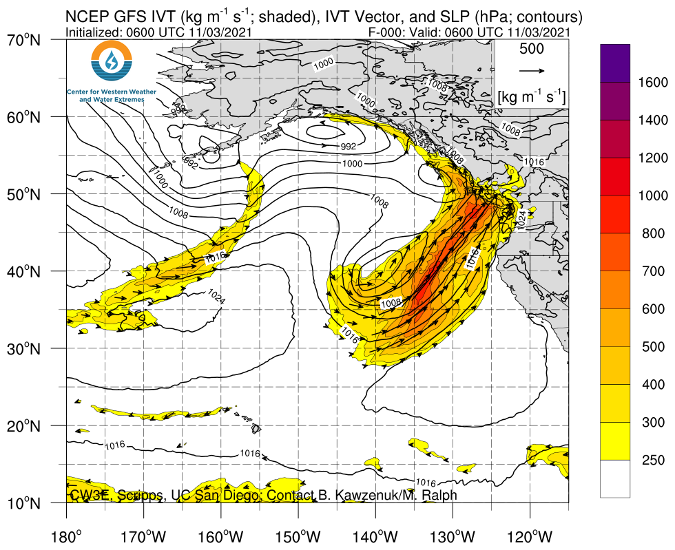
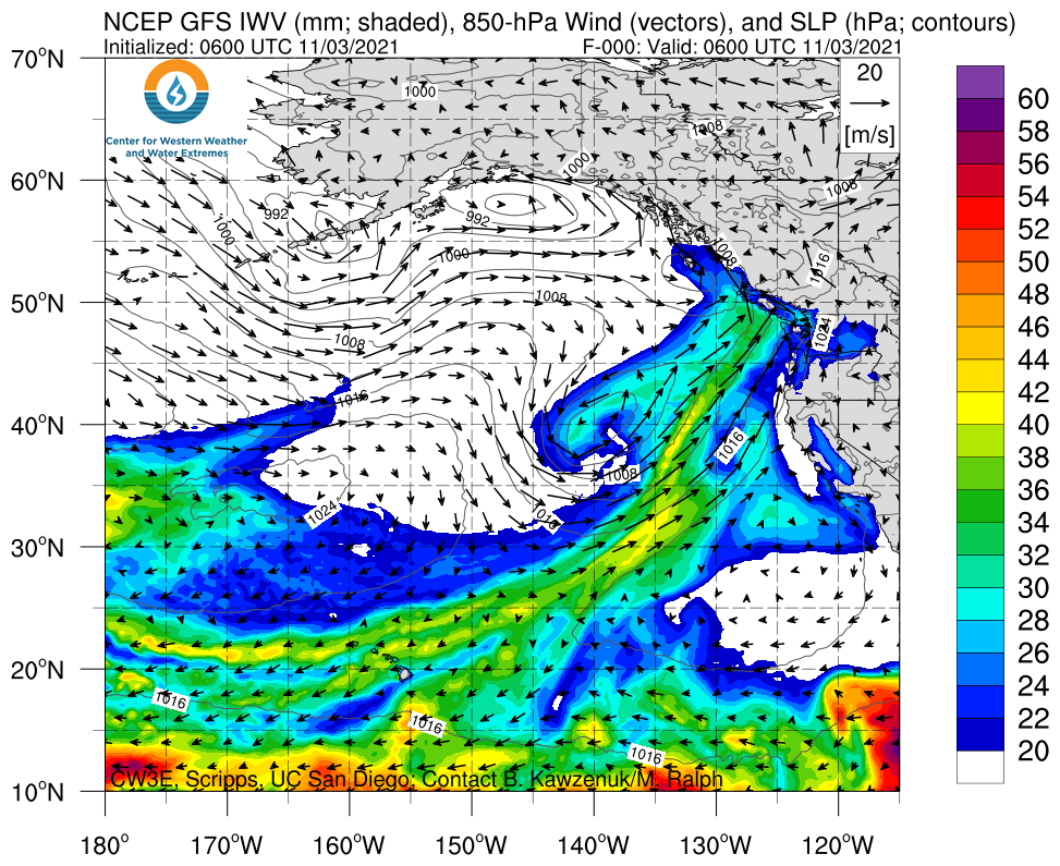
- A series of low-pressure systems and atmospheric rivers (ARs) are forecasted to impact the western US this week into early next week
- The first AR made landfall last night across Washington and Oregon
- AR 4 conditions (based on the Ralph et al. 2019 AR Scale) are forecasted in portions of coastal Oregon
- AR 2/AR 3 conditions are forecasted elsewhere along the coast between Northern California and Washington
- After the first AR dissipates, multiple weak disturbances are forecasted to bring weak AR conditions to the US West Coast on Friday and Saturday
- Another stronger AR may make landfall early next week, but there is considerable uncertainty regarding the AR timing, location, and magnitude
- The first AR is forecasted to produce an additional 1–3 inches of precipitation across portions of Northern California, western Oregon, and western Washington, with higher amounts possible in the Olympic Mountains and near the California/Oregon border
- At least 3–7 inches of total precipitation is forecasted over the Pacific Coast Ranges, Cascades, and Sierra Nevada during the next 7 days, with more than 10 inches possible in the Olympic Mountains
Click images to see loops of GFS IVT & IWV forecasts Valid 0600 UTC 3 November – 0000 UTC 10 November 2021 |
|
 |
 |
Summary provided by C. Castellano, C. Hecht, J. Kalansky, and F. M. Ralph; 3 November 2021
To sign up for email alerts when CW3E post new AR updates click here.
*Outlook products are considered experimental

