
CW3E AR Update: 4 February 2020 Outlook
February 4, 2020
Click here for a pdf of this information.
A landfalling AR will bring heavy rainfall and mountain snowfall to the Pacific Northwest
- A landfalling AR is forecast to impact British Columbia, Washington, and Oregon this week
- Some areas along the Washington and Oregon coast may experience AR conditions for more than 48 hours
- Prolonged inland penetration of AR conditions is likely over the Intermountain West
- At least 2–7 inches of precipitation are expected over portions of western Washington and northwestern Oregon during the next 3 days, with at least 12” of snowfall in the North Cascades and portions of the Intermountain West
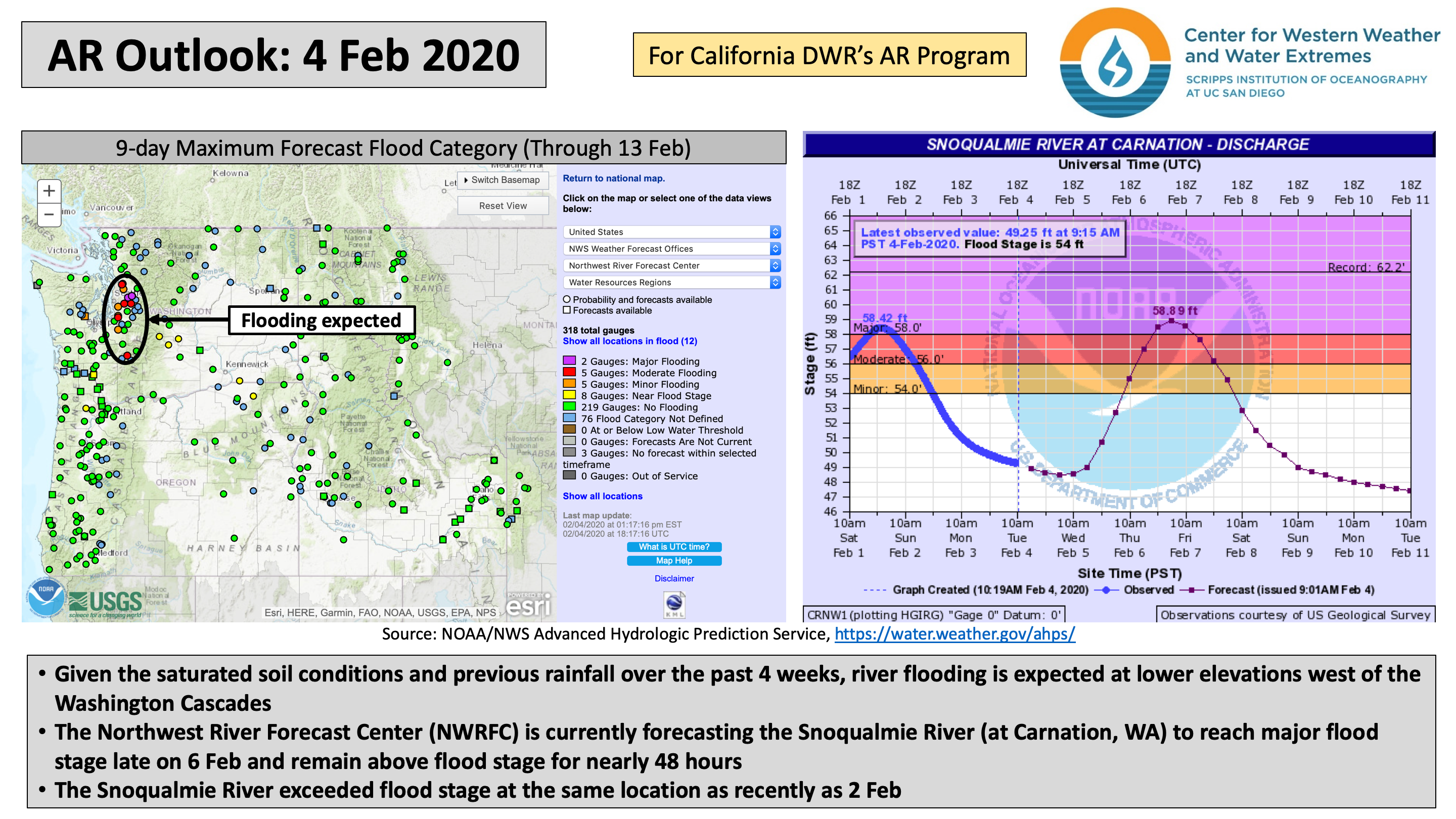
- River flooding is possible once again downstream of the Washington Cascades
- Landfalling AR activity beyond Day 4 (8 Feb) is unlikely as surface high pressure builds over the Northeast Pacific Ocean
Click IVT or IWV image to see loop of GFS analyses/forecasts Valid 0000 UTC 4 February – 0000 UTC 8 February 2020 |
|
 |
 |


Summary provided by C. Castellano, B. Kawzenuk, and F. M. Ralph; 4 February 2020