CW3E AR Update: 5 January 2024 Outlook
January 5, 2024
Click here for a pdf of this information.
Winter Weather Set to Impact US West Coast this Weekend into Early Next Week
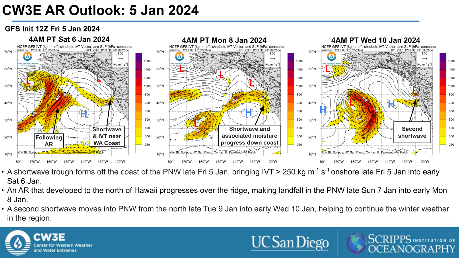
- A series of upper-level shortwave troughs and an atmospheric river (AR) will help drive winter weather set to impact the US West Coast from late Fri 5 Jan through the end of next week.
- The first period of winter weather begins late Fri 5 Jan when the shortwave trough is forecast to form off the PNW coast, deepening and eventually progressing east throughout Sat 6 Jan.
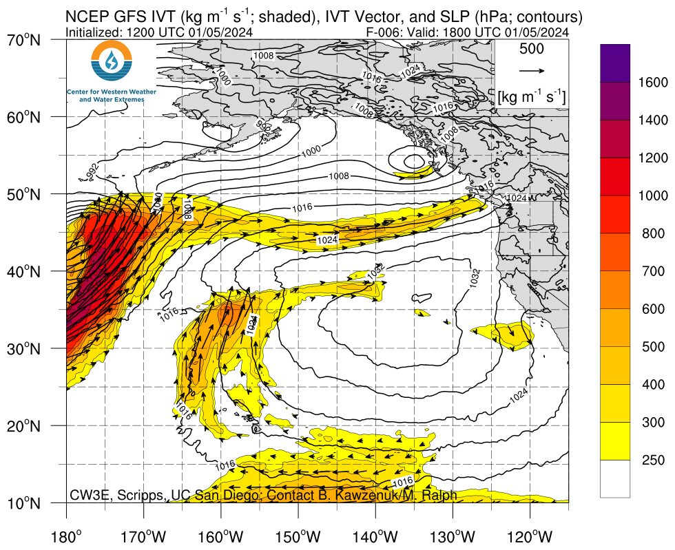
- The second period of winter weather is driven by an AR that is forecast to make landfall as an AR1 to AR2 (based on Ralph et al. 2019 AR scale) into the PNW early Mon 8 Jan.
- A second and third shortwave are forecast to move into the region late Tue 9 Jan and late Thu 11 Jan respectively, continuing the unsettled weather in the region.
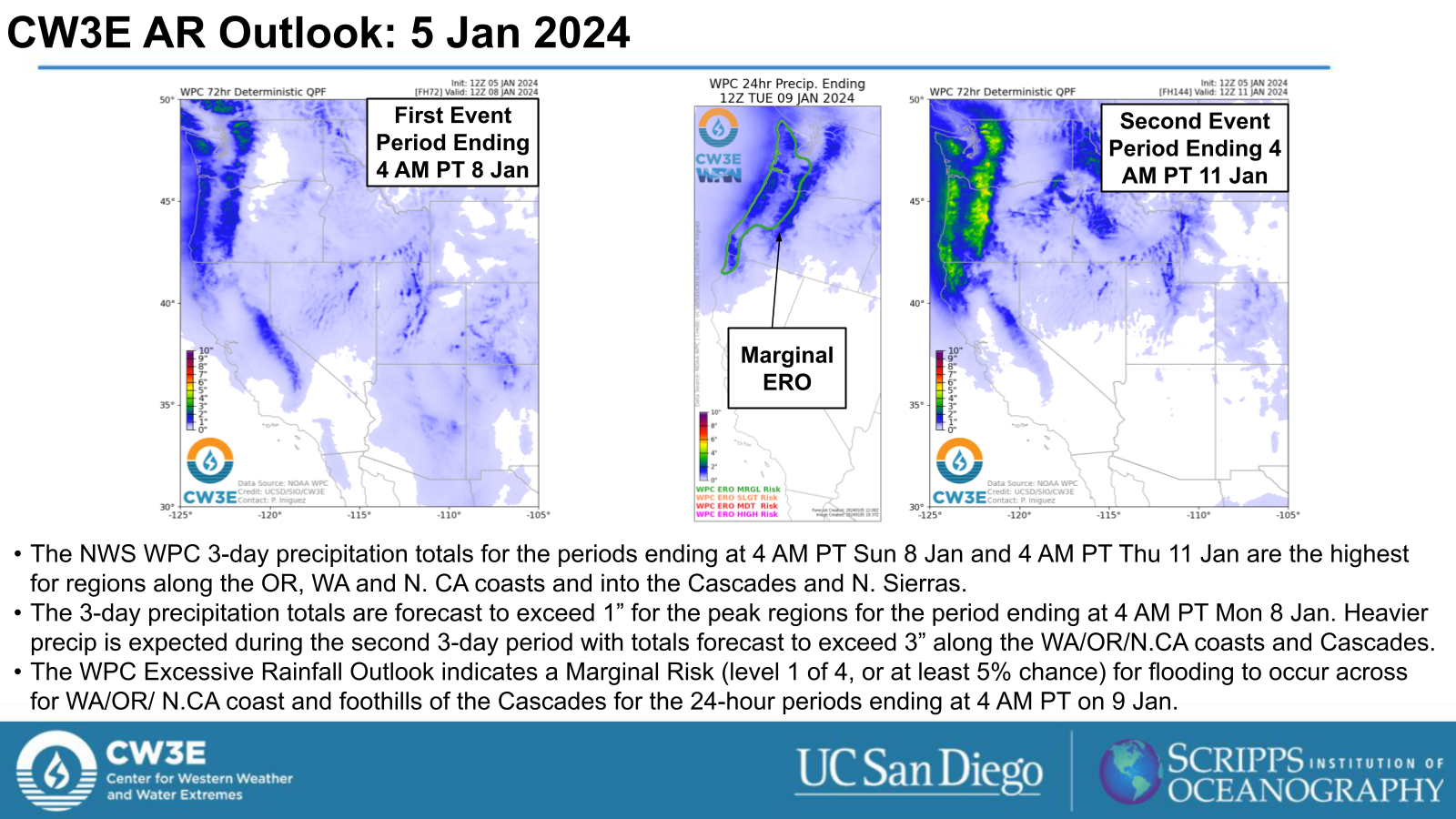
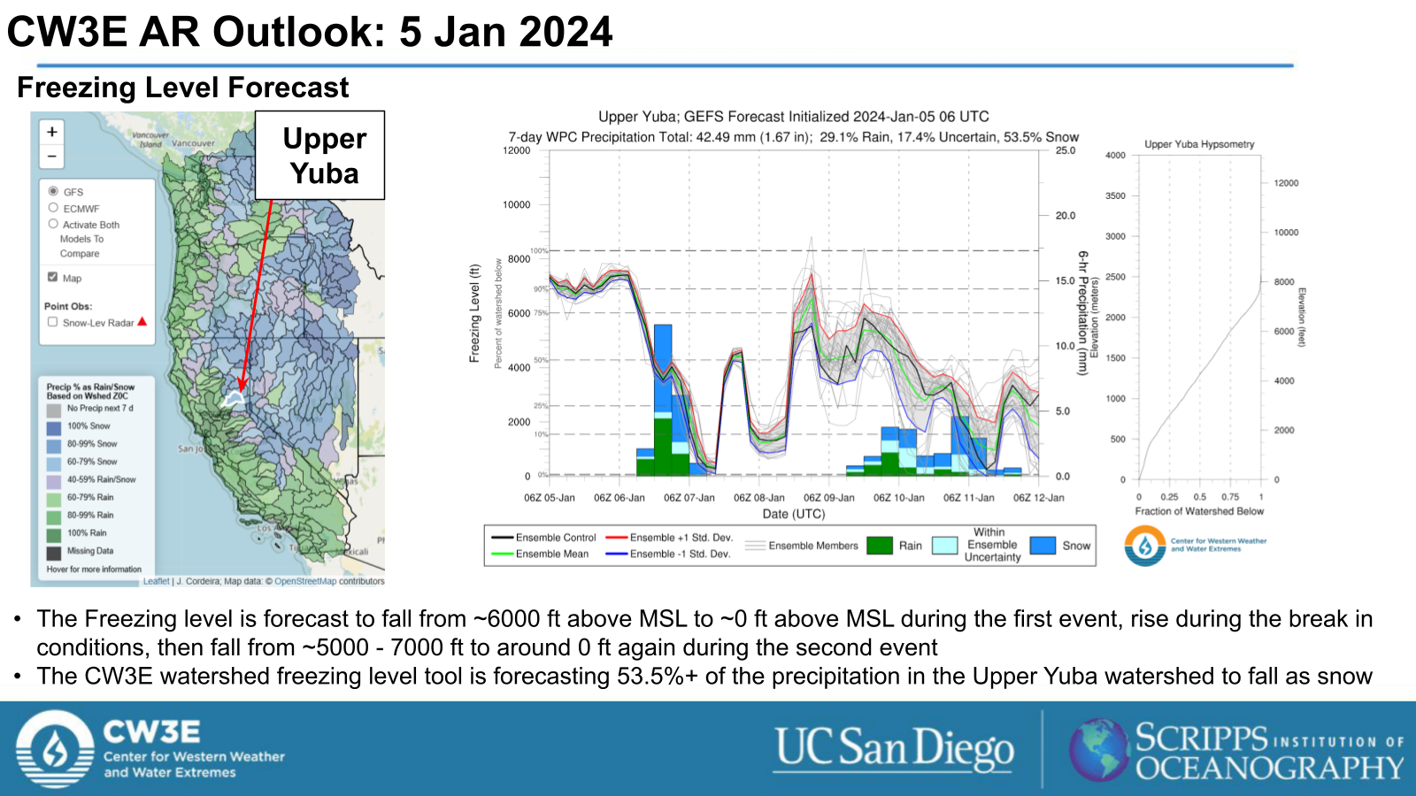
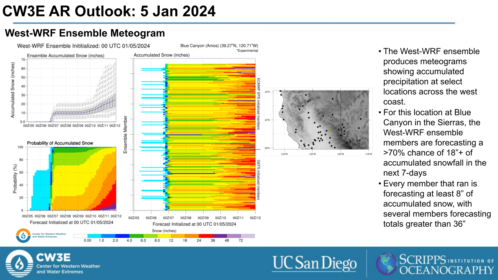
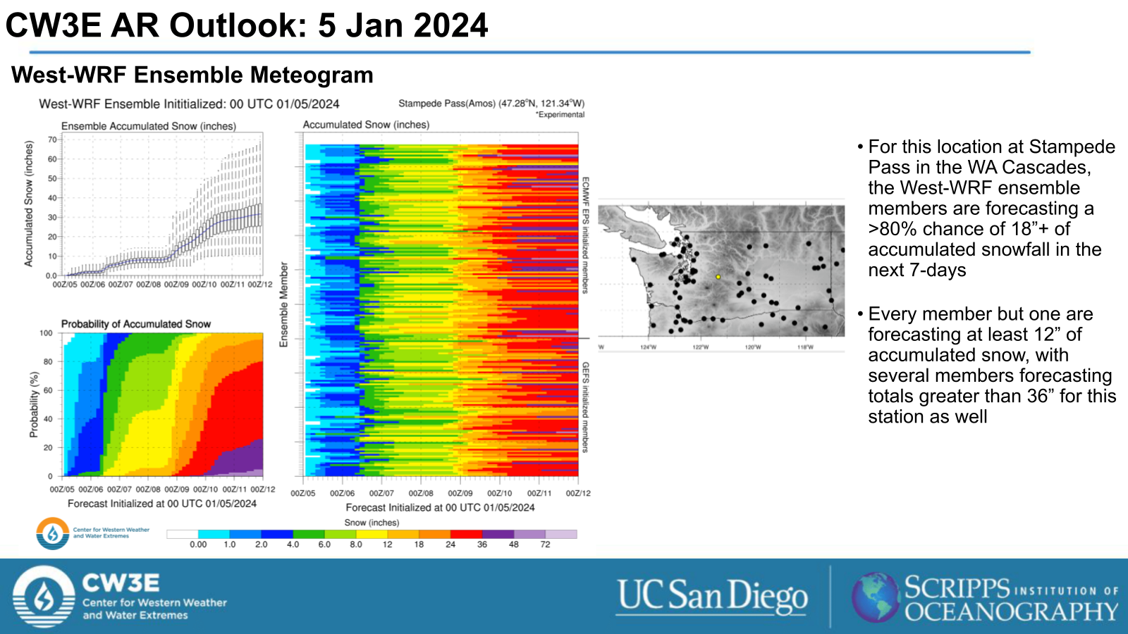
- For the 7-day period encompassing both shortwaves and the AR, significant snowfall accumulations are expected in the Cascades and Sierra Nevada ranges.
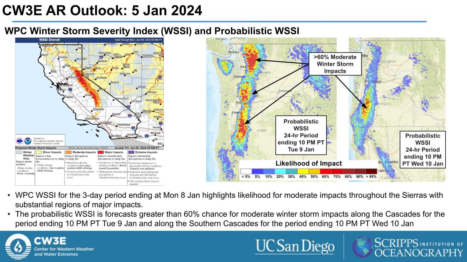
- The Weather Prediction Center’s (WPC) Winter Storm Severity Index (WSSI) indicates that Major Impacts are expected in portions of the Sierra Nevada during the first winter storm period (ending Mon 8 Jan).
- The WPC’s probabilistic WSSI tools indicates greater than 60% chance of moderate impacts with the AR and shortwave trough for the Cascades.
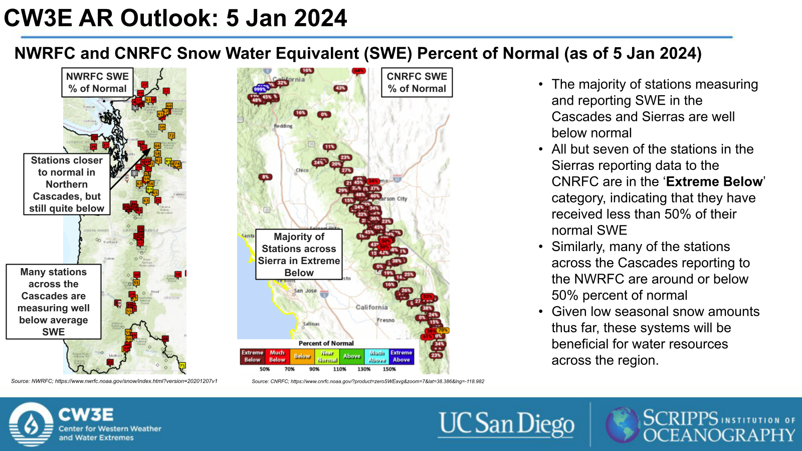
- Given low seasonal snow amounts thus far, these systems will be beneficial for water resources across the region.
Click images to see loops of GFS IVT and IWV forecasts Valid 1800 UTC 5 January 2024 – 0000 UTC 13 January 2024 |
|
 |
 |
Summary provided by M. Steen, P. Iniguez and C.Castellano; 05 January 2024
To sign up for email alerts when CW3E post new AR updates click here.
*Outlook products are considered experimental

