CW3E AR Update: 7 October 2020 Outlook
October 7, 2020
Click here for a pdf of this information.
Update on Atmospheric Rivers Forecast to Impact the US West Coast
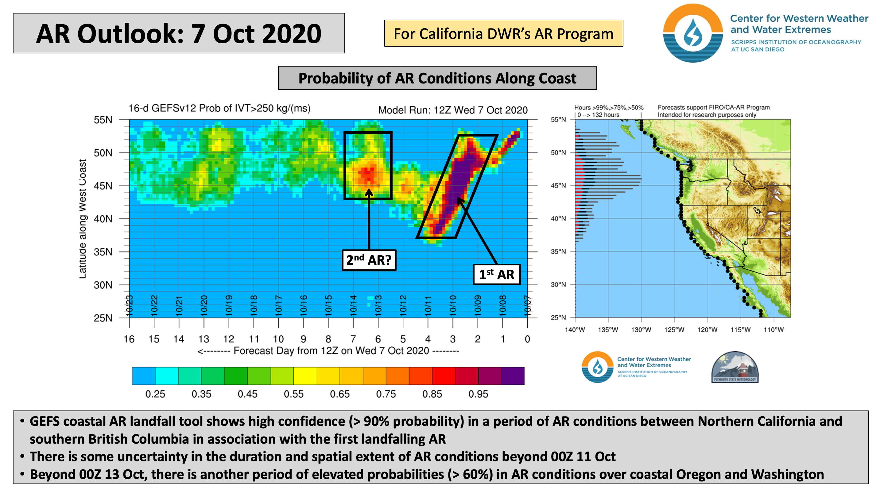
- A unique large-scale flow regime is forecast to result in the landfall of two separate but concurrent ARs over the USWC
- Current forecasts suggest the possibility of an AR 2/AR 3 between extreme Northern California and Washington in association with the first landfalling AR, but there is some uncertainty in the timing, duration, and magnitude of AR conditions
- The GFS and ECMWF are forecasting at least 1–3 inches of precipitation across western Washington and Oregon during the next 5 days, with higher amounts possible over the Olympic Mountains and North Cascades
- Unfortunately, little precipitation is expected in California, where many large fires are still active
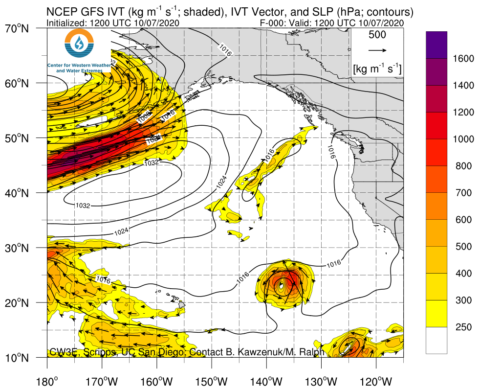
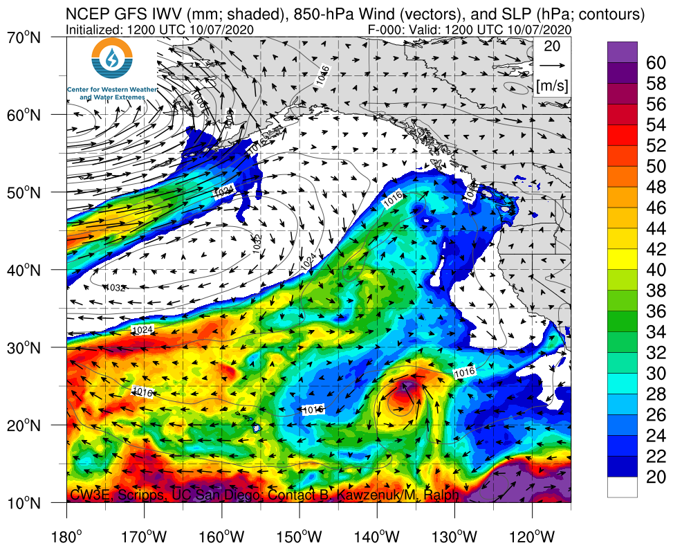
Click images to see loops of GFS IVT/IWV analyses and forecasts Valid 1200 UTC 7 October – 1200 UTC 15 October 2020 |
|
 |
 |
Summary provided by C. Castellano, J. Kalansky, and F. M. Ralph; 7 October 2020
*Outlook products are considered experimental


