CW3E Event Summary: 10-14 December 2021
December 16, 2021
Click here for a pdf of this information.
Atmospheric River Brings Heavy Rain and Snow to the Western US
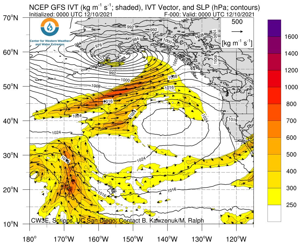
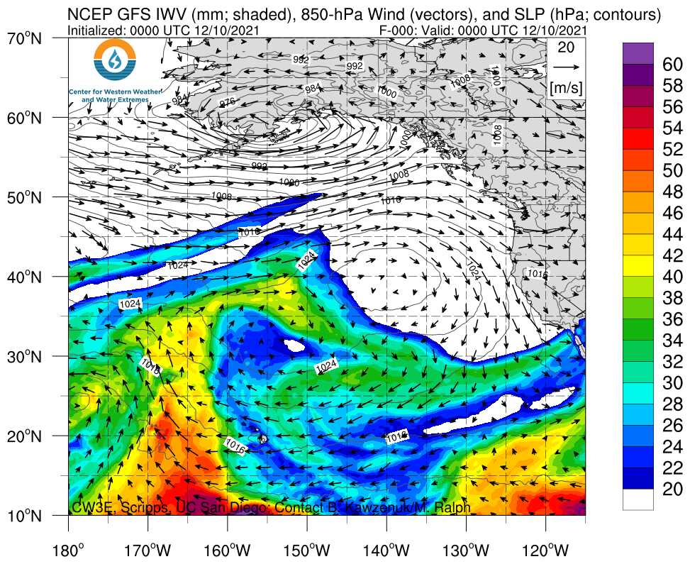
- An atmospheric river (AR) made landfall over the Pacific Northwest on 10 Dec and gradually moved south along the US West Coast
- When the AR reached the San Francisco Bay Area, it temporarily stalled and began to re-intensify as it interacted with an upper-level trough to the west
- AR conditions persisted for at least 48 hours over the Bay Area and the foothills of the Northern Sierra Nevada, resulting in an AR 2/AR 3 (based on the Ralph et al. 2019 AR Scale)
- AR 1 conditions were observed in coastal Southern California
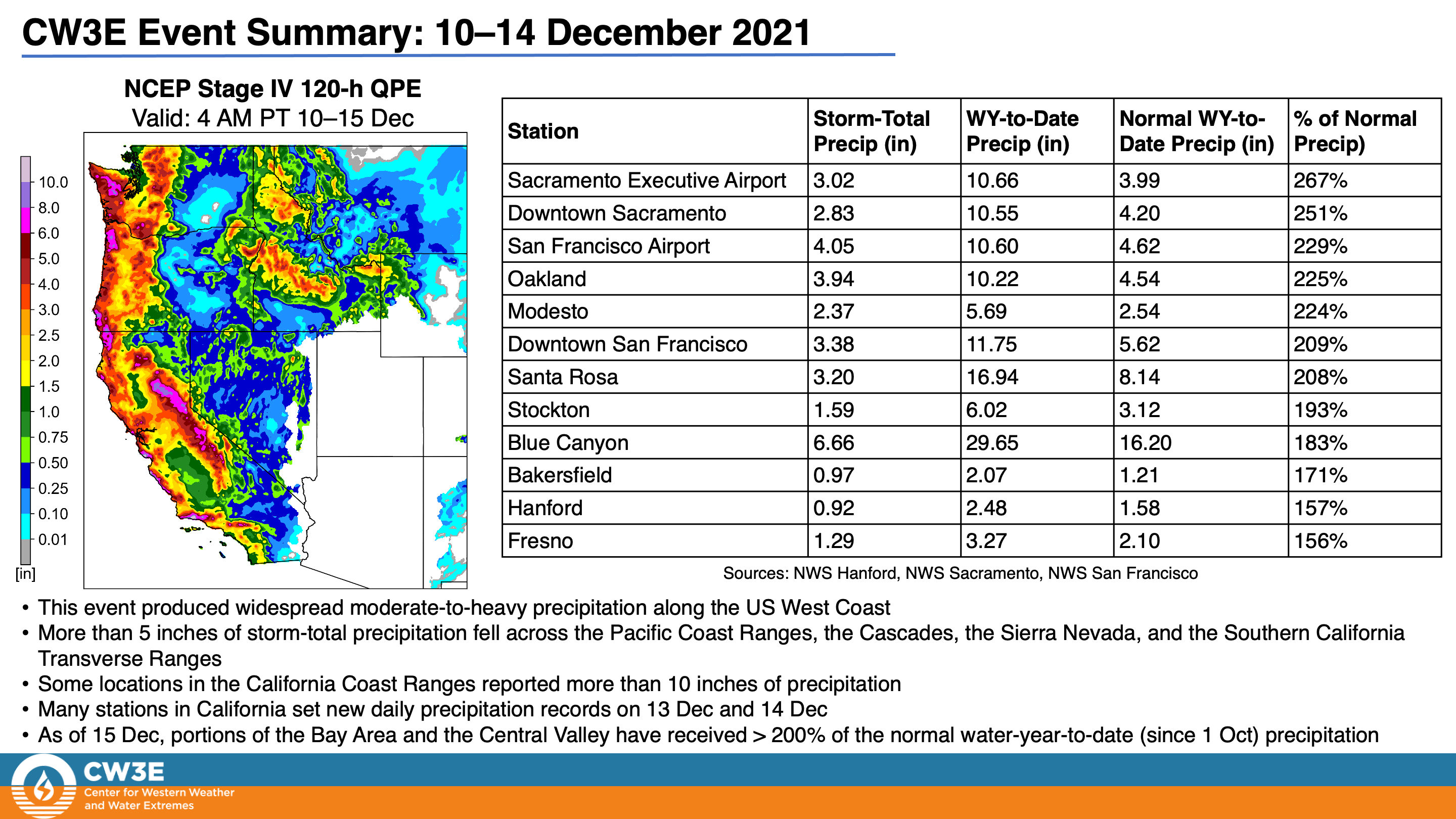
- More than 5 inches of storm-total precipitation fell across the Pacific Coast Ranges, the Cascades, the Sierra Nevada, and the Southern California Transverse Ranges
- Some locations in the California Coast Ranges reported more than 10 inches of precipitation
- Several feet of snow fell in the Olympic Mountains, the Cascades, the Northern Rockies, and the Sierra Nevada
- Low freezing levels supported significant snowfall accumulations below 6,000 feet in the Sierra Nevada as well as in the Southern Oregon and Northern California Coast Ranges
- Intense rainfall on 13–14 Dec caused flooding and slides in the Bay Area and in Southern California
Click images to see loops of GFS IVT/IWV analyses Valid 0000 UTC 10 December – 0000 UTC 15 December 2021 |
|
 |
 |
Summary provided by Chris Castellano, J. Kalansky, Shawn Roj, F.M. Ralph; 16 December 2021
To sign up for email alerts when CW3E post new AR updates click here.
*Outlook products are considered experimental


