
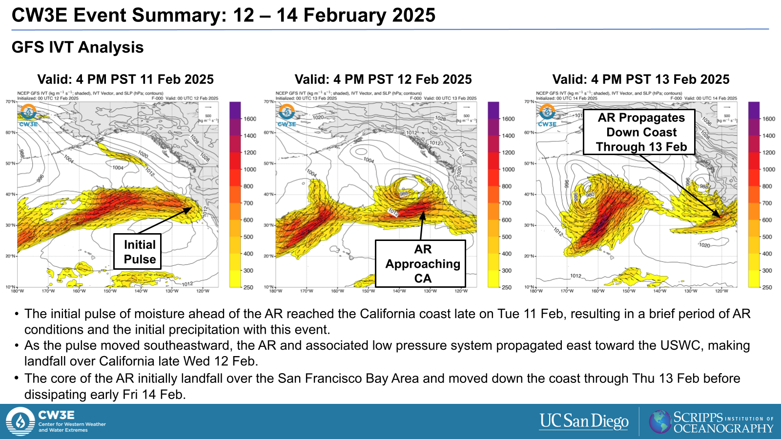
CW3E Event Summary: 12-14 February 2025
24 February 2025
Click here for a pdf of this information.
Atmospheric River Brings Heavy Precipitation to California
The AR:
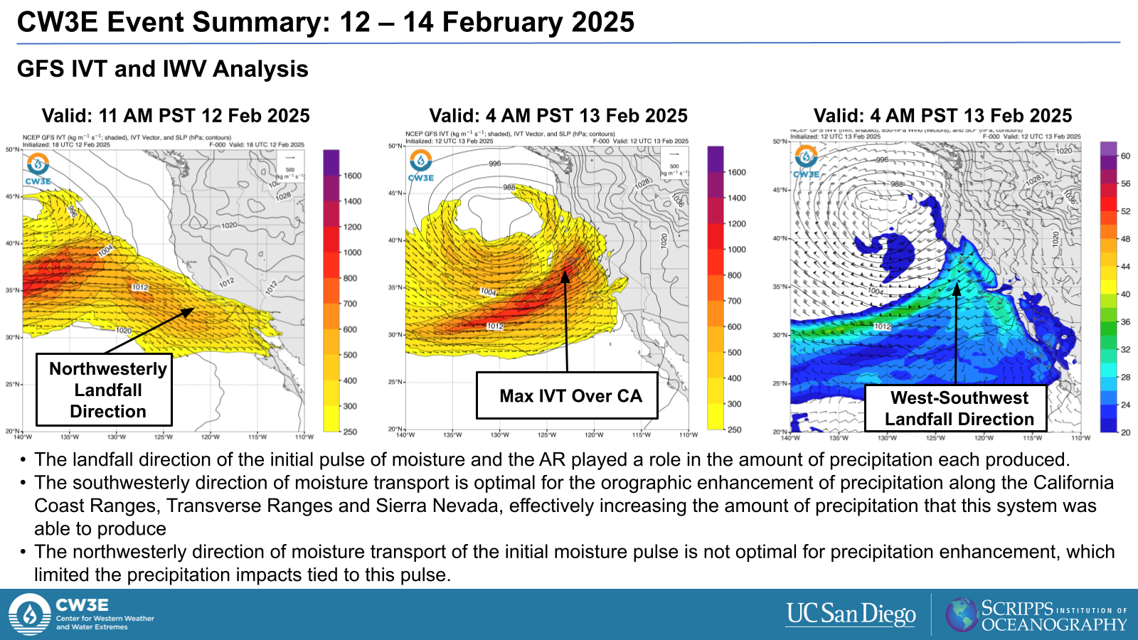
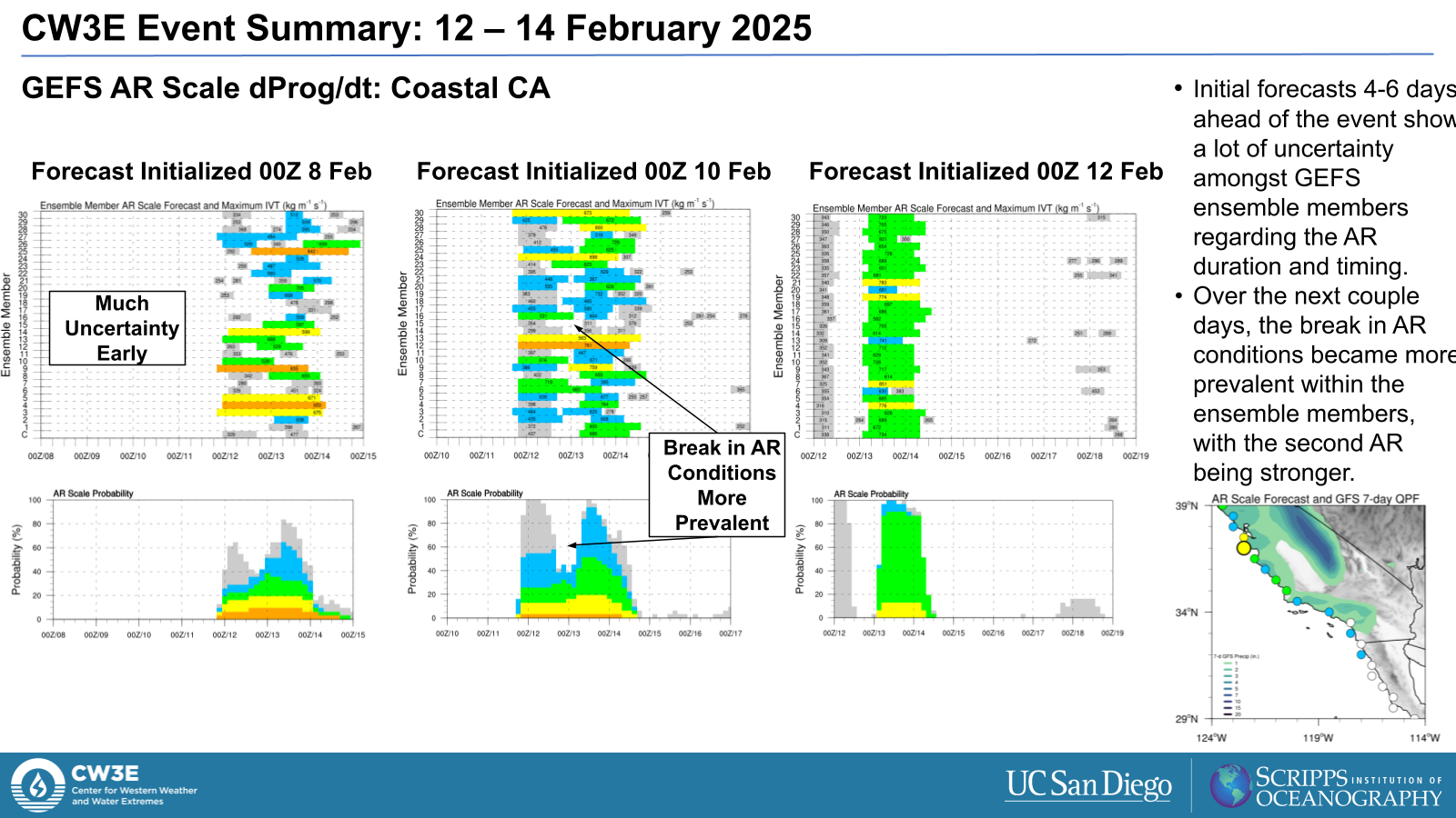
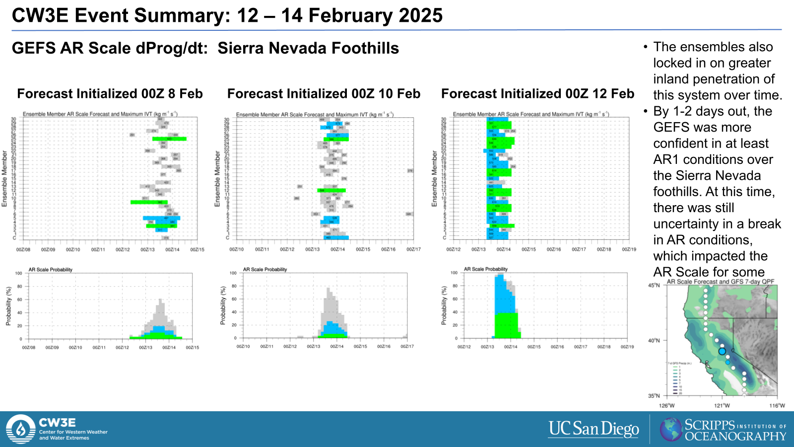
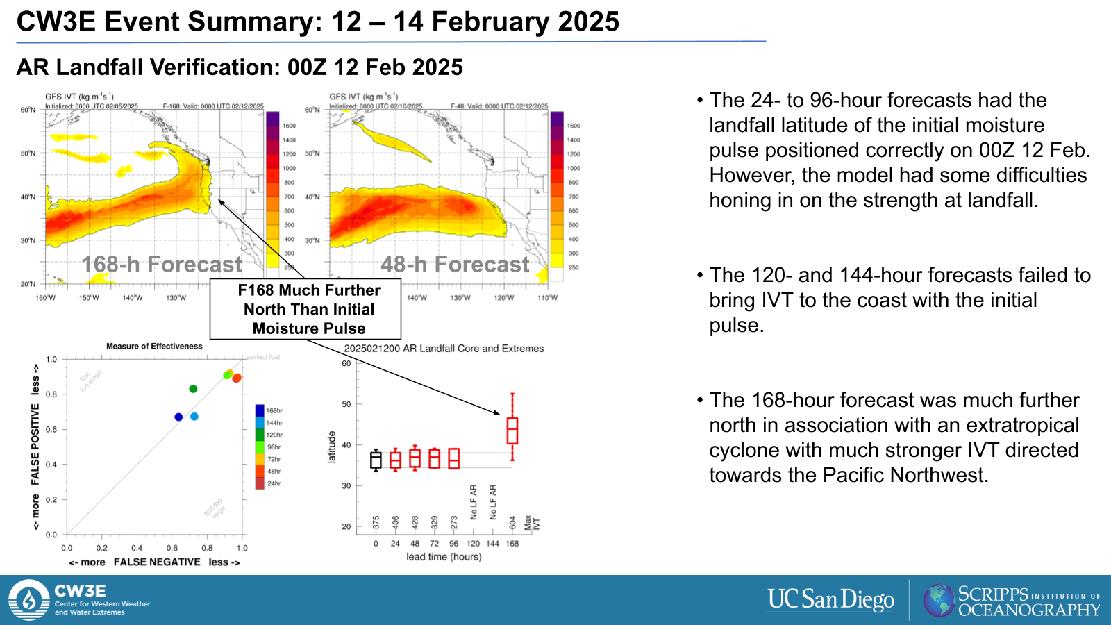
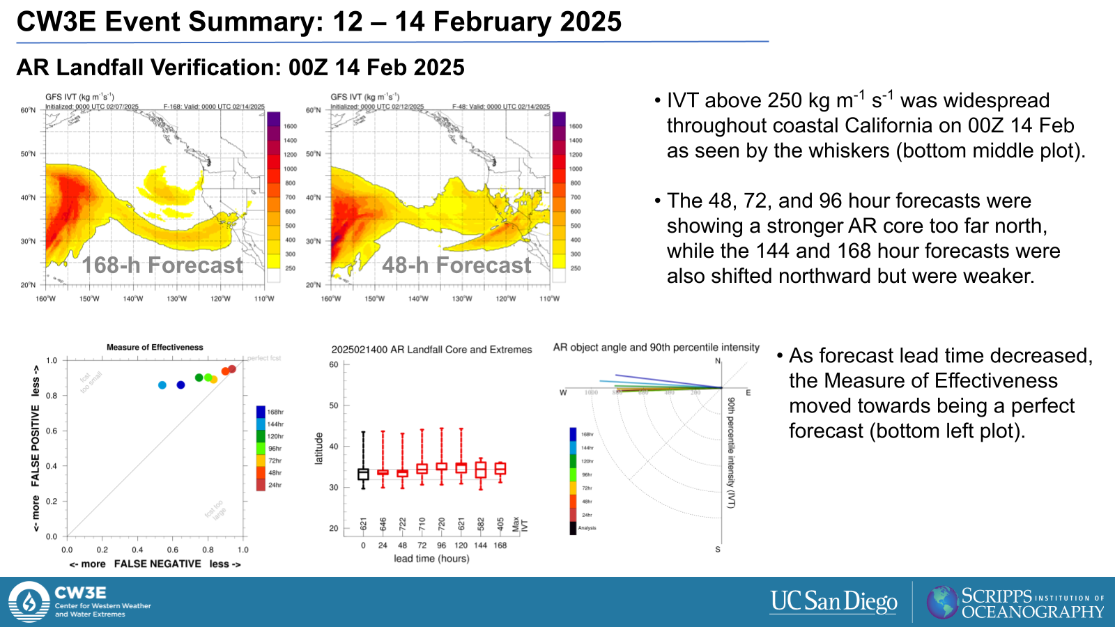
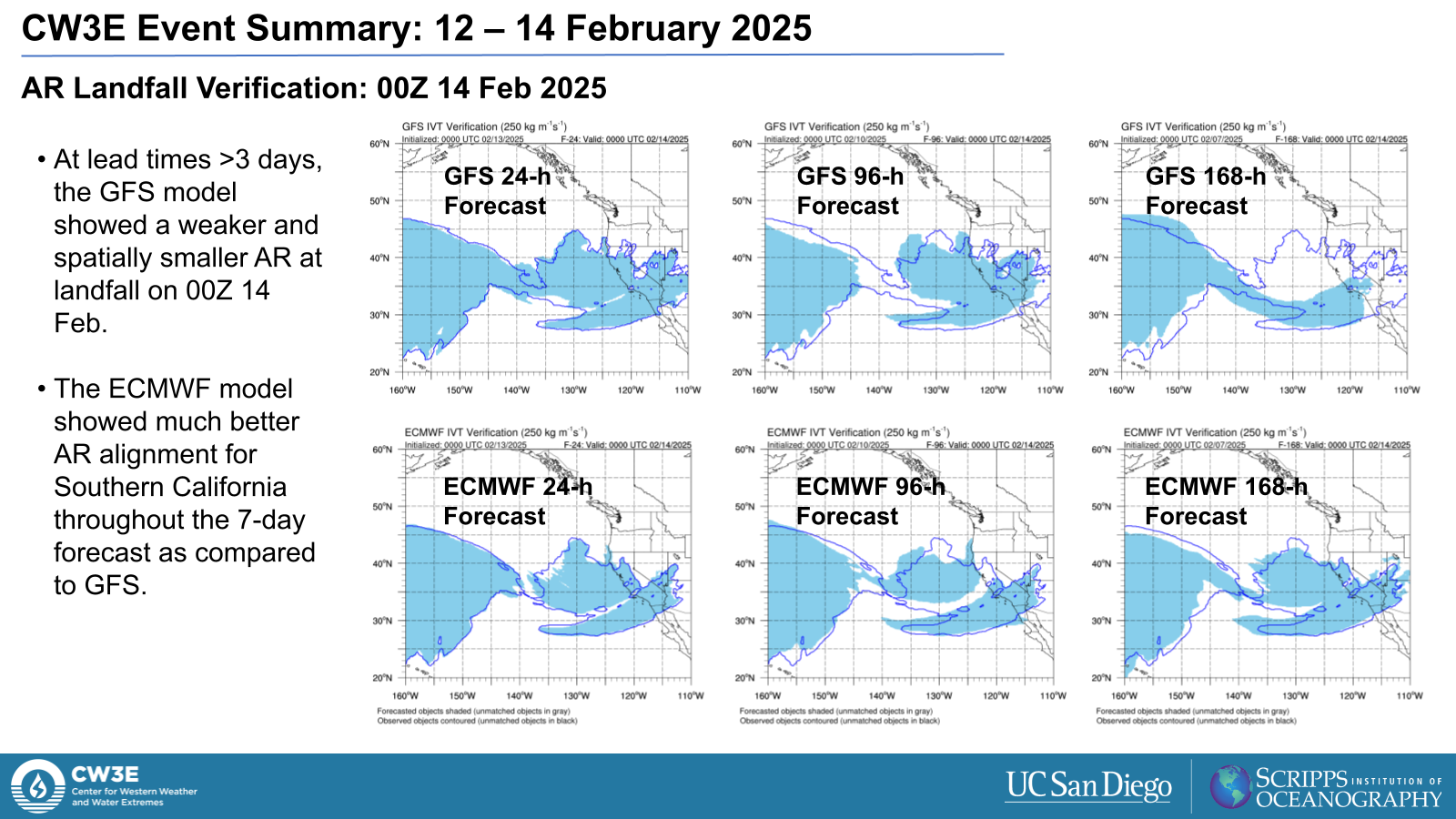
- The atmospheric river made landfall over California on Wed 12 Feb following an initial pulse of moisture. The storm propagated down the California coast through Thu 13 Feb before dissipating early Fri 14 Feb.
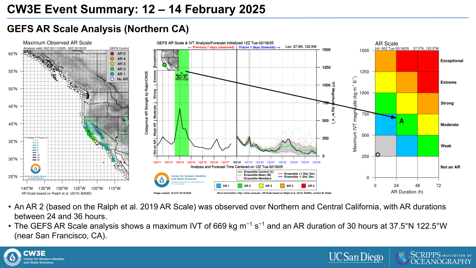
- The southwesterly direction of moisture transport within the core of the AR was optimal for precipitation enhancement over the California Coast Ranges, Transverse Ranges and Sierra Nevada.
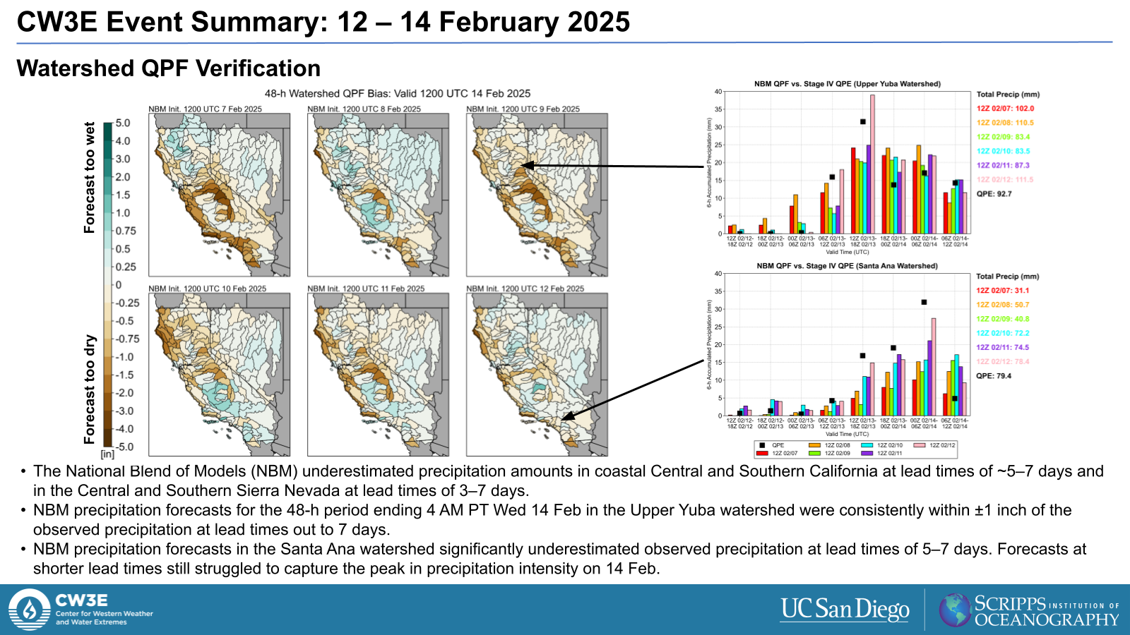
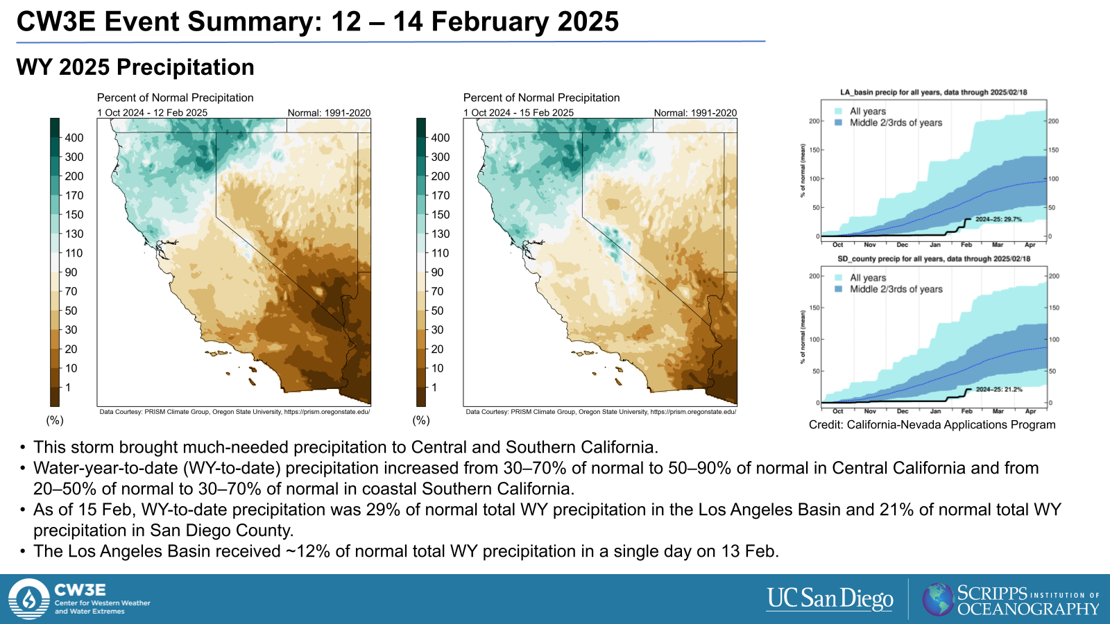
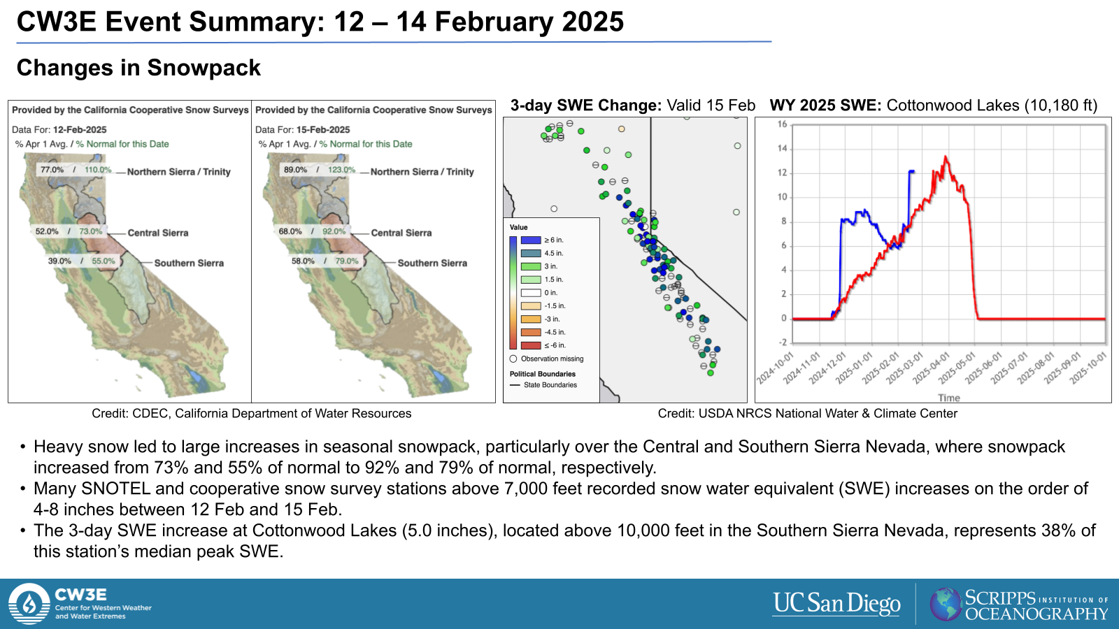
Precipitation and Hydrology:
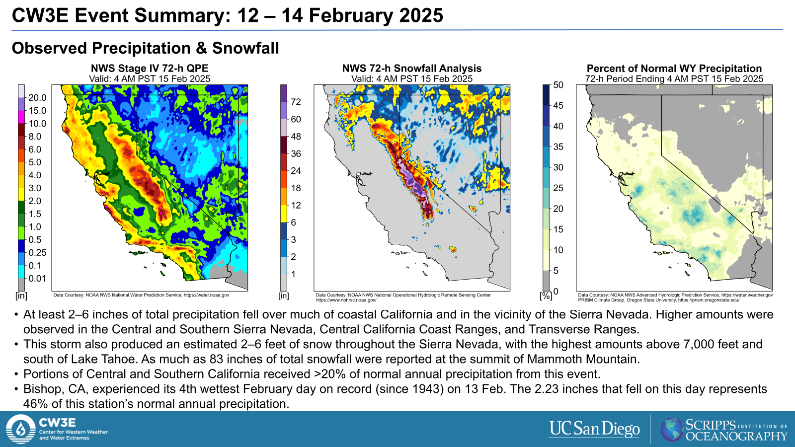
- The storm produced 2-6 inches of precipitation over much of coastal California and in the vicinity of the Sierra Nevada as well as 2–6 feet of snow throughout the Sierra Nevada, with the highest amounts above 7,000 feet and south of Lake Tahoe.
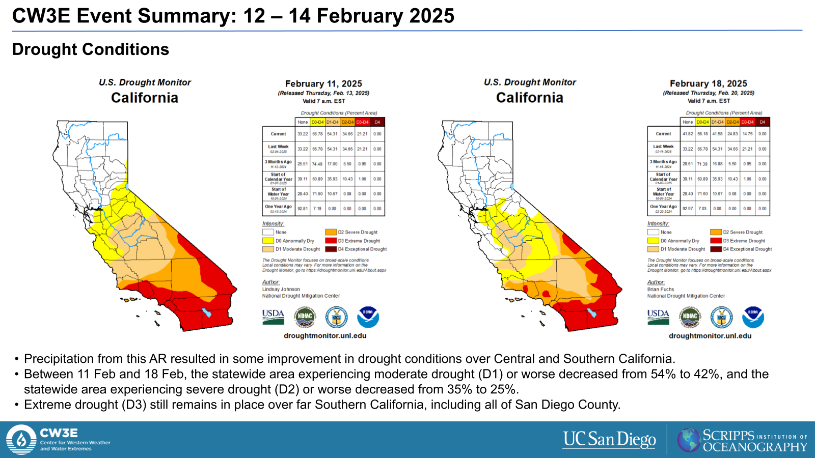
- The precipitation helped improve drought conditions in Central and Southern California and increased snowpack levels in the Central and Southern Sierra Nevada.
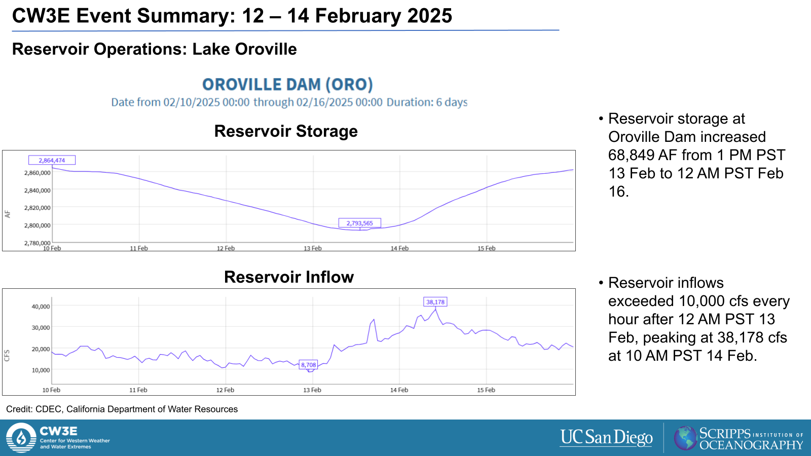
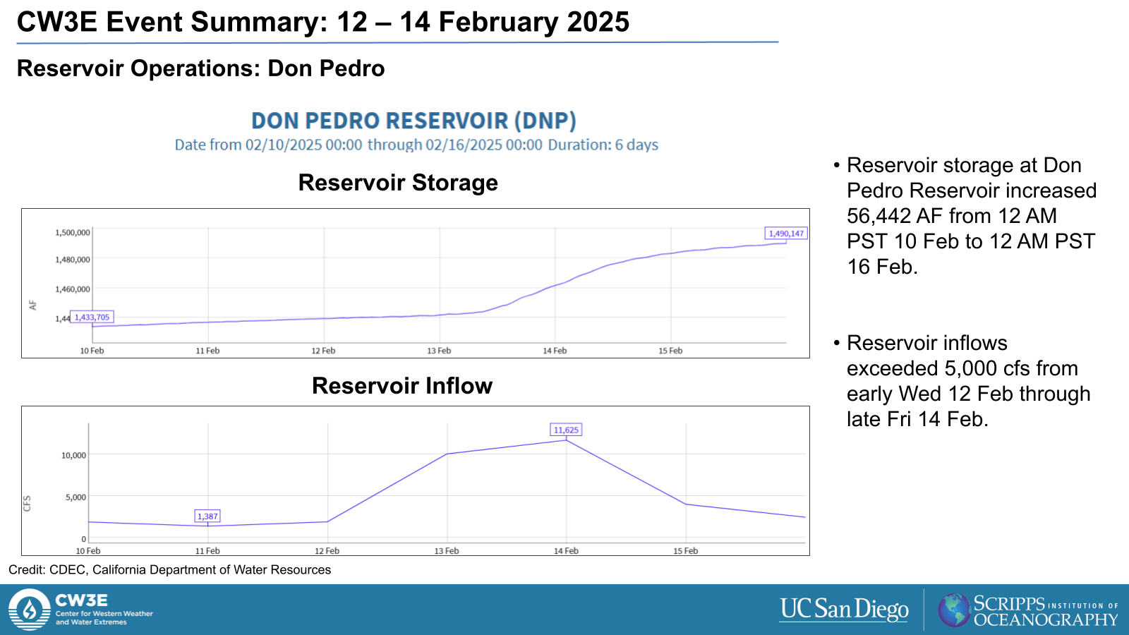
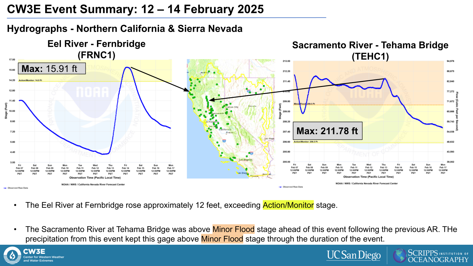
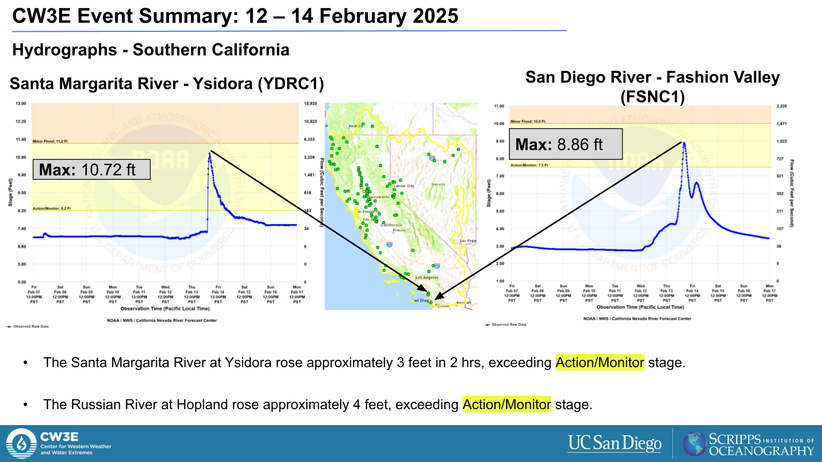
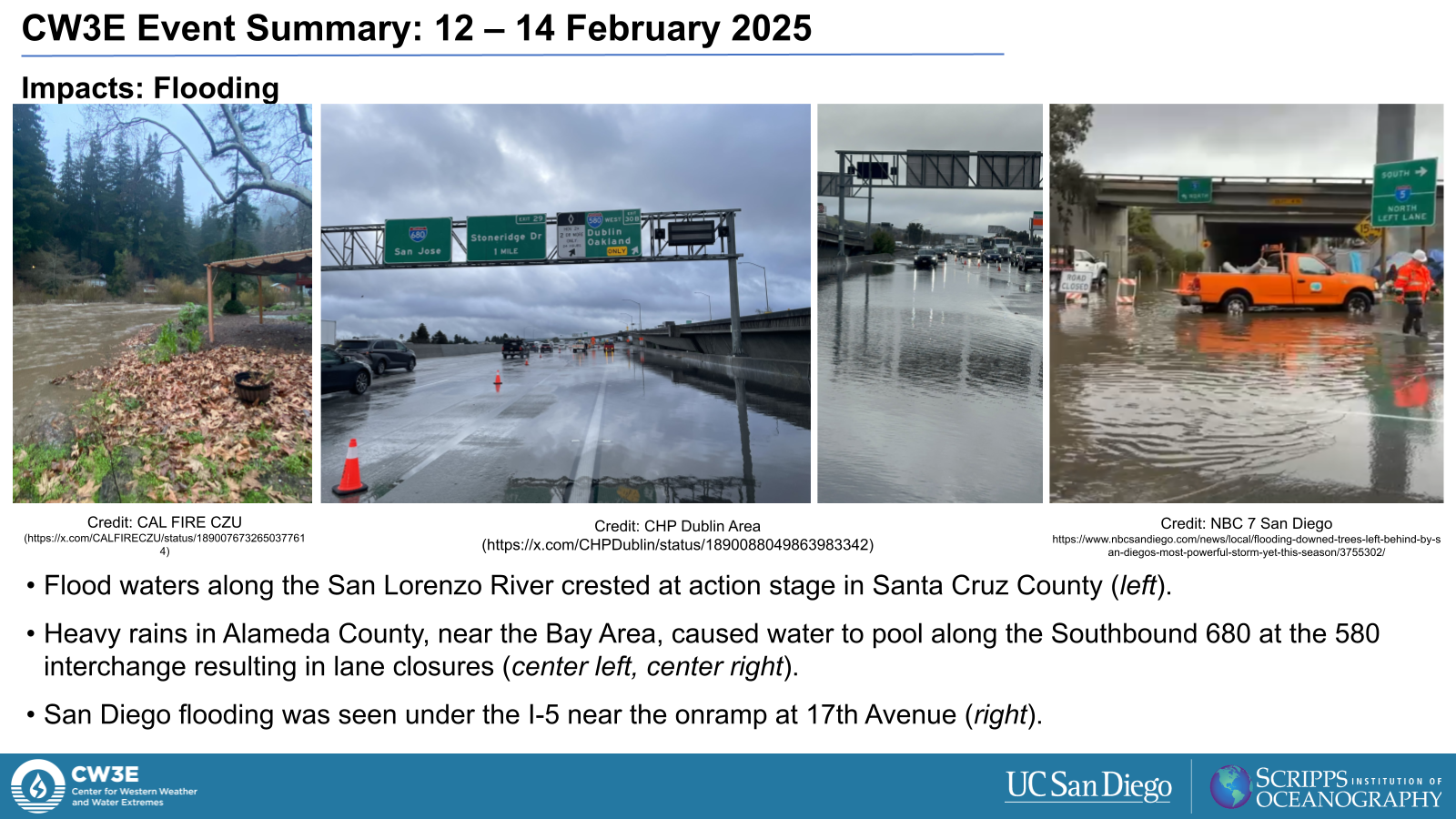
- The heavy precipitation led to stream and reservoir rises across the state of California.
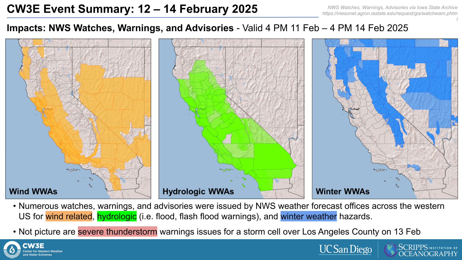
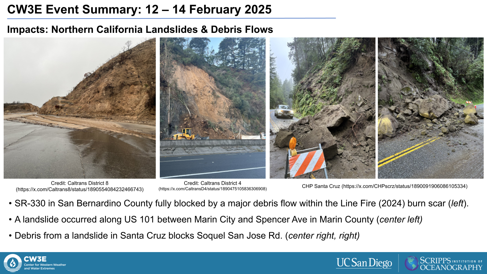
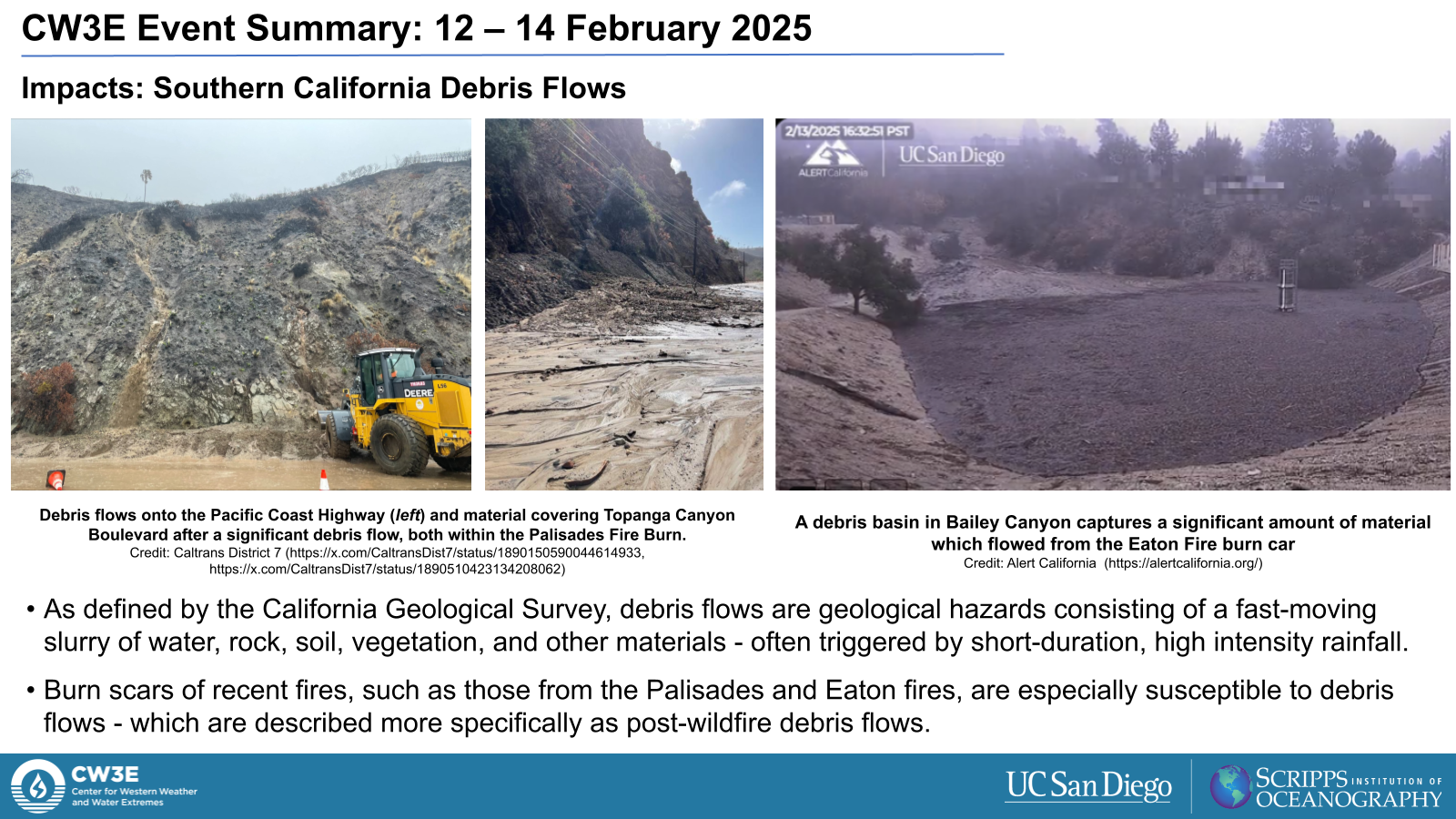
Impacts:
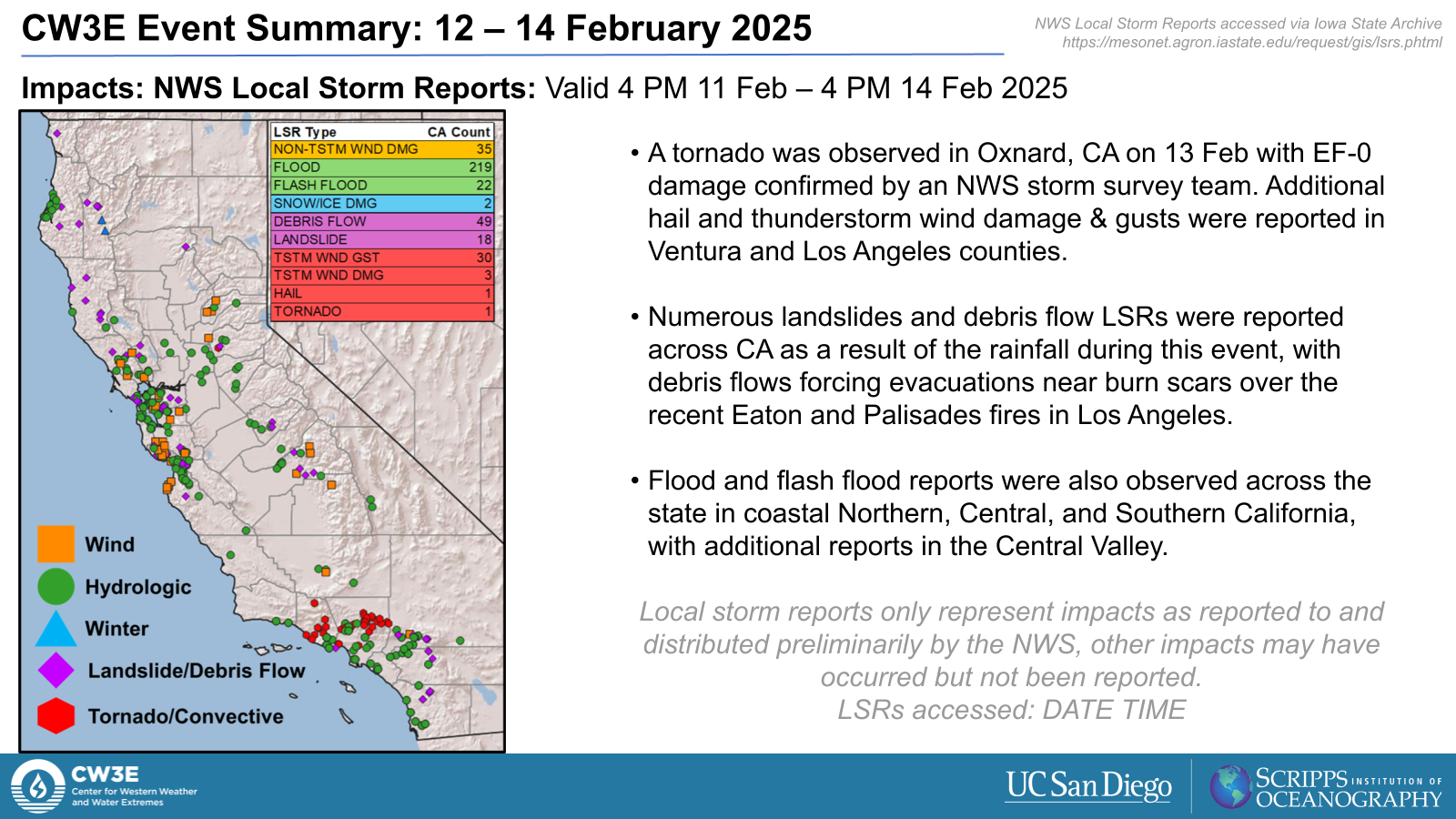
- Numerous landslides and debris flows were reported across CA as a result of the rainfall during this event, with debris flows forcing evacuations near burn scars over the recent Eaton and Palisades fires in Los Angeles.
- Flood and flash flood reports were also observed across the state in coastal Northern, Central, and Southern California, with additional reports in the Central Valley.
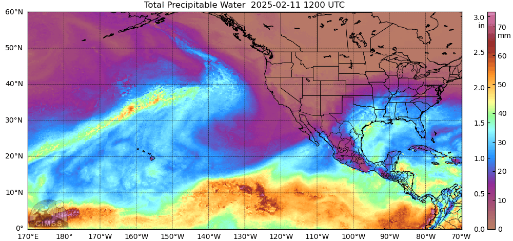
MIMIC-TPW2 Total Precipitable Water
Valid: 1500 UTC 11 February – 0000 UTC 15 February 2025
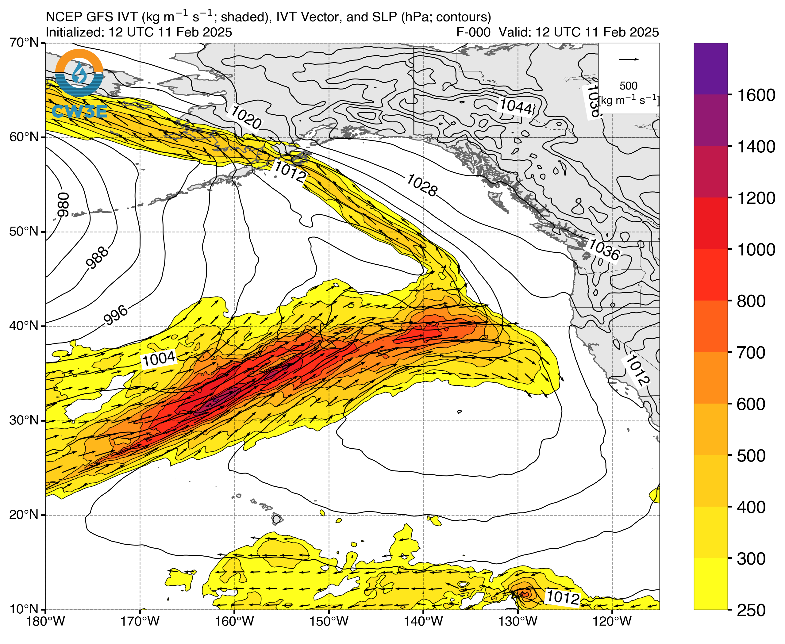
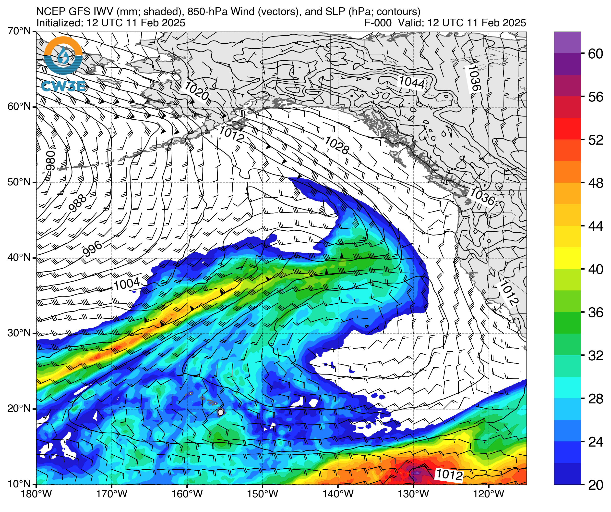
Click images to see loops of GFS IVT/IWV analyses Valid 1800 UTC 11 February – 1800 UTC 14 February 2025 |
|
 |
 |

Summary provided by M. Steen, C. Castellano, S. Bartlett, and S. Roj; 23 February 2025
To sign up for email alerts when CW3E post new AR updates click here.