
CW3E Event Summary: 19-26 October 2021
October 28, 2021
Click here for a pdf of this information.
Strong Atmospheric Rivers Bring Heavy Precipitation and Flooding in California
- Multiple atmospheric rivers (ARs) made landfall along and impacted the US West Coast between 19 Oct and 26 Oct
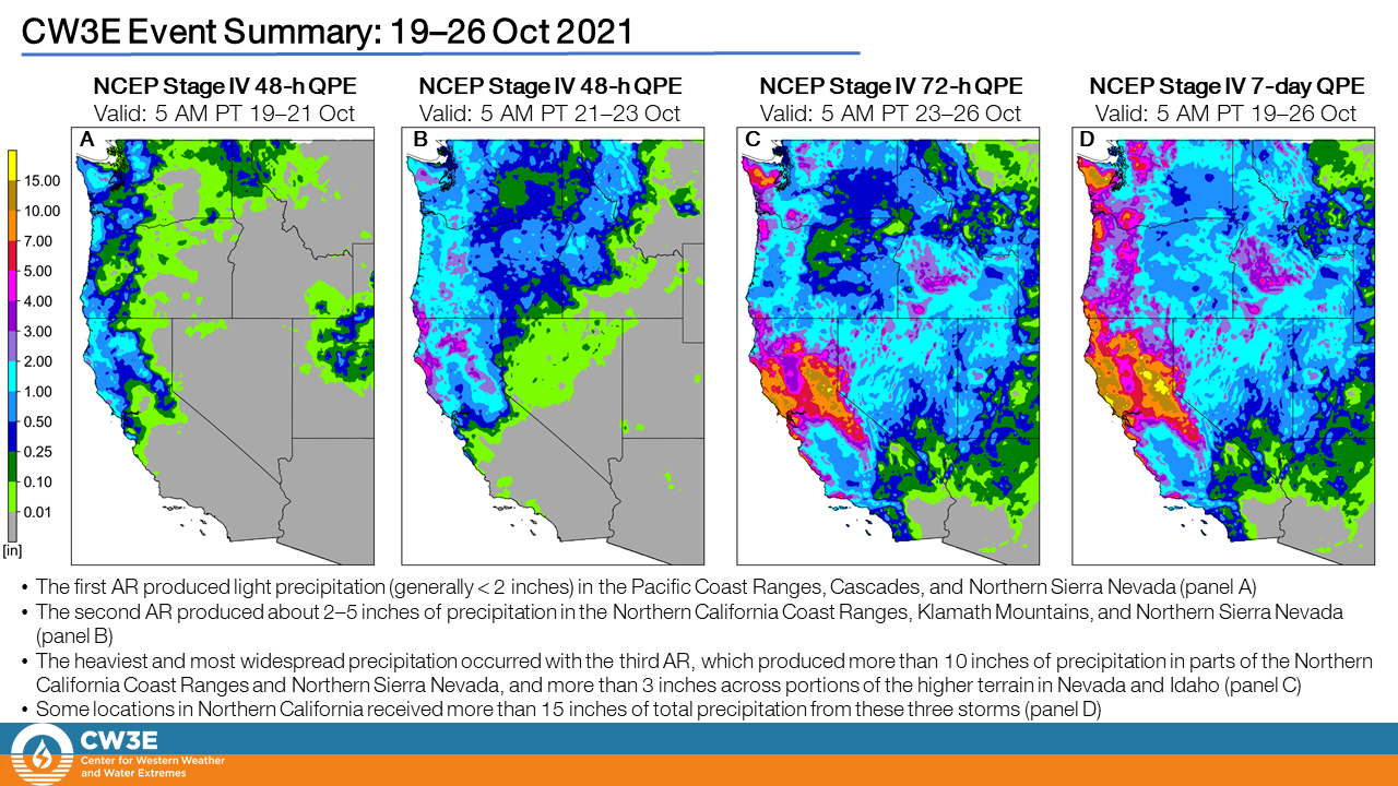
- The first two ARs produced AR 4 conditions in southwestern Oregon and AR 2/AR 3 conditions were observed elsewhere along the coast from the San Francisco Bay Area to the Olympic Peninsula.
- The third AR reached AR 5 conditions over California near Point Reyes due to the combination of maximum IVT values (> 1000 kg m−1 s−1) and AR duration (> 48 hours) (based on the Ralph et al. 2019 AR Scale).
- The third AR was the strongest October AR to make landfall in the Bay Area in the last 40 years.
- Portions of Northern California received more than 15 inches of total precipitation from the three storms.
- Intense rainfall on 24 Oct caused flooding in the Bay Area and triggered multiple slides in Northern California.
- The combination of heavy rain and high winds downed trees and caused power outages throughout the Bay Area.
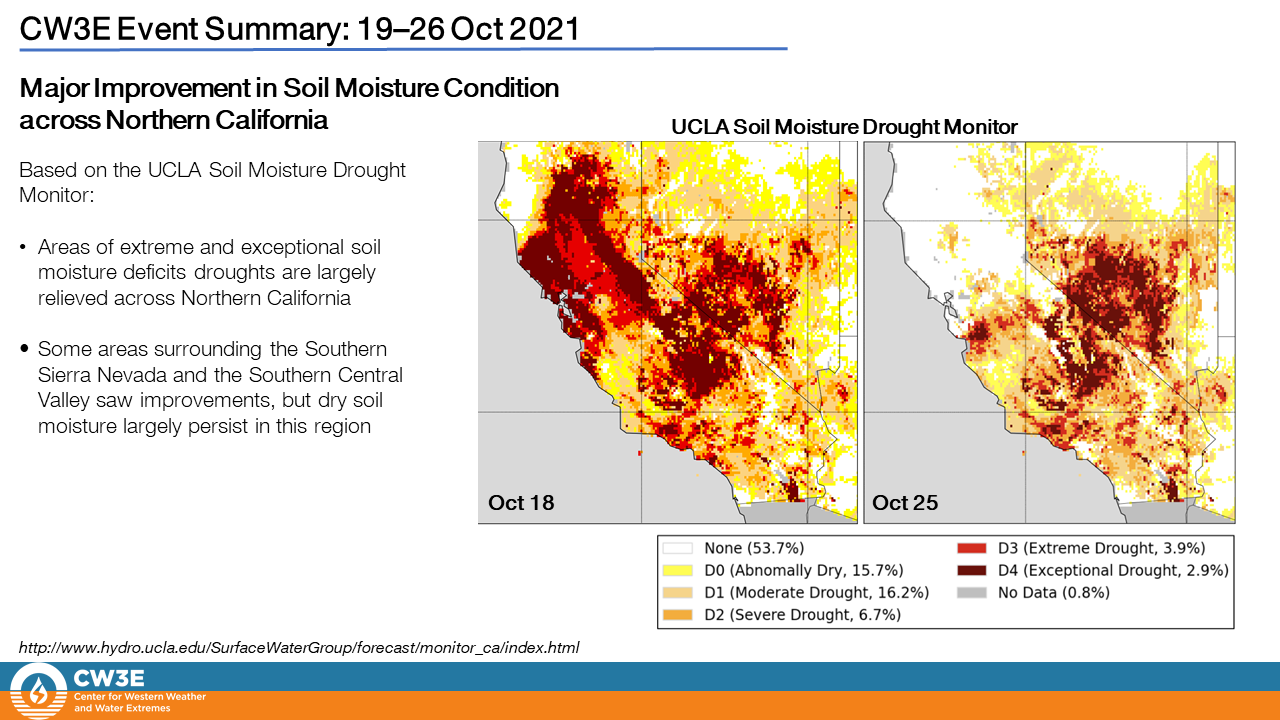
- Although there was heavy rain, reservoirs throughout the western Sierra Mountains and else where only saw small gains in storage.
- The third and strongest AR was well forecasted out to 3-days lead time, with the presence of the AR well forecasted out to 6 days.
- Subseasonal forecasts showed higher AR activity 3 weeks out.
Click images to see loops of GFS IVT/IWV analyses Valid 0000 UTC 17 October – 0000 UTC 26 October 2021 |
|
 |
 |
NOAA/NESDIS/STAR GOES-West GEOCOLOR
Valid 1200 UTC 23 October – 1200 UTC 26 October 2021


Summary provided by CW3E personnel; 28 October 2021
To sign up for email alerts when CW3E post new AR updates click here.
*Outlook products are considered experimental