CW3E Event Summary: 22 January 2024
31 January 2024
Click here for a pdf of this information.
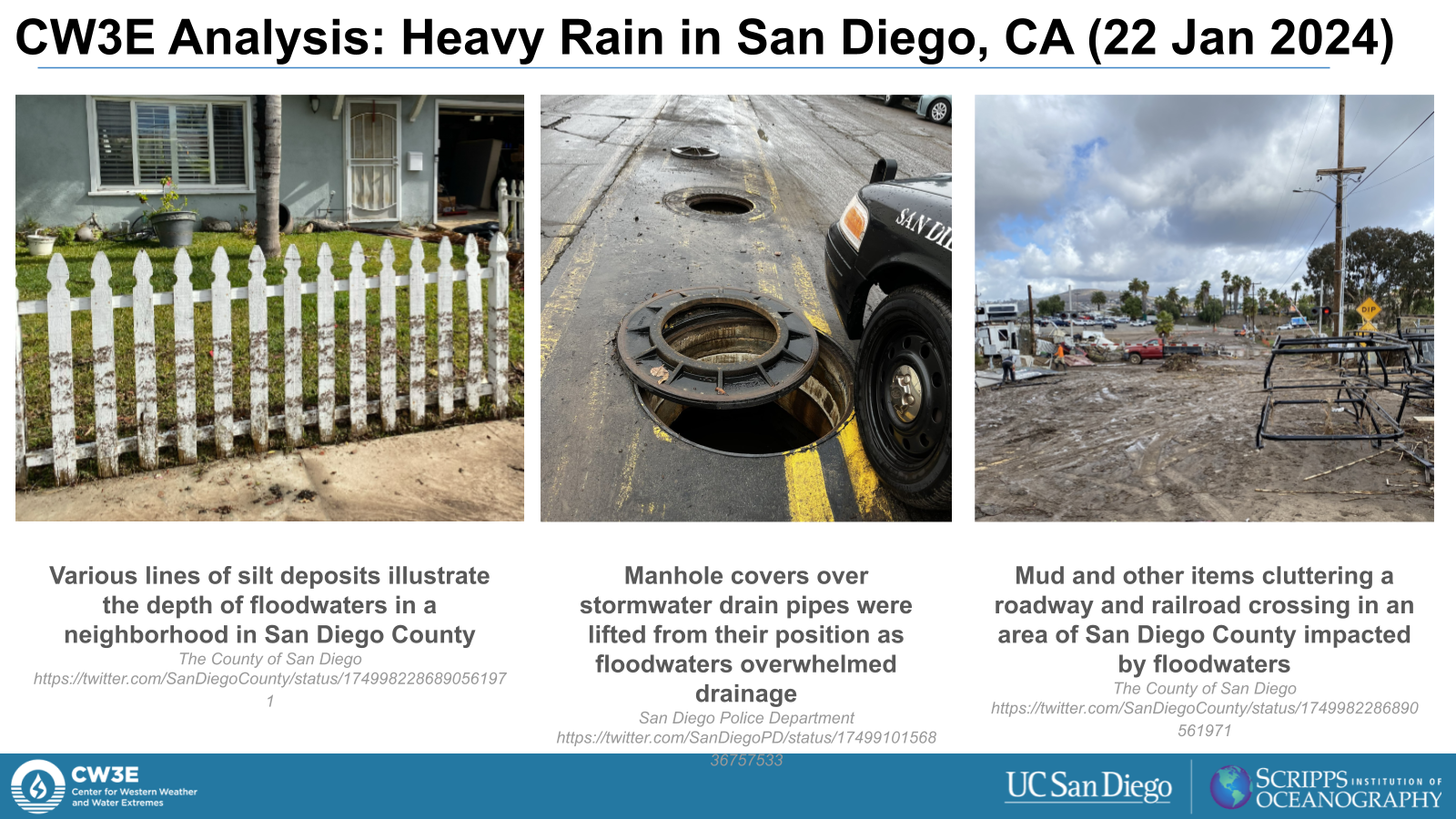
Weak Atmospheric River Brought Heavy Rain to Southern California and Southern Arizona
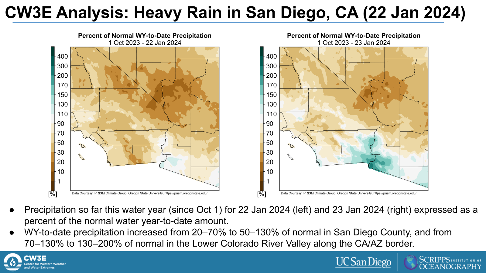
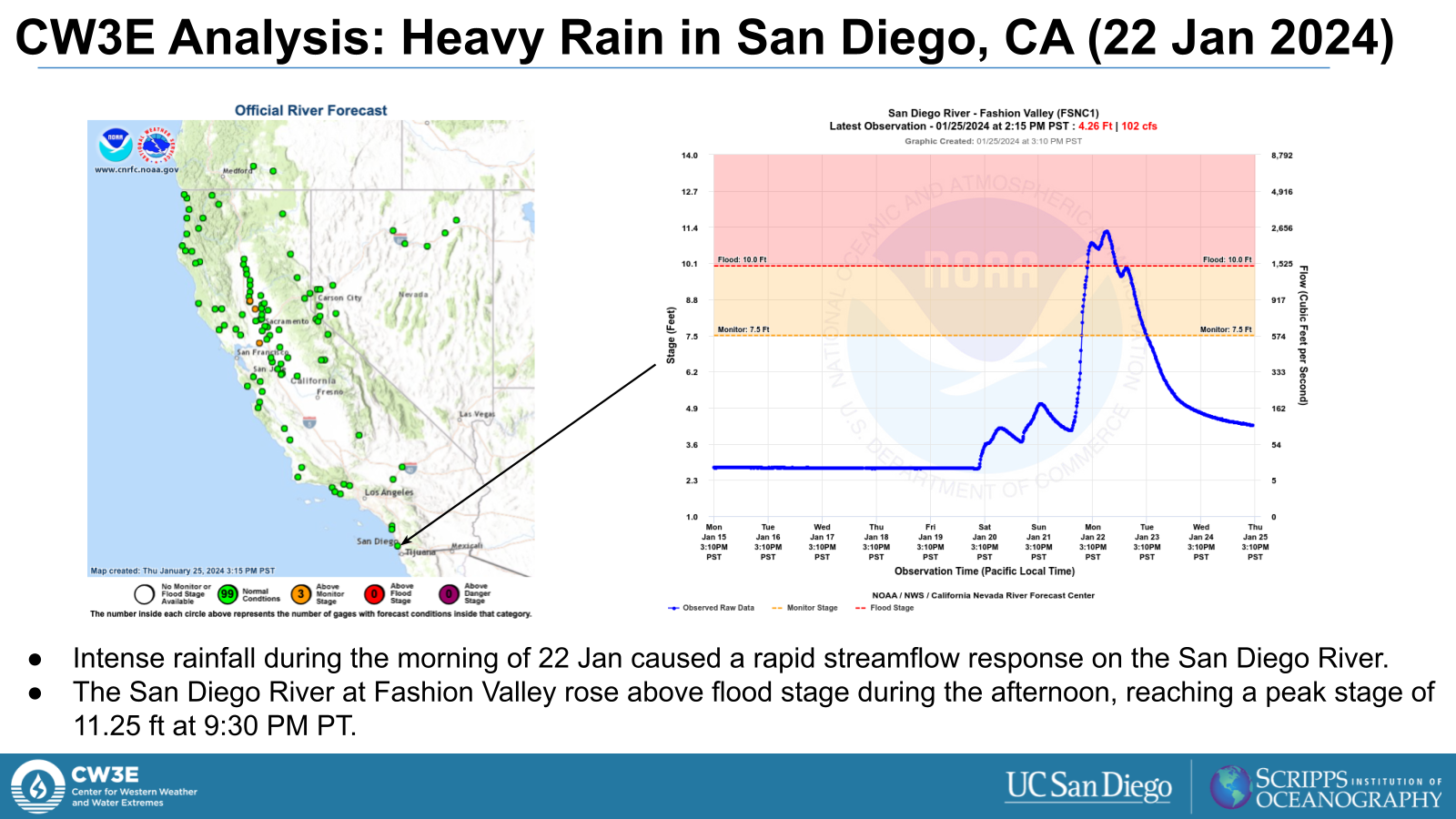
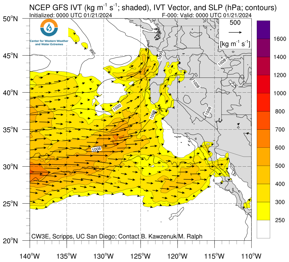
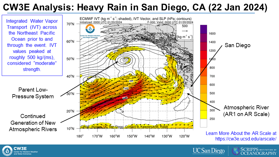
- On January 22, 2024, a weak (AR0 on the Ralph et al. 2019 scale) atmospheric river (AR) moved across southern California and into Arizona
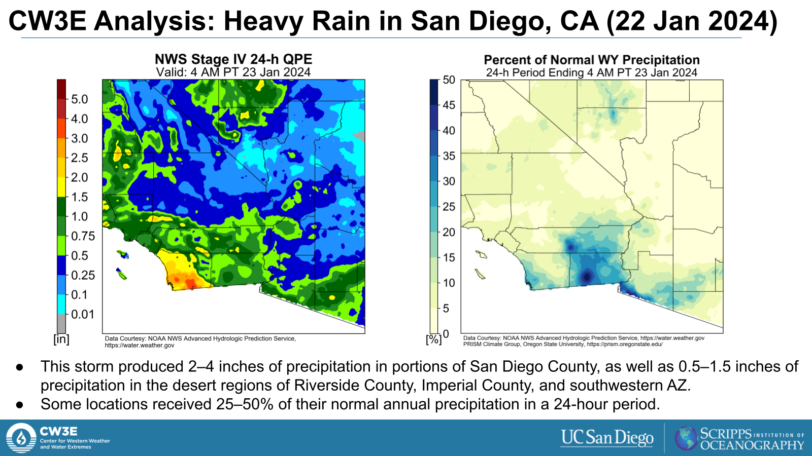
- Broad light to moderate rain accompanied the AR, bringing notable rainfall amounts to the Southwest
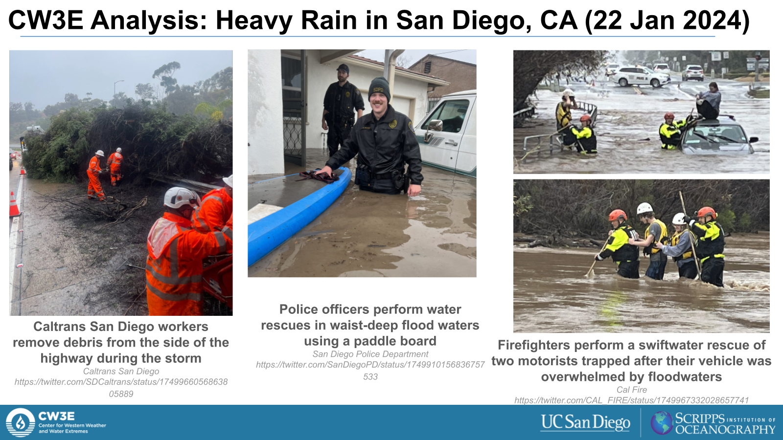
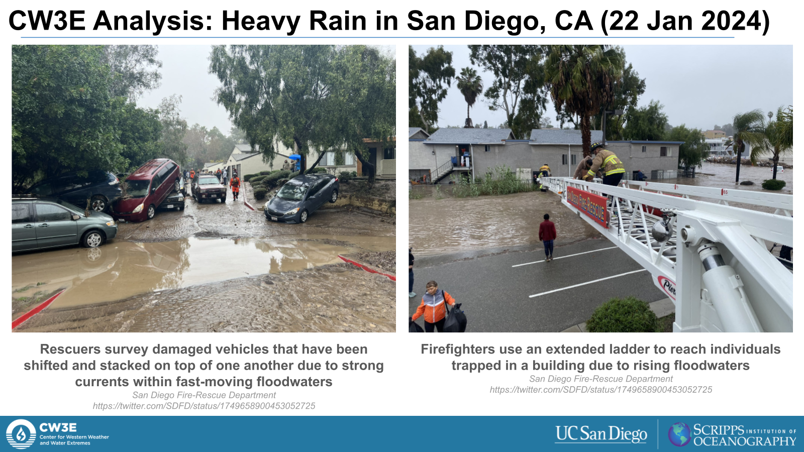
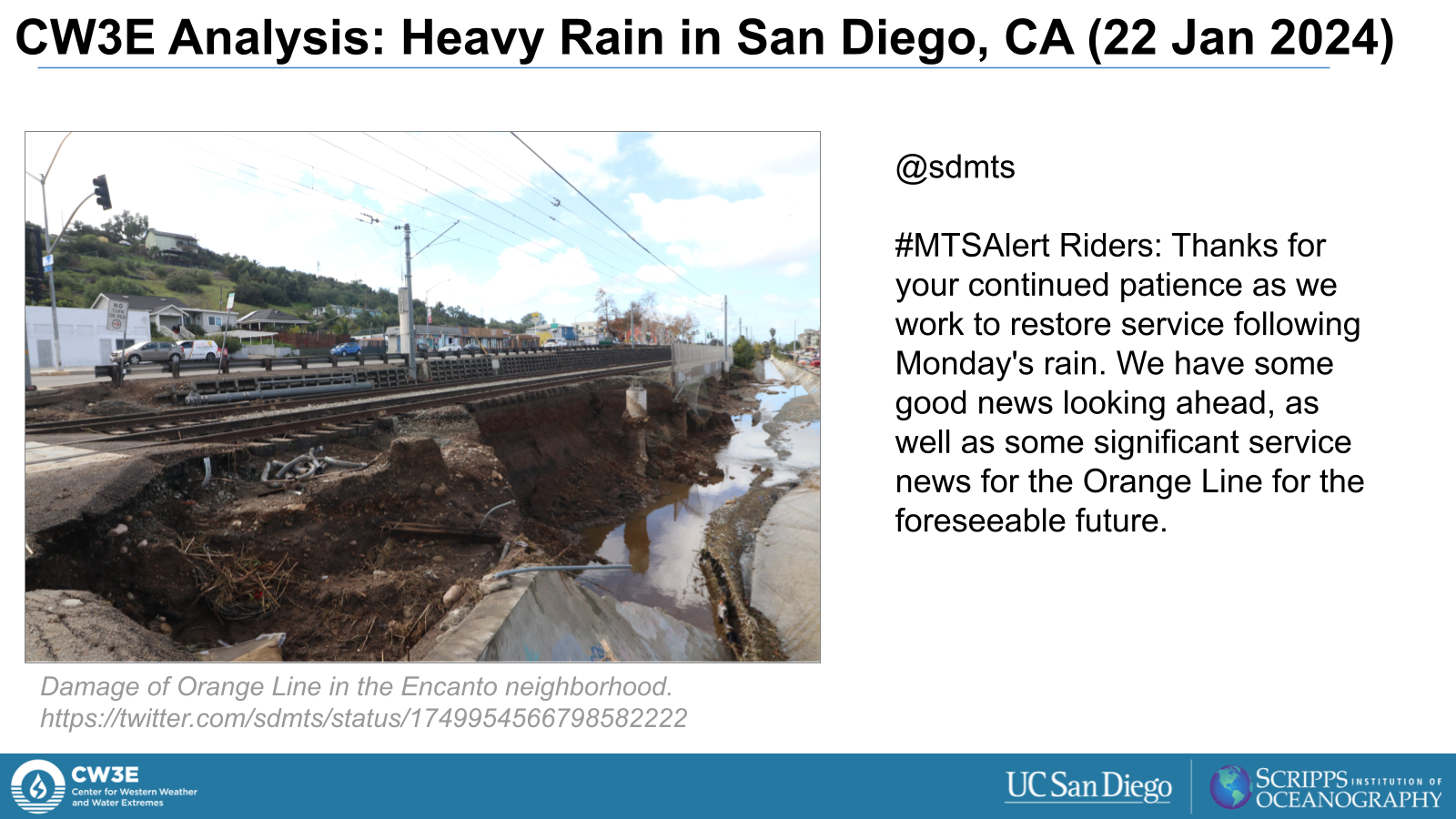
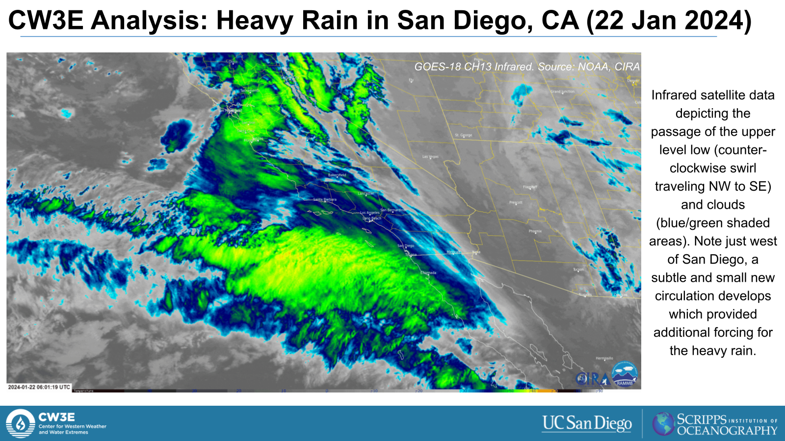
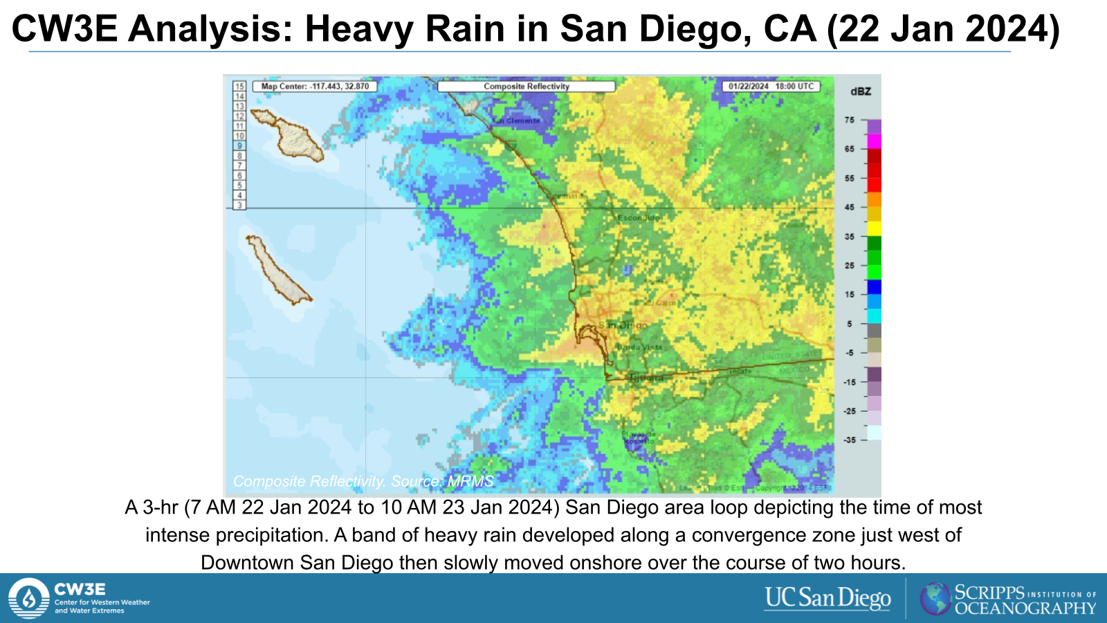
- An area of heavy rain developed offshore from San Diego and persisted for a few hours across the region
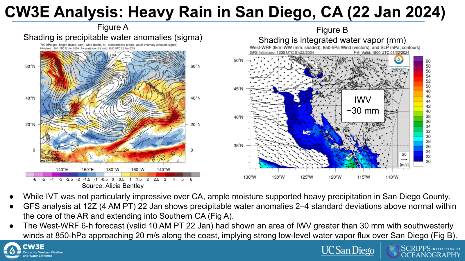
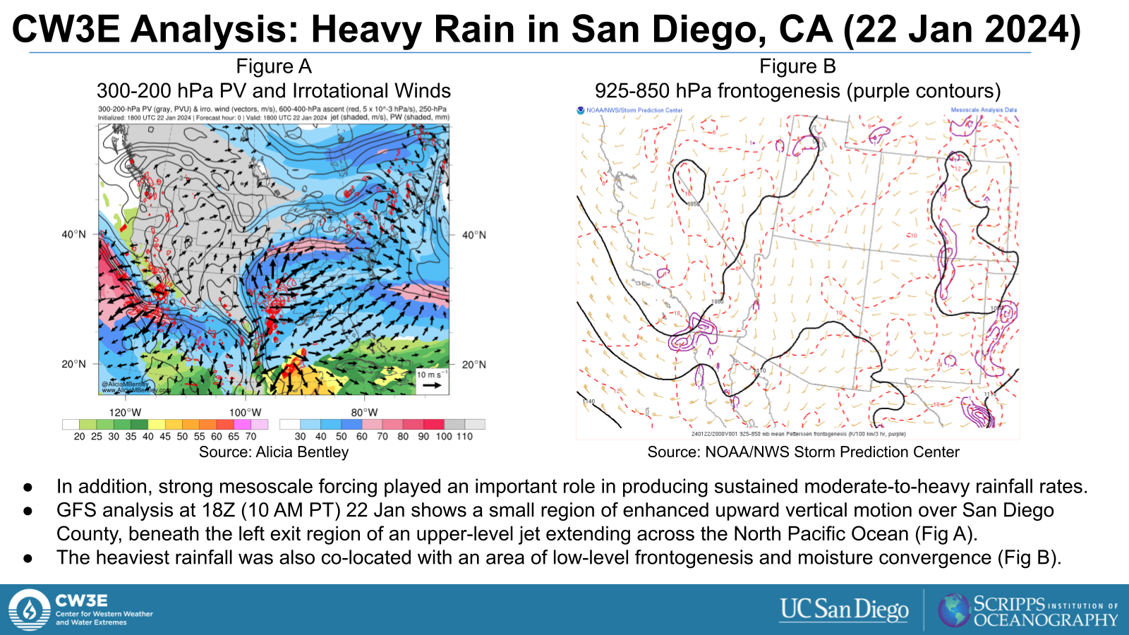
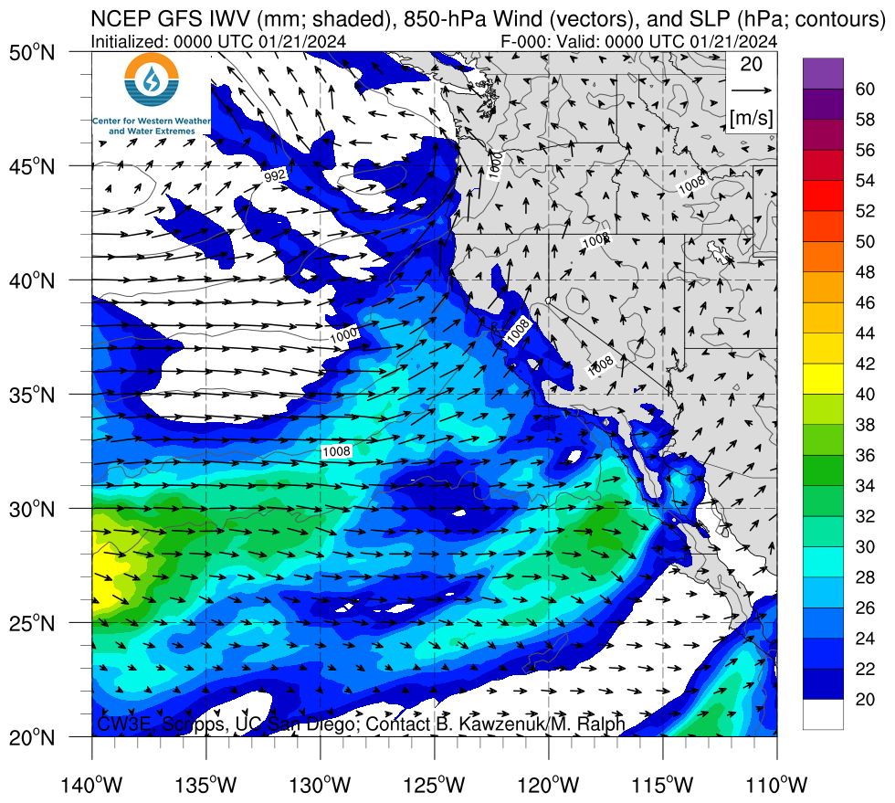
- While IVT was not particularly high, heavy rainfall was supported by strong low-level moisture flux and mesoscale forcing for ascent beneath the left exit region of an upper-level jet
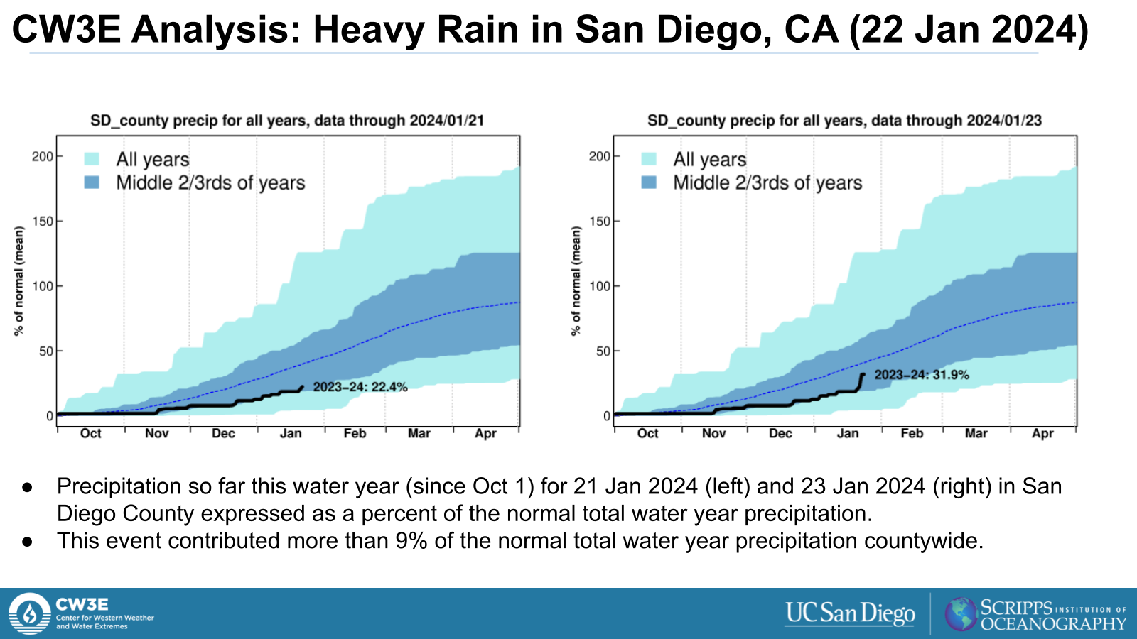
- San Diego/Lindbergh Field (KSAN) recorded 2.73” of rain, which set a new daily record (previous record was 1.57” in 1963
- This ranks as the 4th highest daily rainfall amount on record (since 1850)
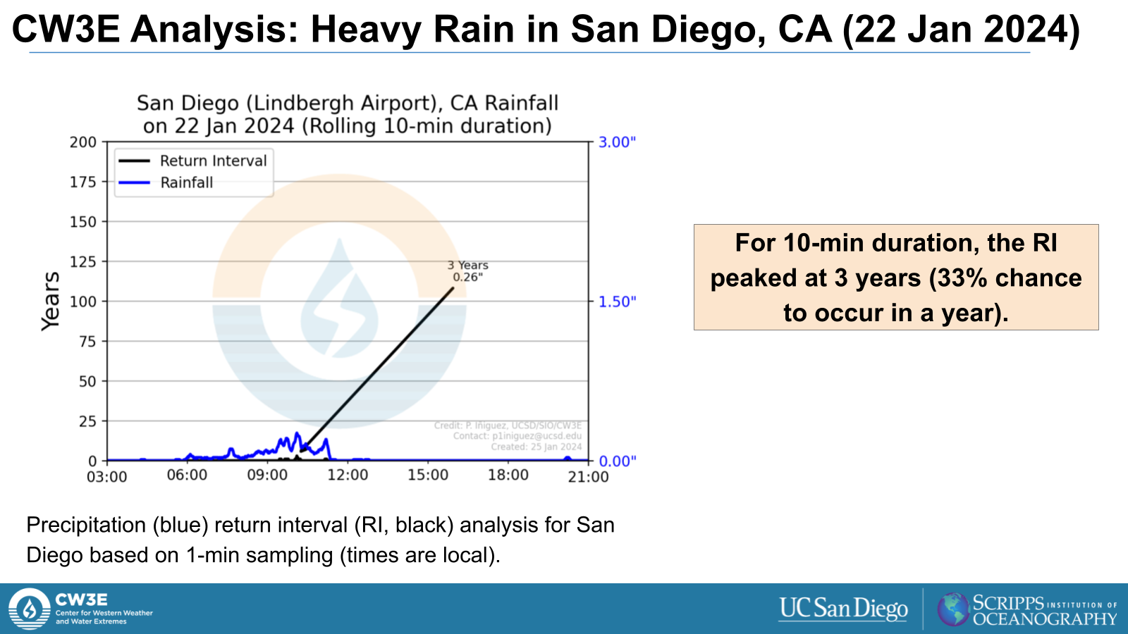
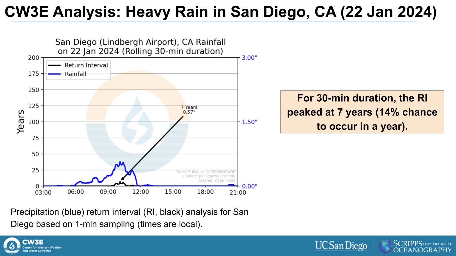
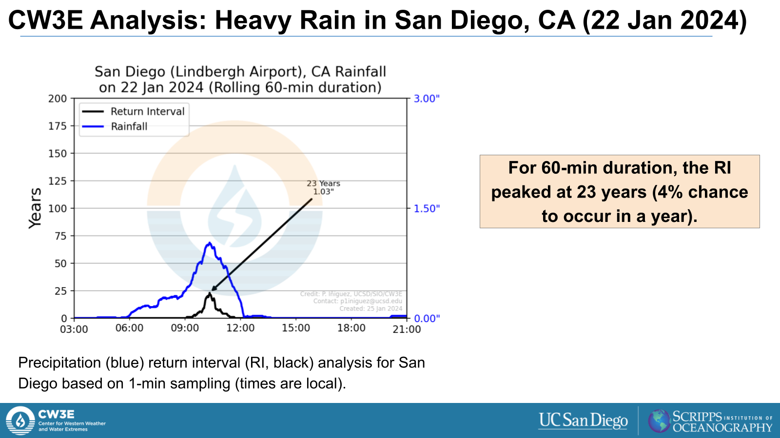
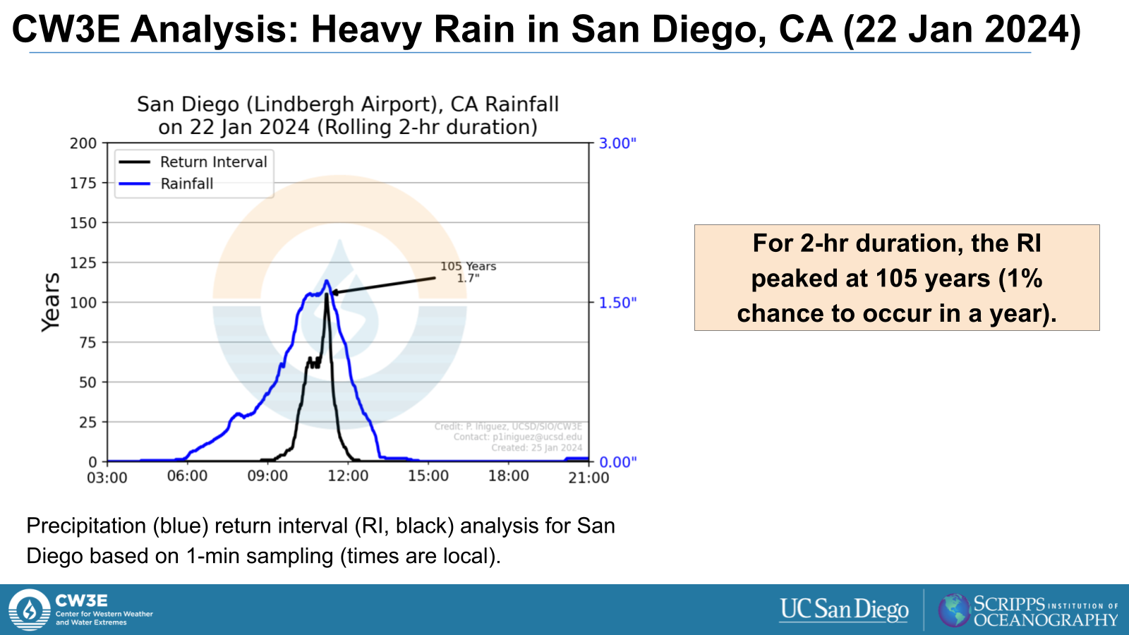
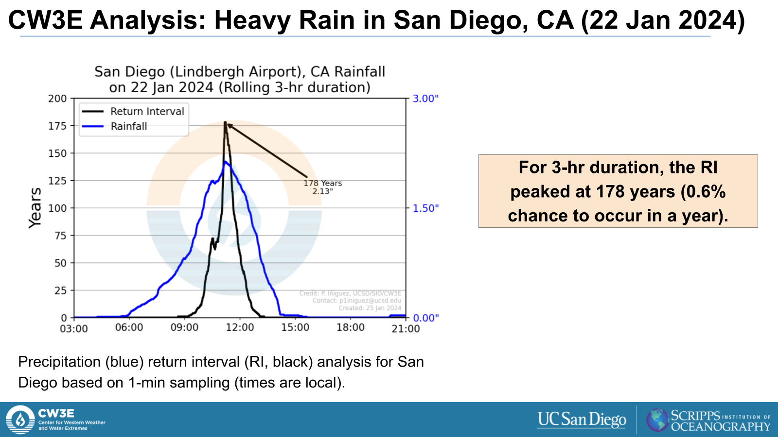
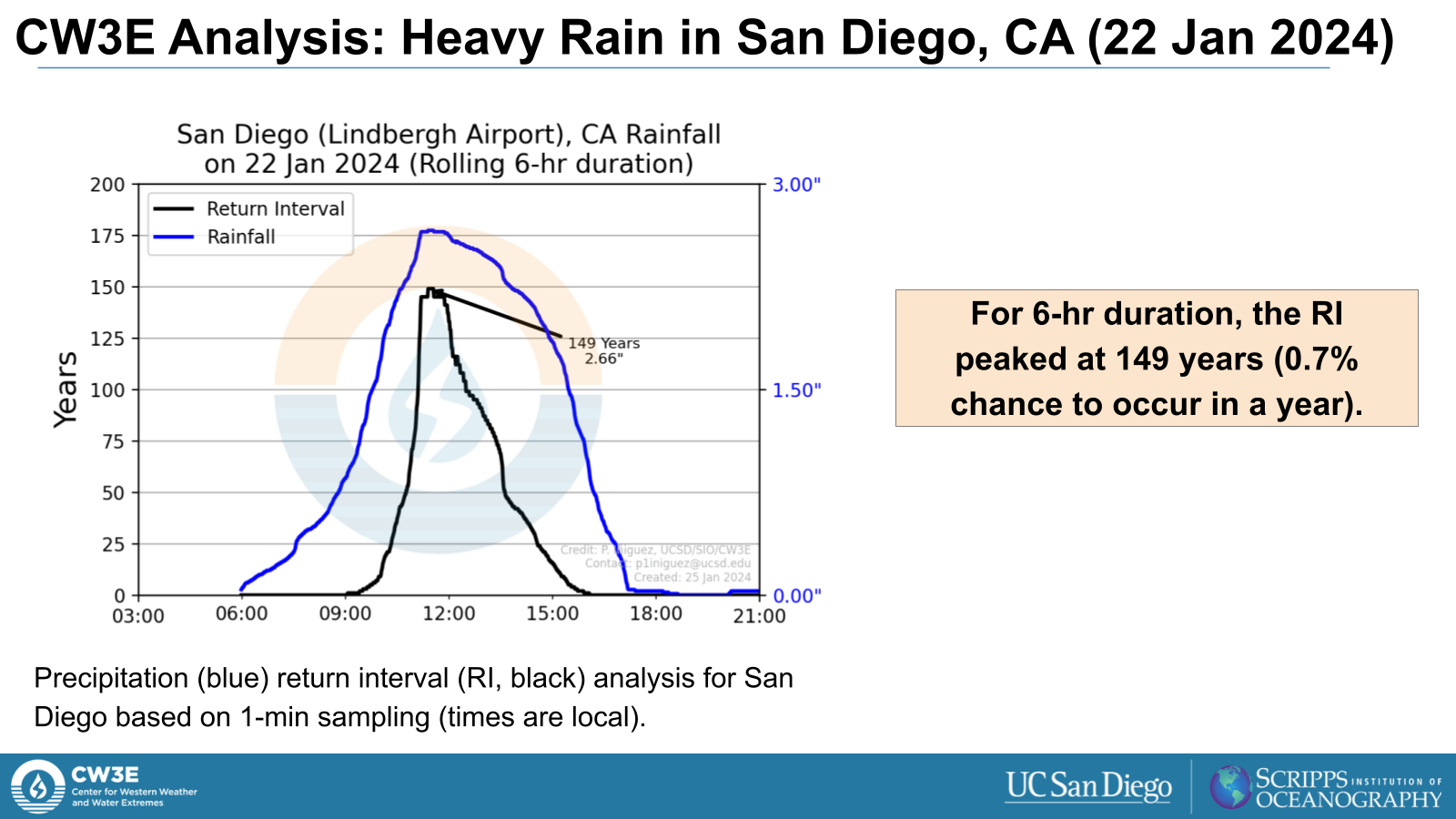
- The rolling 3-hr precipitation (computed from 1-min data) peaked at 2.13”. Based on NOAA Atlas 14 data, this represents a return interval of 178 years (0.6% chance of occurring in a year)
Click images to see loops of GFS IVT/IWV analyses Valid: 0000 UTC 21 January – 1800 UTC 23 January 2024 |
|
 |
 |
Click image below to see loop of infrared satellite imagery Note: Full animation may take a moment to load |
 |
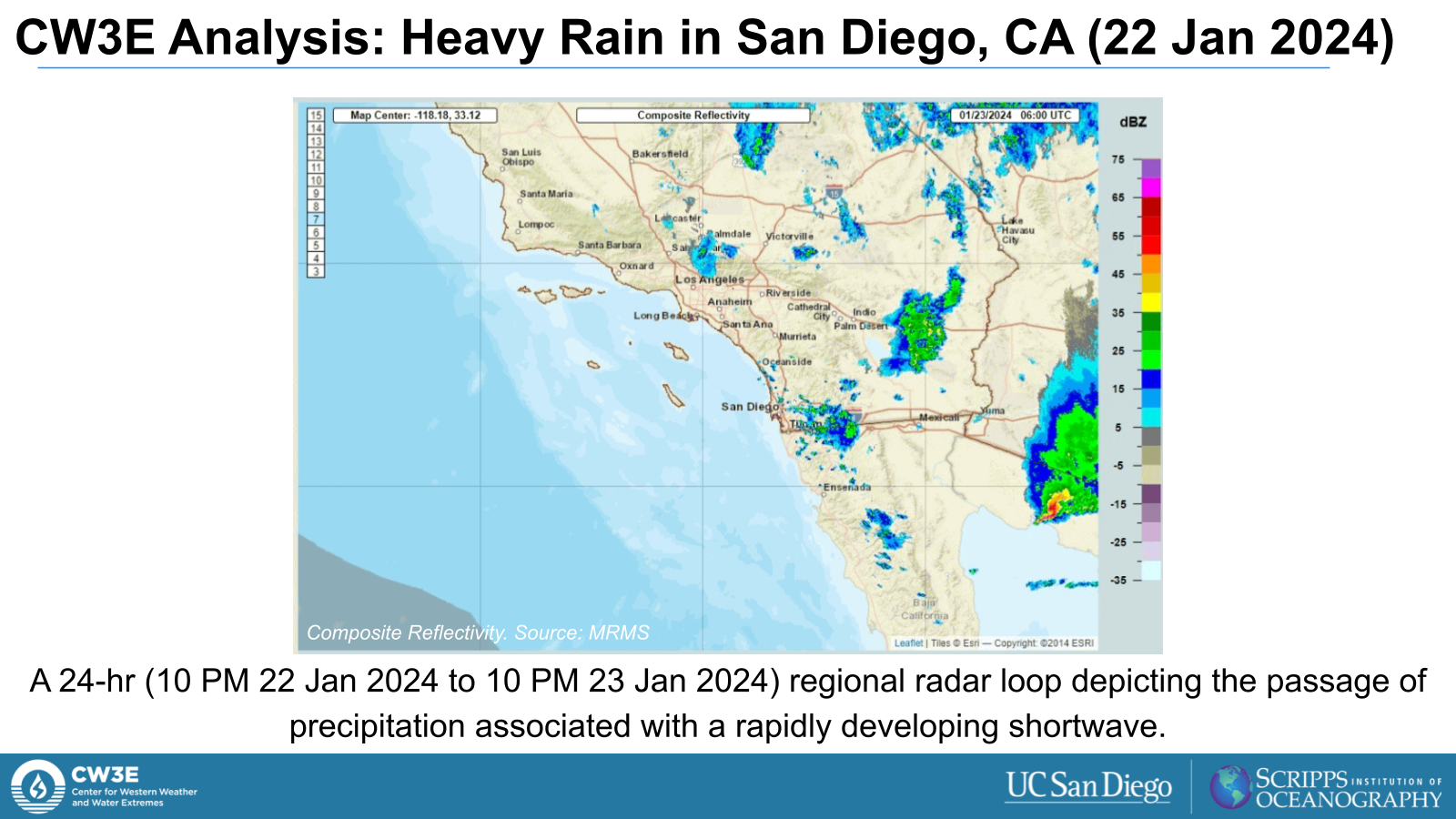
Click image below to see the regional Southern California radar loop Note: Full animation may take a moment to load |
 |
Click image below to see the San Diego radar loop Note: Full animation may take a moment to load |
 |
Click image below to see the Integrated Water Vapor Transport loop Note: Full animation may take a moment to load |
 |
Summary provided by P. Iniguez, M. Steen, S. Bartlett, S. Roj, and J. Kalansky; 31 Jan 2024
To sign up for email alerts when CW3E post new AR updates click here.

