CW3E Event Summary: 29 November – 5 December 2022
December 6, 2022
Click here for a pdf of this information.
Active Weather Pattern Brings Heavy Rain and Snow to Western US
- A low-pressure system associated with an upper-level shortwave trough and a weak atmospheric river (AR) impacted the western US during 30 Nov – 2 Dec
- A second low-pressure system and shortwave trough/cutoff low primarily impacted California on 2–5 Dec
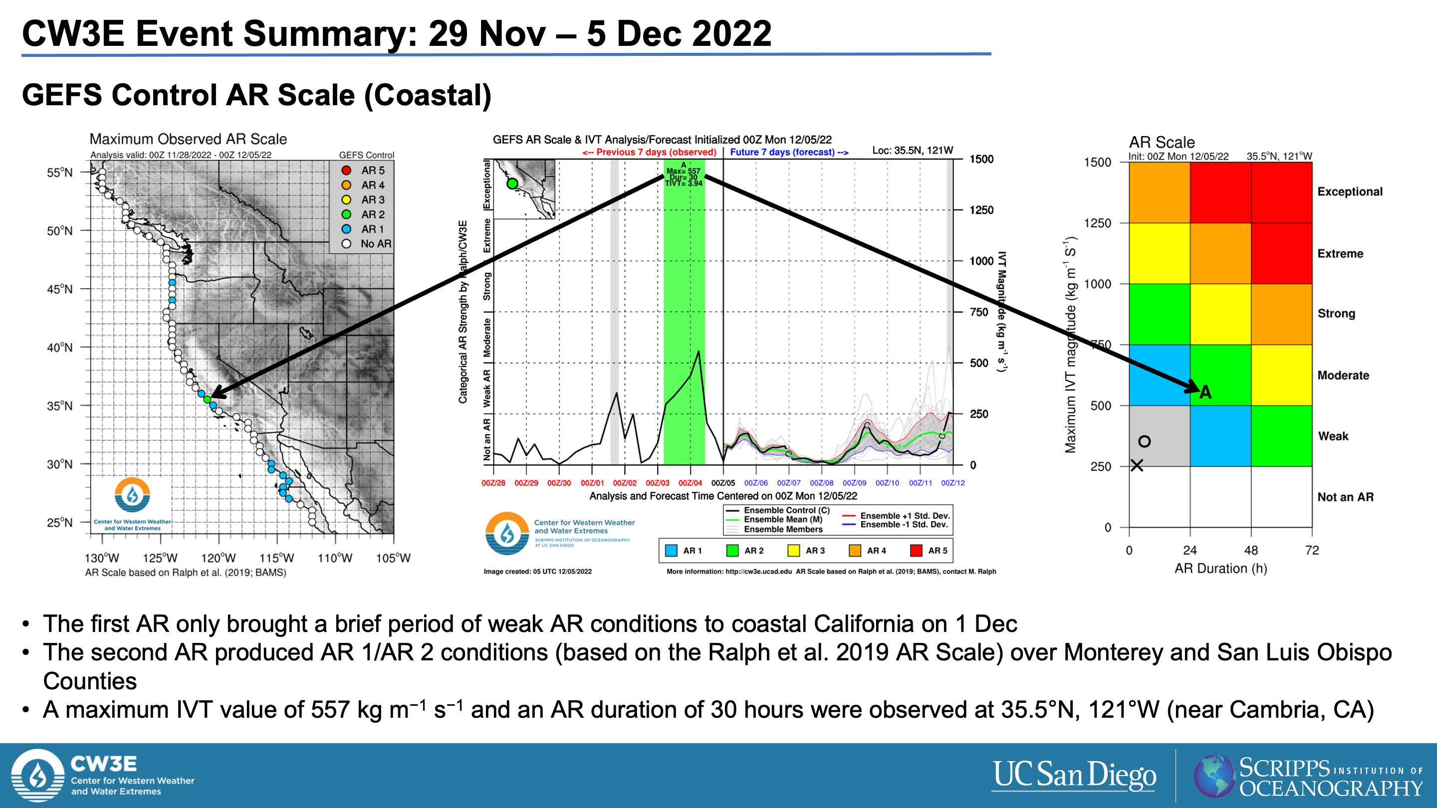
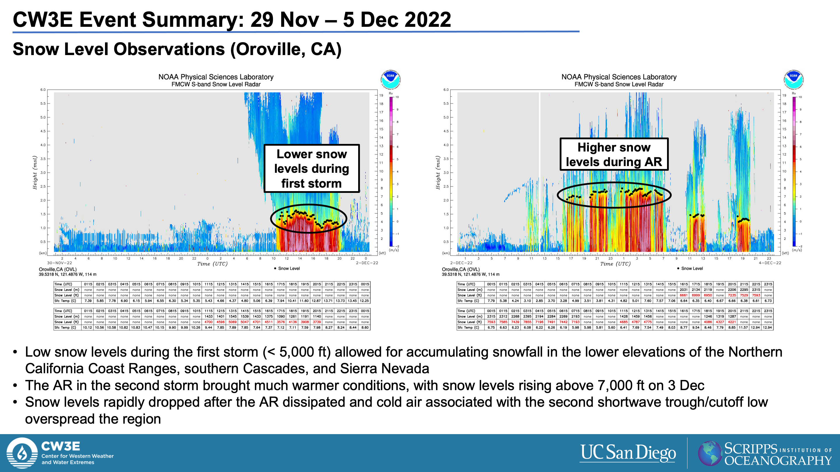
- A moderate-strength atmospheric river (AR) developed over California on 3 Dec as the second shortwave trough became cut off from the main midlatitude flow and interacted with a region of subtropical moisture
- AR 2 conditions (based on the Ralph et al. 2019 AR Scale) were observed over the Central California coast
- A separate AR associated with a tropical moisture export (TME) brought AR 2 conditions to southern Arizona on 3–4 Dec
- The first storm produced 2–4 feet of snow in the Washington Cascades and Rocky Mountains in Idaho, Montana, and Wyoming, as well as 1–2 feet of snow in the Sierra Nevada
- The second storm and AR produced more than 5 inches of rain over the Big Sur coast and 1–3 feet of snow in the higher terrain of the Sierra Nevada
- Heavy rain on 3 Dec caused a rockslide on Highway 1 south of Big Sur, CA
- The third AR produced 2–4 inches of rain across portions of Arizona, resulting in flooding in Pinal County
Summary provided by C. Castellano, S. Bartlett, C. Hecht, J. Kalansky, S. Roj, and F.M. Ralph; 6 December 2022
To sign up for email alerts when CW3E post new AR updates click here.
*Summary products are considered experimental


