CW3E Event Summary: 9-15 March 2023
20 March 2023
Click here for a pdf of this information.
Atmospheric Rivers Produce Heavy Precipitation and Flooding in California
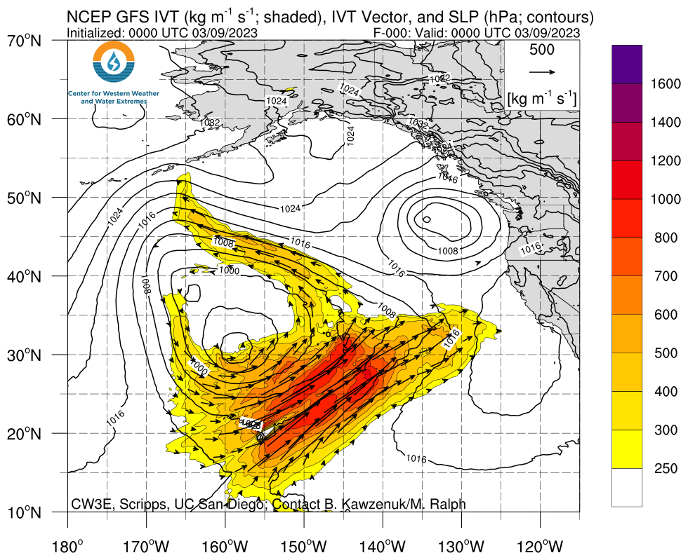
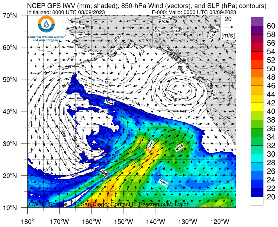
- Two atmospheric rivers (ARs) made landfall over California during 9–15 Mar
- These ARs were characterized by the transport of very warm, moist air from the tropical North Pacific into the midlatitudes
- The first AR brought AR3 conditions (based on the Ralph et al. 2019 AR Scale) and IVT magnitudes > 750 kg m-1 s-1 to Monterey and Santa Cruz Counties
- The second AR brought AR2 conditions and IVT magnitudes > 500 kg m-1 s-1 to Central and Southern California
- The heaviest precipitation fell during the first AR in the Central and Southern Sierra Nevada, with some locations recording > 12 inches in a 3-day period and sustained precipitation rates > 0.5 inches/hour
- High freezing levels limited snowfall accumulations below 7,000 feet in both storms
- Snow survey stations located above 7,000 feet recorded 7-day SWE increases > 12 inches
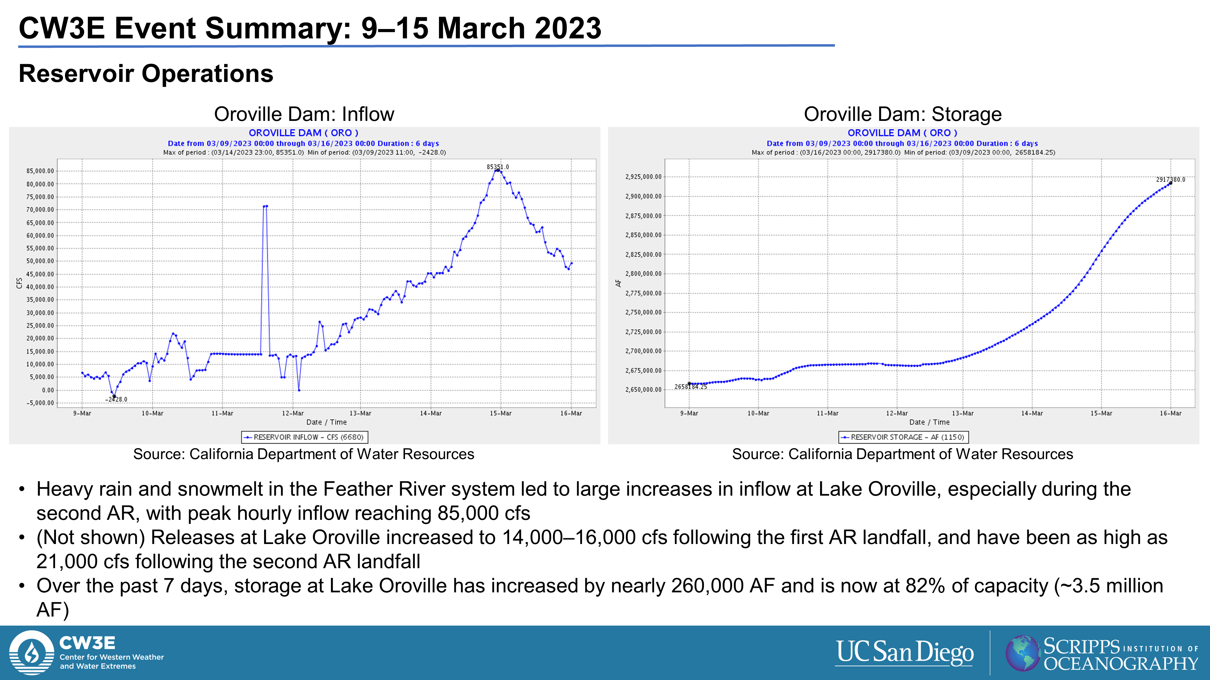
- High reservoir inflows prompted dam operators to open the main spillway and increase releases to > 15,000 cfs at Oroville Dam after the first AR
- The combination of heavy rainfall and melting snowpack led to widespread riverine flooding across Northern and Central California
- The most destructive flooding occurred along the Pajaro River in the community of Pajaro, CA, and along the Kern River in Kernville, CA
- An EF-1 tornado caused structural damage to mobile homes and farms in Tuolumne County
Click images to see loops of GFS IVT/IWV analyses Valid 0000 UTC 9 March – 0000 UTC 16 March 2023 |
|
 |
 |
Summary provided by C. Castellano, S. Bartlett, S. Roj, and J. Kalansky; 20 Mar 2023
To sign up for email alerts when CW3E post new AR updates click here.
*Outlook products are


