CW3E AR Update: 31 October 2022 Outlook
October 31, 2022
Click here for a pdf of this information.
Strong Atmospheric River Forecast to Impact Pacific Northwest Later this Week
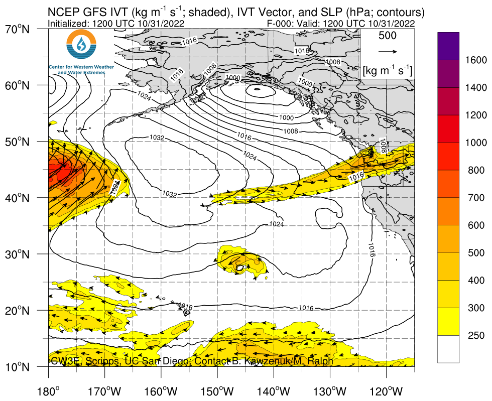
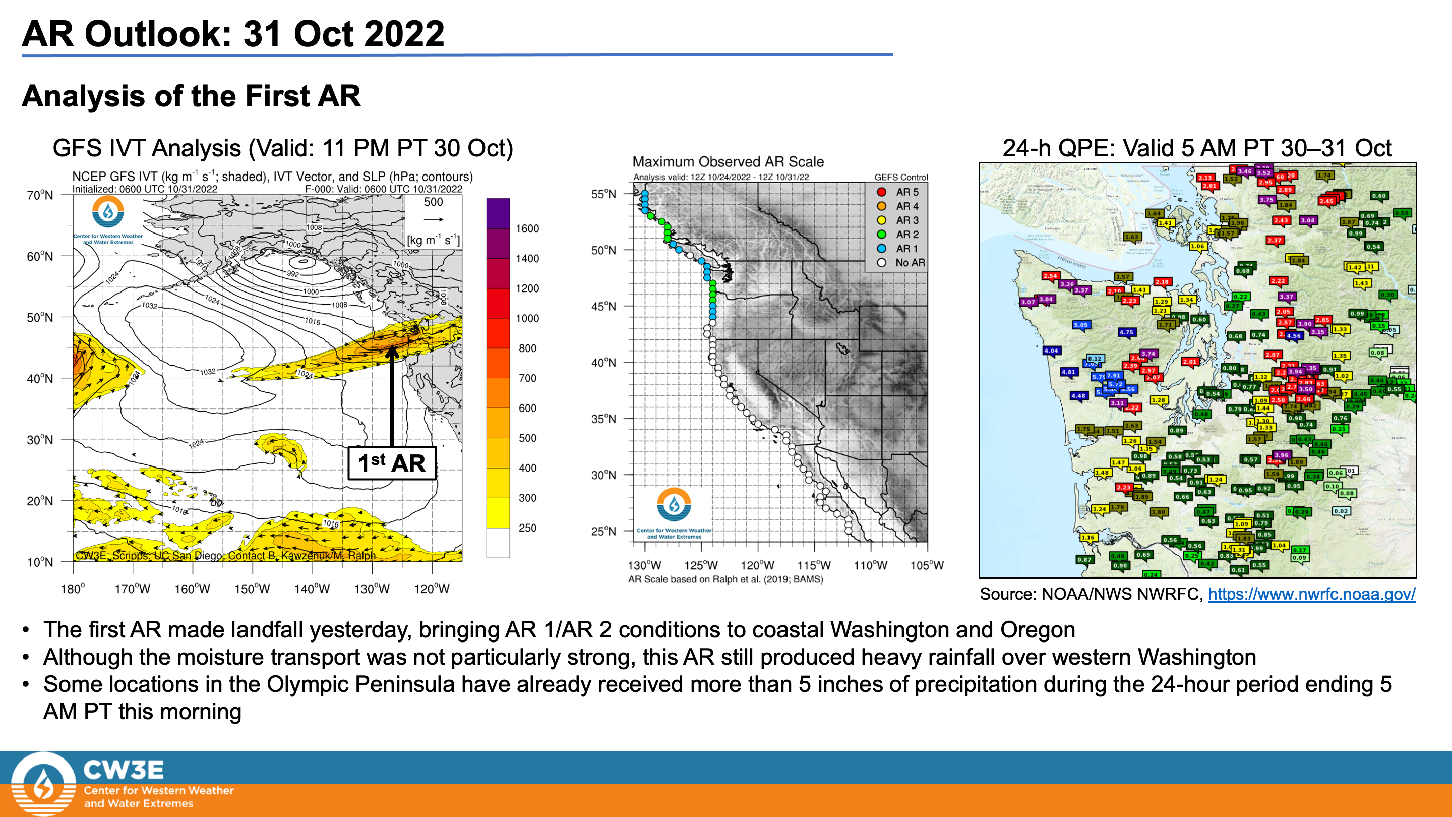
- An atmospheric river (AR) made landfall yesterday, bringing AR 1/AR 2 conditions (based on the Ralph et al. 2019 AR Scale) to coastal Washington and Oregon
- This AR produced heavy rainfall in western Washington, with portions of the Olympic Peninsula receiving more than 5 inches of precipitation since Sunday morning
- An upper-level shortwave trough will interact with the remnants of the first AR, bringing the first significant snowfall of the season to the Sierra Nevada
- A stronger AR is forecast to make landfall over Washington on Thursday and gradually move southward into Oregon and California
- AR 3/AR 4 conditions are currently forecast across much of coastal Washington and Oregon, with AR 1/AR 2 conditions forecast in Northern California
- AR 2/AR 3 conditions are also possible in interior Washington and Oregon due to significant inland penetration of the second AR
- The NWS Weather Prediction Center is forecasting more than 5 inches of total precipitation over portions of western Washington and Oregon during the next 7 days
- Additional heavy rainfall in areas that received heavy precipitation from the first AR could lead to riverine flooding in western Washington
- Significant snowfall is possible in the higher terrain of the North Cascades during the second AR
Click images to see loops of GFS IVT & IWV forecasts Valid 1200 UTC 31 October – 1200 UTC 7 November 2022 |
|
 |
 |
Summary provided by C. Castellano, C. Hecht, S. Bartlett, S. Roj, and F. M. Ralph; 31 October 2022
To sign up for email alerts when CW3E post new AR updates click here.
*Outlook products are considered experimental


