CW3E Welcomes Paul Iñiguez

CW3E Welcomes Paul Iñiguez

August 2, 2023

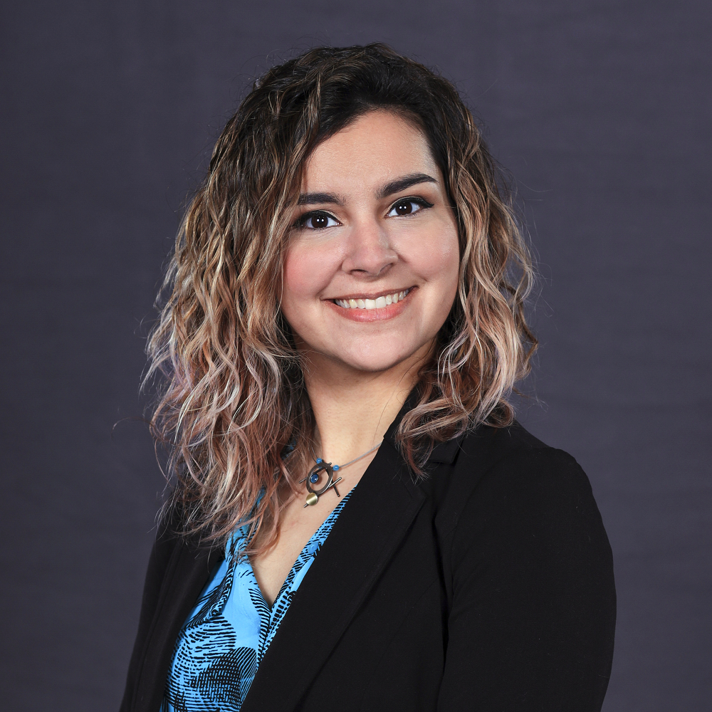
Paul Iñiguez joined CW3E as a Forecast Verification Analyst on August 1, 2023. Paul brings a wealth of operational forecasting experience to the center, gained through over 20 years with the NOAA National Weather Service (NWS). Paul is a native Minnesotan and earned his BS in Meteorology from St. Cloud State University. The early years of his NWS career took Paul to Weather Forecast Offices (WFOs) in Little Rock, AR and Phoenix, AZ, where he also earned an MA in Geography from Arizona State University (thesis: urban/anthropogenic effects on precipitation patterns across the Phoenix metropolitan area). Paul joined WFO Hanford, CA as the Science & Operations Officer (SOO) in 2012, which provided him with extensive experience with California’s unique climates (including the extreme drought of the early/mid 2010s). While there he managed the office’s science integration and training programs and led the operational forecast unit. In 2015, Paul returned to WFO Phoenix as the SOO, also leading that office’s science integration and training programs and being deeply involved in the day-to-day forecast operations. This included extreme precipitation events both from intense short duration rainfall from monsoonal thunderstorms and occasional deep, energetic winter storms with atmospheric rivers. Paul also spearheaded the office’s extensive extreme heat program and was an integral member of the team behind the development of the NWS HeatRisk prototype. Now at CW3E, Paul looks forward to leveraging his years of forecasting, coding, and leadership experience to contribute to the center’s forecast and verification efforts.

CW3E Publication Notice: Highlighting two new publications on the development of a regional coupled ocean–atmosphere model

CW3E Publication Notice

Highlighting two new publications on the development of a regional coupled ocean–atmosphere model

August 2, 2023

Two new papers on the development of the regional coupled ocean–atmosphere model were published in Geoscientific Model Development. This research contributes to CW3E’s 2019–2024 Strategic Plan to improve weather, hydrology, and coupled modeling capabilities that can be applied to the western United States. In our previous work, we have demonstrated that using coupled ocean–atmosphere model can improve the forecast of atmospheric rivers (ARs) associated with strong sea surface temperature changes. The new implements of the coupled model can allow us to investigate the sub-seasonal to seasonal predictability of ARs and study the physics of the ocean, wave, and sea-ice under AR conditions. Early research indicates ocean-atmosphere coupling can improve extended range (7-14 days) forecasts of atmospheric rivers. The work from the papers describes the new methods for coupling dynamics that can be applied to ARs to test how they might further improve AR forecasts.

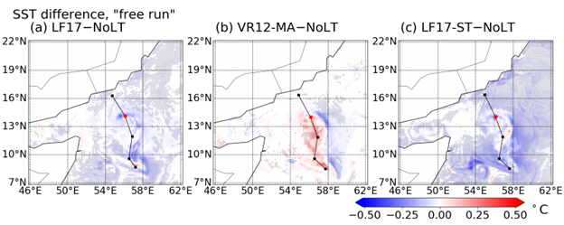
The two new papers describe the implementations of waves and sea ice modules in the coupled model SKRIPS (Scripps–KAUST Regional Integrated Prediction System). The first paper, entitled “Waves in SKRIPS: WAVEWATCH III coupling implementation and a case study of Tropical Cyclone Mekunu”, by Rui Sun (SIO), Alison Cobb (SIO), Ana B Villas Bôas (Colorado School of Mines), Sabique Langodan (KAUST), Aneesh C. Subramanian (CU Boulder), Matthew R. Mazloff (SIO), Bruce D. Cornuelle (SIO), Arthur J. Miller (SIO), Raju Pathak (KAUST), Ibrahim Hoteit (KAUST). In this work, the wave model WAVEWATCH III model into the regional coupled model SKRIPS with flexibility options, meaning the coupled system can run with or without the wave component. The implementations also include the effect of Stokes drift, Langmuir turbulence, sea surface roughness, and wave-induced momentum fluxes. The skill of the newly implemented model is tested using a series of coupled and uncoupled simulations of tropical cyclone Mekunu, which occurred in the Arabian Sea in May 2018, using a series of 20-ensemble member experiments. Although the characteristics of the tropical cyclone are not significantly different due to the effect of surface waves when using different parameterizations, the coupled models better capture the minimum pressure and maximum wind speed. Moreover, in the region of the cold wake, the coupled model successfully captures the effect due to Langmuir turbulence that cools down the sea surface temperature by about 0.5 degrees and deepens the mixed layer by about 20 meters.

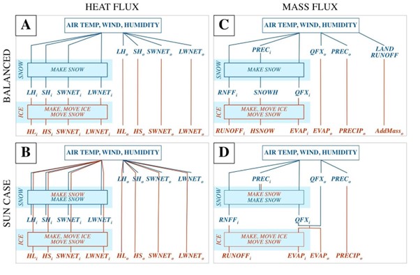
The second paper entitled “Conservation of heat and mass in P-SKRIPS version 1: the coupled atmosphere–ice–ocean model of the Ross Sea” by Alena Malyarenko (Victoria University of Wellington; NIWA), Alexandra Gossart (Victoria University of Wellington), Rui Sun (SIO), Mario Krapp (GNS Science). This paper addresses the conservation of heat and mass fluxes between coupled models when sea-ice exists, which is often overlooked due to computational difficulties. At the regional scale, the non-conservation of water and energy can lead to model drift over multi-year model simulations. A new version of the SKRIPS coupled model setup for the Ross Sea region is proposed (P-SKRIPS, version 1, a). The development includes full conservation of heat and mass fluxes transferred between the climate (PWRF) and sea ice–ocean (MITgcm) models. We examine open water, sea ice cover, and ice sheet interfaces. We show evidence of the flux conservation in the results of a 1-month-long summer and 1-month-long winter test experiment. P-SKRIPS v.1 shows the implications of conserving heat flux over the Terra Nova Bay and Ross Sea polynyas in August 2016, eliminating the mismatch between total flux calculation in PWRF and MITgcm up to 922 W /m-2.

Figure 1: The schematic description of the SKRIPS regional coupled ocean–atmosphere model. The yellow block is the ESMF/NUOPC coupler; the white blocks are the ocean and atmosphere components; the red blocks are the implemented MITgcm–ESMF, WRF–ESMF, and WW3–ESMF interfaces.

Figure 2: The snapshots of the ensemble-averaged SST difference. Panels (a-c) show the SST difference between the simulations with Langmuir turbulence (CPL.LF17, CPL.VR12-MA, and CPL.LF17-ST) and without Langmuir turbulence (CPL.NoLT). The markers indicate the regions where the SST difference is significant (P < 0.05).

Figure 3: Exchanged flux pathways through snow and sea ice routines in PWRF (blue) and MITgcm (red), (A) and (C) represent the SKRIPS set up and (B) and (D) the P-SKRIPS. The i and o indices represent the variable over ice and ocean, respectively. LH, SH, SWNET and LWNET stand for latent heat, sensible heat, net shortwave radiation and net long wave radiation in W/m2. Prec stands for precipitation, QFX and EVAP for surface evaporation and RNFF for surface meltwater runoff (all in mm). SNOWH is the variable for the amount of snow on sea ice (in m). In panels (B) and (D) the overlapping blue and red lines indicate the fluxes are re-calculated by MITgcm and WRF.

Sun, R., Cobb, A., Villas Bôas, A.B., Langodan, S., Subramanian, A.C., Mazloff, M.R., Cornuelle, B.D., Miller, A.J., Pathak, R. and Hoteit, I., 2023. Waves in SKRIPS: WAVEWATCH III coupling implementation and a case study of Tropical Cyclone Mekunu. Geoscientific Model Development, 16(12), pp.3435-3458. https://doi.org/10.5194/gmd-16-3435-2023

Malyarenko, A., Gossart, A., Sun, R. and Krapp, M., 2023. Conservation of heat and mass in P-SKRIPS version 1: the coupled atmosphere–ice–ocean model of the Ross Sea. Geoscientific Model Development, 16(11), pp.3355-3373. https://doi.org/10.5194/gmd-16-3355-2023
CW3E Presents at UCSD’s Future Leaders Summer Program

CW3E Presents at UCSD’s Future Leaders Summer Program

July 25, 2023
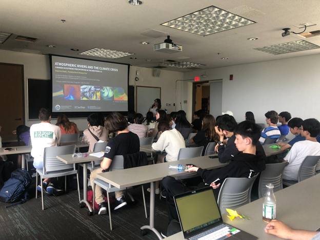
CW3E hosted 32 international and domestic high school students attending the Future Leaders Summer Program for a session on Climate Crisis. The program is conducted by the 21st Century China Center and the Global Leadership Institute at the UC San Diego School of Global Policy and Strategy. The program is designed for high school students to develop problem-solving and diplomacy skills in global affairs, especially as they pertain to the roles of China, the U.S., Pacific and Indo-Pacific region countries including Mexico and India. The 2023 program focused on four critical issues: climate crisis, energy innovation (e.g., renewable energy, electric vehicles, etc.), artificial intelligence and global pandemics.
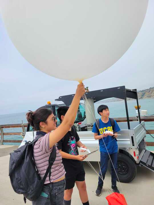
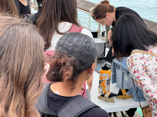
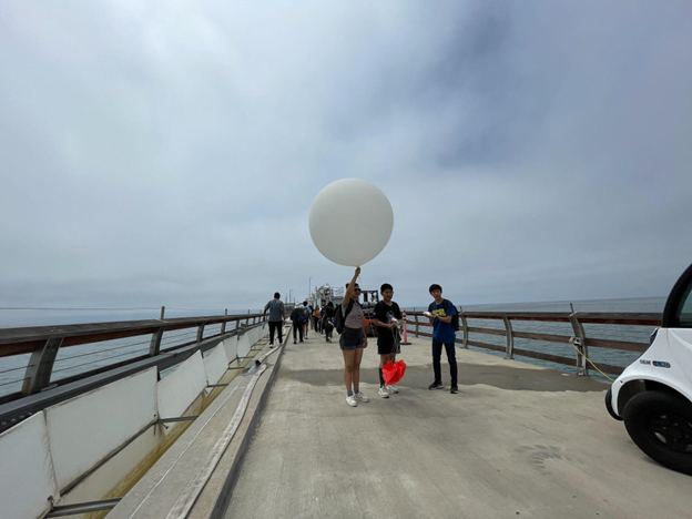
First, CW3E’s Douglas Alden and Ali Wolman led high school students from Global Leadership Institute in a weather balloon launch and a tour of the Ellen Browning Scripps Memorial Pier. The pier houses numerous environmental monitoring stations and enables small boat and scientific diving operations. During the group’s tour, students were able to see how busy a working research pier can get with cars, boats, golf carts, and people coming and going. Halfway down the pier, students gathered around CW3E’s weather station and Douglas introduced the sensors that observe variables including humidity, temperature, precipitation, and wind speed & direction. Students got an introduction to the technology used to set up and track the radiosonde sensor attached to the weather balloon. The group passed around example balloons and radiosondes, observed, and asked questions while Douglas and Ali prepared the weather balloon and radiosonde. Student volunteers from the Future Summer Leaders Program released the balloon on the group’s countdown.

Students continued their tour of Scripps Pier with a short talk from an Eastern Pacific Cloud Aerosol Precipitation Experience (EPCAPE) scientist about the work EPCAPE is doing studying aerosols in the atmosphere and their impact on cloud properties. Students continued to the end of the pier, where they saw the tide room. During the rainy season, CW3E keeps our radiosonde system set up there. In addition, students were able to see the saltwater intake that feeds saltwater tanks on campus including at the Birch Aquarium, the crane used to launch boats and lift them back onto the pier, and the staircase that lowers to the ocean surface to provide water access for researchers scuba diving around the pier.

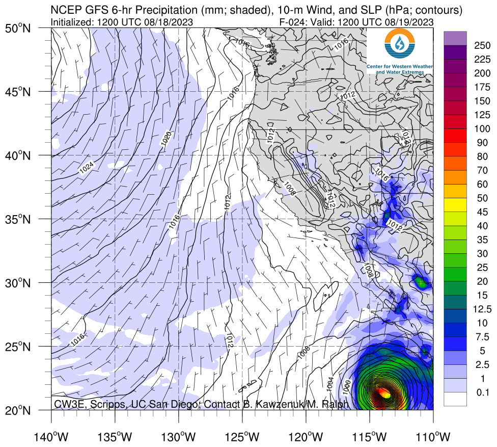
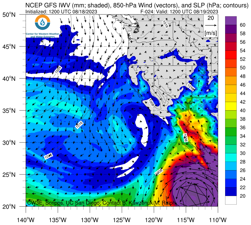
After the pier tour, CW3E’s Deanna Nash was the guest speaker for the Interview with Experts in the Field: Climate Crisis and gave a presentation on some of the work the center is doing to improve the resiliency of different communities in the face of climate change. The presentation focused on several core areas of the center: precipitation extremes in the Western U.S., Forecast Informed Reservoir Operations (FIRO), Atmospheric River Reconnaissance, and climate science. Additionally, Deanna shared her experiences as a postdoctoral researcher at CW3E and summarized her current research on landslides, floods and avalanches triggered by precipitation in Southeast Alaska. Discussion with the students throughout the presentation dealt with many topics, including policy implications of scientific findings, building community resilience to extreme events due to climate change, and pathways to becoming a scientist. CW3E is grateful to have had the opportunity to interact with the intelligent and enthusiastic students.


CW3E Welcomes Sarah Burnett

CW3E Welcomes Sarah Burnett

July 19, 2023
Sarah Burnett joined CW3E as a field researcher on July 17, 2023. Earlier in the year, Sarah worked part-time with the Field Team, releasing weather balloons and measuring stream water flow to make observations of the atmospheric rivers hitting the west coast. Sarah earned a B.S. in physics in 2019 and an MA in physics education in 2020 from Stanford University. While at Stanford, she interned at SLAC National Accelerator Laboratory, testing an algorithm to model optical distortions of the Dark Energy Camera. After graduating, she taught introductory physics at Fremont High School in Sunnyvale, CA, and became a Knowles Teaching Fellow to advance her teaching practice. As a teacher, Sarah focused on Universal Design for Learning to make the curriculum accessible and useful to a diverse set of students. At CW3E, Sarah will continue assisting with observations of stream flow and precipitation, as well as data management and analysis. In her free time, Sarah can be found practicing piano, painting, and yoga.

CW3E Welcomes Matthew Steen

CW3E Welcomes Matthew Steen

July 18, 2023
Matthew Steen join CW3E on July 1, 2023, as a Forecast Verification Analyst. Prior to this position, Matthew worked with CW3E part-time to assist with the most recent Atmospheric River Reconnaissance season as part of the forecast team where he helped create and deliver the daily forecast discussions. Matthew completed his B.S. in Meteorology at Millersville University in 2021 and earned his M.S. in Applied Meteorology at Plymouth State University in 2023. At Plymouth State, he compared dual-pol radar and MRMS QPE products for precipitation events in the Northern Plains and mid-Atlantic for completion of his M.S. thesis. In addition to his thesis research at Plymouth State, he also served as the REU Assistant for the Northeast Partnership for Atmospheric and Related Sciences (NEPARS) REU during the summer of 2022, where during this time he helped mentor research for three pairs of students while completing early work on his thesis. At CW3E will be assisting with research projects being completed at the center, primarily with forecasts and observations, as well as continuing to support the AR Recon forecasting team during the next AR season.

Sixth Annual Yampa Basin Rendezvous Brings Together Community to Address Water Resilience

Sixth Annual Yampa Basin Rendezvous Brings Together Community to Address Water Resilience

July, 17 2023

The 6th Annual Yampa Basin Rendezvous (YBR) conference was held June 1-2nd, providing a platform for leading experts, policymakers, non-profit organizations, and community stakeholders to address the pressing water resource challenges faced by the Yampa Basin region. The conference, held at Colorado Mountain College’s Steamboat Springs campus, was organized by the Center for Western Weather and Water Extremes (CW3E), Colorado Mountain College, Yampa Valley Sustainability Council, Friends of the Yampa, the Upper Yampa Water Conservancy District, River Network, Yampatika, and Steamboat Ski and Resort Corporation.

The conference theme, “Snows, Flows, and Drought: Managing for Western Water Resilience” aimed to foster collaboration, share knowledge, and promote innovative solutions to ensure sustainable water management practices in the Yampa Basin. The basin, located in northwest Colorado, is known for its unique water supply dynamics as one of the wildest remaining major tributaries of the Colorado River and the importance of its resources for various sectors, including agriculture, energy, and recreation.

YBR began with an inspiring welcome address by newly-elected Congressman Joe Neguse, U.S. Representative for Colorado’s 2nd Congressional District, focusing on the urgent need to adapt to changing climate patterns and the potential impacts on water availability in the region. Congressman Neguse highlighted the important role that the Yampa River plays in the greater Colorado River system and several recent pieces of legislation designed to protect the river system and those who rely on it.

Over the course of the conference, a series of panel discussions, field trips, a community keynote, and a poster session focused on critical topics including future climate projections, community engagement, ecosystem health, and adaptation. Participants engaged in lively discussions and shared cutting-edge research findings, technological advancements, and best practices from their respective fields.

YBR also facilitated valuable networking opportunities, enabling stakeholders to connect with experts and forge collaborations. Participants included representatives from federal and state agencies, local governments, tribal nations, non-profit organizations, academia, and industry sectors dependent on the Yampa Basin’s water resources.

A significant highlight of the YBR was the Community Keynote event co-hosted by YBR and Friends of the Yampa. The event was headlined by Erica Gies, Author of Water Always Wins, who inspired attendees with her keynote address on water resiliency strategies utilized by communities around the world. The event also featured Friends of the Yampa’s (FOTY) annual State of the Yampa address delivered by Kent Vertrees, FOTY board member and owner of Steamboat Powdercats.

YBR demonstrated the power of collective action and knowledge sharing in addressing water resource challenges. By fostering interdisciplinary dialogue, the event aimed to lay the foundation for a resilient future in the Yampa Basin, ensuring water security for generations to come.

As the conference drew to a close, participants departed with a renewed commitment to collaborate, innovate, and prioritize the sustainable management of the Yampa Basin’s precious water resources. With the knowledge and connections gained from the YBR conference, stakeholders are now better equipped to navigate the complex water challenges ahead and develop effective strategies for a thriving future utilizing the Yampa Basin as a model for western water resources.

CW3E Publication Notice: Seasonal forecasting of precipitation, temperature, and snow mass over the western U.S. by combining ensemble post-processing with empirical ocean-atmosphere teleconnections

CW3E Publication Notice

Seasonal forecasting of precipitation, temperature, and snow mass over the western U.S. by combining ensemble post-processing with empirical ocean-atmosphere teleconnections

July 14, 2023

A new paper entitled “Seasonal forecasting of precipitation, temperature, and snow mass over the western U.S. by combining ensemble post-processing with empirical ocean-atmosphere teleconnections,” was recently published in the AMS Journal of Weather and Forecasting by William Scheftic, Xubin Zeng, and Michael Brunke from the University of Arizona. This paper tests our experimental real-time ensemble seasonal forecasts of snowpack through snow water equivalent (SWE), 2m temperature (T2m) and precipitation (P) across hydrologic subbasins of the western U.S. after post-processing two currently operational state-of-the-art climate models: NCEP CFSv2 and ECMWF SEAS5. The winter forecasts have been hosted internally at CW3E and contribute to DeFlorio et al. (2023; submitted to BAMS and under revision). This work contributes to CW3E’s 2019–2024 Strategic Plan to enable more effective reservoir management through improved weather and water forecasts by demonstrating successful experimental ensemble forecasts of snowpack at the seasonal scale.

This research contributed to our understanding of, and efforts to improve, seasonal climate forecasting over the western U.S. in several ways, as highlighted in Figure 1. First, through our stage 1 adjustment which corrects for prior biases in the forecast distribution and adjusts for errors in spread, significant biases even in current state-of-the-art seasonal climate models were removed from all variables and improved skill over the original model. Second, through our stage 2 adjustments which further adjusts the forecast based on the linear relationship between stage 1 forecast errors and a set of land, oceanic and atmospheric predictor indices, we showed that significant SWE errors arising from poor model snowpack initialization could be further adjusted leading to improved forecasts. The impact of stage 2 adjustments on T2m and P forecasts was more limited, as the residual stage 1 error was not significantly related to the predictor indices. Finally, this study contributed to our understanding of the predictability of SWE relative to T2m and P. Here we saw enhanced skill in SWE, especially during the spring snowmelt period and in regions where snowpack is important but more challenging to initialize and forecast. Further analysis showed that the skill of SWE outperformed, but was strongly related to, the persistence of observed anomalies.

Figure 1: Adapted from Scheftic et al. (2023). The differences between original and Stage 1 forecasts (col 1) and the differences between Stage 1 and 2 forecasts (col 2) of the average of CFSv2 and SEAS5 median RPSS across all seasons for all subbasins in the western U.S. for T2m (top), P (middle), and SWE (bottom) at 1 month lead over all seasons. Subbasins outlined in bold black are 95% significant according to a bootstrap analysis. Skill for super-ensemble (SENS) Stage 2 forecasts for RPSS (right two columns). The 3rd column shows median skill across all seasons for all subbasins at 1 month lead. Subbasins outlined in thick gray show significant improvement (at 95% level) over one of the two models and those in bold black show significant improvement over both models (note: no subbasins were significant over both models). The 4th column shows median skill across all subbasins for each season and lead time. For instance, the value corresponding to “0-mon” and “OND” refers to the median RPSS for early October forecasts of October-December, while the value corresponding to “1-mon” and “NDJ” refers to the median SAC for early October forecasts of November-January. Note: RPSS is the ranked probability skill score which compares the performance of the full ensemble of the forecast to a reference ensemble that uses all historical observed data in the training period acting as a climatological distribution. RPSS of 1 represents perfect skill, RPSS of 0 has the same skill as the reference, and negative RPSS represents forecasts that performed worse than the reference.

DeFlorio, M. J., & Coauthors (2023). The transition from California’s extreme drought to major flooding: Evaluating experimental subseasonal and seasonal forecasts of the onslaught of landfalling atmospheric rivers and associated extreme precipitation during Winter 2022-2023, Bulletin of the American Meteorological Society, in review.

Scheftic, W. D., Zeng, X., & Brunke, M. A. (2023). Seasonal forecasting of precipitation, temperature, and snow mass over the western U.S. by combining ensemble post-processing with empirical ocean-atmosphere teleconnections, Weather and Forecasting (published online ahead of print 2023). https://doi.org/10.1175/WAF-D-22-0099.1

CW3E Members Attend 4th Annual Atmospheric River Reconnaissance Workshop at ECMWF in Reading, UK

CW3E Members Attend 4th Annual Atmospheric River Reconnaissance Workshop at ECMWF in Reading, UK

July, 13 2023

Members of CW3E’s AR Recon team attended the 4th Annual Atmospheric River Reconnaissance (AR Recon) Workshop at the European Centre for Medium-Range Weather Forecasts (ECMWF) held in Reading, UK and online during June 27–30, 2023. The goals of this workshop included highlighting the accomplishments of the exceptionally active 2023 AR Recon season and spotlighting the impact of data collected and assimilated during AR Recon into various operational weather models. The workshop also previewed research in progress using data collected during the season, discussed the upcoming collaboration between the North Atlantic Waveguide, Dry Intrusion, and Downstream Impact Campaign (NAWDIC) and AR Recon, and discussed future plans for the growth of AR Recon. Organization of the workshop was guided by the AR Recon Modeling and Data Assimilation Steering Committee.

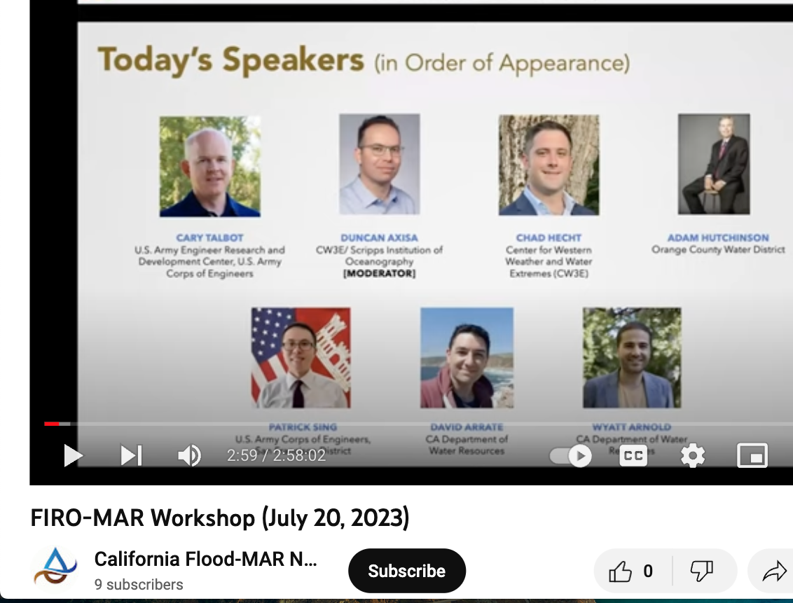
The first day of the workshop began with opening remarks by Florian Pappenberger, Director of Forecasts & Deputy-Director General at ECMWF, and a presentation on AR Recon motivation and achievements by Marty Ralph, CW3E Director and PI of AR Recon. The remainder of the day focused on AR Recon during Water Year 2023 (and, at times, beyond). The morning sessions focused primarily on observational platforms and techniques associated with AR Recon, as well as analysis of the meteorological characteristics associated with landfalling ARs based on AR Recon observations. The afternoon sessions focused primarily on the use of sensitivity products, both the adjoint and ensemble methods, to highlight areas where targeted AR Recon observations, particularly dropsondes, would be most beneficial to the accuracy of numerical weather prediction model run solutions. The importance of AR Recon to water management operations was also highlighted by Cary Talbot, National Lead, Forecast-Informed Reservoir Operations Program (FIRO) at the US Army Engineer Research & Development Center. The day concluded with a reception and poster viewing session.

The second day of the workshop began with a presentation by Rear Admiral Nancy Hann, Director of the NOAA Office of Marine and Aviation Operations (OMAO), describing NOAA’s current and future aircraft support for AR Recon, followed by an overview of AR Recon observational strategies and impacts on NOAA/NCEP modeling by Vijay Tallapragada, Senior Scientist for EMC and Co-PI of AR Recon. The remainder of the morning continued to focus on modeling, data assimilation, and impact studies related to AR Recon observations. This general theme continued into the afternoon, which featured a celebration of ECMWF’s successful implementation of its newest version of the Integrated Forecasting System (Cycle 48r1). Chris Davis, NCAR Senior Scientist and Chair, WMO WWRP Science Steering Committee, highlighted activities of the World Weather Research Programme relevant to AR Recon. The day concluded with a workshop dinner at Bel and the Dragon in the Reading town centre.

The third day of the workshop was kicked off by Helen Dacre, Professor of Meteorology at the University of Reading, who presented on precipitation efficiencies in extratropical cyclones and the role of ARs. The remainder of the morning session continued with a focus on scientific advances in physical process understanding and how these advances could be considered and/or applied toward future AR Recon targeting operations. Topics included interactions between the WCB and the jet stream, dry intrusions, and even tropical cyclones in the western Pacific. The afternoon featured a panel discussion regarding new directions and the future of AR Recon. Each member of the audience was invited to provide one comment based on the workshop, and a wide variety of constructive ideas was discussed.

The fourth day of the meeting transitioned to the NAWDIC Workshop, with a presentation from Christian Grams, Professor of Meteorology at the Karlsruhe Institute of Technology outlining the primary field campaign and its various complementary projects. CW3E Director, Marty Ralph, gave a presentation on the potential collaborations between AR Recon and the NAWDIC campaign, discussing the potential for coordinating sampling flights off the US East Coast with flights over Europe. The morning session featured discussion of various projects that will occur under the NAWDIC umbrella, including the UK led CAPRI field campaign (Cyclones, coupled Atmosphere-surface, Processes and Risk of Impacts), French led contributions via SAFIRE aircraft and ground-based sensor deployment, and proposed US plans to sample upstream, antecedent atmospheric conditions associated with high-impact weather events. The day finished with breakout group sessions on Atmospheric Rivers and Dry Intrusions, the presentation of a case study representing the full collaborative efforts of the group, and reporting on the results of the breakout group discussions.

The full meeting agenda, recording of each talk, copies of presentation slides, and posters presented at the meeting can be found here, on the ECMWF’s website for the event.

AR Recon Workshop Session Topics

AR Recon in Water Year 2023

Modeling, Data Assimilation and Impact Studies

Scientific Advances in Physical Process Understanding

The Future of AR Recon

Attendees of the 4th Annual Atmospheric River Reconnaissance Workshop at the European Centre for Medium-Range Weather Forecasts offices in Reading, UK (27 June 2023, Photo: ECMWF)

CW3E Welcomes Nick Schneider

CW3E Welcomes Nick Schneider

June 12, 2023

Nick Schneider joined CW3E on May 1, 2023, as a research engineer to support Forecast Informed Reservoir Operations projects. Nick previously worked for the San Francisco Public Utilities Commission where he assisted in the development of an automated flood predicition interface utilizing precipitation forecasts from the AQPI system. Nick earned a B.S. in civil engineering with a minor in mathematics from the University of California, Davis in 2021. While in Davis, he also interned at Resource Management Associates where he assisted in the development and application of numerical models for the analysis of current, forecasted, and proposed conditions for surface water systems ranging from tidal marshes to large scale river-reservoir systems. At CW3E, Nick will assist in FIRO engineering research and in the evaluation of other reservoir systems throughout the West beyond Lake Mendocino.

CW3E Publication Notice: Using Deep Learning for an Analysis of Atmospheric Rivers in a High-Resolution Large Ensemble Climate Dataset

CW3E Publication Notice

Using Deep Learning for an Analysis of Atmospheric Rivers in a High-Resolution Large Ensemble Climate Dataset

June 5, 2023

A new paper entitled “Using Deep Learning for an Analysis of Atmospheric Rivers in a High-Resolution Large Ensemble Climate Dataset” was recently published in Journal of Advances in Modeling Earth Systems by CU Boulder PhD Candidate Tim Higgins, Aneesh Subramanian (CU Boulder), Andre Graubner (ETH Zurich), Lukas Kapp-Schwoerer (ETH Zurich), Peter A. G. Watson (University of Bristol), Sarah Sparrow (University of Oxford), Karthik Kashinath (NVIDIA), Sol Kim (UC Berkeley), Luca Delle Monache (CW3E), and Will Chapman (NCAR). In this work, a light-weight convolutional neural network (CNN) that was first introduced in Wu et al. (2019) and named “CGNet”, was applied towards tracking ARs. The same CNN has previously been applied to other purposes including object identification in cityscapes (Figure 3a). This method, which took the name “CG-Climate”, was used to both track ARs in reanalysis data to show consistency with other common methods and to demonstrate the benefits of using it to track ARs in a large-ensemble regional climate dataset.

Human expert hand labels from 80 different weather and climate scientists at labeling campaigns taking place at CW3E, NCAR, UC Berkeley, Lawrence Berkeley National Laboratory, the 2019 ARTMIP workshop, and the 2019 Climate Informatics Workshop were used to create the training dataset, “ClimateNet” (Prabhat et al. 2021). Examples of human hand labels are shown in Figure 3b. The CNN was trained on AR masks as well as IWV, mean sea level pressure, 850 mb zonal wind, and 850 mb meridional wind. While there are already many existing AR tracking methods that work well, this method has some unique benefits in some contexts. It is able to run at an exceptionally fast speed and uses an exceptionally low amount of computational resources. It is also highly flexible with constraints on input data. It does not require IVT, which can be unavailable in some datasets, and it can be run on any regional domain and at any resolution.

One key characteristic of this method is that ARs detected from it were typically bigger than those detected by more traditional heuristic-based methods. This resulted in inconsistencies between CG-Climate and other methods when evaluating every individual grid point (Figure 8a). This could largely be attributed to labels in the training set that were created by humans being larger than labels that were calculated from other methods. CG-Climate was consistent in finding the same AR events as a variety of other detection methods (Figure 8b).

CG-Climate was run on a large-ensemble and high-resolution climate dataset named “Weather@Home”. A case study was used to extrapolate the time and computational resources that would be required to run it on a common heuristic-based method. CG-Climate used several orders of magnitude less computational memory and almost one order of magnitude less time, which can be a critical constraint when applying an AR tracking method to a large amount of data. ARs that were tracked in Weather@Home under the early-21st century forcing scenario had a similar frequency to those tracked in reanalysis data over the same years.

Figure 1: Figure 3 from Higgins et al. (2023). An example of two different applications of semantic segmentation. (a) A feature-label pair of objects in a cityscape. (b) A feature label pair of ARs in an IWV field. AR contours are shown in purple, blue, green, and pink.

Figure 1: Figure 8 from Higgins et al. (2023). Precision and recall between each detection algorithm and all other ARTMIP algorithms (truth). The thresholds used are the number of algorithms that overlap for any given AR. Precision is defined as the number of true positives divided by the sum of true positives and false positives. Recall is defined as the number of true positives divided by the sum of true positives and false negatives. The area under the curve indicates the level of agreement with the truth. Precision/recall curves are shown for (a) AR events and (b) AR grid points.

Higgins, T. B., Subramanian, A. C., Graubner, A., Kapp‐Schwoerer, L., Watson, P. A. G., Sparrow, S., et al. (2023). Using Deep Learning for an Analysis of Atmospheric Rivers in a High‐Resolution Large Ensemble Climate Data Set. Journal of Advances in Modeling Earth Systems, 15(4), e2022MS003495. https://doi.org/10.1029/2022MS003495

Prabhat, Kashinath, K., Mudigonda, M., Kim, S., Kapp-Schwoerer, L., Graubner, A., et al. (2021). ClimateNet: an expert-labeled open dataset and deep learning architecture for enabling high-precision analyses of extreme weather. Geoscientific Model Development, 14(1), 107–124. https://doi.org/10.5194/gmd-14-107-2021

Xu, B., Wang, N., Chen, T., & Li, M. (2015, November 27). Empirical Evaluation of Rectified Activations in Convolutional Network. arXiv. Retrieved from http://arxiv.org/abs/1505.00853