CW3E AR Update: 6 March 2023 Outlook
March 6, 2023
Click here for a pdf of this information.
Warm Atmospheric River to Bring Heavy Precipitation, Potential Flooding to California Later This Week
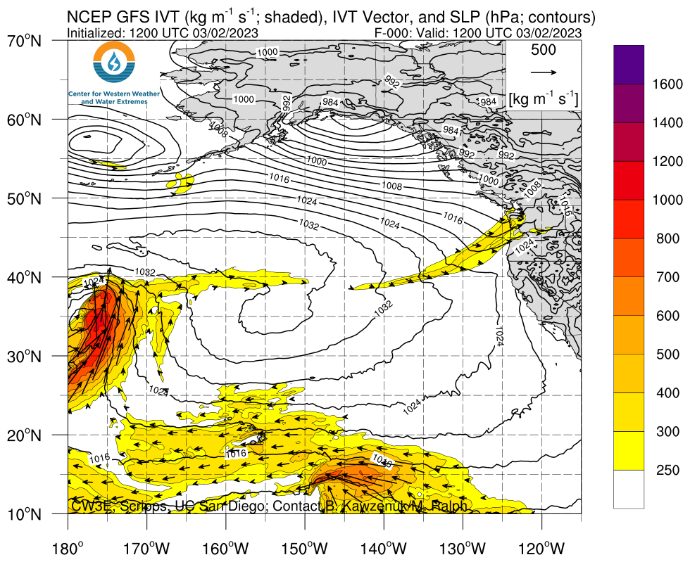
- An atmospheric river (AR) is forecast to make landfall in California later Thursday, bringing with it considerable rainfall to the region through Saturday
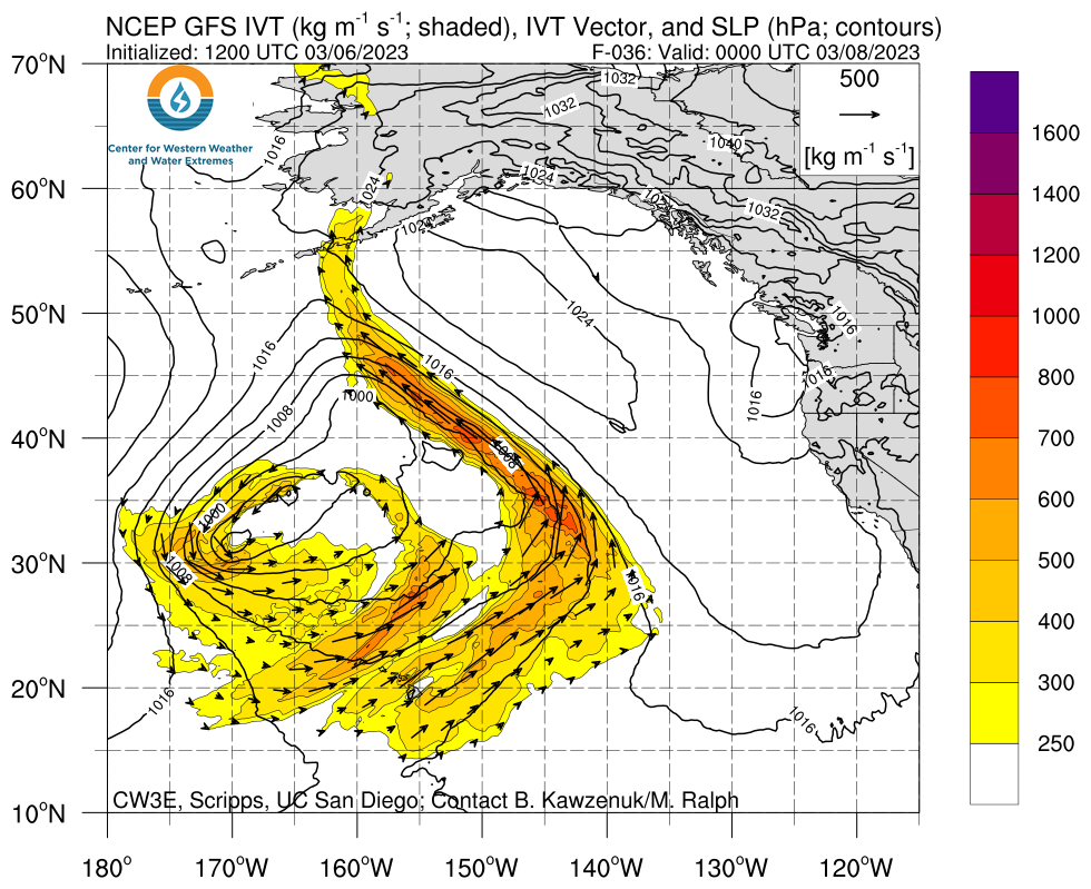
- IVT > 750 kg m-1 s-1 is forecast during AR landfall along the coast of California, bringing AR 3/AR 4 conditions (based on the Ralph et al. 2019 AR Scale) to Central and Northern California
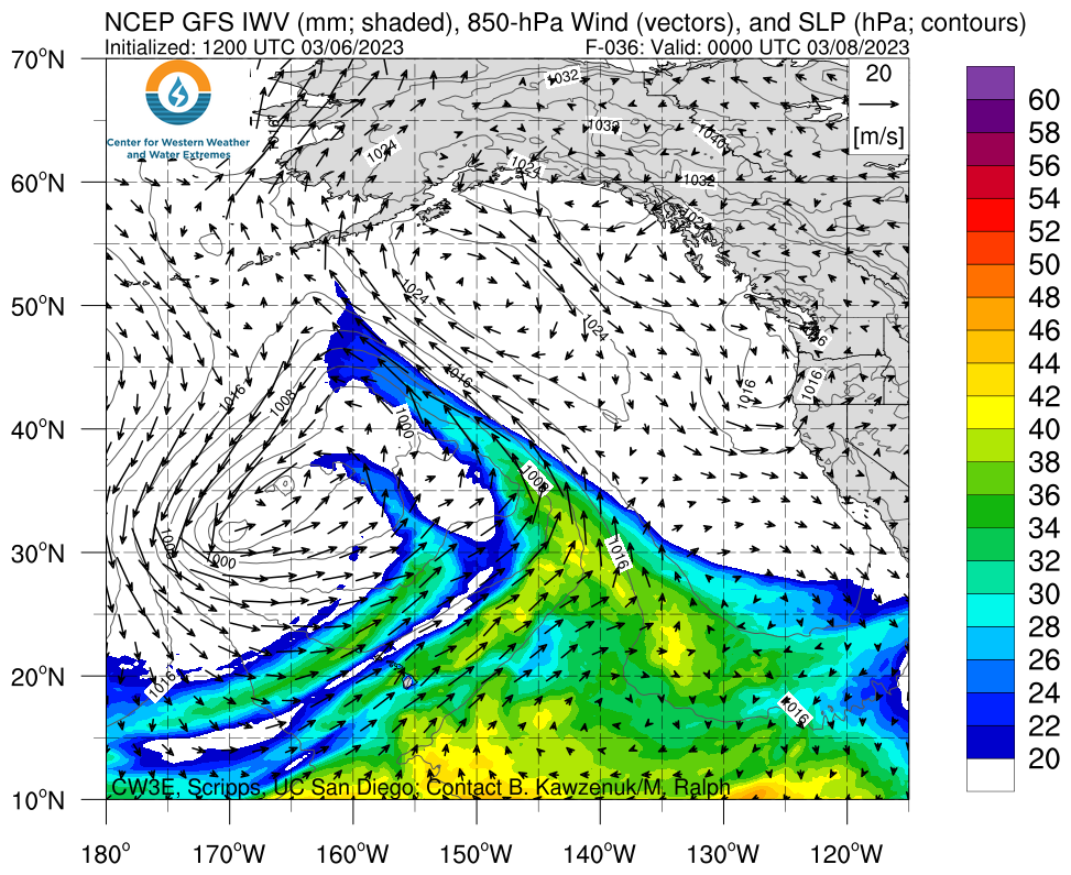
- This AR is forecast to be a warm storm, with a broad region of 850-hPa temperatures > 0° C forecast over California during this storm period
- The 00Z ECMWF is forecasting a stronger AR at coastal locations in Central California as compared to the GFS, while the GFS is forecasting a slightly longer duration of AR conditions along the coast
- Models are showing low-to-moderate confidence in a second AR landfall in California early next week
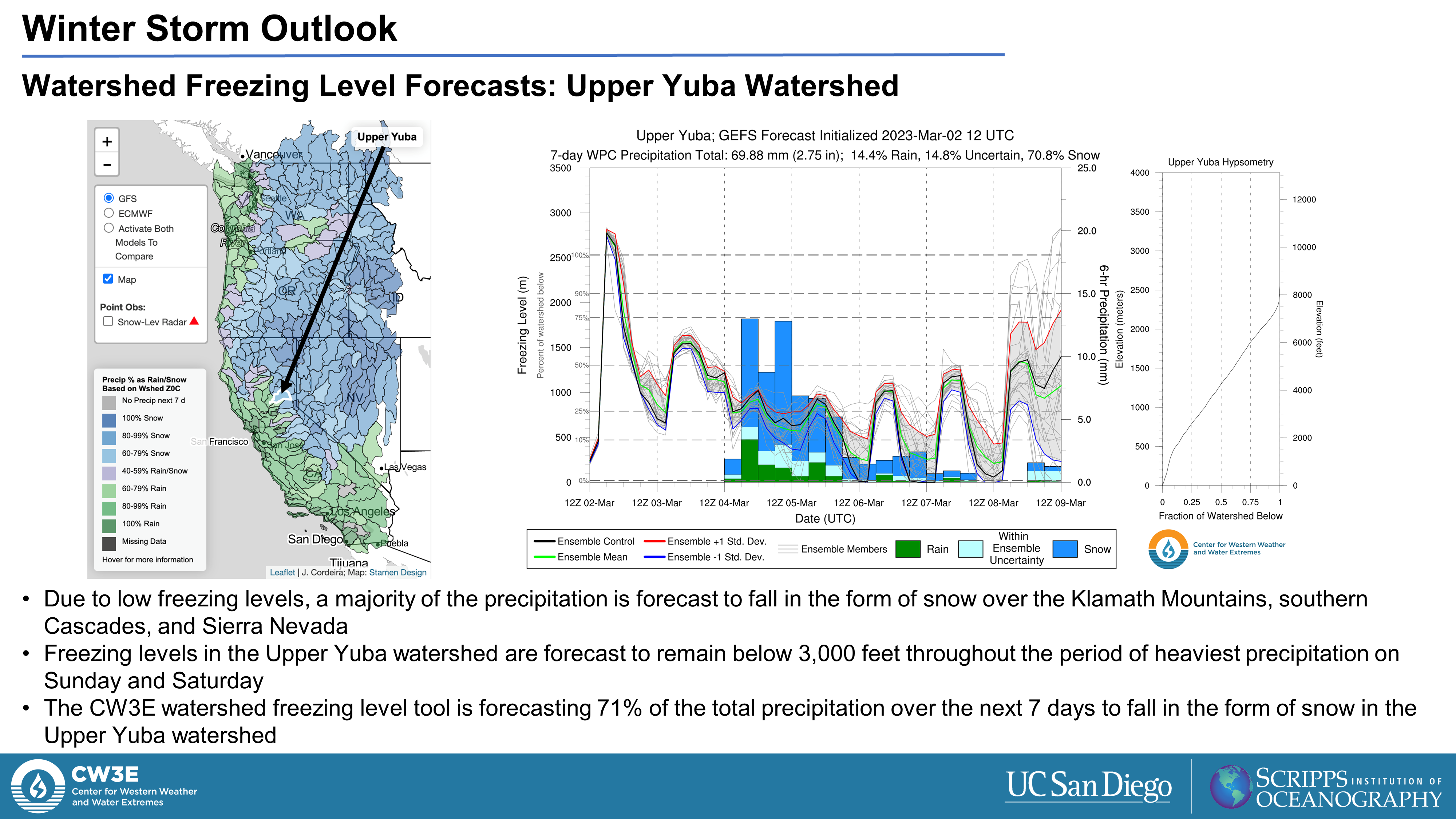
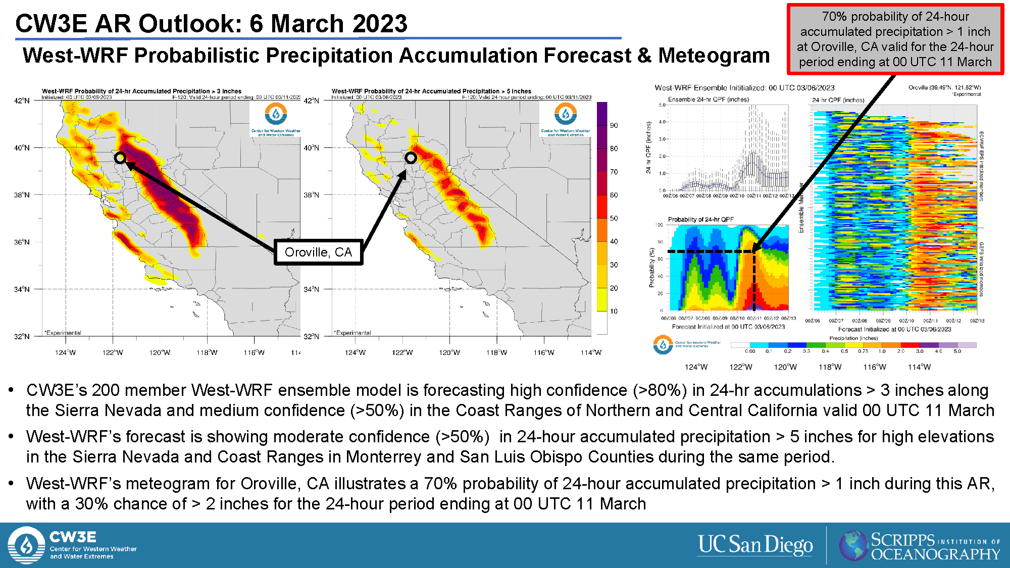
- The NWS Weather Prediction Center (WPC) has forecast 48-hour precipitation totals > 3 inches over the Coast Ranges of Northern and Central California and > 5 inches over the Sierra Nevada in association with the first AR
- The 00Z ECMWF is forecasting considerably more precipitation (5.06 in) for the Russian River Watershed as compared to the 00Z GFS (1.32 in), highlighting significant model-to-model uncertainty with this event
- GEFS ensemble has forecast freezing levels to rise rapidly, to nearly 6,000 feet across Northern California and the Sierra Nevada ahead of this AR
- The combination of high freezing levels, heavy precipitation, and existing snowpack conditions will likely result in a substantial amount of rain-on-snow, thereby increasing runoff and the potential for flooding
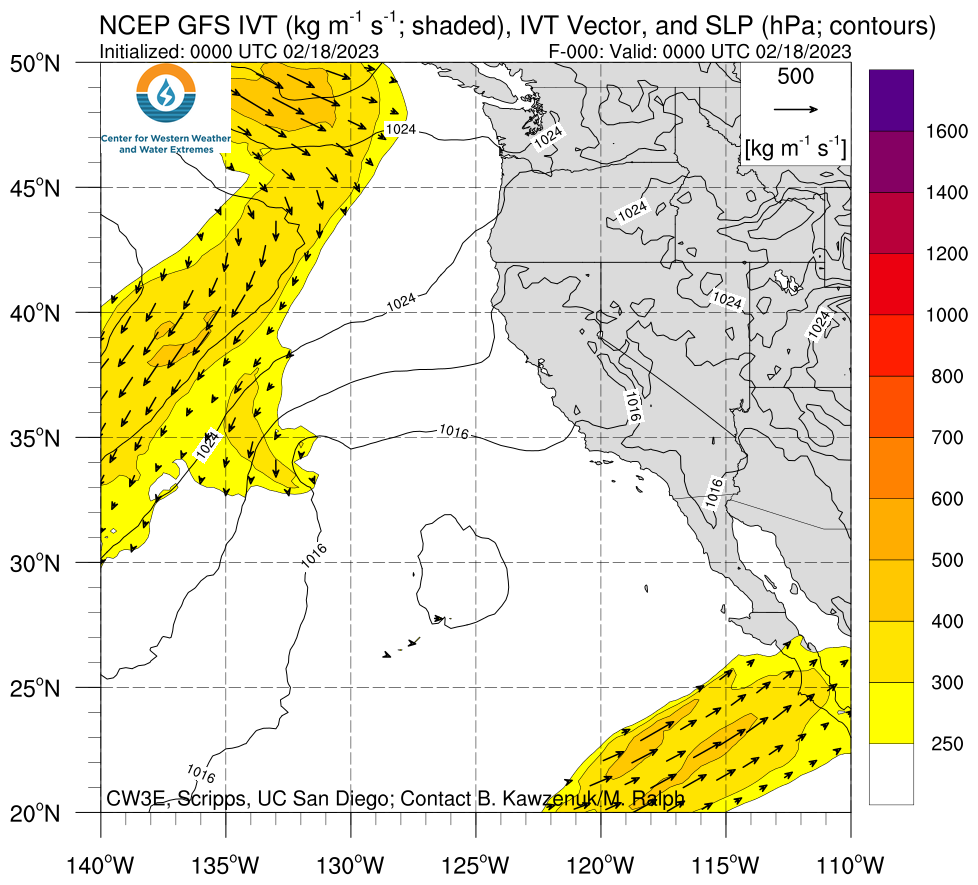
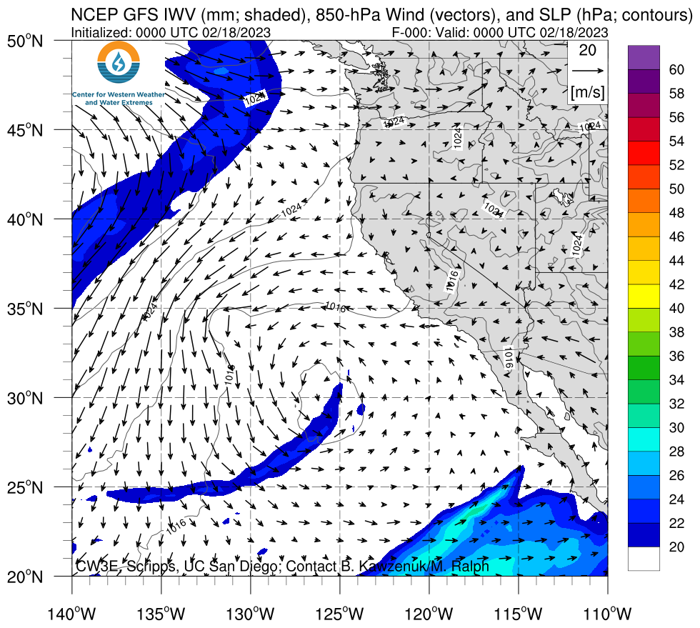
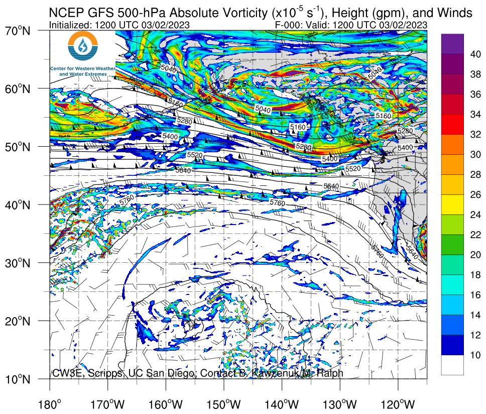
Click images to see loops of GFS IVT and IWV forecasts Valid 0000 UTC 8 March – 0900 UTC 12 March 2023 |
|
 |
 |


Summary provided by S. Bartlett, S. Roj, C. Castellano, and J. Kalansky; 6 March 2023
To sign up for email alerts when CW3E post new AR updates click here.
*Outlook products are considered experimental