Distribution of Landfalling Atmospheric Rivers over the U.S. West Coast During Water Year 2021: End of Water Year Summary

Distribution of Landfalling Atmospheric Rivers over the U.S. West Coast During Water Year 2021: End of Water Year Summary

October 11, 2021

For a pdf of this information click here.

Analysis by Chad Hecht, Julie Kalansky, & F. Martin Ralph. This analysis is considered experimental. For questions regarding the data or methodology please contact Chad Hecht

CW3E AR Update: 7 October 2021 Outlook

CW3E AR Update: 7 October 2021 Outlook

October 7, 2021

Click here for a pdf of this information.

Atmospheric River to Bring Rain to Southern California and Interior Southwestern U.S.

  • An atmospheric river (AR) is forecasted to make landfall across Southern California today
  • AR 2 conditions are forecasted in coastal San Diego County, with maximum IVT values > 500 kg m-1 s-1
  • AR 2 conditions are also possible over portions of the interior southwestern U.S. due to substantial inland penetration of this AR
  • The heaviest precipitation (0.5–1.5 inches) associated with this AR is expected over the Peninsular and eastern Transverse Ranges in Southern California and the higher terrain in southwestern Utah, northern Utah, and southeastern Idaho

Click images to see loops of GFS IVT & IWV forecasts

Valid 0600 UTC 7 October – 0000 UTC 10 October 2021


Summary provided by C. Castellano, B. Kawzenuk, J. Kalansky, and F. M. Ralph; 7 October 2021

To sign up for email alerts when CW3E post new AR updates click here.

*Outlook products are considered experimental

CW3E Event Summary: 4-5 October 2021

CW3E Event Summary: 4-5 October 2021

October 5, 2021

Click here for a pdf of this information.

Rare October Thunderstorms Light Up Southern California

  • Scattered thunderstorms produced heavy downpours and frequent lightning in Southern California during the evening of 4 Oct and early morning of 5 Oct
  • The thunderstorms formed in a region of moist, unstable air, downstream of an upper-level cutoff low
  • Many stations in western San Diego County received more than 0.50 inches of rain
  • Lightning caused fires and scattered power outages throughout San Diego County


Summary provided by C. Castellano, C. Hecht, J. Kalansky, J. Martinez Claros, N. Oakley, and F. M. Ralph; 5 October 2021

CW3E Event Summary: 16-19 September 2021

CW3E Event Summary: 16-19 September 2021

September 21, 2021

Click here for a pdf of this information.

Atmospheric River Brings Much Needed Precipitation to the Pacific Northwest

  • A strong atmospheric river (AR) made landfall over Washington and Oregon during 17th of September
  • Portions of coastal Washington and Oregon experienced AR 3/AR 4 conditions (based on the Ralph et al. 2019 AR Scale)
  • More than 5 inches of precipitation fell in parts of the Olympic Peninsula and North Cascades
  • This precipitation fell while numerous large wildfires were burning across the Pacific Northwest and Northern California
  • While this recent rain didn’t end all current fire activity and the fire season it brought much need moisture to the fuels across the region

Click images to see loops of GFS IVT & IWV forecasts

Valid 0000 UTC 14 September – 1800 UTC 22 September 2021


Summary provided by C. Hecht, C. Castellano, J. Kalansky, and F. M. Ralph; 21 September 2021

*Outlook products are considered experimental

CW3E AR Update: 28 September 2021 Outlook

CW3E AR Update: 28 September 2021 Outlook

September 28, 2021

Click here for a pdf of this information.

Atmospheric River Brings Rain to the Pacific Northwest

  • A strong atmospheric river (AR) made landfall over Washington during the early morning of 26 September
  • Portions of coastal Washington and Oregon experienced AR 3/AR 4 conditions (based on the Ralph et al. 2019 AR Scale)
  • More than 3 inches of precipitation fell in parts of the Olympic Peninsula and North Cascades

MIMIC-TPW2 Total Precipitable Water

Valid 0000 UTC 25 September – 0000 UTC 28 September

Images from CIMSS/University of Wisconsin


September to End on a Wet Note in the Pacific Northwest

  • Yet another AR is forecast to make landfall over the Pacific Northwest tomorrow
  • AR 2/AR 3 conditions (based on the Ralph et al. 2019 AR Scale) are possible over coastal Washington and northern coastal Oregon
  • About 1–3 inches of precipitation are forecasted across much of western Washington over the next 72 hours, with higher amounts possible in the Olympic Mountains and North Cascades
  • Given the more northerly track of the AR and associated surface cyclone, little or no precipitation is expected in most of Oregon and Northern California

Click images to see loops of GFS IVT & IWV forecasts

Valid 0600 UTC 28 September – 0000 UTC 1 October 2021


Summary provided by C. Castellano, C. Hecht, J. Kalansky, B. Kawzenuk, and F. M. Ralph; 28 September 2021

To sign up for email alerts when CW3E post new AR updates click here.

*Outlook products are considered experimental

CW3E AR Update: 16 September 2021 Outlook

CW3E AR Update: 16 September 2021 Outlook

September 16, 2021

Click here for a pdf of this information.

First major atmospheric river of season to impact the Pacific Northwest

  • A strong atmospheric river (AR) is forecast to make landfall across Washington and Oregon late tonight
  • AR 4/AR 5 conditions (based on the Ralph et al. 2019 AR Scale) are possible over coastal Washington and northern coastal Oregon
  • AR 2/AR 3 conditions are also possible over interior Oregon and Washington
  • At least 2–5 inches of precipitation are forecasted in the Pacific Coast Ranges and Cascades, with higher amounts likely in the Olympic Mountains and North Cascades
  • Precipitation from this event will likely aid fire containment efforts in the northwestern U.S., but will not be enough to alleviate long-term drought conditions in much of the western U.S.
  • Click images to see loops of GFS IVT & IWV forecasts

    Valid 1200 UTC 16 September – 1200 UTC 20 September 2021


    Summary provided by C. Castellano, C. Hecht, B. Kawzenuk, and F. M. Ralph; 16 September 2021

    *Outlook products are considered experimental

CW3E AR Update: 13 September 2021 Outlook

CW3E AR Update: 13 September 2021 Outlook

September 13, 2021

Click here for a pdf of this information.

An increase in activity over the Eastern Pacific is forecast to bring multiple ARs to the Pacific Northwest

  • The first AR is forecast to be weak and brief, bringing as much as 1 inch of precipitation to far Northwestern Washington
  • The second AR is forecast to bring much stronger and a longer duration of AR conditions to the Pacific Northwest, though there is currently much higher ensemble spread in timing, magnitude, and overall duration of AR conditions
  • ~12 GEFS ensemble members are predicting the second AR to bring AR 4 or higher conditions to Coastal Oregon
  • The NWS Weather Prediction Center is currently forecasting as much as 7 inches of precipitation to fall across several high elevation locations in the Pacific Northwest during the next seven days
  • While early season ARs tend to produce less precipitation than their mid-winter counterparts, any precipitation that these two ARs produce will bring much needed relief to the numerous active wildfires and drought conditions in the Pacific Northwest
  • Click images to see loops of GFS IVT & IWV forecasts

    Valid 1200 UTC 13 September – 1200 UTC 23 September 2021


    Summary provided by C. Hecht, C. Castellano, J. Kalansky, and F. M. Ralph; 13 September 2021

    *Outlook products are considered experimental

CW3E Hosts 2021 Summer Intern Program

CW3E Hosts 2021 Summer Intern Program

September 3, 2021

The CW3E summer internship program, coordinated by Cody Poulsen with support from Will Chapman and Mike Sierks, concluded on August 20th, 2021. Over a two-month span, interns studied a myriad of topics under the tutelage of their mentors; these focuses were wide ranging, from creating an interactive dashboard to using Python for AR Recon data impact analysis.

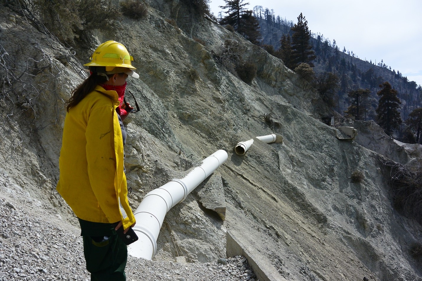
Opportunities for interns to obtain first-hand experience with meteorological instrumentation and processes were also available by partaking in radiosonde launches on Scripps Pier and engaging fieldwork. Lastly, weekly workshops, as well as invitations for students to attend regular CW3E meetings via Zoom, provided a deeper glimpse into the different facets of life as a researcher. Through said research and activities, interns were able to expand and strengthen their knowledge of ARs, coding, scientific processes, instrumentation, and hydrometeorology, as a whole.

The internship program culminated in research presentations on August 13th. Interns were each given fifteen-minutes to present their research from the past two months and subsequently answers questions; they were then able to utilize the final week of the program to polish said research and present it in a two-page summary. The list of interns, and their summaries, can be found here.

For those in-person, a beach adjacent event wrapped up the summer internship program and provided an opportunity for conversation with individuals outside of their normal day-to-day. In all, the 2021 CW3E summer internship program was a successful return to predominantly in-person learning for both interns and mentors alike.

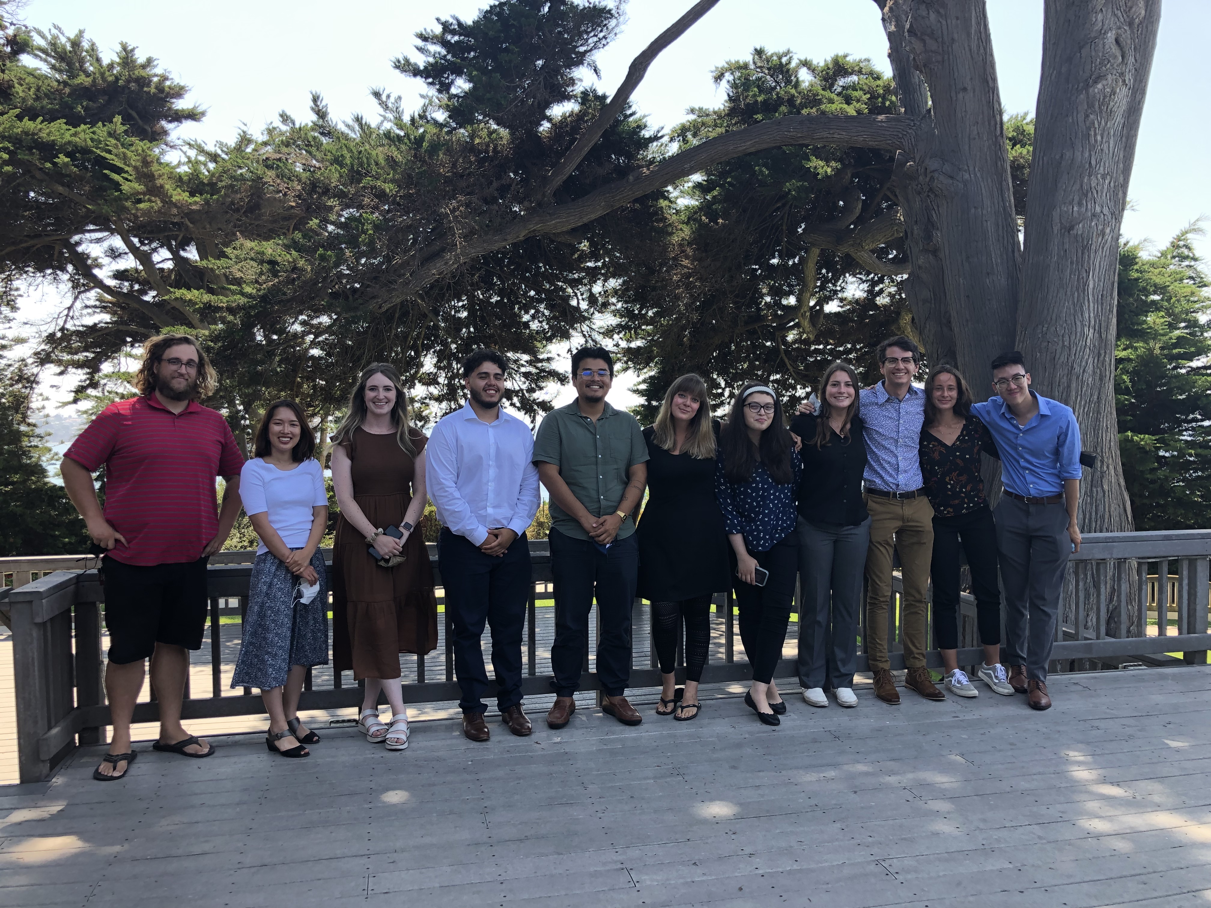
From left: Cody Poulsen (CW3E), Ryoko Araki (SDSU), Lauren Bolotin, Adolfo Lopez-Miranda, Gilberto Estrada Camacho, Hillary Beckmeyer, Diana Montoya-Herrera, Janelle Wargo, Levi Newell, Sierra Dabby, and Martin Liu.

CW3E Publication Notice: A warming climate adds complexity to post-fire hydrologic hazard planning

CW3E Publication Notice

A warming climate adds complexity to post-fire hydrologic hazard planning

July 29, 2021

Nina Oakley, a research scientist with CW3E, recently published an invited commentary in the journal Earth’s Future. The commentary was written in response to Kean and Staley (2021), “Forecasting the Frequency and Magnitude of Postfire Debris Flows Across Southern California”, which demonstrates a method for estimating recurrence interval of post-fire debris flows. Kean and Staley (2021) also test the sensitivity of debris flow frequency and magnitude to possible future changes in fire behavior and rainfall intensity.

In this commentary article, Oakley expands on the concept of climate change and debris flow hazards addressed in Kean and Staley (2021) and describes weather and climate-related data and information needs to support planning for post-fire hydrologic hazards in a warming climate. Key points include:

A USFS Burned Area Emergency Responder evaluates the 2019 Apple Fire in Southern California for post-fire hydrologic hazards.

  • Time between wildfire and the first instance of high-intensity rainfall may be relatively short, and potentially shorter in a warming climate, leaving little time for identification of hazard areas and implementation of mitigation strategies. Assessing the potential for post-fire hydrologic hazards and their impacts prior to wildfire occurrence can reduce some of the challenges associated with conducting a rapid post-fire response.
  • There is uncertainty in the magnitude of sub-daily precipitation intensification, especially for the US West Coast cool season. Further research to understand atmospheric processes at play in sub-daily precipitation intensification along the West Coast and the magnitude of the change would provide insight to future post-fire debris flow frequency and magnitude, supporting long-range planning efforts.
  • Developing “climate scaling factors” that can be applied to frameworks already in use for planning and design (e.g., NOAA Atlas 14) may be valuable for post-fire hazard planning. However, it is possible that scaling factors will vary based on storm characteristics.
  • As post-fire hydrologic hazards are typically assessed at a “small catchment scale” (~a few km2) and their likelihood is best represented by rainfall intensities at sub-hourly durations, reanalysis products (simulations of past weather/climate) and climate projections that address these temporal and spatial scales are extremely valuable for assessing post-fire hydrologic hazards. Some challenges in accomplishing these efforts are noted.
  • Field monitoring programs that include high temporal resolution rainfall measurements and debris flow response and timing (or lack thereof) are critical for calibration and further development of debris flow models.
  • Existing operational weather radars have poor coverage in many areas of complex terrain in the West where post-fire debris flows present a hazard. Telemetered rain gauges deployed to burn areas of concern can provide support for “nowcasting” or forecast model verification, but only provide data at a point. Permanent installation or deployment of weather radars to fill gaps or provide additional information in areas of concern to support forecasting efforts.

This article addresses CW3E’s Strategic Plan Priority Area of Monitoring and Projections of Climate Variability and Change. It outlines some of the major weather and climate data and information needs to manage post-fire hydrologic hazards in a warming climate. Addressing these information needs will help to quantify the changing risk of post-fire hazards to support preparedness and planning.

Oakley, N.S. (2021). A warming climate adds complexity to post-fire hydrologic hazard planning. Earth’s Future, 9, e2021EF002149. https://doi.org/10.1029/2021EF002149