CW3E AR Update: 8 January 2024 East Coast Outlook

CW3E AR Update: 8 January 2024 East Coast Outlook

January 8, 2024

Click here for a pdf of this information.

Two Low Pressure Systems to Bring Heavy Precipitation to East Coast

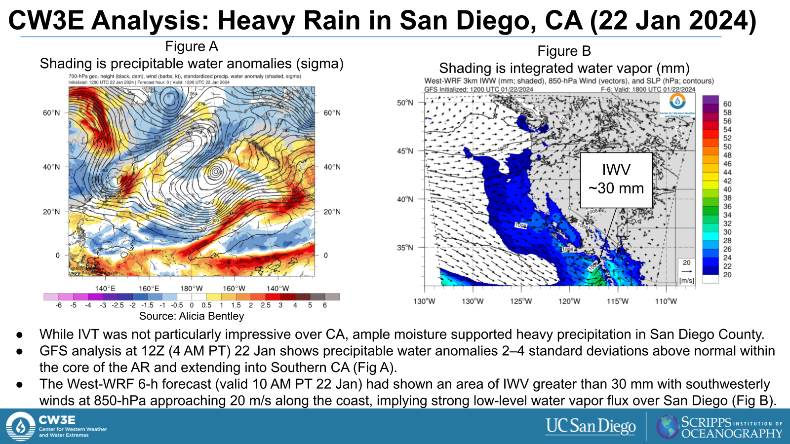
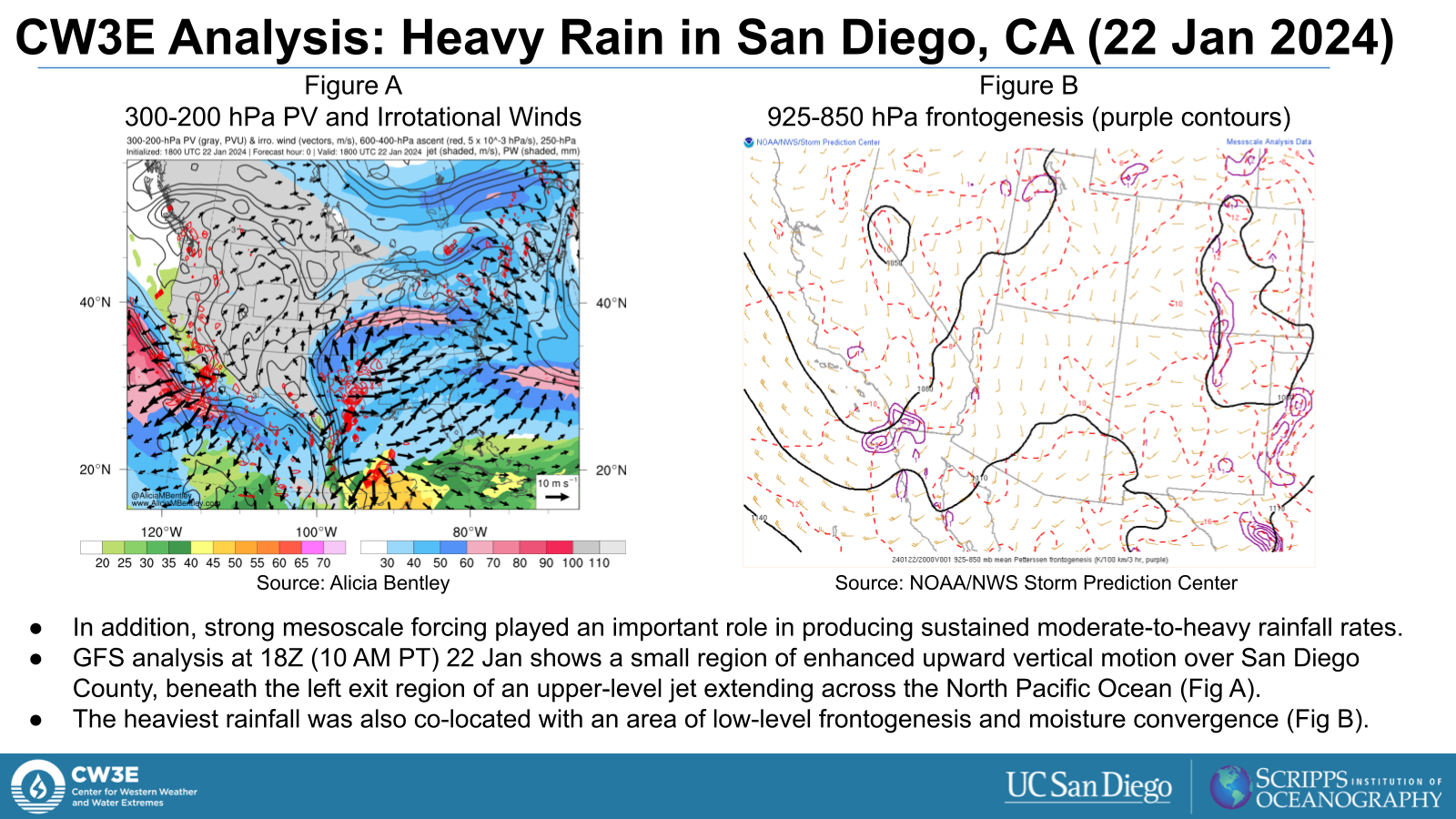
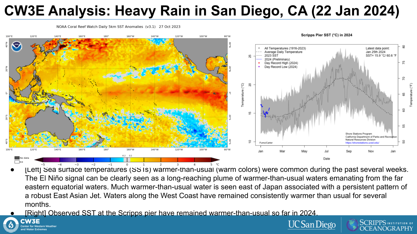
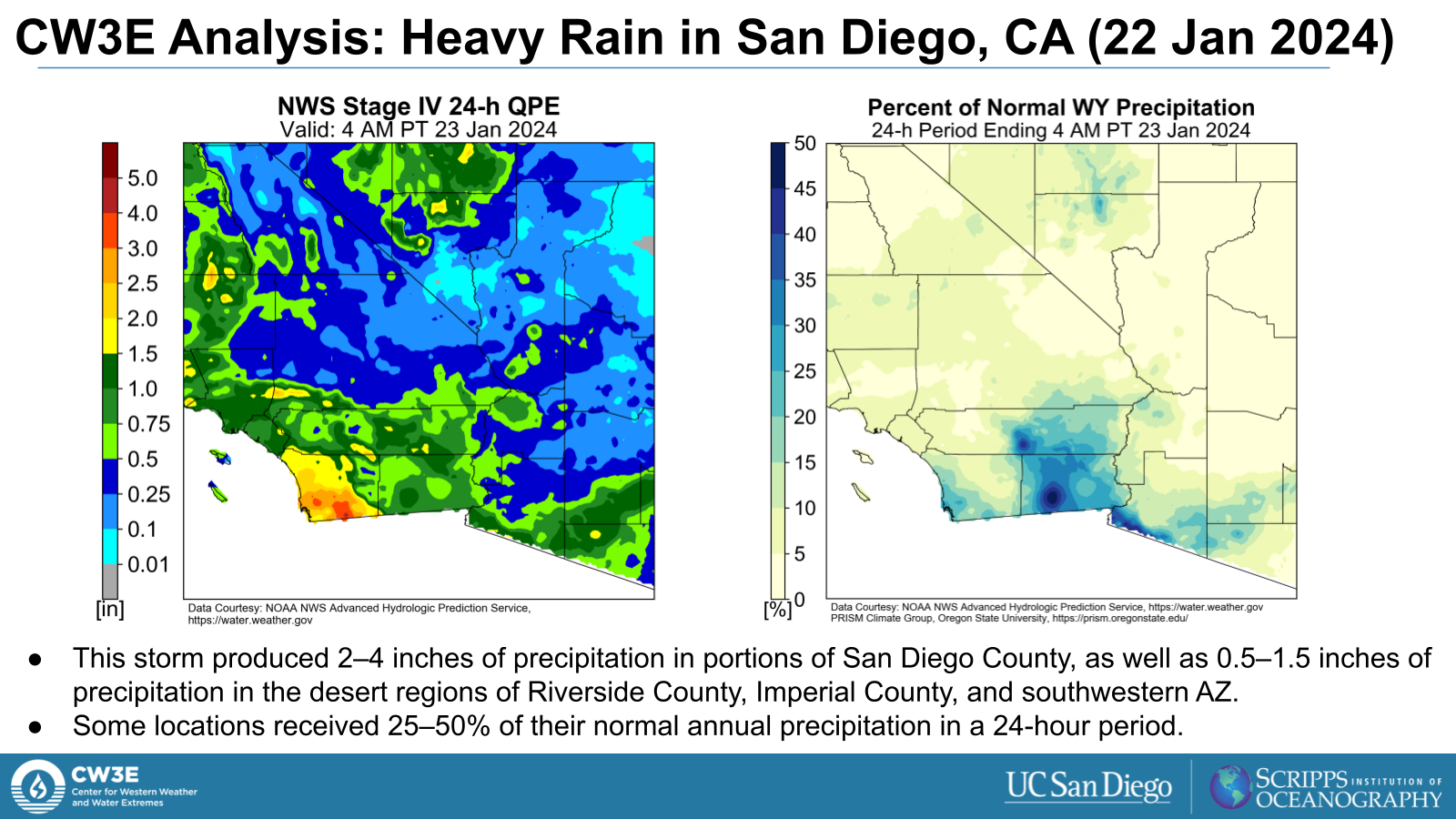
  • Two low pressure systems and associated atmospheric rivers (AR) are forecast bring heavy precipitation to much of the Eastern and Midwest US this week.
  • The first strong AR (IVT > 1200 kg m-1 s-1 in the core) is forecast to form early Mon 8 Jan, progressing up the US East Coast through Wed 10 Jan before moving out to the Atlantic.
  • The first system is forecast to bring heavy precipitation, a mix of rain and snow, to the Eastern US.
  • Given the recent AR that impacted the eastern US, there is an increased threat of flooding throughout this event, with the Weather Prediction Center (WPC) Excessive Rainfall Outlook (ERO) forecasting a Moderate Risk (level 3 of 4, or 40% chance) for flooding for select areas through Tuesday Night.
  • The second AR (IVT > 1200 kg m-1 s-1 in the core) forms in the Gulf Thu 11 Jan, propagating through the East Coast out over the Atlantic by Fri 12 Jan.
  • The NWS WPC is forecasting an additional 1+ inches of rainfall for the region as it progresses up the coast. This continues the threat for flooding throughout the region.

Click images to see loops of GFS IVT and IWV forecasts

Valid 0000 UTC 8 January 2024 – 0000 UTC 14 January 2024


Summary provided by M. Steen, S.Bartlett, C.Castellano, and P. Iniguez; 8 January 2024

To sign up for email alerts when CW3E post new AR updates click here.

*Outlook products are considered experimental

CW3E AR Update: 5 January 2024 Outlook

CW3E AR Update: 5 January 2024 Outlook

January 5, 2024

Click here for a pdf of this information.

Winter Weather Set to Impact US West Coast this Weekend into Early Next Week

  • A series of upper-level shortwave troughs and an atmospheric river (AR) will help drive winter weather set to impact the US West Coast from late Fri 5 Jan through the end of next week.
  • The first period of winter weather begins late Fri 5 Jan when the shortwave trough is forecast to form off the PNW coast, deepening and eventually progressing east throughout Sat 6 Jan.
  • The second period of winter weather is driven by an AR that is forecast to make landfall as an AR1 to AR2 (based on Ralph et al. 2019 AR scale) into the PNW early Mon 8 Jan.
  • A second and third shortwave are forecast to move into the region late Tue 9 Jan and late Thu 11 Jan respectively, continuing the unsettled weather in the region.
  • For the 7-day period encompassing both shortwaves and the AR, significant snowfall accumulations are expected in the Cascades and Sierra Nevada ranges.
  • The Weather Prediction Center’s (WPC) Winter Storm Severity Index (WSSI) indicates that Major Impacts are expected in portions of the Sierra Nevada during the first winter storm period (ending Mon 8 Jan).
  • The WPC’s probabilistic WSSI tools indicates greater than 60% chance of moderate impacts with the AR and shortwave trough for the Cascades.
  • Given low seasonal snow amounts thus far, these systems will be beneficial for water resources across the region.

Click images to see loops of GFS IVT and IWV forecasts

Valid 1800 UTC 5 January 2024 – 0000 UTC 13 January 2024


Summary provided by M. Steen, P. Iniguez and C.Castellano; 05 January 2024

To sign up for email alerts when CW3E post new AR updates click here.

*Outlook products are considered experimental

CW3E Subseasonal Outlook: 3 January 2024

CW3E Subseasonal Outlook: 3 January 2024

January 3, 2024

Click here for a pdf of this information.


Summary provided by Z. Yang, C. Castellano, J. Wang, M. DeFlorio, and J. Kalansky; 3 January 2024

To sign up for email alerts when CW3E post new AR updates click here.

*Outlook products are considered experimental

CW3E AR Update: 3 January 2024 East Coast Outlook

CW3E AR Update: 3 January 2024 East Coast Outlook

January 3, 2024

Click here for a pdf of this information.

Pair of Atmospheric Rivers Forecast to Bring Precipitation to East Coast

  • A pair of atmospheric rivers (AR) are forecast to develop over of the Gulf of Mexico, bringing heavy precipitation to much of the Eastern US.
  • The first AR is forecast to form early Fri 5 Jan, progressing up the US East Coast through Sun 7 Jan before moving out to the Atlantic.
  • The first system is forecast to bring heavy precipitation, a mix of rain and snow, to the Eastern US. The SE US and Mid-Atlantic are expected to receive rain and New England, NY and PA are expected to receive more mixed precipitation and snow.
  • The second, much stronger AR (IVT > 1200 kg m-1 s-1 in the core) forms in the Gulf last Mon 8 Jan into Tue 9 Jan, propagating through the region by Thu 11 Jan.
  • The NWS Weather Prediction Center is forecasting > 2 inches of rainfall near the core of the AR on Days 6 and 7 as it progresses up the coast.

Click images to see loops of GFS IVT and IWV forecasts

Valid 1200 UTC 5 January 2024 – 0000 UTC 11 January 2024


Summary provided by M. Steen, S.Bartlett, P. Iniguez and C.Castellano; 03 January 2024

To sign up for email alerts when CW3E post new AR updates click here.

*Outlook products are considered experimental

CW3E AR Update: 27 December 2023 Outlook

CW3E AR Update: 27 December 2023 Outlook

December 27, 2023

Click here for a pdf of this information.

Pair of Atmospheric Rivers Forecast to Make Landfall along US West Coast

  • A pair of Atmospheric Rivers (AR) are forecast to make landfall in the Pacific Northwest (PNW), with the first having already made landfall early Wed 27 Dec. AR conditions are forecast to continue through Sat 30 Dec.
  • The GEFS control run is forecasting AR1 to AR3 conditions (based on Ralph et al. 2019 AR scale) for both ARs for the PNW.
  • The GEFS control run is forecasting AR1 conditions for the first AR and AR1 to AR2 conditions for the second AR for Northern CA.
  • There is uncertainty in the duration of AR conditions and possible break between ARs in the GFS and ECMWF model ensembles.
  • The National Weather Service (NWS) Weather Prediction Center (WPC) is currently forecasting 3-day precipitation totals ≥ 2” with highest precipitation totals over the Northern CA coast and CA/OR border.
  • The WPC Excessive Rainfall Outlook (ERO) indicates a Marginal Risk (level 1 of 4, at least 5%) of exceeding flash flood guidance for Northern CA and the Southern OR coast for the 24-hour periods ending at 18Z on 30 Dec

Click images to see loops of GFS IVT and IWV forecasts

Valid 1200 UTC 27 December 2023 – 0600 UTC 31 December 2023


Summary provided by M. Steen and S. Roj; 27 December 2023

To sign up for email alerts when CW3E post new AR updates click here.

*Outlook products are considered experimental

CW3E AR Update: 22 December 2023 Outlook

CW3E AR Update: 22 December 2023 Outlook

December 22, 2023

Click here for a pdf of this information.

Pair of Atmospheric Rivers Forecast to Make Landfall along US West Coast

  • A pair of Atmospheric Rivers (AR) are forecast to make landfall in the Pacific Northwest (PNW) early Mon 25 Dec and continue through Wed 27 Dec.
  • The GEFS control run is forecasting AR1 to AR2 conditions (based on Ralph et al. 2019 AR scale) for the first AR period and AR2 to AR3 conditions for the second AR period for the PNW.
  • The GEFS control run is forecasting up to AR1 for the first AR period and AR1 to AR2 conditions for the second AR period for Northern CA.
  • There is uncertainty in the AR landfall timing, duration and possible break in AR conditions in the GEFS, ECMWF EPS and West-WRF Ensembles.
  • The National Weather Service (NWS) Weather Prediction Center (WPC) is currently forecasting 3-day precipitation totals ≥ 2” with highest precipitation totals over the Olympic Peninsula and CA/OR border.
  • The WPC Excessive Rainfall Outlook (ERO) indicates a Marginal Risk (level 1 of 4, at least 5%) of exceeding flash flood guidance for the Olympic Peninsula for the 24-hour period ending at 4 AM Tue 26 Dec.
  • The NWS Climate Prediction Center’s Day 8-14 Hazard Outlook shows risks of heavy precipitation for Northern and Central CA from 29 Dec 2023 through 2 Jan 2024 with the surface low and the associated frontal boundary and potential third AR at the end of next week.

Click images to see loops of GFS IVT and IWV forecasts

Valid 1800 UTC 24 December 2023 – 1800 UTC 28 December 2023


Summary provided by M. Steen, P. Iniguez, S. Roj, S. Bartlett and J. Kalansky; 22 December 2023

To sign up for email alerts when CW3E post new AR updates click here.

*Outlook products are considered experimental

CW3E Event Summary: 21 December 2023

CW3E Event Summary: 21 December 2023

21 December 2023

Click here for a pdf of this information.

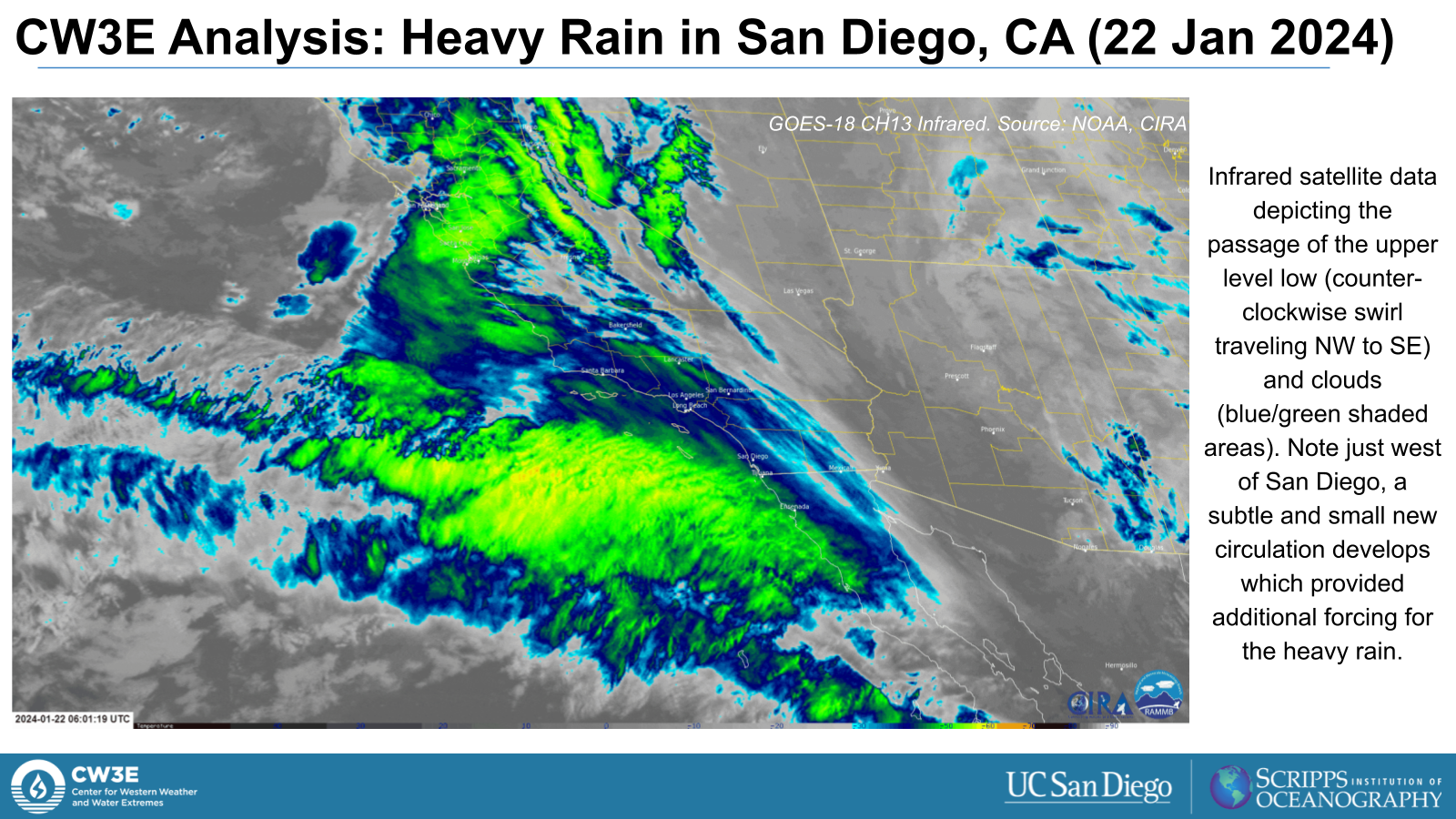
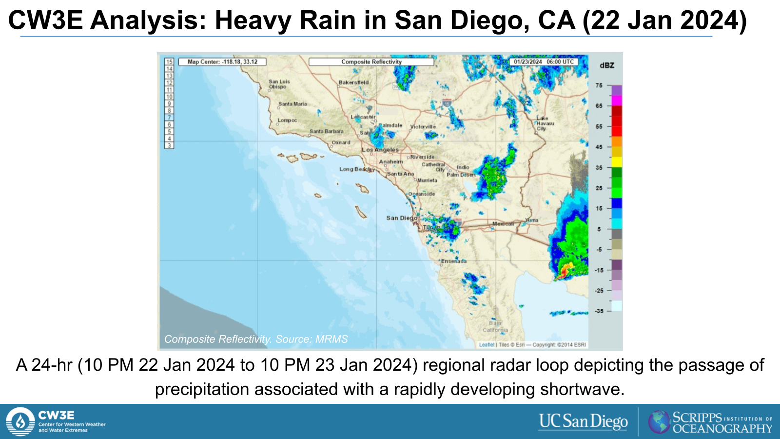
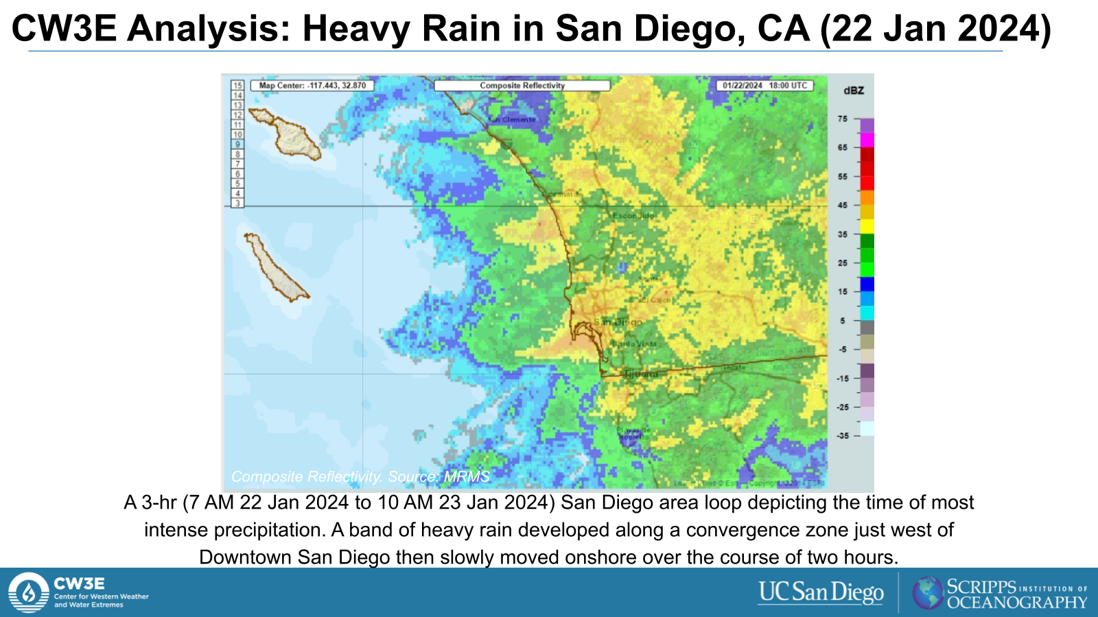
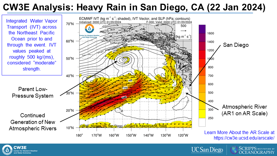
Low Pressure System Brings Heavy Precipitation to Southern California

  • A low pressure system that formed in the Gulf of Alaska south of the Aleutian Islands on Mon 18 Dec progressed down the US West Coast through this week, approaching California late Tue 19 Dec
  • The system brought elevated moisture levels from the southern Pacific as it propagated down the CA coast, resulting in heavy precipitation across much of Southern California on Wed 20 Dec into Thu 21 Dec
  • The third and strongest AR produced AR3/AR4 conditions (based on the Ralph et al. 2019 AR Scale) over coastal WA/OR, as well as AR2 conditions in portions of the interior Pacific Northwest.
  • There were numerous flood reports in both Santa Barbara and Ventura counties, including reports of multiple feet of water over roadways, inundated lanes, and mud/other debris covering streets.
  • As a results of the short duration, high intensity precipitation, low lying areas became inundated with water, flooding homes and businesses in Oxnard & Port Hueneme, California requiring numerous water rescues.

Click images to see loops of GFS IVT/IWV analyses

Valid: 0000 UTC 12 December – 0000 UTC 23 December 2023


Summary provided by M. Steen, S. Bartlett, and P. Iniguez; 21 Dec 2023

To sign up for email alerts when CW3E post new AR updates click here.

CW3E Subseasonal Outlook: 20 December 2023

CW3E Subseasonal Outlook: 20 December 2023

December 20, 2023

Click here for a pdf of this information.


Summary provided by J. Wang, C. Castellano, Z. Yang, M. DeFlorio, and J. Kalansky; 20 December 2023

To sign up for email alerts when CW3E post new AR updates click here.

*Outlook products are considered experimental

CW3E AR Update: 20 December 2023 Outlook

CW3E AR Update: 20 December 2023 Outlook

December 20, 2023

Click here for a pdf of this information.

Atmospheric River Forecast for US West Coast Landfall on Christmas

  • An Atmospheric River (AR) is forecast to make landfall in the Pacific Northwest (PNW) early Mon 25 Dec and continue through Wed 27 Dec.
  • The GEFS control run is forecasting AR3 to AR4 conditions (based on Ralph et al. 2019 AR scale) for the PNW.
  • Due to the long lead time with this event, there is uncertainty in the AR landfall timing and duration in the GEFS, ECMWF EPS and West-WRF Ensemble.
  • The NWS Weather Prediction Center (WPC) is currently forecasting 3-day precipitation totals ≥ 2” with highest precipitation totals over the Olympic Peninsula and CA/OR border.
  • The NWS Climate Prediction Center’s Day 8-14 Hazard Outlook shows risks of heavy precipitation, heavy snow and high winds for Northern CA from 12/27 through 12/30.

Click images to see loops of GFS IVT and IWV forecasts

Valid 0600 UTC 24 December 2023 – 0000 UTC 28 December 2023


Summary provided by M. Steen, S. Bartlett, and S. Roj; 20 December 2023

To sign up for email alerts when CW3E post new AR updates click here.

*Outlook products are considered experimental