CW3E AR Update: 10 January Summary and Outlook
January 10, 2019
Click here for a pdf of this information.
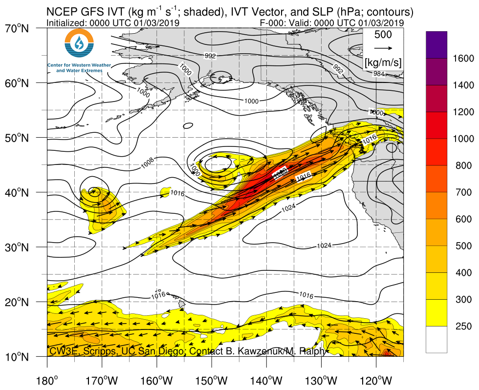
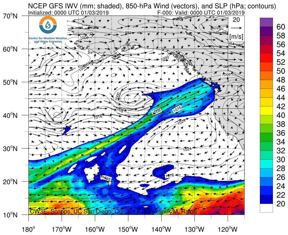
Several ARs have made landfall over the U.S. West Coast over the past week
- A strong AR made landfall over the PNW on 3-4 January, followed by a short lived moderate strength AR over much of the U.S. West Coast on 4-5 Jan, and a third AR made landfall on 8-9 January with moderate strength.
- The 7 day accumulated precipitation from the three systems was over 300 mm over the Olympic Mountains and over 200 mm over the Coastal and Sierra Nevada Mountains in CA.
- These short lived ARs are part of an active pattern over the North Pacific Ocean that will continue to produce ARs for the next several days.
Click IVT or IWV image to see loop of 0-hour GFS analysis Valid 0000 UTC 3 January – 0000 UTC 10 January 2019 |
|
 |
 |
SSMI/SSMIS/AMSR2-derived Integrated Water Vapor (IWV)
Valid 1200 UTC 6 January – 1200 UTC 10 January 2019
Images from CIMSS/Univ. of Wisconsin
NEXRAD Radar Reflectivity
Valid 0000 UTC 5 January – 1200 UTC 10 January 2019
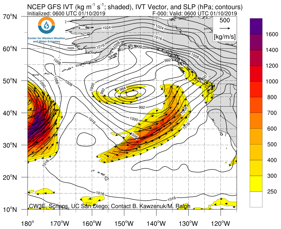
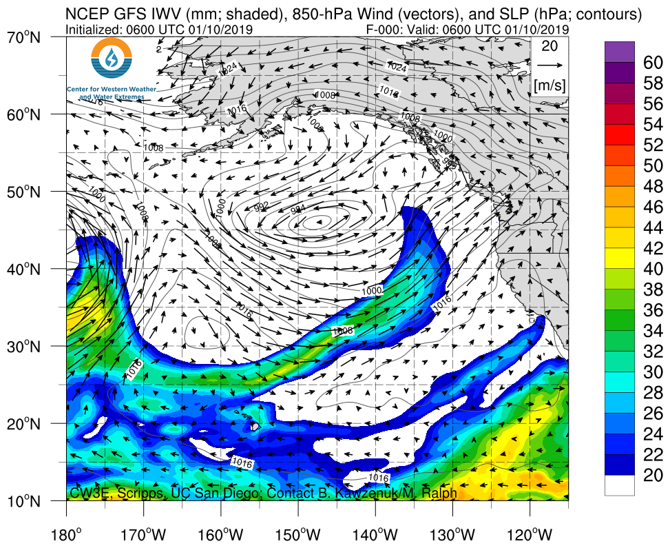
Multiple ARs forecast impact the US West Coast over the next several days
- A weak-to-moderate AR is expected to make landfall over the U.S. West coast over the next two days.
- This AR is expected to make landfall with a southerly orientation limiting precipitation accumulations.
- A closed low system followed by a second AR are expected to produce up to 5 inches of precipitation over CA during 14-17 January.
- Forecast confidence in the strength and timing of AR conditions during the second AR is currently low.
- The GEFS is suggested additional AR activity over the U.S. West Coast in the long range forecast (19-20 January).
Click IVT or IWV image to see loop of 0-168 hour GFS forecasts Valid 0600 UTC 10 January – 1800 UTC 17 January 2019 |
|
 |
 |
Summary provided by B. Kawzenuk, J. Kalansky, C. Hecht, and F. M. Ralph; 2 PM PT 10 January 2019


