
CW3E AR Update: 20 October 2021 Outlook
October 20, 2021
Click here for a pdf of this information.
Multiple Atmospheric Rivers to Bring Heavy Precipitation to Northern California
- A series of landfalling atmospheric rivers (ARs) will impact the western US this week into early next week
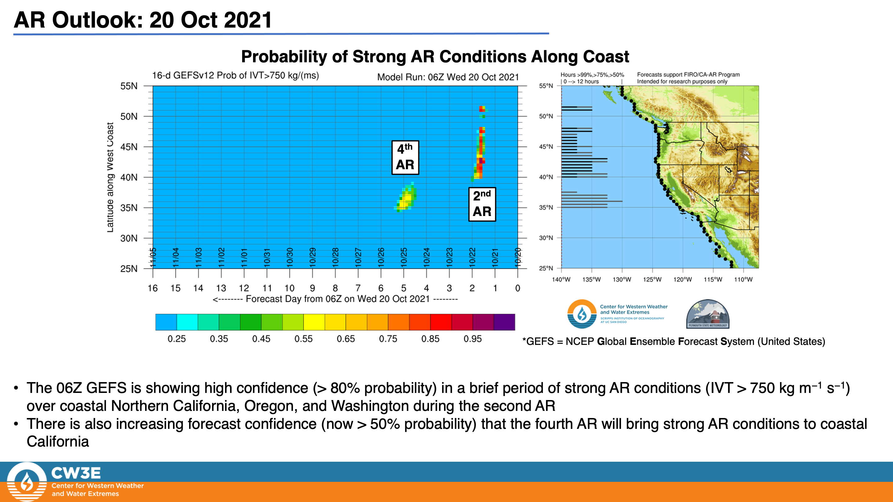
- AR 4/AR 5 conditions (based on the Ralph et al. 2019 AR Scale) are expected in coastal southern Oregon in association with the first and second ARs today through Friday
- The strongest AR is forecasted to make landfall across Central and Northern California on Sunday, potentially bringing AR 4/AR 5 conditions to the San Francisco Bay Area
- Inland penetration of this AR may bring AR 2/AR 3 conditions to portions of the interior western US
- Yet another landfalling AR is forecasted to impact the US West Coast on 26–27 Oct
- The first two ARs are forecasted to produce 2–5 inches of rainfall in portions of Northern California and southern Oregon
- The fourth AR is forecasted to bring widespread precipitation to much of the western US, with the heaviest precipitation amounts in Northern California
- Significant snowfall accumulations are also possible in the Sierra Nevada in association with the fourth AR
- Portions of Northern California may receive more than 10 inches of total precipitation over the next 7 days
Click images to see loops of GFS IVT & IWV forecasts Valid 1200 UTC 20 October – 1200 UTC 28 October 2021 |
|
 |
 |


Summary provided by C. Castellano, C. Hecht, B. Kawzenuk, J. Kalansky, and F. M. Ralph; 20 October 2021
To sign up for email alerts when CW3E post new AR updates click here.
*Outlook products are considered experimental