CW3E Event Summary: 5-10 April 2020
April 15, 2020
Click here for a pdf of this information.
Unsettled weather pattern brings record precipitation to Southern California
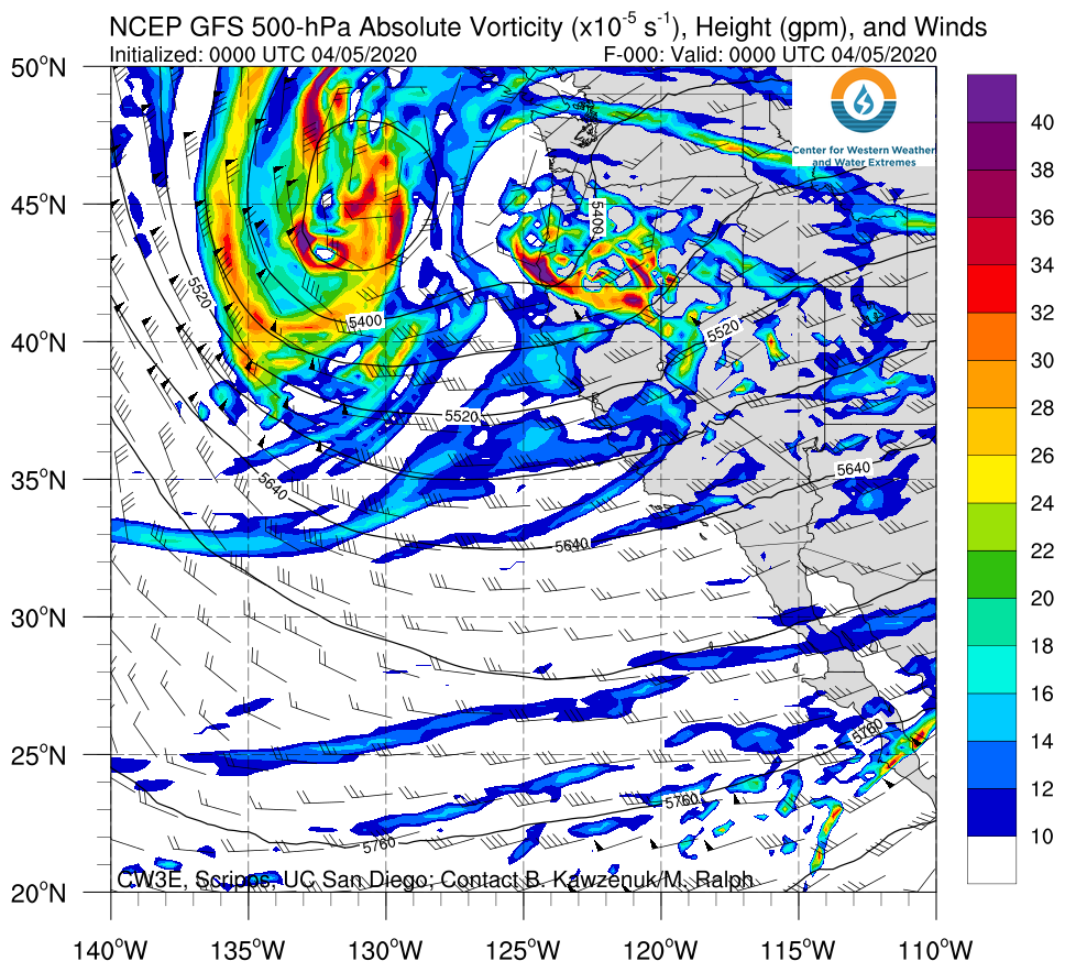
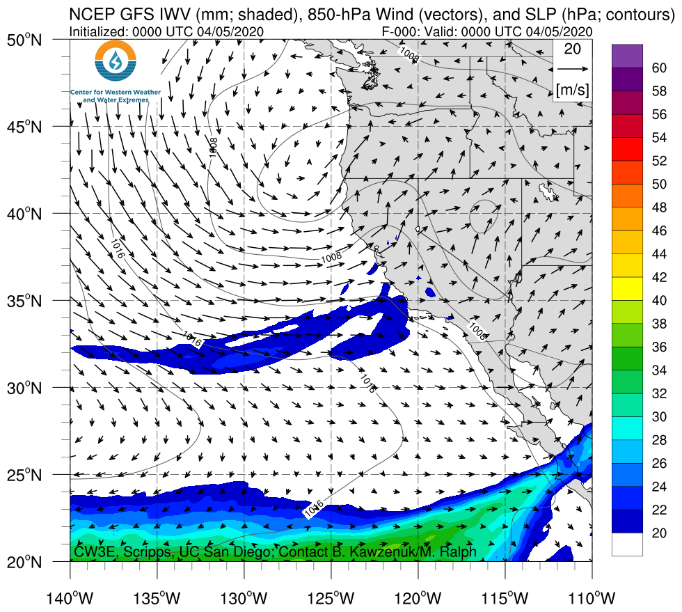
- Multiple episodes of heavy rainfall during 5–10 Apr were associated with a cutoff low near the U.S. West Coast
- More than 2 inches of precipitation fell over a large portion of Southern California, with the highest amounts (> 6 inches) in the Transverse Ranges and northern San Diego County
- Significant snowfall (> 12 inches) occurred in the higher elevations of the Transverse Ranges
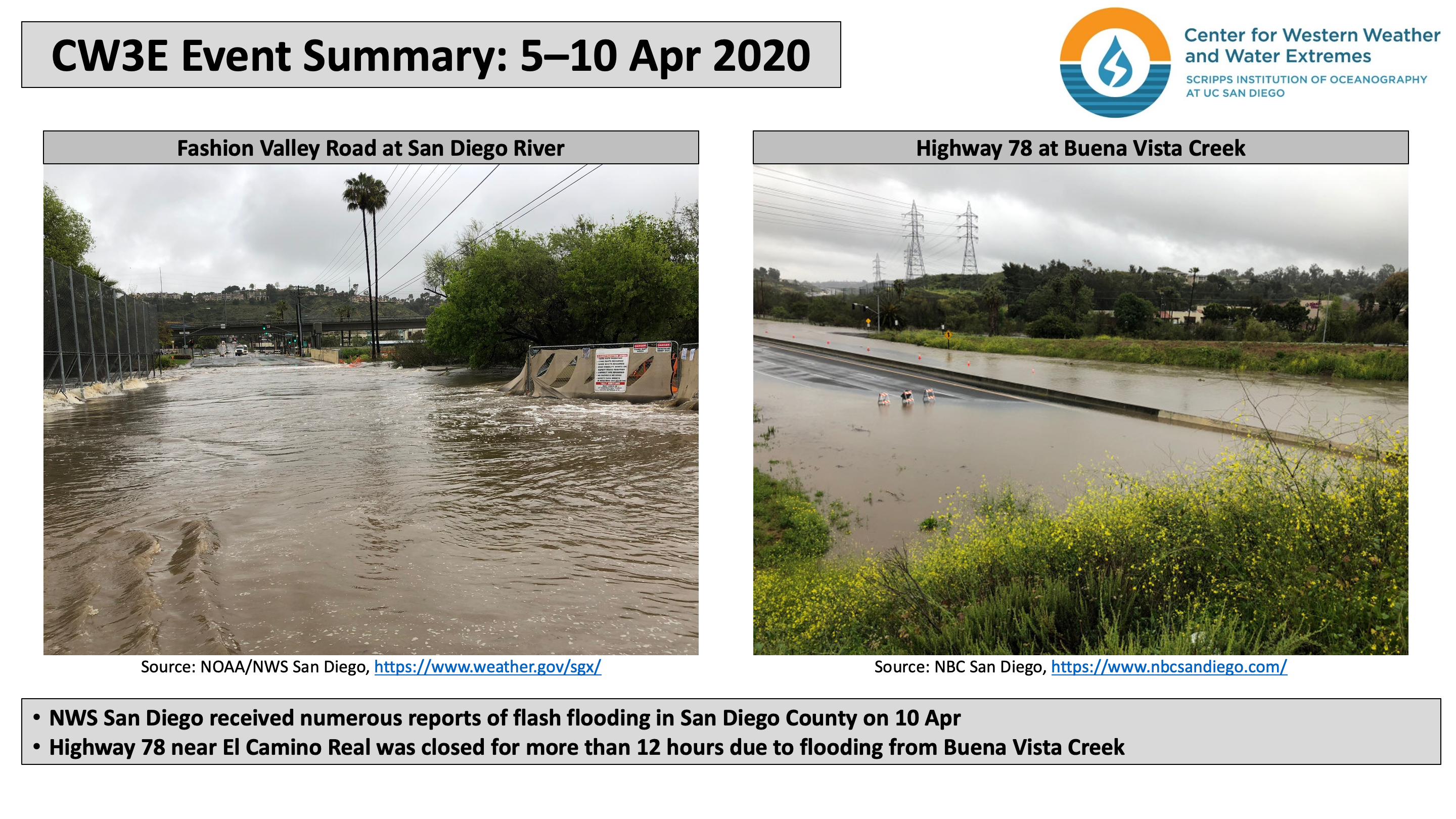
- Intense rainfall resulted in flash flooding throughout San Diego County on 10 Apr
Click 500-hPa Absolute Vorticity or IWV image to see loop of GFS analyses Valid 0000 UTC 5 April – 1200 UTC 11 April 2020 |
|
 |
 |
Summary provided by C. Castellano, C. Hecht, J. Kalansky, B. Kawzenuk, and F. M. Ralph; 15 April 2020


