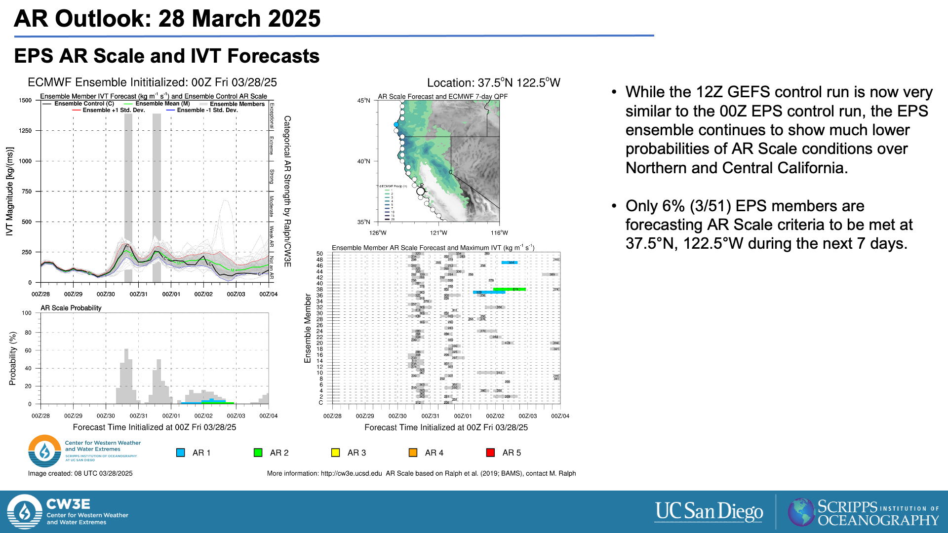
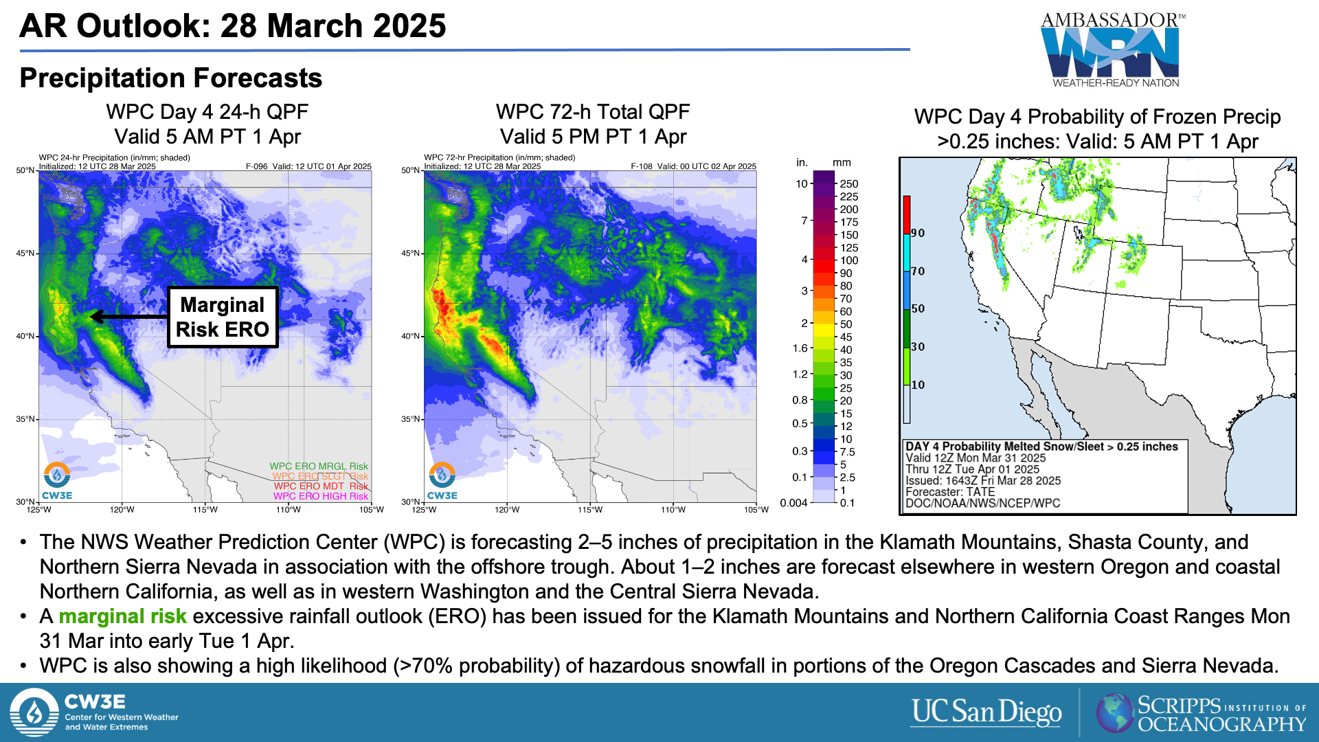
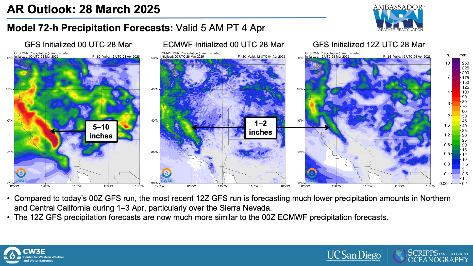
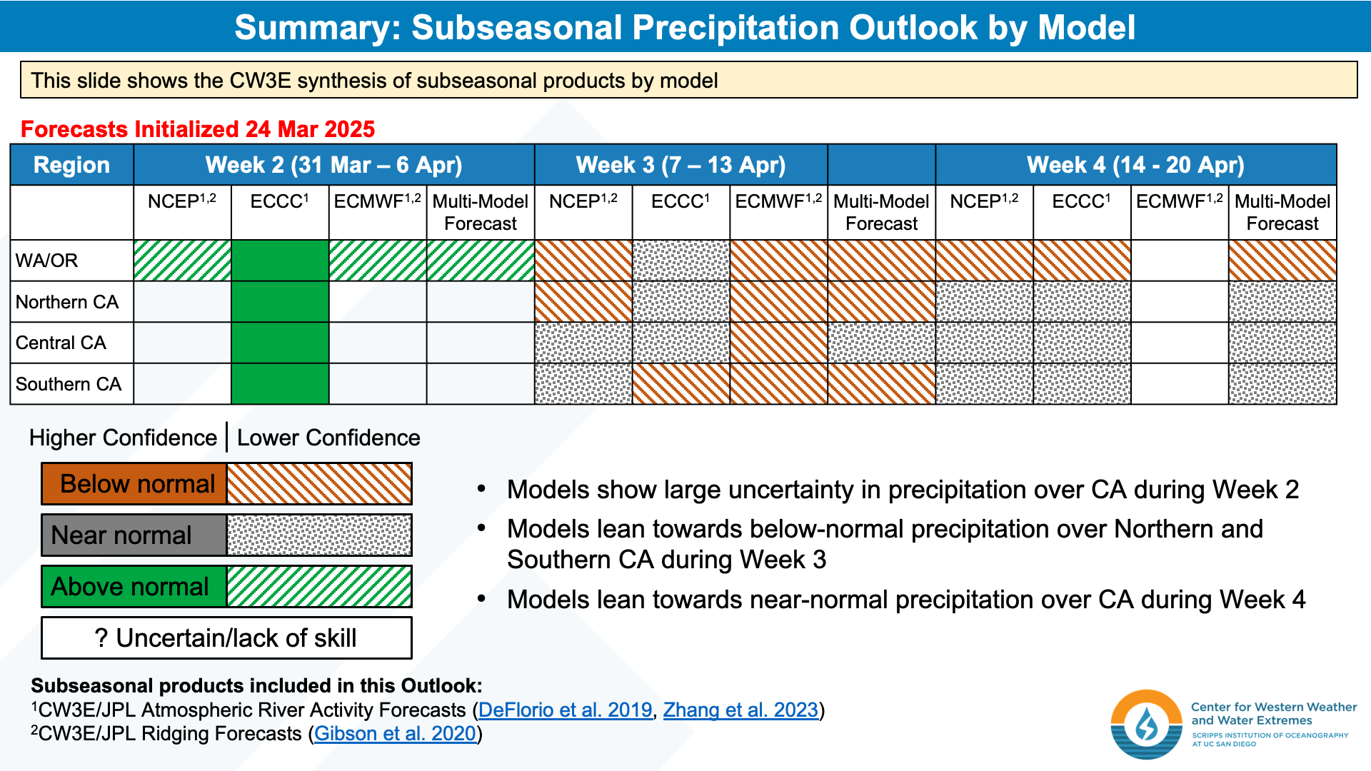
CW3E Publication Notice
Kickoff of a Joint AMS/ASCE Effort to Assess the Potential Contribution of AI in Addressing Infrastructure Resilience in a Changing Climate
June 10, 2025
CW3E staff recently co-authored a journal article titled “Kickoff of a joint AMS/ASCE effort to assess the potential contribution of AI in addressing infrastructure resilience in a changing climate” in the Bulletin of the American Meteorological Society. This paper was led by Jason Giovannettone, Climate and Sustainability Director at Sisters of Mercy of the Americas, among co-authors across institutions including Anna Wilson (CW3E), Teng Wu (University at Buffalo), and ZhiQiang Chen (University of Missouri-Kansas City). This meeting summary is motivated by the desire to connect scientists and engineers from two organizations, the American Meteorological Society (AMS) and the American Society of Civil Engineers (ASCE), both working towards understanding potential uses of Artificial Intelligence (AI) in addressing climate resiliency. This work aligns with CW3E’s strategic goal to develop AI-based predictive capabilities for extreme weather associated with atmospheric rivers (ARs).
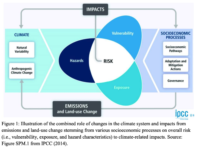
Figure 1. Illustration of the combined role of changes in the climate system and impacts from emissions and land-use change stemming from various socioeconomic processes on overall risk (i.e., vulnerability, exposure, and hazard characteristics) to climate-related impacts. Source: Figure SPM.1 from IPCC (2014).
To support building robust connections between the two organizations, AMS Water Resources Committee (WRC) and the ASCE Technical Committee on Future Weather and Climate Extremes (FWCX) virtually hosted webinars on three consecutive Thursdays in November 2024. Specifically, the two groups wanted to collaborate more openly on the use of AI in the following:
- Monitoring, predicting, and attributing climatic and extreme meteorological and hydrological events in terms of their intensity, duration, and location.
- Applications that support resilient infrastructure design to withstand extreme events under a changing climate.
The host organizations also acknowledged that such questions must be addressed with a multidisciplinary audience, and targeted an audience which spanned academic, government, private, and non-profit sectors amongst the fields of meteorology, climatology, planning, designing, decision-making, reservoir operations, research, science, and engineering. These webinars hosted talks covering topics relating to current and potential future impacts that AI might have on the improvement of extreme weather event prediction as well as contributions of AI to improvements in design and operations of water resources infrastructure under a changing climate. Speakers included academics and industry leaders, including CW3E’s Director of Research Luca Delle Monache (in Webinar 2). Webinars had up to 213 participants and are archived on the AMS website. Each session included two presenters and allowed participants time to ask questions both online and offline.
This webinar series was the first of more collaborative activities between AMS WRC and ASCE FWCX. As part of organizing the webinar series, AMS and ASCE developed a Memorandum of Understanding, which the authors hope will enable future partnership efforts. The organizations are interested in hosting more joint webinars and pursuing other collaborative mediums such as joint publication of peer-reviewed journal articles, joint sessions at conferences, and joint project coordination related to the use of AI in extreme weather and hydrologic events prediction as well as water resources infrastructure design and operation.
Giovannettone, J., Wilson, A., Wu, T., & Chen, Z. (2025). Kickoff of a Joint AMS/ASCE Effort to Assess the Potential Contribution of AI in Addressing Infrastructure Resilience in a Changing Climate. Bulletin of the American Meteorological Society, 106(6), E1045-E1051. https://doi.org/10.1175/BAMS-D-25-0077.1