CW3E Event Summary: 9-12 December 2022
December 14, 2022
Click here for a pdf of this information.
Atmospheric River with Strong Dynamical Forcing Produced Heavy Precipitation Throughout California
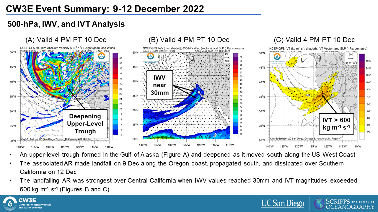
- An upper-level trough over the Gulf of Alaska on 9 December deepened along the US West Coast producing a landfalling atmospheric river (AR) and heavy orographic precipitation
- The landfalling AR was ranked as an AR2 (based on the Ralph et al. 2019 AR Scale) along the Oregon coast and an AR1 along the Central California coast
- The deterministic GFS struggled to forecast the AR location, magnitude, and orientation at lead times > 3 days
- The storm produced heavy precipitation along the Central California coast between the San Francisco Bay area and Santa Barbara
- Mining Ridge received 12.80 inches of precipitation over a 72-hour period ending 9 AM 12 Dec; an R-Cat 2 according to the Ralph and Dettinger (2012) classification
- The largest snowfall totals (> 6 feet) were observed across the higher terrain of the Sierra Nevada with the Klamath mountains receiving 1-3 feet of snowfall
- CW3E’s surface meteorology station at Seven Oaks Dam observed 1 inch of rain during the event. Approximately 20% of water year normal precipitation has fallen at the station
- Recent storms in California have been cold, efficient snow producers leading to a discrepancy between water year to date precipitation and current snowpack in the Sierra Nevada
- The AR resulted in multiple rainfall-related swift water rescues, snowfall-related road closures, and dangerous backcountry avalanche conditions
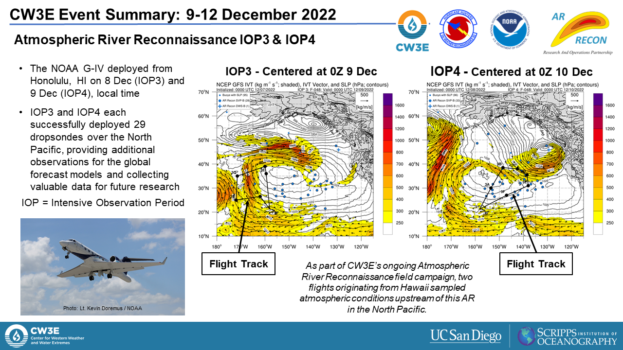
- As part of CW3E’s ongoing Atmospheric River Reconnaissance research field campaign, two flights originating from Hawaii sampled atmospheric conditions upstream of this AR in the North Pacific
|
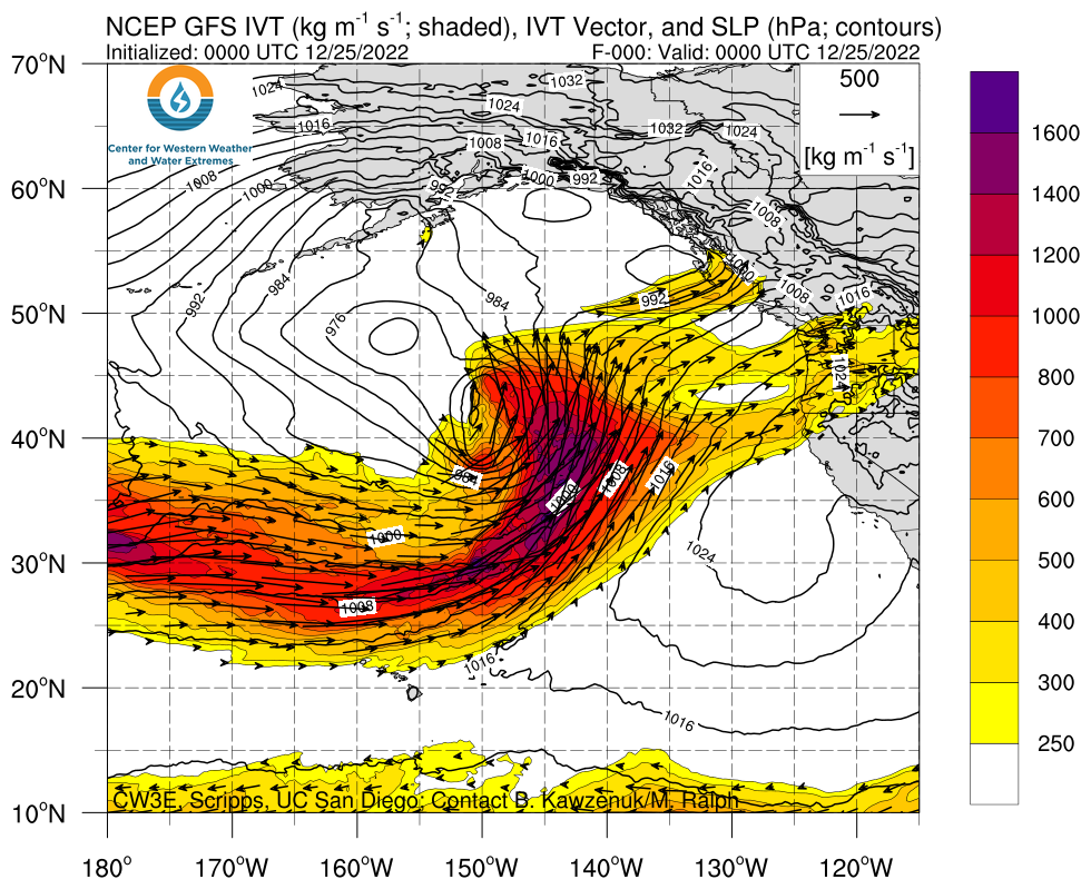
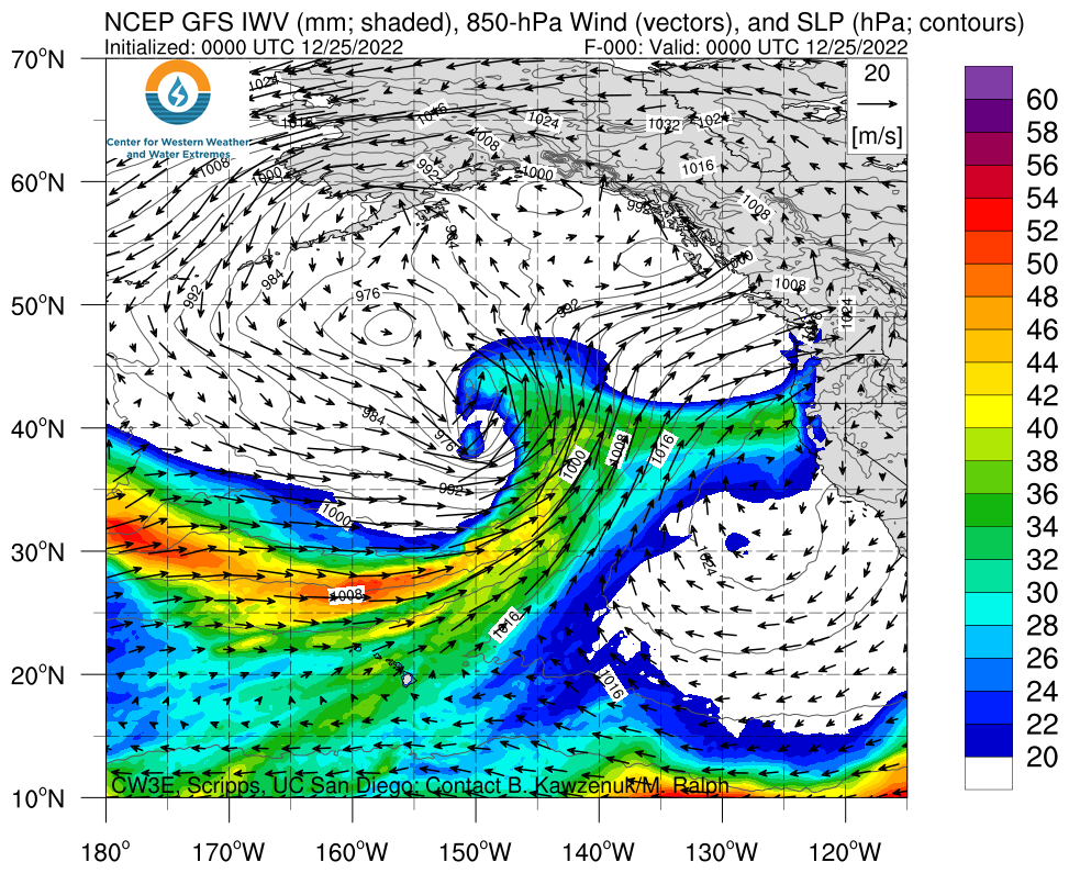
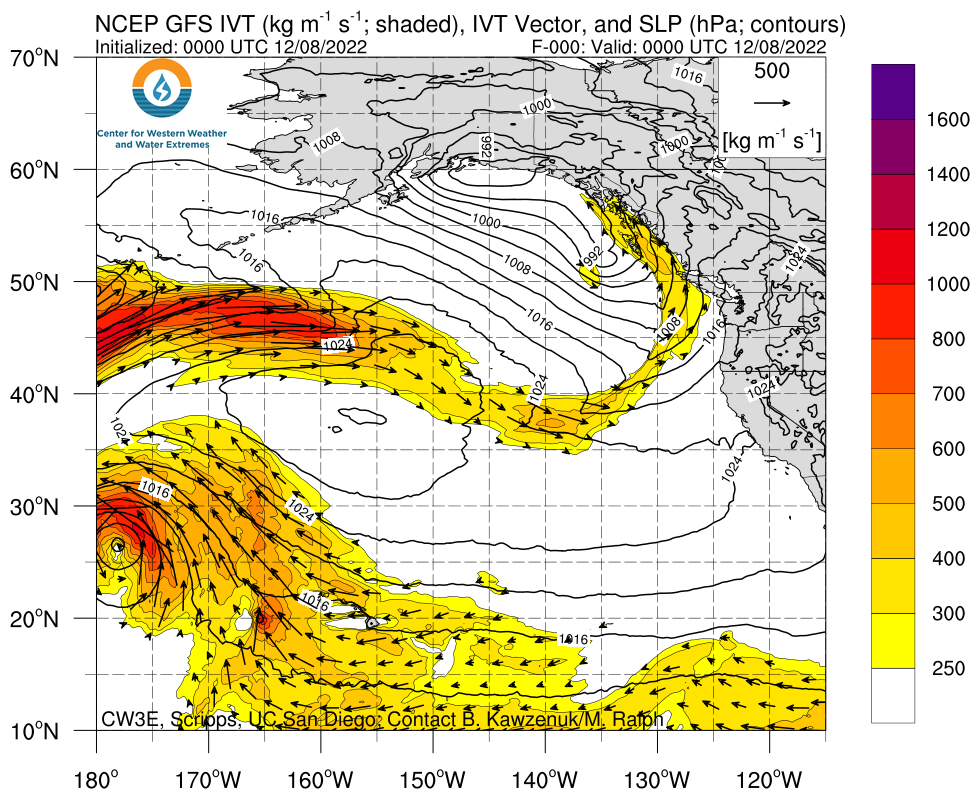
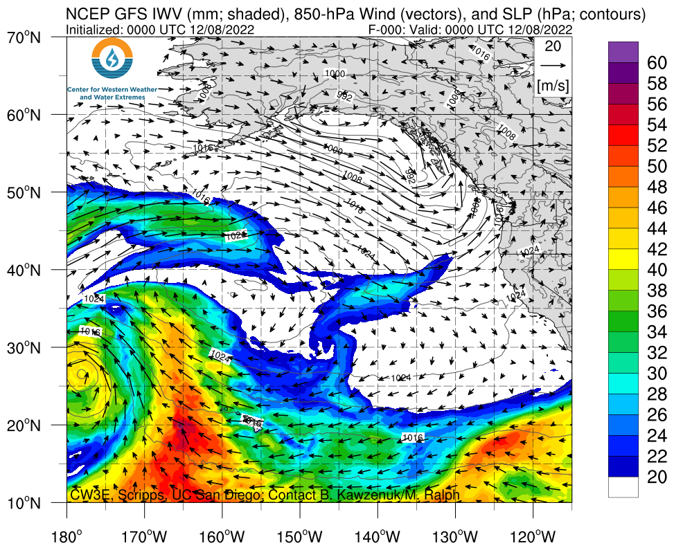
Click images to see loops of NAM IVT/IWV analyses
Valid 0000 UTC 8 December – 1800 UTC 12 December 2022
|
|
|


Summary provided by Shawn Roj, Samuel Bartlett, Matthew Steen, Jay Cordeira, Jon Rutz, Chris Castellano, J. Kalansky, B. Kawzenuk, F.M. Ralph; 14 Dec 2022
To sign up for email alerts when CW3E post new AR updates click here.
*Outlook products are considered experimental