CW3E Welcomes Sarah Ogle

CW3E Welcomes Sarah Ogle

October 8, 2020

Sarah Ogle joined CW3E as a Climate Science Ph.D. student in September 2020. She received a B.S. in Geology from Carleton College in 2019. Native to San Diego, she’s excited to be back in her hometown for graduate school even though she enjoyed watching fabulous thunderstorms and walking to class when it felt like -50ºF in Minnesota.

Sarah has been fascinated by weather ever since she was four years old and her mom taught her numbers by looking at the weather page in the newspaper. This developed Sarah’s interest in weather, climate and the natural world ultimately leading her to decide to start a PhD in climate science.

Sarah is no stranger to Scripps Institution of Oceanography (SIO) as she interned at SIO every summer in college. She worked with Dr. Lynne Talley for three summers and she researched air-sea fluxes in the Southern Ocean. In 2018, she worked at CW3E and researched her senior thesis on atmospheric rivers and their effects on landslides in Washington State.

After graduating from Carleton, Sarah worked at the United States Geological Survey (USGS) for a year on projects that seek to understand and model the geology and water resources of San Diego, Anza, Santa Monica, and Whittier. During this year, Sarah also coached football and spent time with her family. Throughout her PhD, Sarah hopes to continue working on California water resources research at CW3E as this combines her geology background with her climate science Ph.D. while allowing her to address pressing water resources issues in her home state.

CW3E AR Update: 7 October 2020 Outlook

CW3E AR Update: 7 October 2020 Outlook

October 7, 2020

Click here for a pdf of this information.
Update on Atmospheric Rivers Forecast to Impact the US West Coast

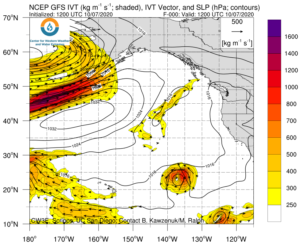
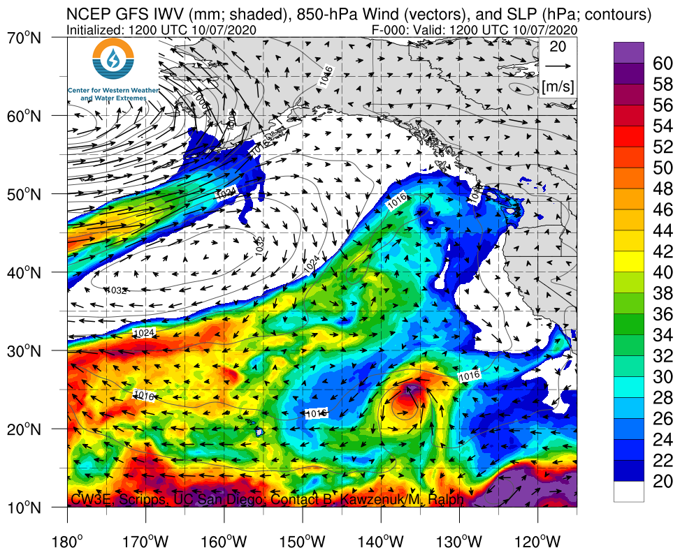
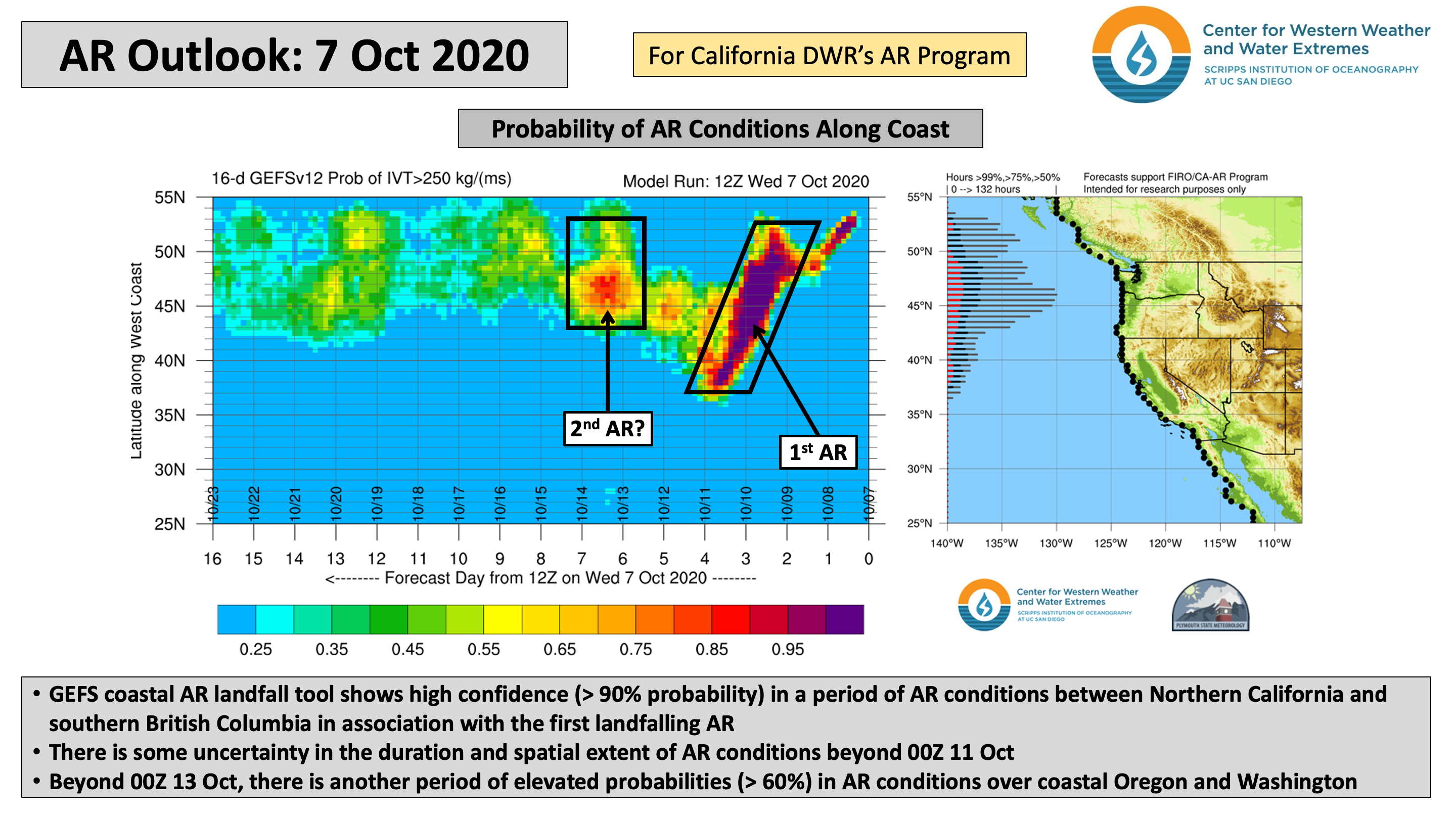
  • A unique large-scale flow regime is forecast to result in the landfall of two separate but concurrent ARs over the USWC
  • Current forecasts suggest the possibility of an AR 2/AR 3 between extreme Northern California and Washington in association with the first landfalling AR, but there is some uncertainty in the timing, duration, and magnitude of AR conditions
  • The GFS and ECMWF are forecasting at least 1–3 inches of precipitation across western Washington and Oregon during the next 5 days, with higher amounts possible over the Olympic Mountains and North Cascades
  • Unfortunately, little precipitation is expected in California, where many large fires are still active

Click images to see loops of GFS IVT/IWV analyses and forecasts

Valid 1200 UTC 7 October – 1200 UTC 15 October 2020


Summary provided by C. Castellano, J. Kalansky, and F. M. Ralph; 7 October 2020

*Outlook products are considered experimental

CW3E AR Update: 5 October 2020 Outlook

CW3E AR Update: 5 October 2020 Outlook

October 5, 2020

Click here for a pdf of this information.

Update on Atmospheric Rivers Forecast to Bring Precipitation to the US West Coast

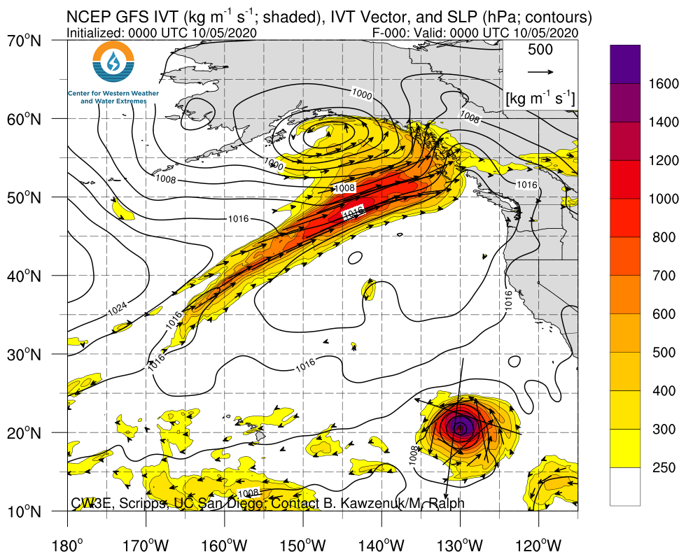
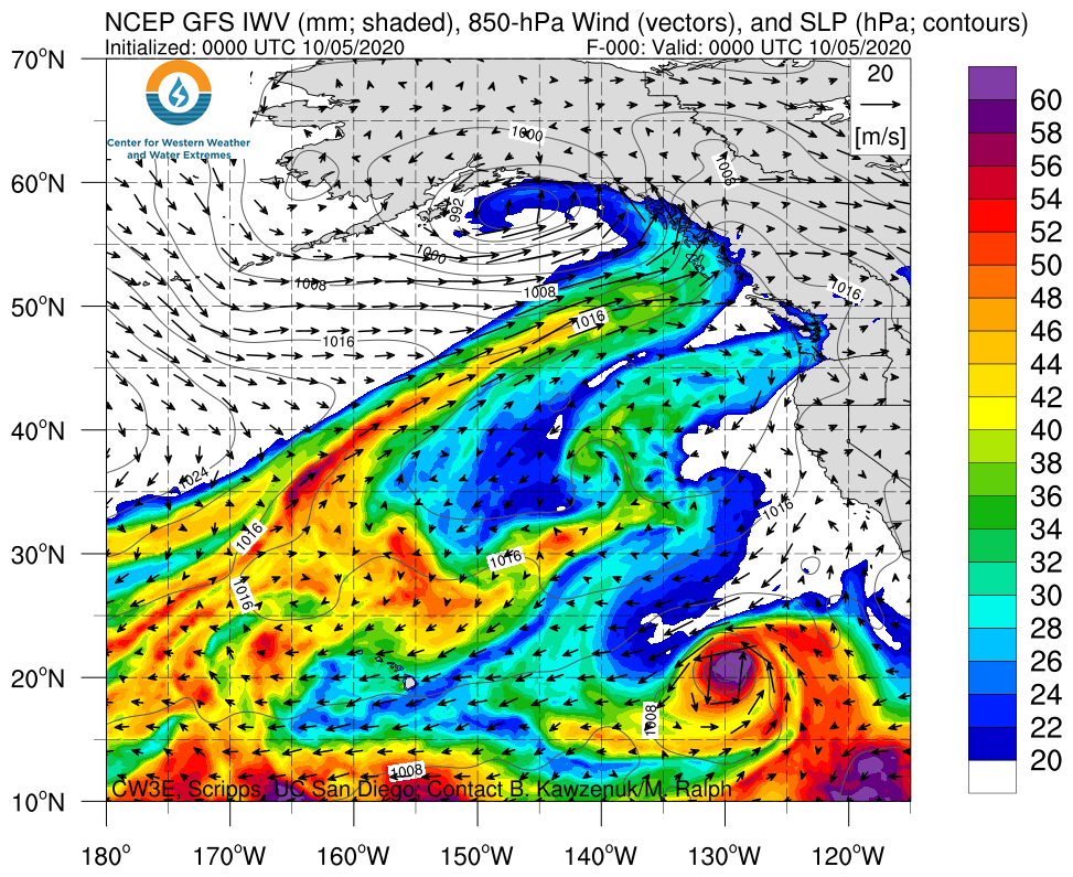
  • A unique large-scale flow regime is forecast to result in the landfall of two separate but concurrent ARs over the USWC
  • Current forecasts suggest that IVT magnitudes over southern Oregon may reach 500 kg m–1 s–1 while AR conditions are forecast to last ~27 hours, resulting in AR 2 conditions
  • There is currently a large amount of uncertainty in the forecast, which is resulting in a large spread of potential outcomes
  • The GFS, ECMWF, and NBM are forecasting different precipitation accumulations from Washington to Northern CA
  • Due to the numerous fires currently burning across California, this precipitation in the forecast may bring much needed relief to extremely dry conditions

Click images to see loops of GFS IVT/IWV analyses and forecasts

Valid 0000 UTC 5 October – 1800 UTC 14 October 2020


Summary provided by C. Hecht, C. Castellano, J. Kalansky, and F. M. Ralph; 5 October 2020

*Outlook products are considered experimental

CW3E Event Summary: 23-27 September 2020

CW3E Event Summary: 23-27 September 2020

September 29, 2020

Click here for a pdf of this information.

Active weather pattern brings first major precipitation event of the season to the Pacific Northwest

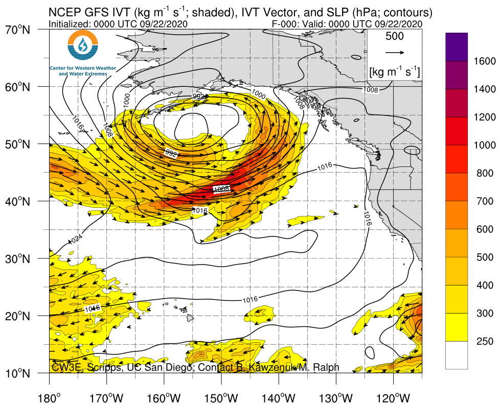
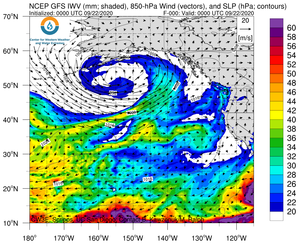
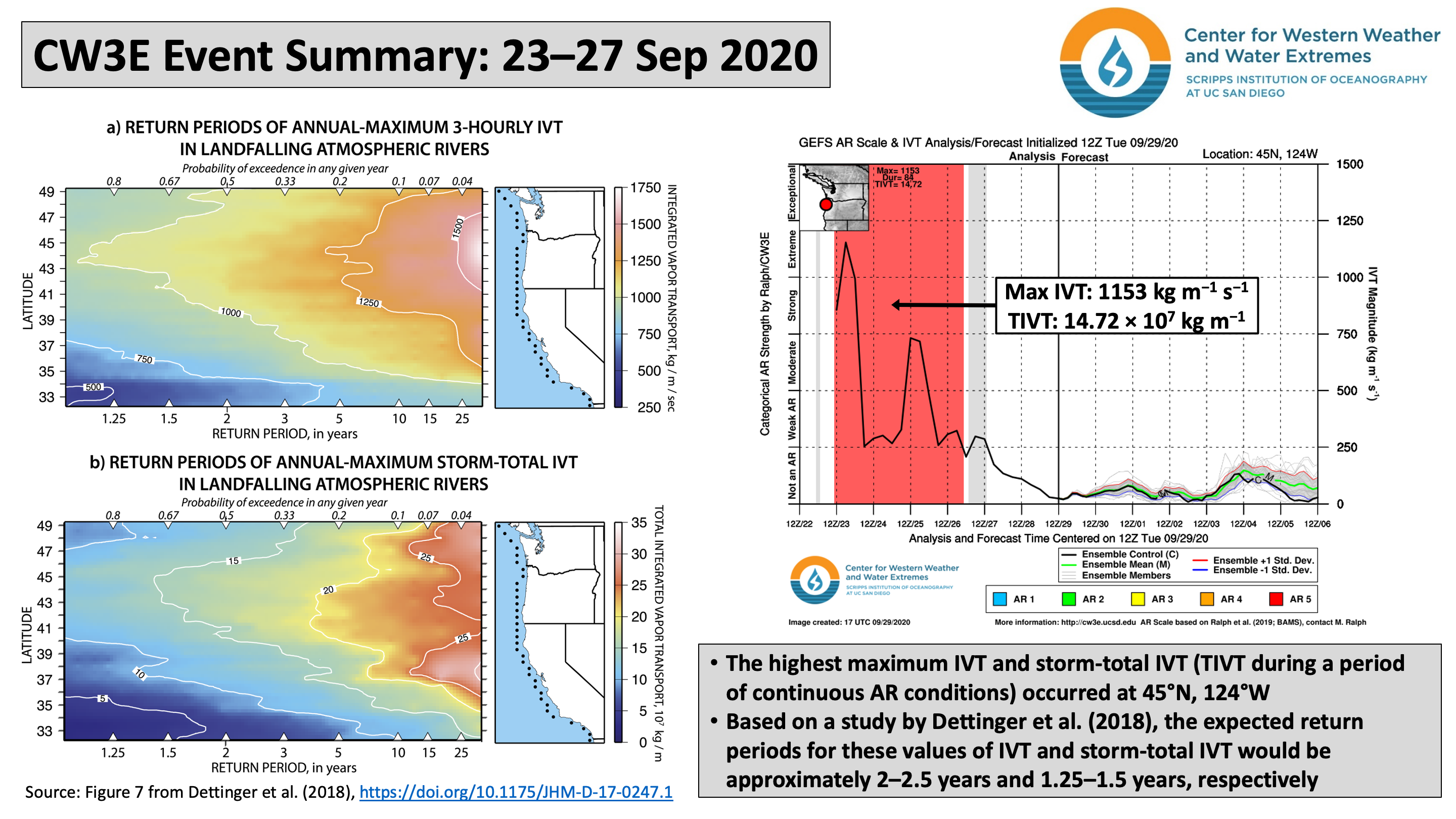
  • A family of landfalling ARs produced heavy rainfall across western North America during 23–27 Sep
  • Some locations along the northwestern coast of Oregon experienced AR5 conditions [based on the Ralph et al. (2019) AR scale]
  • Total estimated 7-day precipitation ending 28 Sep exceeded 2 inches across most of western Washington and northwestern Oregon, with more than 5 inches (locally > 10 inches) in the Olympic Mountains and North Cascades

Click images to see loops of GFS IVT/IWV analyses

Valid 0000 UTC 22 September – 0000 UTC 28 September 2020


Summary provided by C. Castellano, J. Kalansky, B. Kawzenuk, and F. M. Ralph; 29 September 2020

CW3E Welcomes Linghan Li

CW3E Welcomes Linghan Li

September 29, 2020

Linghan Li joined CW3E as a Research Data Analyst in September 2020. Linghan received her PhD in Oceanography from Scripps Institution of Oceanography, University of California, San Diego, under the guidance of Art Miller. She also holds a MS in Space Physics from Chinese Academy of Sciences and a BE in Electrical Engineering from Wuhan University. Linghan’s PhD dissertation focused on sea ice variability in the Bering Sea, including its atmospheric and oceanic dynamic and thermodynamic controls, using global and regional ocean/ice models and satellite observations. After completing her dissertation, she worked on several coastal ocean modeling projects as a Research Associate at University of Washington.

In her new position at CW3E, Linghan will study ocean-atmosphere interactions, particularly relating to the understudied field of local and remote ocean influences on atmospheric river (AR) evolution and predictability. In this regard, her research will also explore the current ability of coupled models to represent AR evolution over the global oceans via satellite remote sensing and field campaign data. Collectively, these efforts target the improved understanding and forecasting of ARs and their impacts in the western US and globally. Beyond her primary research on ocean-atmosphere interactions, Linghan will also support an ongoing assessment of California climate variability and change in collaboration with scientists in California-Nevada Climate Applications Program.

CW3E AR Update: 24 September 2020 Outlook

CW3E AR Update: 24 September 2020 Outlook

September 24, 2020

Click here for a pdf of this information.

Update on Active Period of Atmospheric Rivers over the Pacific Northwest

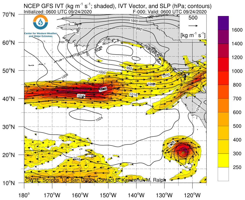
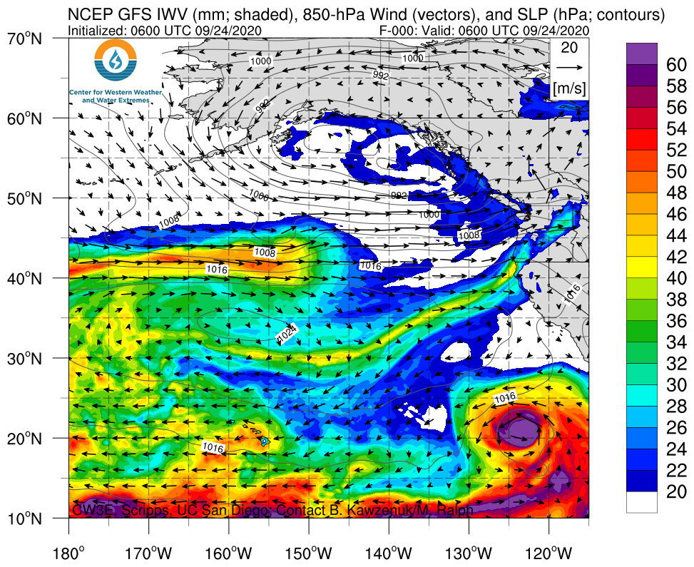
  • As an AR is currently impacting the Pacific Northwest, two additional ARs are forecast to bring precipitation to the region and British Columbia
  • Current forecasts suggest that IVT magnitudes over northern Oregon may not drop below 250 kg m–1 s–1, which would result in total AR condition duration of ~75 hours
  • The combination of strong IVT magnitudes and long durations results in an AR 5 on the AR Scale (Ralph et al. 2019)
  • Since this is an early season AR and soil moisture across the PNW is dry, impacts associated with these ARs may not be as hazardous as an AR of similar strength that makes landfall in the middle of winter
  • As much as 7 inches of precipitation has already fallen over the Cascade Mountains of northern Washington and an additional 4–5 inches is forecast to fall during the next period of AR activity

GOES-17 PACUS Domain GeoColor

Valid 0000 UTC 22 September – 1200 UTC 24 September 2020


Click images to see loops of GFS IVT/IWV analyses and forecasts

Valid 1200 UTC 24 September – 1200 UTC 04 October 2020

Forecasting an active week of ARs in the PNW


Summary provided by C. Hecht, B. Kawzenuk, J. Kalansky, and F. M. Ralph; 21 September 2020

*Outlook products are considered experimental

Virtual Happy Hour: CW3E Post-Doc Appreciation

CW3E Launches Public Subseasonal-to-Seasonal (S2S) Experimental Forecast Webpage for Winter 2020-2021

September 24, 2020

In honor of National Post Doc Appreciation Week, CW3E got together to appreciate and celebrate all of our post-docs during a virtual happy hour. We are extremely fortunate to have a group of such smart, motivated, and collaborative post-docs. Thank you all for your many valuable contributions to CW3E!

Our current CW3E post-docs are:

William (Ty) Brandt, PhD

Tom Corringham, PhD

Negin Hayatbini, PhD

Ellen Knappe, PhD

Nora Mascioli, PhD

Allison Michaelis, PhD

Alison Cobb, PhD

CW3E Event Summary: 14-18 September 2020

CW3E Event Summary: 14-18 September 2020

September 22, 2020

Click here for a pdf of this information.

Landfalling AR and Cutoff Low bring much-needed rainfall and improved air quality to the Pacific Northwest

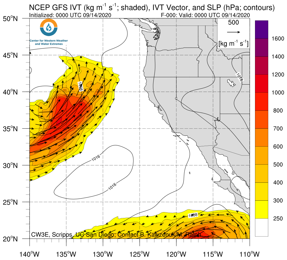
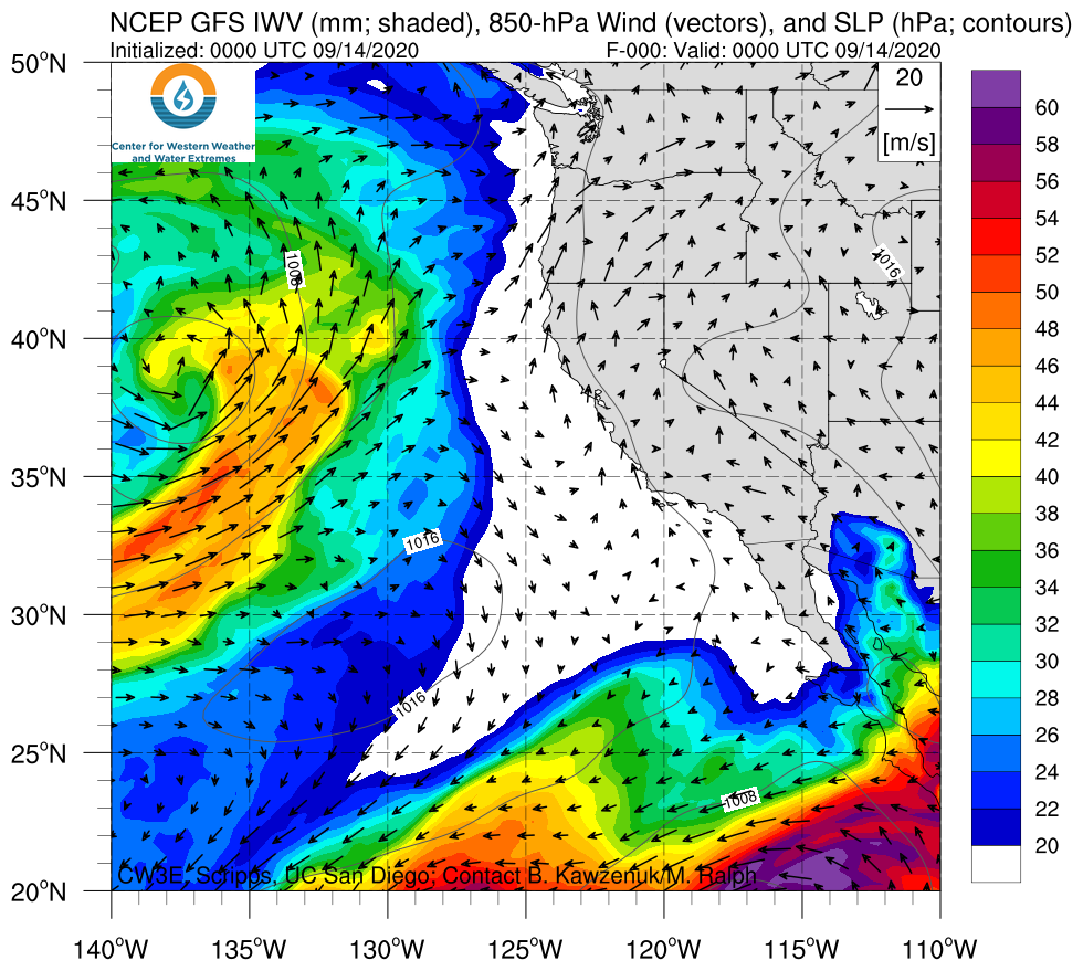
  • A landfalling AR and cutoff low produced light-to-moderate precipitation (0.50–2 inches) over portions of western Washington and Oregon
  • Weak-to-moderate AR conditions persisted for more than 48 consecutive hours along the Oregon coast [AR3 based on the Ralph et al. (2019) AR Scale]
  • Precipitation and changes in wind direction and humidity significantly improved the air quality and alleviated the wildfire threat in western Washington and Oregon

Click images to see loops of GFS IVT/IWV analyses

Valid 0000 UTC 14 September – 0000 UTC 21 September 2020


Summary provided by C. Castellano, C. Hecht, J. Kalansky, N. Oakley, and F. M. Ralph; 22 September 2020

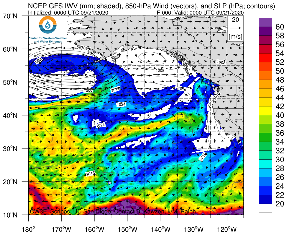
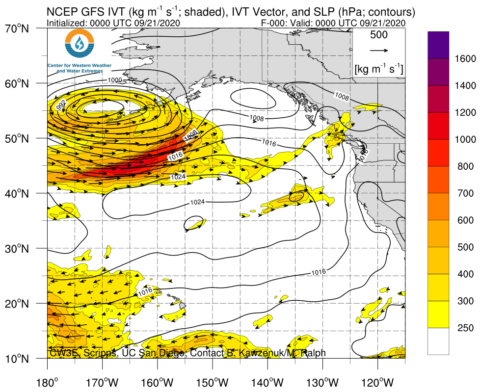
CW3E AR Update: 21 September 2020 Outlook

CW3E AR Update: 21 September 2020 Outlook

September 21, 2020

Click here for a pdf of this information.

Update on potentially strong atmospheric river forecast to impact the Pacific Northwest

  • Forecast agreement between models and ensemble members has increased in the magnitude, duration, and location of AR conditions in association with the potentially strong AR forecast to make landfall this week
  • Forecasts of the strongest IVT magnitudes have shifted further south where AR 5 conditions are now forecast to impact Northern Oregon
  • Although AR 5s are often hazardous later in the season, given early season conditions (dry soils, low streamflow) this AR is unlikely to produce hazardous impacts
  • Ensemble probabilities of strong AR conditions (IVT magnitudes >750 kg m–1 s–1) have also increased over portions of the PNW
  • Model forecasts of precipitation accumulations have increased for portions of the Cascade, Olympic, and Coastal Mountains, though there is still some model-to-model disagreement in exact accumulation

Click images to see loops of GFS IVT/IWV analyses and forecasts

Valid 0000 UTC 21 September – 0000 UTC 01 October 2020


Summary provided by C. Hecht, C. Castellano, B. Kawzenuk, N. Oakley, J. Kalansky, and F. M. Ralph; 21 September 2020

*Outlook products are considered experimental

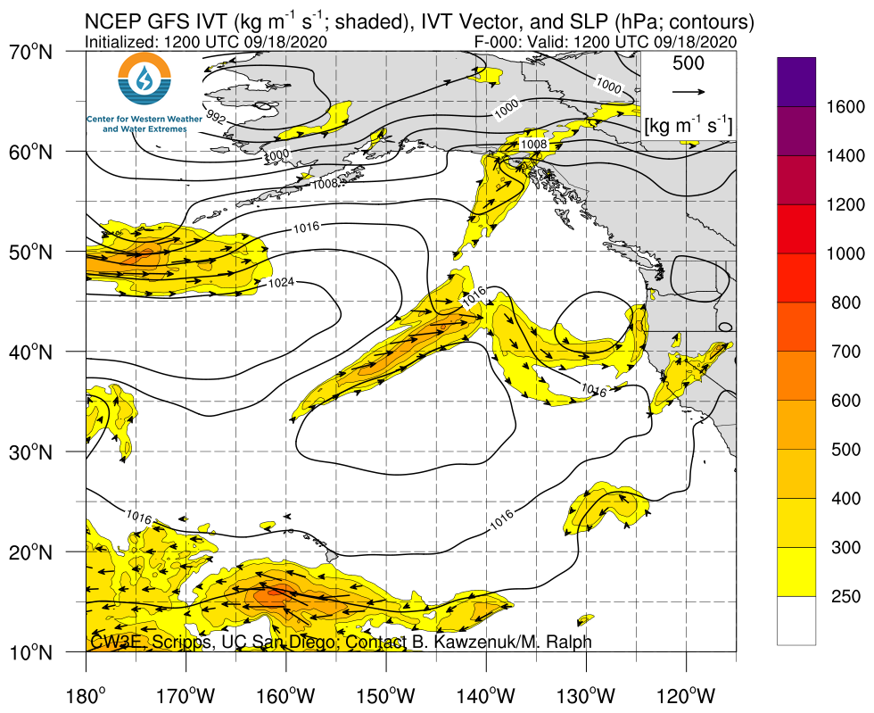
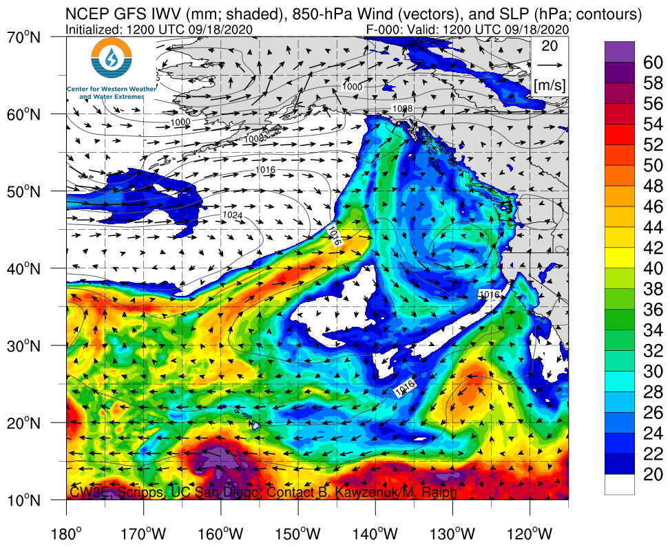
CW3E AR Update: 18 September 2020 Outlook

CW3E AR Update: 18 September 2020 Outlook

September 18, 2020

Click here for a pdf of this information.

A Potentially Strong Atmospheric River Could Douse the Pacific Northwest Next Week

  • Model forecasts are currently indicating the potential for a strong AR to make landfall over the PNW next week, but large ensemble spread in IVT forecasts is leading to considerable uncertainty in AR Scale (ranging from no AR to AR 5 in some locations)
  • Forecasts of maximum IVT magnitude over the Washington Coast range from < 400 kg m–1 s–1 to > 1200 kg m–1 s–1
  • While forecast uncertainty is currently high, more than 4 inches of precipitation are possible over the Olympic Peninsula during the next 7 days (Note: the 7-day forecast may not encompass the entirety of this event)

Click images to see loops of GFS IVT/IWV analyses and forecasts

Valid 1200 UTC 18 September – 1200 UTC 28 September 2020


Summary provided by C. Hecht, C. Castellano, B. Kawzenuk, J. Kalansky, and F. M. Ralph; 18 September 2020

*Outlook products are considered experimental