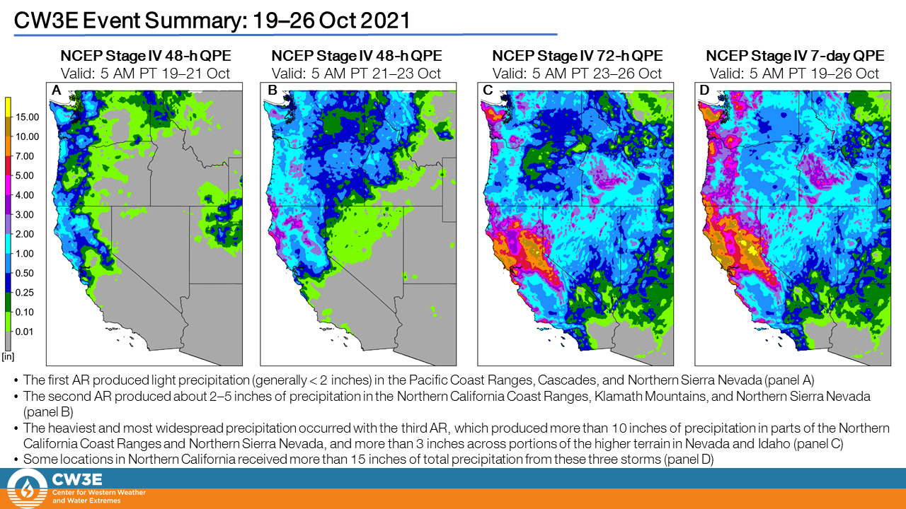
CW3E Publication Notice
Probabilistic Predictions from Deterministic Atmospheric River Forecasts with Deep Learning
October 29, 2021
William E. Chapman, PhD candidate with CW3E, recently published a paper (Chapman et al., 2021) in Monthly Weather Review, along with co-authors F. Martin Ralph, Negin Hayatbini, and Luca Delle Monache (CW3E/Scripps Institution of Oceanography), Shang-Ping Xie (Scripps Institution of Oceanography), Stefano Alessandrini (National Center for Atmospheric Research), Aneesh C. Subramanian (University of Colorado Boulder), and Sebastian Lerch (Karlsruhe Institute of Technology). The paper, titled “Probabilistic Predictions from Deterministic Atmospheric River Forecasts with Deep Learning”, contributes to the goals of CW3E’s 2019-2024 Strategic Plan to support Atmospheric River (AR) Research and Applications and Emerging Technologies by examining Deep Learning (DL) methods for generating reliable and accurate probabilistic forecasts of integrated vapor transport (IVT) under AR conditions.
This study uses a 34-year reforecast, based on CW3E West-WRF mesoscale model of North American West Coast IVT, to test the dynamically/statistically derived 0-120 hour probabilistic forecasts for IVT under AR conditions. These predictions are compared to the Global Ensemble Forecast System (GEFS) dynamic model and the GEFS calibrated with a neural network. The DL methods are also tested against an established, but more rigid, statistical-dynamical ensemble method (the Analog Ensemble). Using continuous ranked probability skill score and Brier skill score as verification metrics, the study’s findings show that the DL methods compete with or outperform the calibrated GEFS system at lead times from 0-48 hours and again from 72-120 hours for AR vapor transport events (Figure 1). The study examines the implications of varying the length of the training dataset, with results showing that the DL methods learn relatively quickly and ~10 years of hindcast data are required to compete with the GEFS ensemble. The results from this study indicate that DL methods, which are flexible and easy to implement with modern DL toolboxes, generate reliable and skillful probabilistic forecasts, learn relatively quickly, and can compete with or outperform the GEFS system for AR vapor transport events. While there is still work to be done to optimize these methods, this study shows that they are already capable of adding value to state of the art weather prediction.
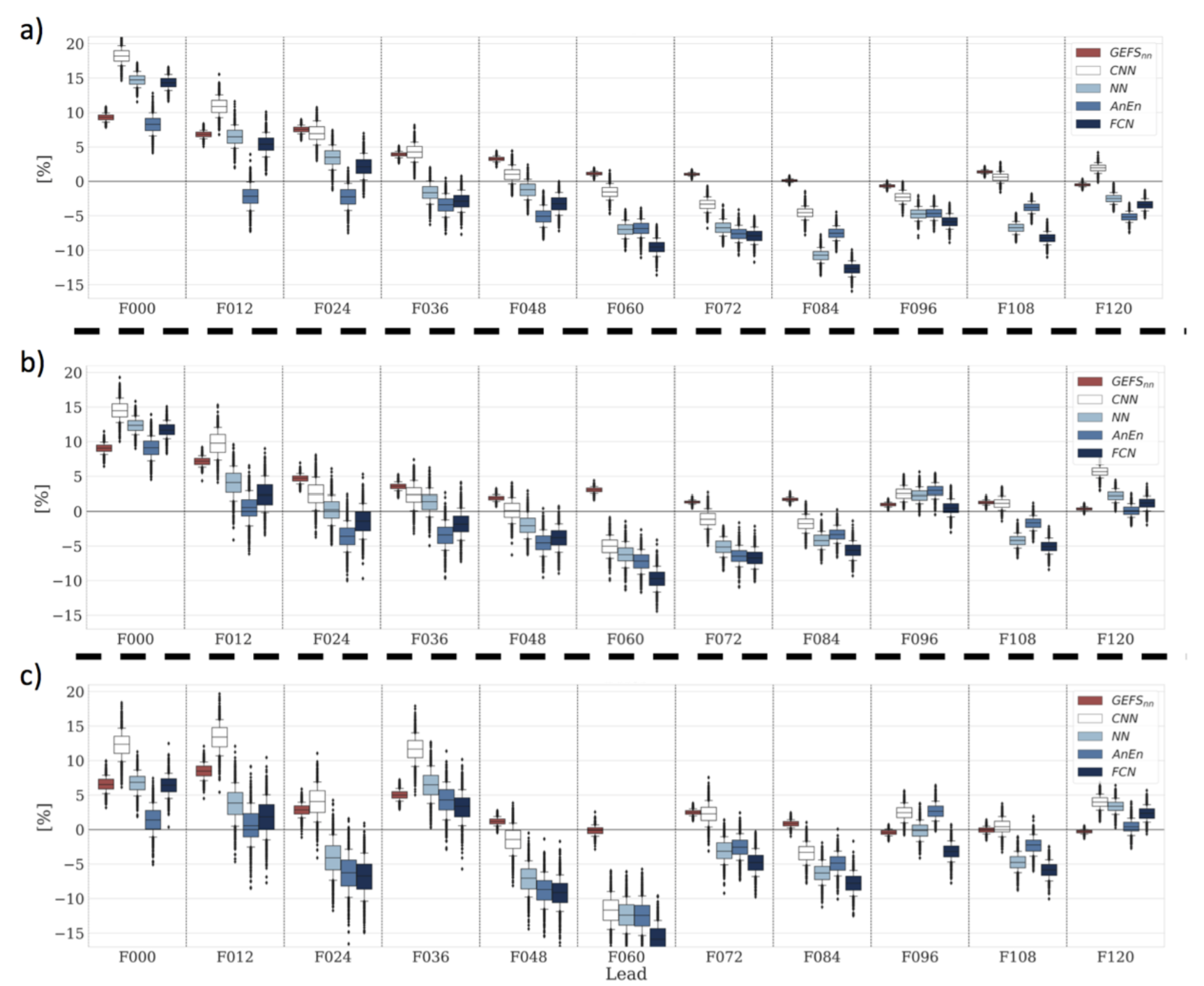
Figure 1: Brier skill score at thresholds of 250 (a), 350 (b), and 500+ (c) [kg m-1 s-1] forecasted units of IVT against the forecast lead time for the ensemble mean or predicted mean from each forecast system. The GEFS ensemble is used as the reference forecast, with positive values showing percent improvement. Shown predictions include GEFSnn (dark red), GEFS (light red), CNN (white), NN (light blue), AnEn (blue), FCN (dark blue). The error bars indicated the 95% bootstrap confidence intervals (where n=1000).
Chapman, W. E., Delle Monache, L., Alessandrini, S., Subramanian, A. C., Ralph, F. M., Xie, S., Lerch, S., & Hayatbini, N. (2021). Probabilistic Predictions from Deterministic Atmospheric River Forecasts with Deep Learning, Monthly Weather Review, https://doi.org/10.1175/MWR-D-21-0106.1.